|
|

|
|
Mynydd y GelliStone Circle
|
||||||||||||||||||||||||
|
|
|
Images (click to view fullsize) |
|
Photographs: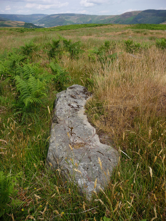
 Maps / Plans / Diagrams:
|
Fieldnotes |
|
|
A number of people have reported trouble in finding and getting to the site. I have made a google map to the site which comes in from the back way via Clydach Vale. This avoids any interaction with the tip or the farm and is a nice walk in my opinion The map can be found here http://goo.gl/maps/pnom |
Posted by Pryderi 30th November 2010ce Edited 30th November 2010ce |
|
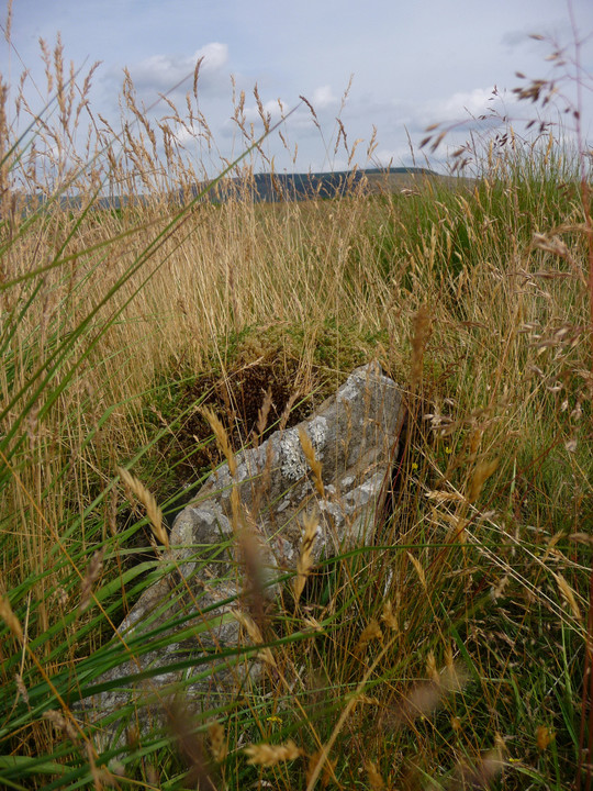
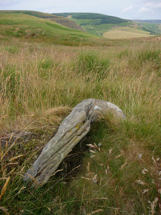
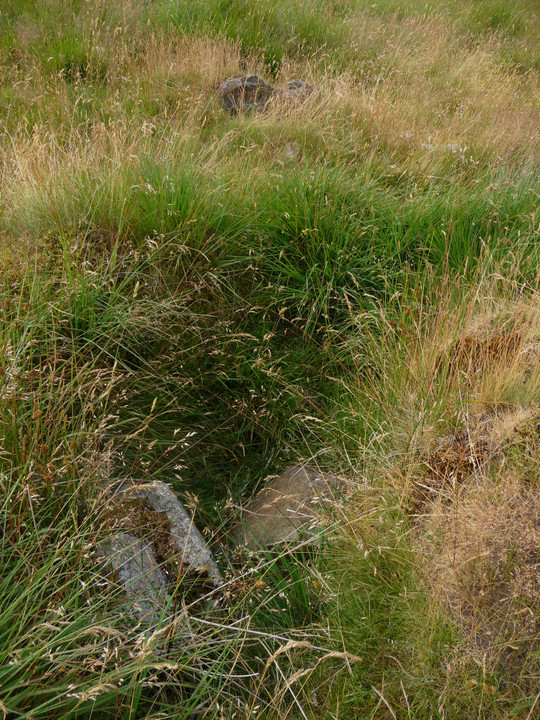
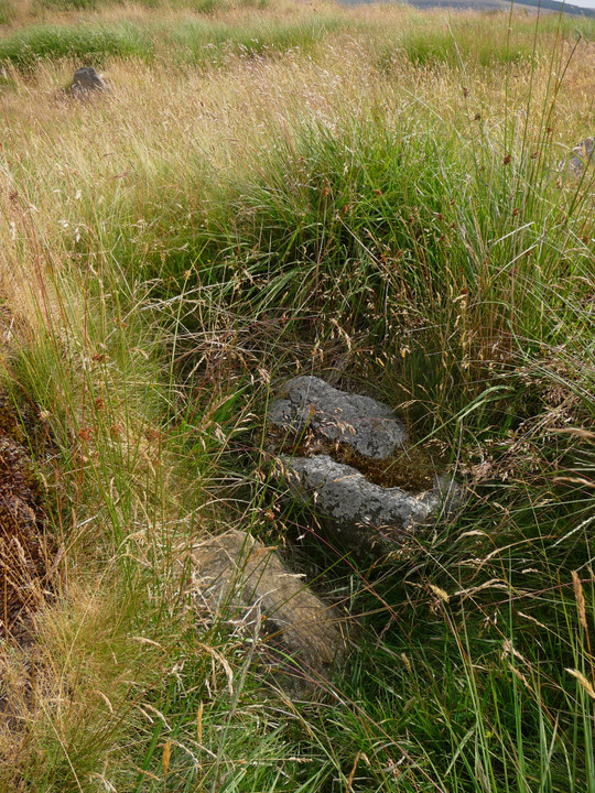
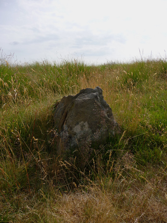
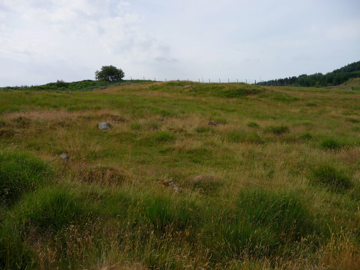
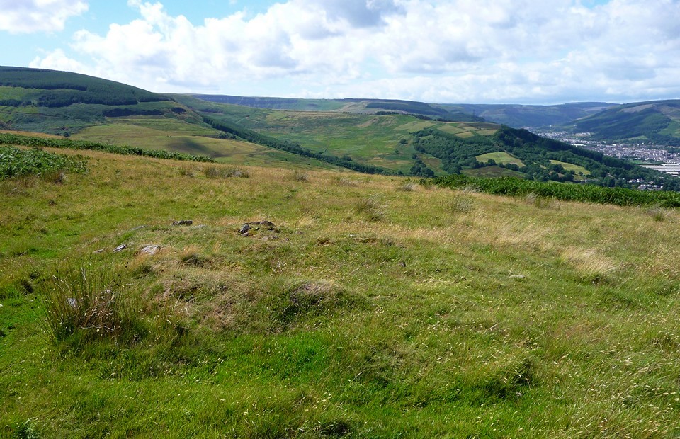
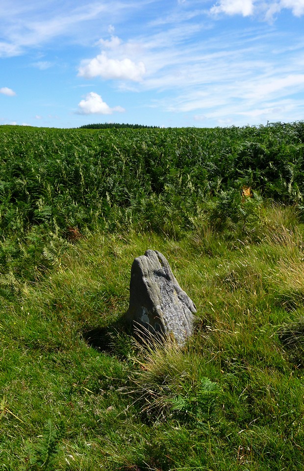
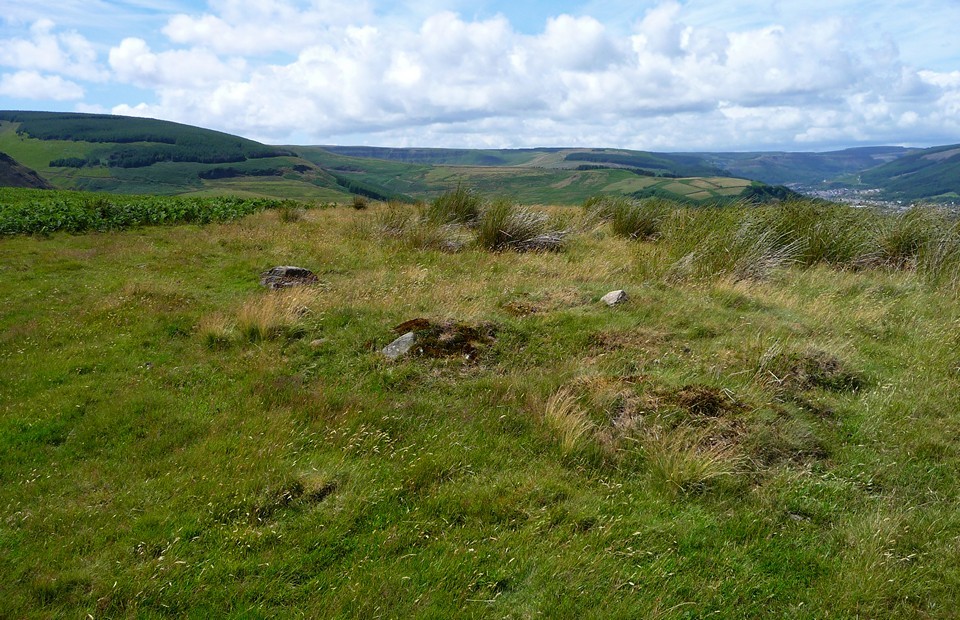
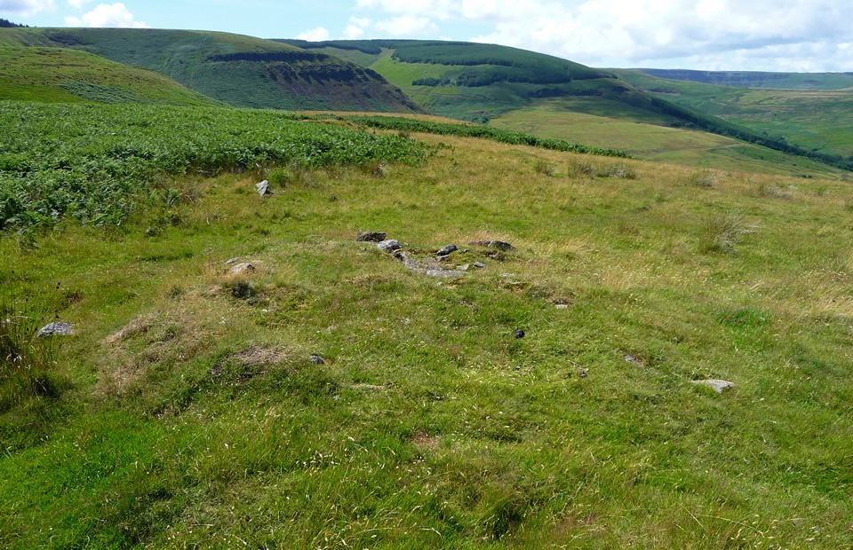
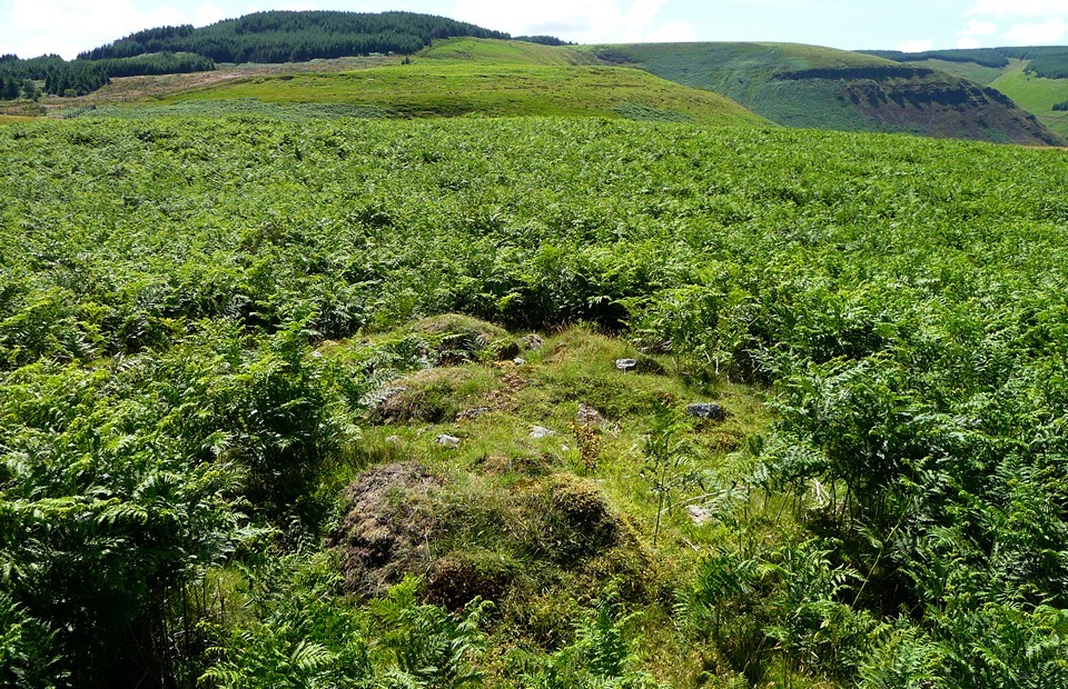
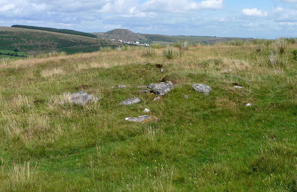
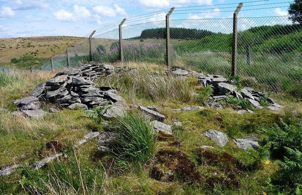
Visited 6.11.10 Now it's not very often I set out on a days 'adventures' with only one target in site but after failing on my last attempt, I was determined to succeed this time. Since it appears to be no longer possible to gain entry to the access road leading up to the former landfill site I decided upon a different tactic. Once you find the village of Gelli (not as easy as it sounds as the road signs are not as good as they could be) I headed for Bwllfa Farm (as per Burl's advice). It is probably easiest to ask a local for directions as it is a bit of a maze of terraced houses / side roads to navigate. (As an aside I saw my first house with Christmas decorations!!) Once you have parked, walk up the track that takes you to the farm and you will come to the metal gate which is at the bottom of the farm drive. Immediately to the left of the metal gate is a sort of 'home made' wooden stile (strangely enough I saw two pigs feet at the bottom of the stile!). Climb over the stile and you come onto the road which leads to the landfill site (the same road that the bloke on the gate won't let you up!). Walk up the road and just before you reach the locked gates at the top, you will see a parking bay on your right and a battered public footpath sign. Go up the grass bank and follow the chain link fence (on you left) for about 10 minutes. You will then see a green 'shed like' structure on the other side of the fence. The cairns are a bit further on, over to your right. I am no expert and it took me quite a while a while to 'get my eye in' and spot what I believe were several of the cairns. They ranged from small ones, about 2 metres in diameter to large ones about 10 metres across. They were all covered in grass/moss and consisted of low mounds with stones sticking out of the surface. Some of the stones were large but most were small. There are a lot of 'natural' stones sticking out of the ground so it is possible that some of what I saw was natural and not a cairn. The ground was very uneven and the grass / brown ferns still fairly high so it was not an easy exercise to locate the cairns. The ring cairn (about 10 metres across) is in the same area but nearer the fence – there were several larger stones in this cairn. From where I parked it took half hour to walk to the site and although I am glad I finally managed to visit –the 'Welsh Stonehenge' in all honesty it is hardly worth the effort. There isn't a great deal to see although there are reasonable views to be had. The highlight for me was spotting what appeared to be a lone standing stone quite close to where the hill starts to shelve off. It is about 20 inches high and triangular in shape. Again, I am no expert so perhaps this was also 'natural'? One other thing I saw was an obviously recent burial site on top of the mountain. There was a small wooden cross with still freshly cut flowers around it. It made me think that over the thousands of years people were still using this site as a final resting place. Goes to show that some ancient traditions are still maintained? There are certainly worse places you could end up. |
Posted by CARL 8th November 2010ce |
|
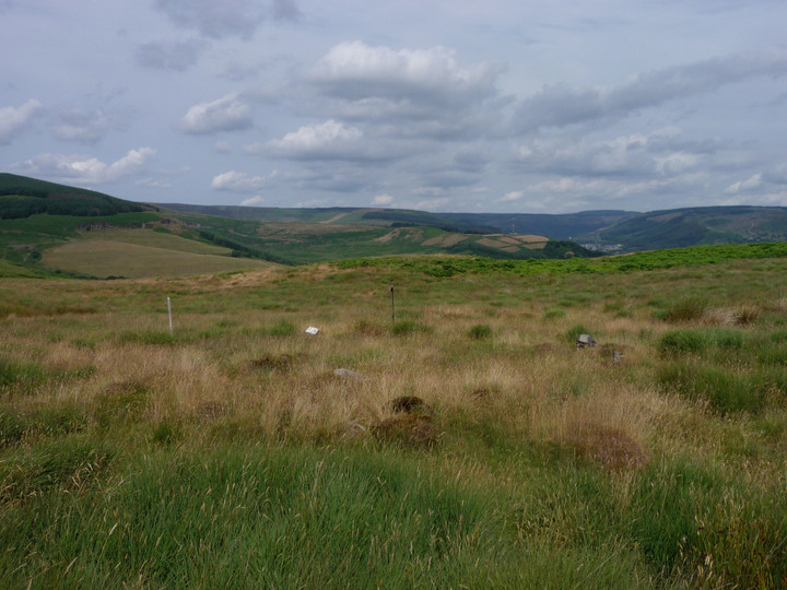
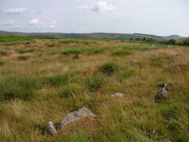
I'm pleased to see that the tips and landfill mentioned in previous fieldnotes are closed and are slowly being covered over by vegetation. The route takes a turn for the difficult, as I find myself having to cross a steep cwm (and a rusty barbed wire fence) in order to continue eastwards, but eventually I'm up on the plateau of Mynydd y Gelli ("Mountain of the Grove" or "Wooded Mountain") itself. I know roughly what I'm looking for, from the links posted on TMA and from the Burl description. The sun is now beaming down on beautiful afternoon. And so I dutifully wander backwards and forwards across the plateau. And backwards and forwards. And backwards and forwards… There are plenty of low clearance cairns in evidence, but I'm not convinced that any of them fit the description of the ring cairn. I spend about an hour wandering across the area and I'm still not convinced. Maybe it's lost in the bracken? I have an idea that it's quite close to the lip of the hillside, but that doesn't help. Eventually I give up. I should mention that a nice easy footpath heads east from the plateau, until you hit the access road for the old tip. Then, it crosses into an area of quarrying and appears to disappear over a cliff. So I waste even more time trying to get back down off the hillside into the town (so close, yet so far). Finally I scramble down through deep vegetation, hoping not to break an ankle in the process. Gah! No idea how to get back up here if I decide to pay a return visit from this direction. I finish up eventually back at Ystrad station, and head back to Cardiff. Rhondda Stonehenge? An over-enthusiastic billing if ever there was one. [Post-visit note: A closer inspection of Coflein on my return suggests that the ring cairn itself is slightly further west than my wanderings, and nearer the tall chain link fence. The "cairns" marked on the OS map – which was mainly where I was looking – do not include the ring cairn. I would advise anyone going to look for this to take a print of the Coflein map at a large scale, rather than trusting to the 1:25000 OS map alone.] This post appears as part of the weblog entry "The Rhondda Stonehenge?" Yeah, right - Mynydd y Gelli
|
 Posted by thesweetcheat
21st September 2010ce |
|
Tried to visit 29.6.10. Grrrrrrrrr….. not happy! 'Jobsworth' on the gate refused me entry and said that the public were not allowed beyond the large locked metal gates. He said he would need permission from his boss to allow me access. I explained that I had come a fair way and could he ring his boss to ask? He wouldn't!!!!! Unfortunately I didn't have Burl's directions with me so another visit required. |
Posted by CARL 8th July 2010ce |
|
Finding this place is a labour of love. I intended to go for a poddle about on Garth Hill today but instead found myself carrying on up past Ponty towards this site, curiosity aroused since reading RedBrickDream's post on it from almost five years ago. If you haven't got a tomtom, take a mate who's a decent navigator. I went up the wrong side of the valley and ended up going 'round in circles in some god-awful new road system they were building in Porth, I went back and forth between Ynyshire (ermn, I'm sorry, it's that an island in Ireland? ;) ), Wattstown and Tonypandy for about an hour....don't ask. Oh, and watch out, they like their speed camera vans around those parts. Aaaanyway, eventually I made it to Gelli. There are no signs for the landfill site anymore as the landfill site caused so much local unrest that they've now closed it down for good. The best thing you can do is follow the signs for the Industrial Estate. When you enter it the road forks in two - take the right-hand high road. Get to the end, turn right then right again onto a main road heading up the hill. Carry on past a speed camera on your right and it's just 'round the corner on your left with a sign for the 'recycling plant'. I found this by asking directions from two local gents, one of whom recounted fond memories of going up to the stones as a young man but had no idea whether they were still there or not. He assumed thay had fallen into the landfill. On your left you will indeed see a small recycling centre. You need to pull in there, go to the booth and tell the person behind the counter that you'd like to go up and have a nose around. I didn't have any problems getting entry and you follow the road up and park in a lay-by just outside the gates to the main landfill site. Just before the gates there are two stiles (or 'kissing gates') on either side of the road. Facing the main gates of the landfill, the stile to your left leads into a field with a huge hill. The hill is an old part of the landfill but if you don't mind climbing about on it, there's some pretty impressive views of the Rhondda valley from up there. Gives you a good appreciation of the lay of the land. Standing atop it, looking down on the town, look up and to your right and you'll see two prominent pointy hills. I've not had a chance to go investigate but it might be one to nose about on if you have the time. The problem with Welsh valleys is that you never know whether it's something significant or a slag heap ;) I was under a bit of pressure as the main gates close at five and, although I arrived in plenty of time, a guy from the landfill wanted to go home at three and, although not out-rightly asking me to hurry things along, seemed to be anxious to head off. I spent quite a bit of time looking out at the other hills around. On my way in to Gelli I passed through Penrhys. Just off a roundabout leaving Penrhys is a car park and 'St. Mary's Well'. It's worth stopping off here if you find it. The well no longer seems to be there but there is a giant statue of the Madonna with child looking out across the valley. It appears to be a renovation of one that was put there in the 1500s. The interesting thing is that this is on the opposite side of the valley to Mynydd Y Gelli. Standing on top of the rubbish heap with a wide view of the valley, looking to your right (in the rough direction of Penrhys and the well) is the aforementioned twin peaks. Another reason it might be worth checking out. I have seen pictures online of the face stone and the main rings but I didn't make it that far due to the time pressures. I would very much like to go back again with someone else who's interested in this, to have another nose about. It's not an easy site to distinguish as there's the remains of a large stone wall and possibly a cottage, so the ground is littered with bits of rock. There is a definite difference between the large, old boulders in my pictures and all the wall debris, but that combined with the undergrowth makes the site well camouflaged. Breathtaking view though. You can't help but think that if the local council had treasured the site instead of turning it into a dump for dungy nappies, it could have a similar pull as Castlerigg just for the scenery. I took a couple of quick picks (including St. Mary's Well) here. Not the most impressive, but a start. |
Posted by Thinair 26th January 2007ce Edited 26th January 2007ce |
|
Mynydd y Gelli, as this site is also known (somewhat optimistically) as "the Welsh Stonehenge"' (Burl, 1995: 174). I've not heard this site referred to as Rhondda Stonhenge before. Like the English one, though, what's left is being ruined by pollution. No trunk roads here though just a hole full of stinking plastic bags. This place is paradoxiaclly grim and breathtaking. At the end of a winding road from Gelli up to a massive landfill site there is a stile. Heading west, the site is easy to miss. You're instinctively drawn away from the line of the chain link fence that divides the encroaching stenching land fill from the magnificent hillside views to the North over to Rhondda Fach.You then miss the site. At the edge of a plateau some few hundred yards west of the rings are a number of equally spaced partially buried stones. Outliers dot the slopes below. This would appear to be what Burl (op cit) refers to as "the wreckage of three more dubious cists". Dubious or not, this was once a special place for ritual and ceremony. Look around at the views and the alignments! Rhondda-Cynon-Taf, the local authority have only vague records of this ancient monument and, with an absence of landmarks for map reading and a Quatermass land-fill getting nearer all the time, finding this site was hard work on a foggy day in March 2002. The rings are next to the chainlink fence on a ENE-WSW axis. Burl reports them as being 10.2m by 9m in diameter. Ignore Burl's directions. Follow the road to the landfill site and get out by the gates and lorries. Follow the fence on the brow of the hill to the site. None of the stones are taller than about 75cm, the OS map doesn't record the circle by name, nor does it record the growth of the landfill (a local politcal hot potato) instead it coyly records "Cairns". For now Taffhenge or Tiphenge, remains sadly neglected and seldom visited. |
10th August 2002ce Edited 28th March 2006ce |
Links |
|
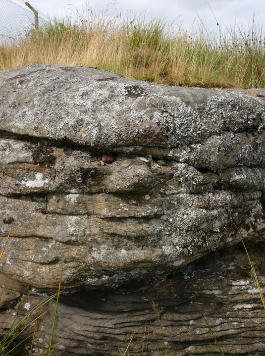
MegalithicaInteresting photos of this unobtrusive site, with pictures of the carved faces and simulacra on the stones (plus other Welsh sites, by John Harding) |
 Posted by Rhiannon
16th May 2002ce Edited 26th January 2007ce |