|
|

|
|
Hwylfa'r CeirwStone Row / Alignment
|
||||||||||||||||||||||||
|
|
|
Images (click to view fullsize) |
|

|
Fieldnotes |
|
|
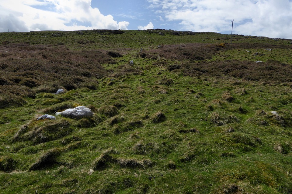
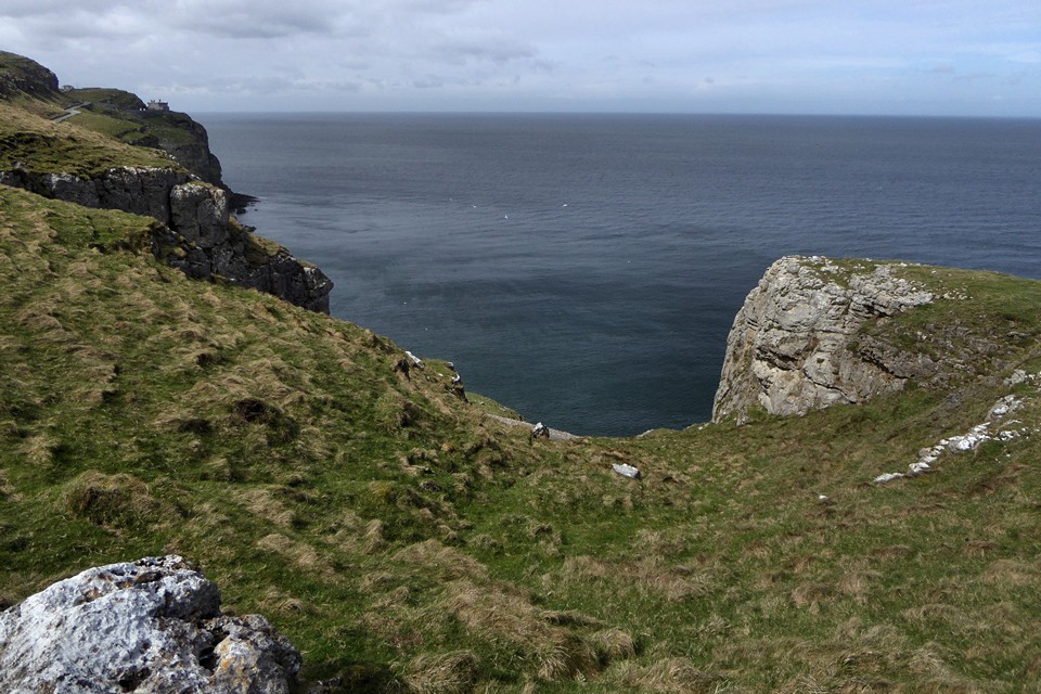
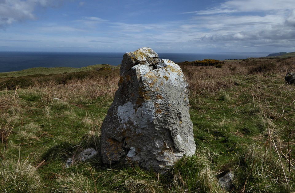
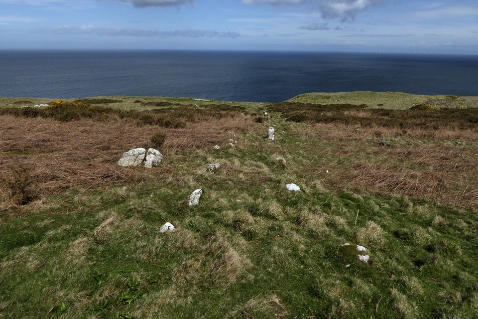
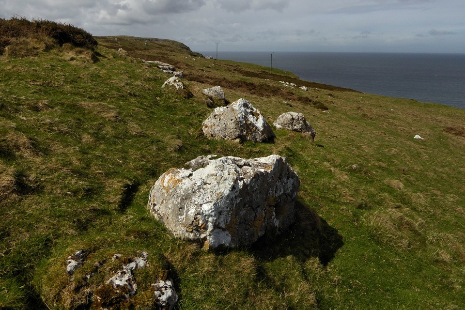
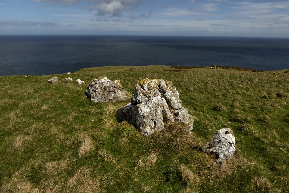
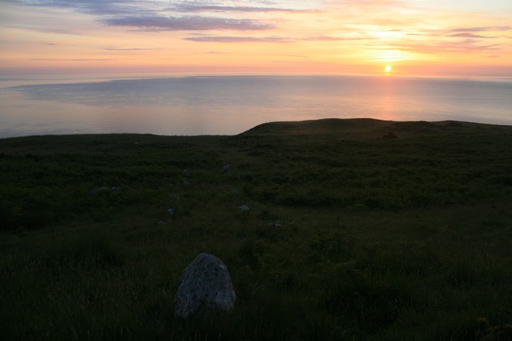
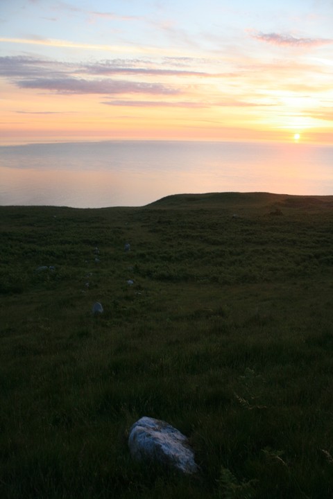
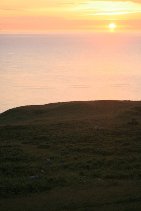
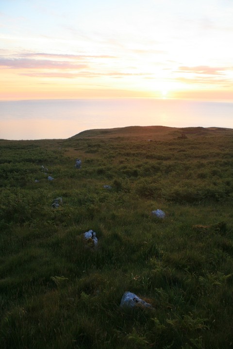
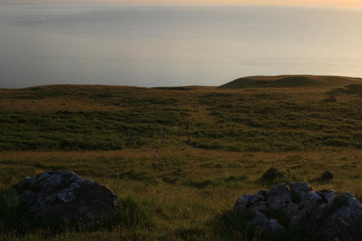
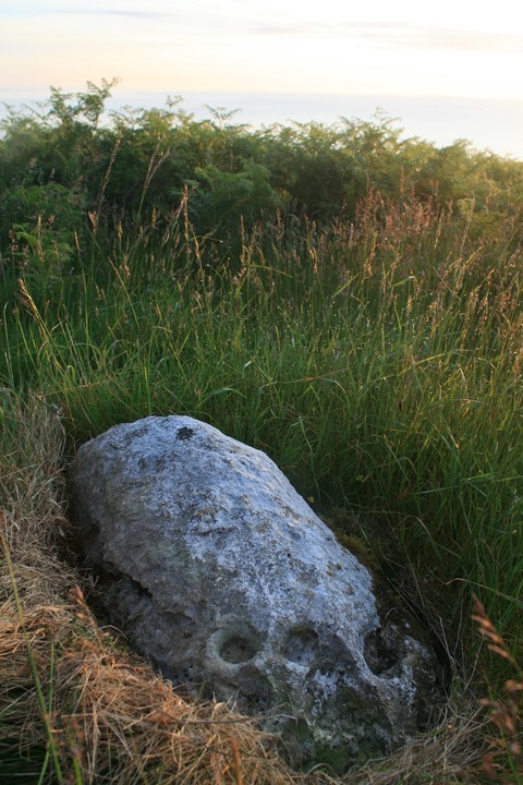
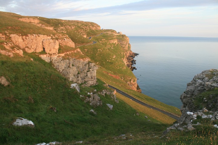
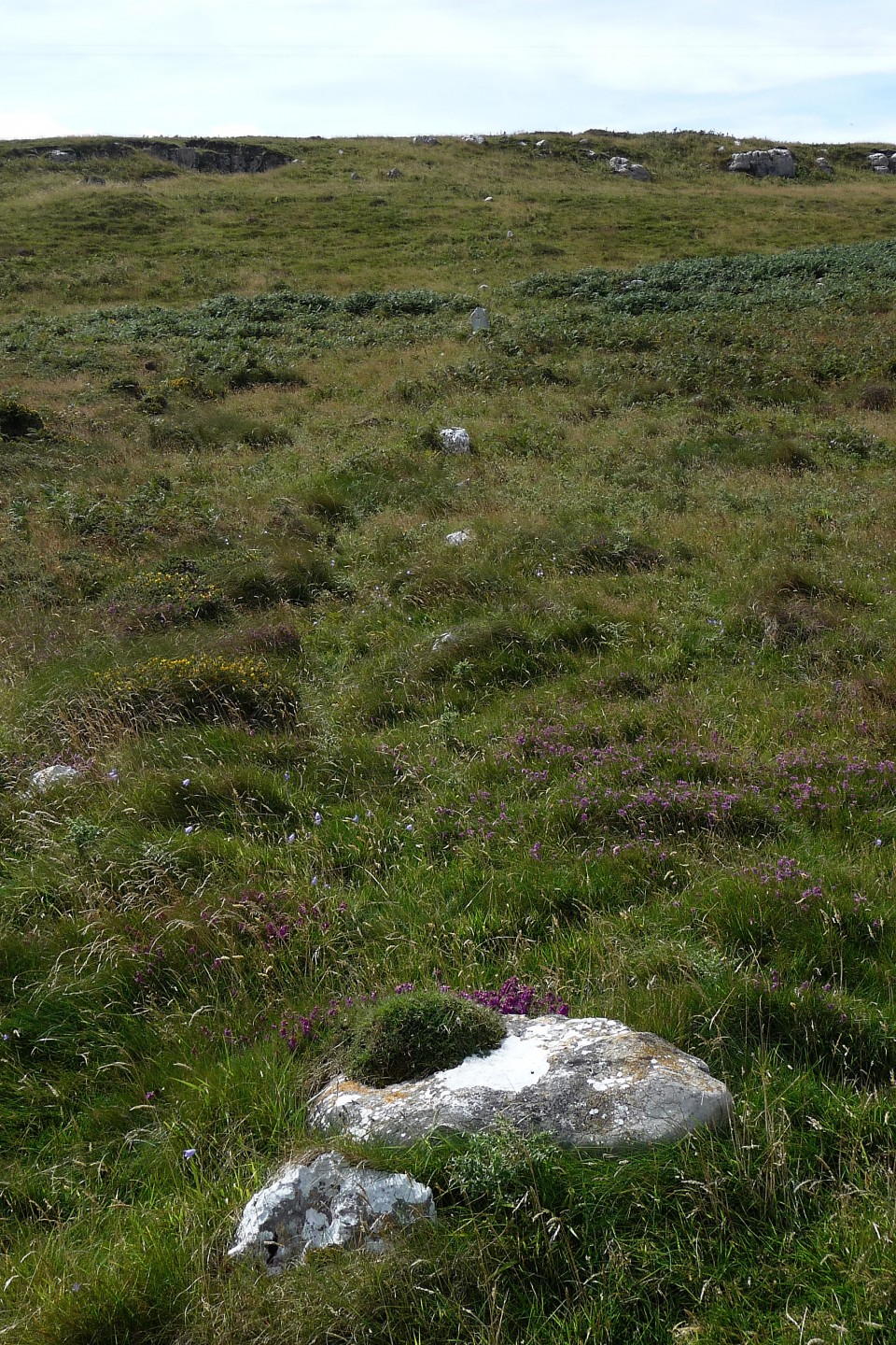
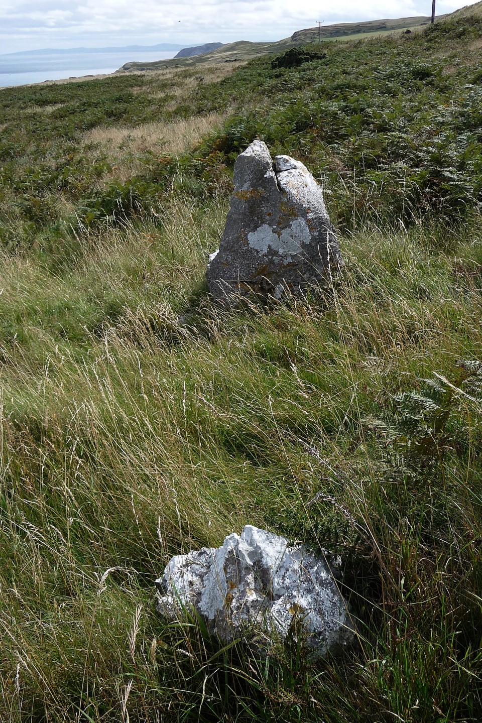
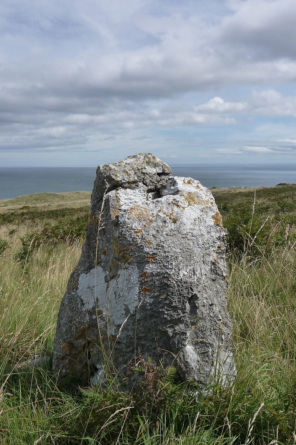
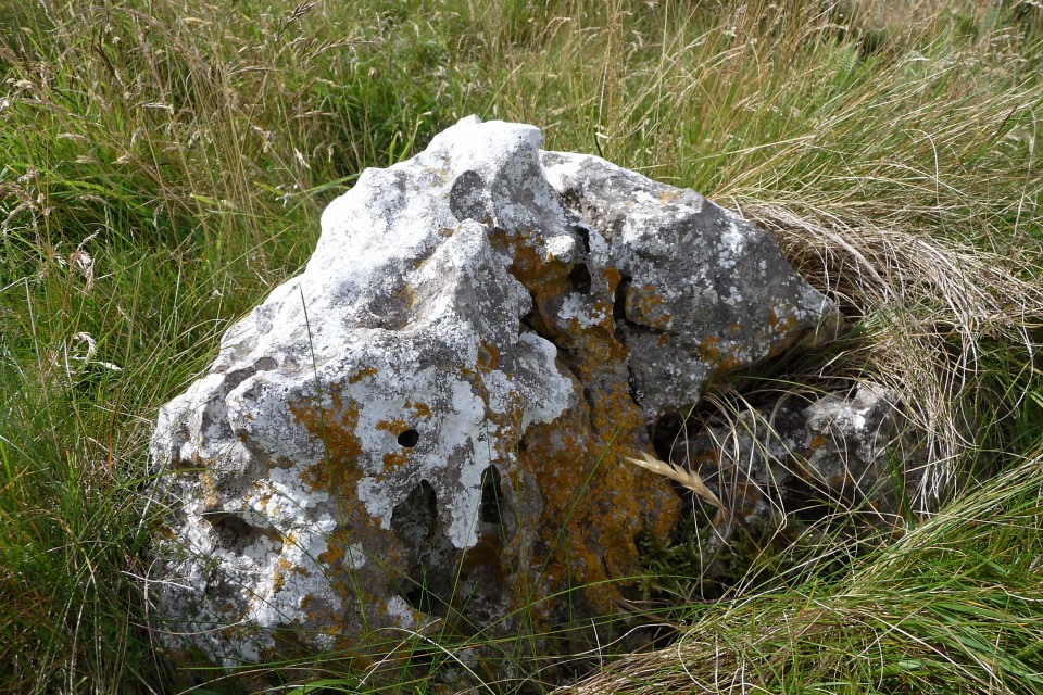
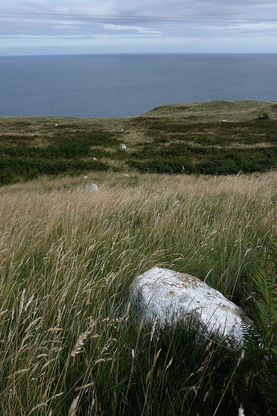
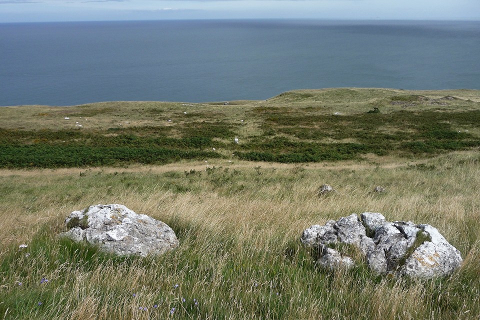
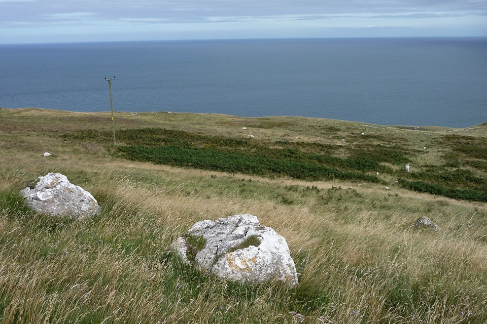
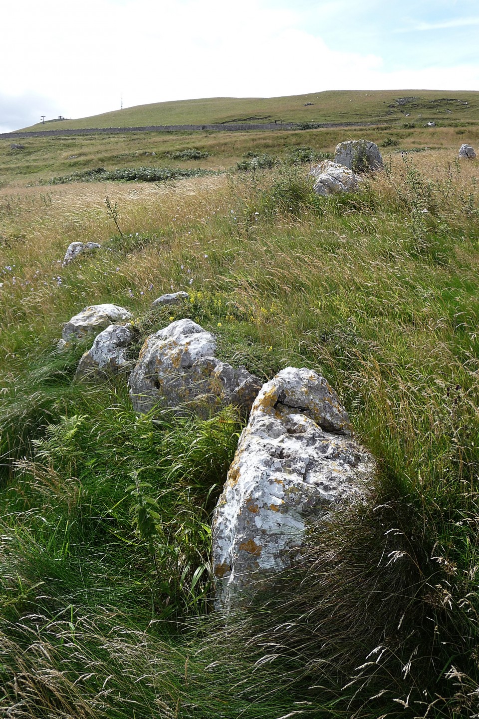
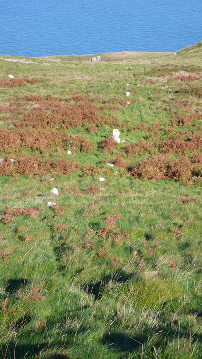
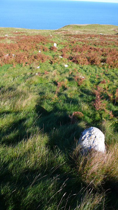
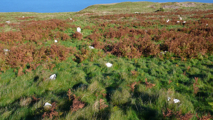
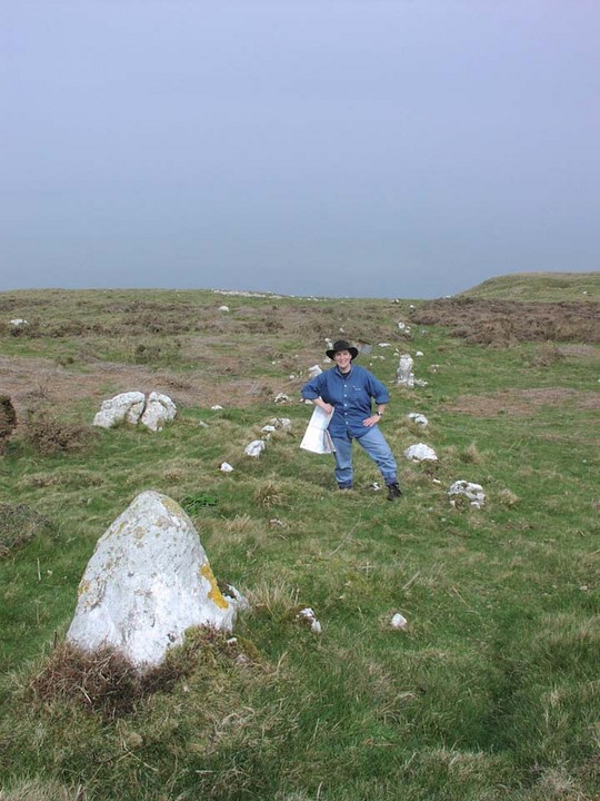
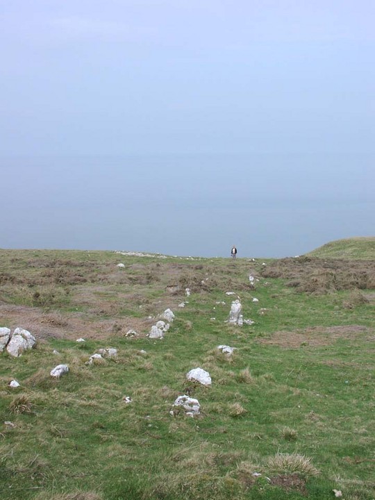
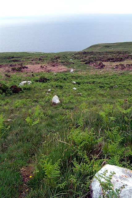
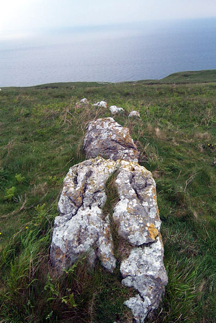
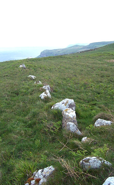
If you need to be on the road by two am, as painful as that sounds it's not as painful as deciding if it's worth going to bed at all. I plumped for staying up without sleep for a day, but with two days of oversleeping under my belt, so after a time team or two I was packed up and the only one on the road by 2am. The summer solstice is a special time of year, not just for those with megalithic tendencies, but just because it doesn't get really dark. Even at two am, the ever present glow of long northern summers can be seen brighter than half a dozen full moons. After a quick night visit to lleyty'r Filiast, and narrowly missing a police car on the thin mountain road, I was parked up near St Tudnos church and well. I love being up rediculously early, loads of different birdsong, clearish blue skies and not a soul about, excepting road hogging cops. Brilliant. It's barely a ten minute walk to the stones, I simply turned right on the path across the grass when I got to a left hand turn in the track, walked straight to it. Plenty of time to .....erm, tidy the place up a bit before the birthday boy comes. We want to look our best don't we? At the top of the hill are two large boulders which look like they could've once stood up more erect like. The ragged remains of the two rows run downhill for nearly a hundred yards, where the ground dives steeply but navigably down to the coast. I quickly sought every stone in the rows, especially the ones covered in gorse, moss, ferns and grasses, revealing in the process, a stone that looked like a large elongated skull with eye sockets like for a spider. They could have been cup marks but were most probably just the way limestone erodes. Ooh quick the suns coming, I scamper back up to the top, ready my camera, ready my soul for it's yearly dose of solstice power and set my face to stunned. The big orange ball slowly lifted it's self out of the sea, (you don't see that very often, well, I don't. ) with all the majesty and magnificence that only an actual star can have, then it was over and that was it, a new day had dawned. In ancient Egypt it would be new year and the Nile has flooded, but, if I was even remotely affected by the solstice power, only the day ahead would tell, I as ever set myself as many targets as my legs will carry me too. As tear jerkingly beautiful as the sun rise was, it is not part of any alignment with the stone rows, they point too far to the north, it could be aligned on something on land, the stone rectangle above the rows, or the Ormes peak, or something far out to sea, Morcambe bay perhaps, incidentaly the Isle of Man was very visible and distinct to the north. Or perhaps it really was for Deers to walk up and down on. |
 Posted by postman
21st June 2012ce Edited 3rd July 2012ce |
|
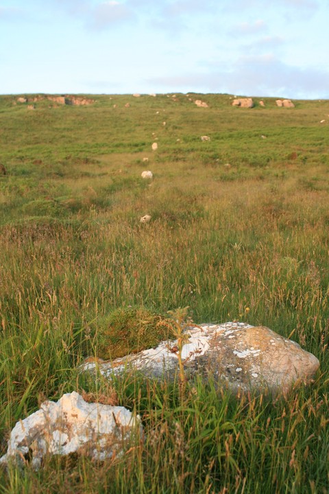
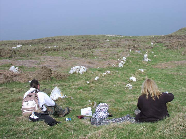
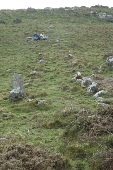
As our initial searching had been confounded by many erratics, the general consensus was that this might not be a very spectacular site. After hoping for something reasonably impressive, I was beginning to think this would be a few short, squat, piddly stones running in a line for 10-20 feet. Thankfully, this wasn't the case – Moth finally located approximately 100yds of Bronze Age handiwork, made from substantial stones, leading towards the Irish Sea. What a treat for a stone row virgin. As we took photos and generally prepared for lunch, a hale and hearty woman approached, enquiring as to whether this was the stone row. We informed her it was, and she asked if we were students of archaeology. I replied that we were Modern Antiquarians, so in effect students of archaeology, but really just megalithic enthusiasts. She explained that she was an ex-midwife who led walking parties, and was walking Great Orme to suss out a new route, with places of interest like the Roman well by the roadside above the stone row. We suggested she check out Lletty'r Filiast. Amongst all the erratics, the uniformity of the stone row was very clear, and picnicking above them, I wondered what their purpose had been. Interestingly, they faced north-ish, so presumably the setting sun would not have been visible at their end. Could they have been a ceremonial route, or something connected with shipping? Moth said they reminded him very much of Dartmoor stone rows, and on our return to the car, we had an interesting discussion about the possibility of Cornish tin miners being drafted in to work the Copper Mines, bringing with them new customs and traditions. This post appears as part of the weblog entry Three Go Mad In Conwy: Part I
|
8th April 2005ce Edited 29th April 2005ce |
|
Not easy to find this. Drive up to the car park/picnic area just before the cemetary and park. Walk along the track that heads north west for about 350ms. There's an information sign. Walk about 50ms beyond this then change direction by 90 degrees and head off north west for about 250ms. Now you need to activate your megalithic radars! We hunted round for quite some time before we located it. There are tons of erratics up here and in the summer with the vegetation high it might be ever harder to find. The OS map really helped, but once you find it. it's unmistakable. This was treaclechops' first stone row and as the weather was so gentle and clement we decided to have our picnic here. A pair of rows, 2ms apart, run down an incline towards the sea for 30 ms or so. Most of the white stones are reasonably small, but one or two of them are perhaps 3 feet tall. Stylistically it reminded us of Dartmoor stone rows. The view into the Irish sea is stunning from up here, perhaps 150 feet above sea-level with more a less a sheer drop below. This post appears as part of the weblog entry Conwy crusade: three burial chambers and a stone row
|
 Posted by Jane
28th March 2005ce Edited 28th March 2005ce |
| This stone row isn't that easy to find - and isn't really spectacular in itself - the view is however worth it. We had the place to ourselves for 1/2 an hour and on a nice day it would make a welcome rest place after visiting the Great Orme Mine. The surrounding landscape is full of great stones and is well worth exploring. |
 Posted by IronMan
5th June 2002ce Edited 19th December 2002ce |
Folklore |
|
In the same neighbourhood [as a hut circle] are the remnants of two singular avenues of upright stones, placed diagonally to each other, forming, between two rows of stones, a walk in the shape of the letter L, one of the avenues descending towards the sea, the other parallel with it.p76 of 'Notes of Family Excursions in North Wales', by J. O. Halliwell, 1860. Online at Google Books This page at the 'Great Orme Expedition Society' http://www.goes.org.uk/html/1880letter.html has a letter from 1880 which explains the name as follows: A few paces westward of Dolfechan we find some divination stones, though the place is generally called at present "Hwylfa Ceirw" because the hunters used to drive the stags between those rows of stones in order to catch and spear them, when the whole mountain was a deer park; but the more ancient name "Cerrig Coch" ie Divination stones still cling to them. |
 Posted by Rhiannon
23rd July 2007ce Edited 23rd July 2007ce |
Miscellaneous |
|
|
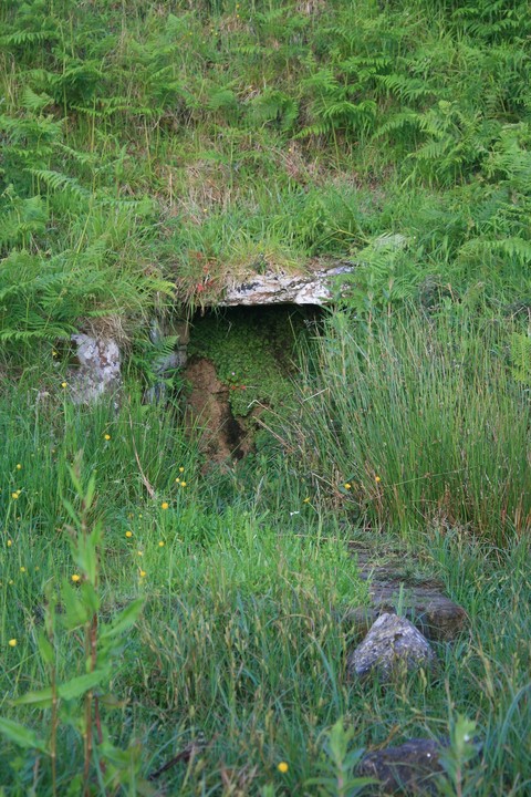
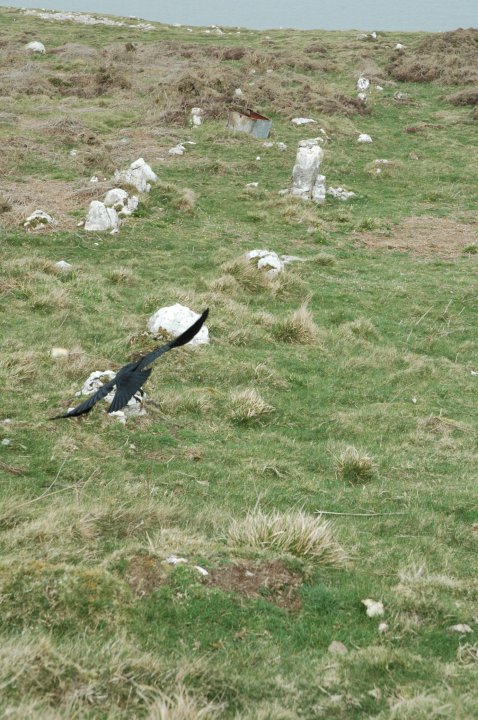
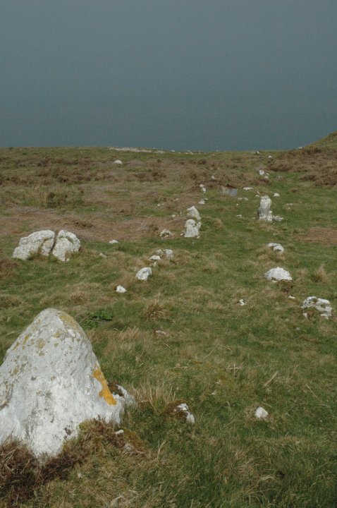
Coflein also mentions the enclosure at the south end (and above) the row: An avenue some 90m long comprising two roughly parallel but sinuous lines of small stones leading NNE from the foot of a natural scarp to the top of a steep-sided hollow leading down the cliff. A short distance to the S is a roughly rectangular enclosure bounded by walls of large limestone blocks. Its relation to the avenue is uncertain. The S side has been disturbed by ancient cultivation. |
 Posted by thesweetcheat
21st August 2011ce |