|
|

|
|
The AubreysPlateau Fort
|
||||||||||||||||||||||||
|
|
|
Images (click to view fullsize) |
|
|
Fieldnotes |
|
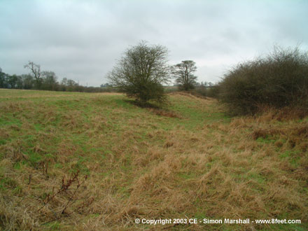
| A hillfort in a valley? Mad. Trees to the NW are worth exploring as the ditch is much wider and deeper in one place - a possible quarry? |
Posted by the fear 24th January 2003ce Edited 27th January 2003ce |
|
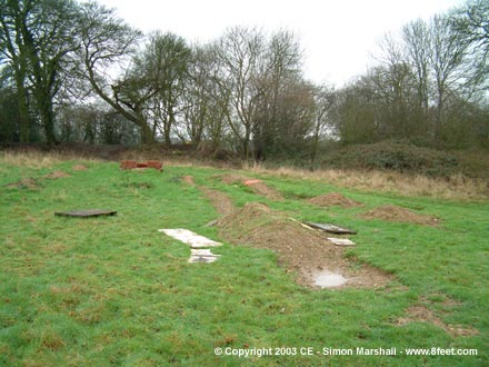
Visited 31st December 2002: First I should warn you that this is one of those sites that has had all the zing kicked out of it. Don't make the journey unless you're ready for disappointment. We parked at the rather incongruous Ramada Jarvis Hotel which intersects the enclosure (I asked permission and they were happy so long as we gave our registration number). A footpath follows the perimeter of the field that the site sits in, but pretty early on we decided to ignore that and follow the edge of the enclosure (there's no livestock or crops in the field). The M1 makes the site pretty unpleasant, mainly because it's so noisy. On the eastern side of the enclosure Lou and I had trouble talking to each other over the racket. In the north west we found a BMX track, presumably made by local kids. Unfortunately it consists of both ditches and ramps dug out of the enclosure. I had a look amongst the mess for worked flint, but didn't find anything. Poor old Aubreys. |
 Posted by Kammer
1st January 2003ce Edited 10th November 2003ce |
Miscellaneous |
|
|
The Aubreys is an Iron Age defensive enclosure, oval in shape and covering approximately 8 hectares. It's now right next to the M1 and the B487 between Hemel Hempstead and Redbourn, and is relatively close to Watling Street (now the A5183). There's a double bank and ditch around most of the enclosure, except for on the west side where there's only a single bank and ditch. There have been flint finds at the site suggesting occupation as far back as 4000 BCE. Excavations indicate that in it's last incarnation as a fortification, the site was not a permanent settlement. It was abandoned during the Roman period. There's a horrible looking (mostly modern) hotel built into the edge of the site. This stands on the site of a 13th Century farmstead. The name Aubreys is derived from the Anglo Saxon meaning an old fortified place. Kammer x |
Posted by Kammer 1st January 2003ce Edited 18th March 2005ce |
Links |
|
Herts DirectAn idiot's guide to the Iron Age in the context of Hertfordshire, this page contains a small black and white aerial photo of the Aubreys. |
Posted by Kammer 3rd January 2003ce Edited 3rd January 2003ce |