|
|

|
|
Drumsturdy / LawsSouterrain
|
|
|
|
Images (click to view fullsize) |
|
|
Fieldnotes |
|
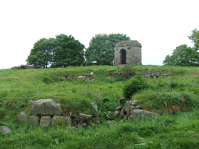
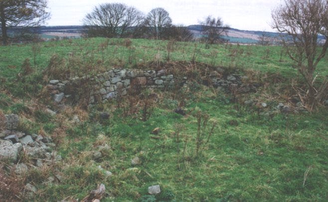
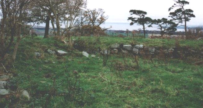
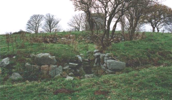
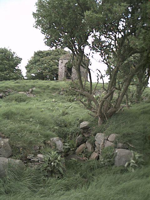
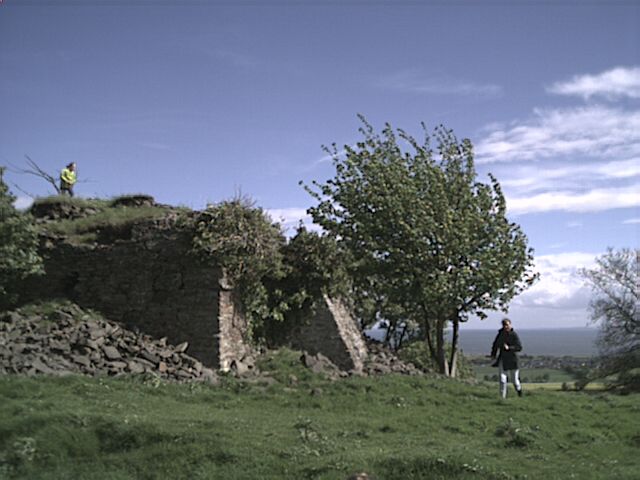
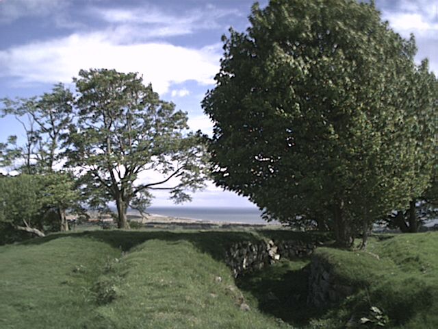
| Drumsturdy hill lies east of Dundee on the A92. Turn north onto the B962, then east on the B961 and turn into the Drumsturdy road up to Laws farm. Ask permission before entering the field by the hill - a bull is often in the field and warning notices are posted! Up a track to the hilltop and the broch can be easily distinguished. Nothing is left above ground level, but the site lies sunk in about 1 metre. An Iron Age fort is also on the site, along with other ruined remains and an absolutely awful late Georgian "folly" (visible in one of the photographs). It has been described thus : "The fort is oval measuring c 400' by 200' within the ruin of a wall 30' thick. The faces of the wall are of large carefully-laid blocks and the core of rubble, in which considerable quantities of vitrified stone have been noted. An outer wall of the same character, but not so thick covers either end of the fort and a third is added on the SW. The broch, now very much robbed and overgrown, is 35' in diameter within a wall 16' thick." The views from this site are spectacular, and it is easy to see why the hill was fortified, as it dominates the landscape round about. Well worth a visit. |
 Posted by nickbrand
26th October 2002ce |
|
Found a few mentions of Drumsturdy / Laws fort, Lucas' 1803 and Groomes 1901 Scotland gazetteers mention the site as a vitrified fort. In an obscure little pamphlet published by the Arbroath Herald and written by Rev Thomson of old church Arbroath around 1890 which is called " Hill forts of Angus" he tells us that the parish accounts of 1842 mentions cists being found there in the 1700's. Also a rumour of 2 workmen finding some gold there. Thomson mentions finds from the "sheep pen" site..querns, iron axes, iron sword, stone cup, coin, armlet, human and other bones, charred wheat and barley. He talks of this site being a remnant of cyclopian skills ( nice word) and the " Scottish Pompeii!! His article on white Cathertun also points out that the boulders there must have been carried up hill, rather than using the local stone. |
Posted by woodhouse 25th April 2002ce |
|
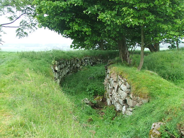
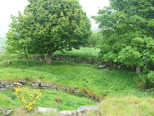
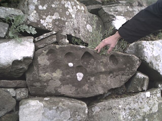
This 120 metre high volcanic "law" is 3km north of Monifieth and from the top you can see for ever. The OS map describes this site as "Fort & Broch", it appears however to be a succession of very different things. There is a small round tower of interesting construction but less than 200 years old. There are also two large square, stone flag built structures, which I assumed to be the fort, one was built with a butress on one side. But the whole site is entirely dominated by a number of underground structures. Whilst these may have passed as ditches associated with the fort, they are very obviously built by souterrain builders. They are boulder and slab constructions, incorporating some wonderful cup stones ( cups big enough to put apples as well as scores of small cups...but no circles). The subsequent structures did cannibalise the earlier ones to a small extent and there are cup stones visible all over the place. As Angus souterrains go I havent seen anything quite as complex or extensive as this. I counted four seperate souterrain "units" The biggest souterrain has at least four concentric tunnels, one of which is forked ( as far as I am aware only Kinord, Aberdeenshire, is built with a "Y" fork in it). The main tunnel is 12 feet across. There are too many signs to mention which suggest that these structures were built by the same folks who built pitcur / ardestie/carlungie etc.(crosslinks between the tunnels, the tunnels curve...cup stones and boulders......) All of the roof slabs were missing..and likely to have been used elsewhere..a likely candidate covers a very old well in the field at the base of the Law....and also shows that there is a source of water at that elevation. One of the other souterrain structures is probably unique. It looks like an underground sheep pen...a circle of about 25 feet diameter...the main reason it probably wasnt a recent sheep pen is that again it is built with a base course of boulders....and a number of cup marked stones. If this is the case then it would suggest that it shows a not unexpected technical development...if the proto picts could build long curved walls and small round chambers...then one day they may have had a go at a big round chamber..and so get more useful area from their labours. A third souterrain structure in the middle of the site may well be largely intact with roof slabs still in place and a general bunny paradise.The fourth is smaller and quite convoluted and has at least two concentric tunnels. The fact that these structures were built with boulders in souterrain style is worth thinking about....this is a volcanic hill with plenty of rock available...but the folks who built these things carried boulders from their source up the hill ! I have found no reference to this site in the ususal souterrain sources, a lady I spoke with at the Laws farm told me the site had never been excavated. So maybe it is possible that it has been overlooked as a souterrain site..the tunnels being considered as defensive ditches... When looked at from the souterrain angle this is a very special site which from the scale and technical complexity of the structures must represent a major achievement for the architects and builders. Directions turn left off the dundee-arbroath road (A92) at the Ardestie earth house signpost ( B962)at the X junction turn left on the drunsturdy road and turn left again after 700metres next to the cottage. Drive up the track to Laws farm..and ask at the farm house..as you have to cross their field of animals to get to the site. |
Posted by woodhouse 24th April 2002ce |
Links |
|
WikimapiaThe broch's outline is quite distinct in this aerial photo. |
Posted by nickbrand 10th August 2006ce Edited 10th August 2006ce |