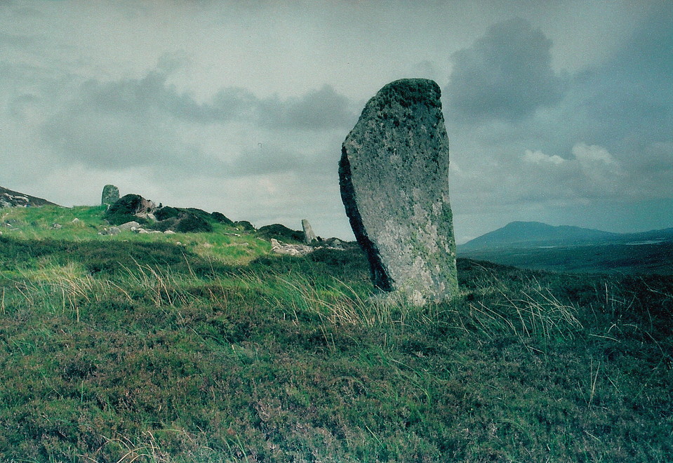
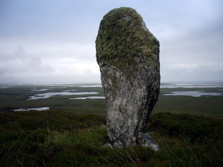
I definitely agree with Gladman that Julian's fieldnote in TMA doesn't give a true sense of the effort required to reach this splendid site but then I think the route Julian took is shorter than Gladman's suggestion albeit, as I discovered, the advantage gained in terms of distance is offset by having to negotiate a fence. Sitting in the nice cafe at Cladach Chirceboist Uneval (the hill) is prominently visible directly in front of you in a north-easterly direction. It looks a darn sight nearer than it does from the starting-point suggested by Gladman which I originally drove up to. Even though it was a fine sunny day and hadn't (I believe) rained for over a week I still didn't fancy trekking across such a wide expanse of boggy terrain so wondered if I could get to it from the main road (the A865) instead. Driving back down towards the cafe I spotted an open gate on the left, about 150 yards before the cafe, and what appeared to be an abandoned single-track road leading to nowhere. Deciding against driving up this (basically it's just loose gravel, rocks and ruts and pits with nowhere to turn which might be very awkward if it's wet) I parked up and set off walking. Re-reading TMA on my return I see Julian says 'the road soon disappears' so assume he must have gone this way and indeed after about three-quarters of a mile or so it ends in a mass of rubble. At this point Uneval is at about two o'clock so off I traipsed over the bog until I came up to Loch Fada and saw that along the top of it, cutting off the route to Uneval, ran a fence, not a particularly forbidding one but still topped with a couple of strands of barbed wire. Getting over it wasn't a huge deal; I'm a month shy of 60 and still reasonably agile so it shouldn't pose most people any great problem. From then on it was steadily uphill through the bog and gorse, still something of a slog but much less so than if you'd come all the way from Gladman's starting-point. Either way it's well worth the trip, as much for the monument itself as for the stupendous views, all the better for being seen in such piercingly clear light. The people that built this really had an eye for its positioning in the landscape.
I was lucky; in less favourable conditions, both underfoot and overhead, this wouldn't have been half so enjoyable but don't be put off treating yourself to what Julian aptly describes as 'the megalithic chaos' of this wonderful place. Walking back to the car I felt extremely pleased with myself, equivalent to when I made the long hike to White Moor on Dartmoor a couple of years ago. I'd reckon on about 45mins/an hour each way but be warned, there is a lot of bog and a couple of small streams around Loch Fada. I went in up to my calves a couple of times but then I walk too fast and perhaps take less care than I should. The road is shown on the OS map; I think it's the one that goes to the left of Loch Fhaing Bhuidhe though once I'd set off walking I couldn't get it out to check because the wind was too strong so I just kept my eyes glued on Uneval and headed in that direction.
A classic, special site and, due to it's remoteness, a visit here is not to be taken lightly. It's an approx 5 mile round trip across rough, tiring terrain.... not sure the TMA book makes that quite clear enough, to be honest.
Park at the 'kink' in the road west of Beinn a'Charra - if heading north-east, this is just after the third loch on your left (Loch a' Charra). There's a track heading north-west at this point - ignore this, since Uineabhal is the low hill away across the moor to the south-east. From here you are basically left to your own devices to cross approx two and a half miles of peat bog, trackless, as far as I could tell. If not, I certainly missed it! Since the weather was somewhat 'changeable' I therefore took a bearing on the southern tip of Loch Dubh and then another to the southern flank of the hill, upon which stands the chambered cairn.
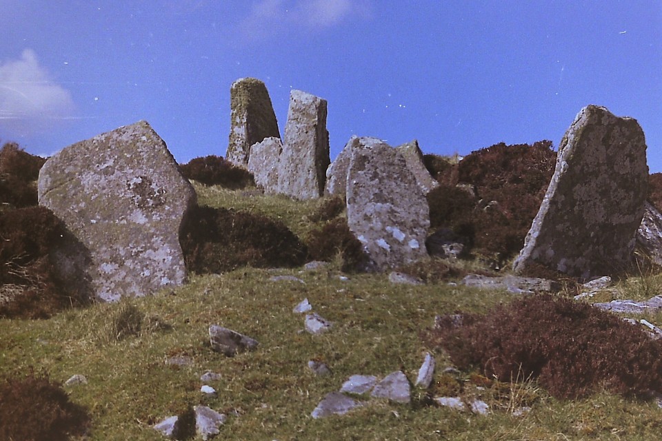
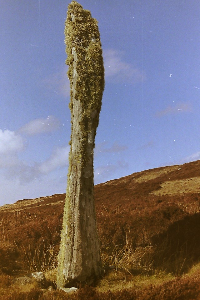
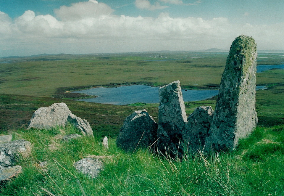
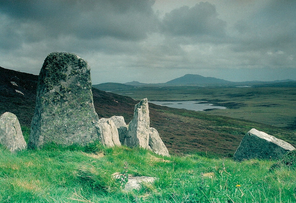
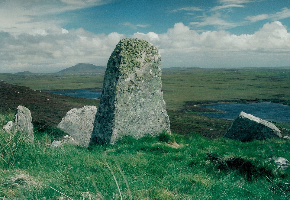
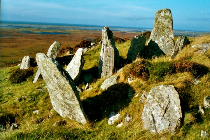
Known in Gaelic as 'Leacach an Tigh Chloiche', it's a substantial cairn with large orthostats forming a kerb. The chamber (roofless) and entrance passage are in the south-eastern flank of the cairn, with a large, free-standing monolith some way beyond the south-western corner. The disturbance at the north end of the cairn is apparently the remains of an Iron Age house inserted during the, er, Iron Age....
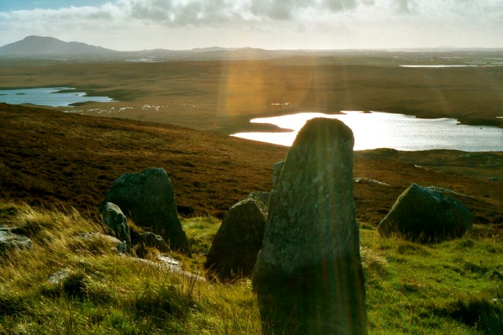
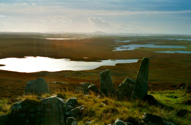
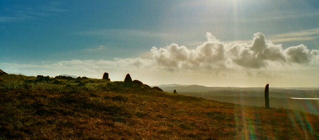
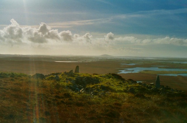
However it is the siting, the views and sheer remoteness which make a visit here a must, the landscape a patchwork of lochs leading to the coast. Climb to the summit of Uineabhal and a small dun is visible on an island within Loch Huna below to the east.

 Posted by GLADMAN