|
|

|
|
High & Low Bridestones DovedaleNatural Rock Feature
|
||||||||||||||||||||||||
|
|
|
Images (click to view fullsize) |
|
Photographs: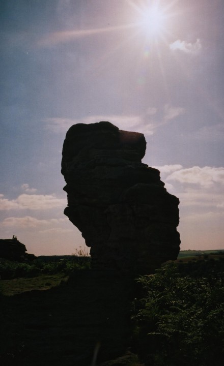
 Artistic / Interpretive:
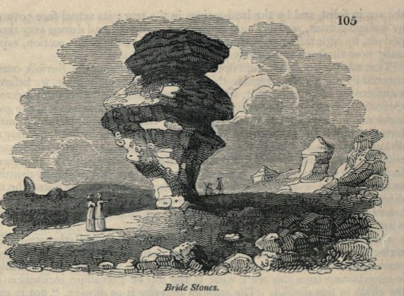
|
Fieldnotes |
|
|
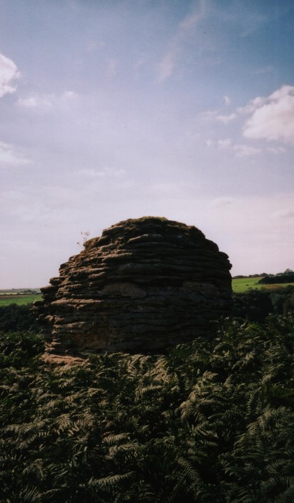
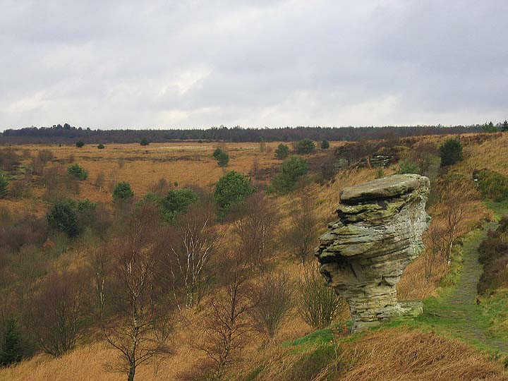
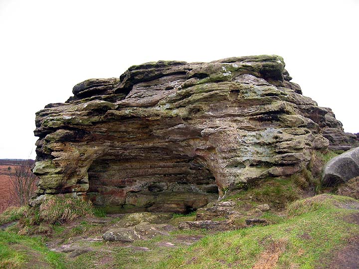
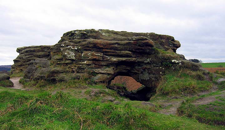
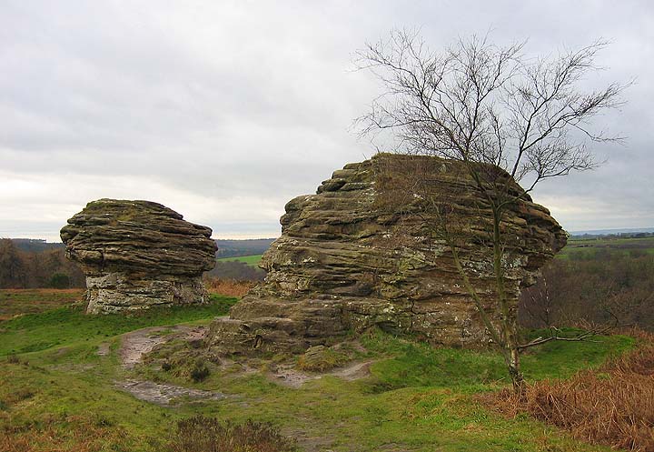
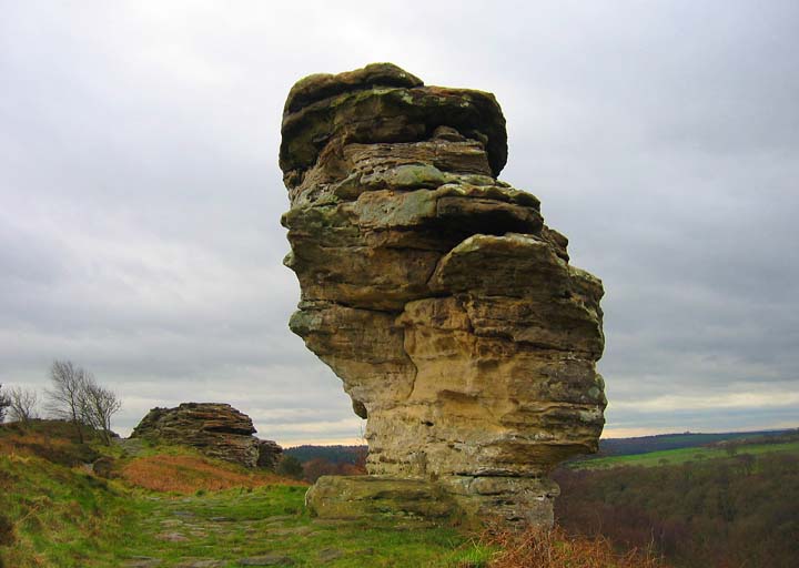
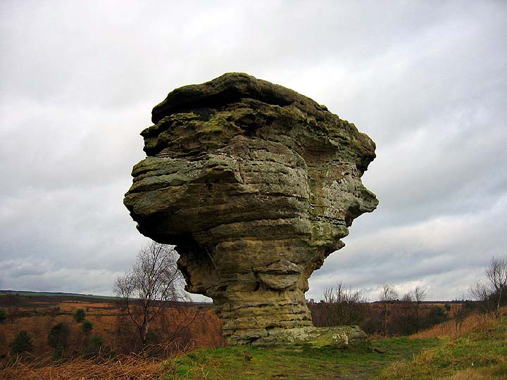
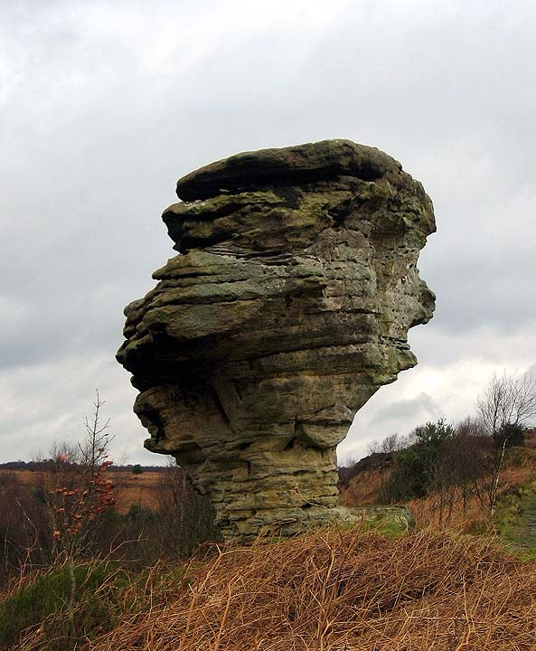
I spent a cold frosty morning in Goathland watching the Plough Stots perform their annual sword dance around the village, with half a day to kill I decided to follow my nose south into the Tabular Hills. The Tabular Hills occupy the southern end of the North York Moors, geologically they are formed of layers of Jurrassic limestone. In prehistory, as today, these hills were rich farmland and a marked contrast to the wide open heather expanse and thin soils of the northern moors. I travelled from Goathland south along the Pickering road. Once past the menacing structure of the Fylingdales military base the road climbs up through Saltergate and past it's famous pub where the peat fire that has burned continuously since 1759 trapping the malevolent spirit of a murdered excise man. From Slatergate the road runs around the edge of the Hole of Horcum, a huge natural bowl that legend tells us was created by either the Devil or Wade the Giant. A few miles along this road is the Dalby Forest drive. This is a toll road operated by the Forestry Commission and is very popular with hikers, bikers and all sorts of outdoor pursuit types. The road leads you into the Dalby Forest, a huge area of managed woodland, rich in archaeology. Being a good yorkshireman I only ever drive along this road in the wintertime when access is free. A couple of miles along the road brings you to the Bridestones car park. The path to the stones is signposted. Once through the gate I recommend you take the left hand of the three paths, this will take along the edge of the woods and then slowly up to the moor top. As you climb from the valley floor you can see the Bridestones standing like sentinels, lining the ridge to the east of you. The moor here has a primeval vibe about it and seeing the stones looking down on you gives you some idea as to how the people who first named these stones may have felt, the mysteriousness of this place would not have been lost on our ancestors. The stones outcrop on either side of a narrow valley, the eastern stones have a monumental vibe around them, the rock overhangs of the western stones may have provided plenty of opportunity for shelter and perhaps a place to observe game moving along Dovedale Griff below. If you in the area it is well worth having a look at the Bridestones. The walk from the car park will take you about 15 minutes. The gated track is quite steep in places and there are quite a few steps on the way to and from the stones. If you are feeling energetic you could park at the Hole of Horcum and make a day of it taking in the Old Wife's Way, Blakey Topping and its standing stones and the Bridestones. |
 Posted by fitzcoraldo
17th January 2007ce Edited 28th March 2007ce |
Miscellaneous |
|
|
Bridestones. Picturesque pillars of rock on our moors, particularly near Blakey Topping, at which love and marriage ceremonies were practised in former times, as these rites of the ancient Britons are recorded to have taken place near their cromlechs or altar- stones. Formed by long aqueous and atmospheric action dispersing the softer parts and leaving the harder standing (such being the cause assigned for their appearance), one among the shapes has been likened to a gigantic mush- room, being 30 feet high, 20 feet broad at the top, on a stalk only three feet broad in one part and seven feet in another. A Glossary of Words used in the Neighbourhood of Whitby. By F. K. ROBINSON of Whitby. London MDCCCLXXVI. Taken from PUBLICATIONS OF THE FOLK-LORE SOCIETY COUNTY FOLK-LORE XLV/ 1899. |
Posted by fitzcoraldo 29th November 2007ce |
Links |
|
PastscapeClick on link to 'Related Text' for info about the stones. |
 Posted by moss
13th July 2014ce Edited 13th July 2014ce |