|
|

|
|
Tripsdale / Bilsdale Bride StonesCairn circle
|
||||||||||||||||||||||||
|
|
|
Images (click to view fullsize) |
|

|
Fieldnotes |
|
|
Back up there yesterday. The easiest way to get up to the site is to follow the footpath at SE56729750. The footpath sign is currently buried in a mass of trees by the roadside but it's still there. |
 Posted by fitzcoraldo
19th May 2004ce |
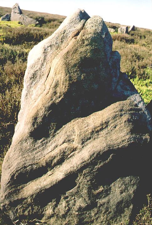
| With reference to the "cup-marks". The jury came back with a verdict of....natural weathering. |
Posted by fitzcoraldo 19th June 2002ce |
|
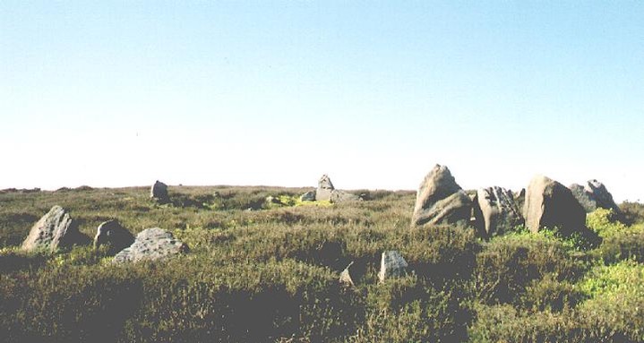
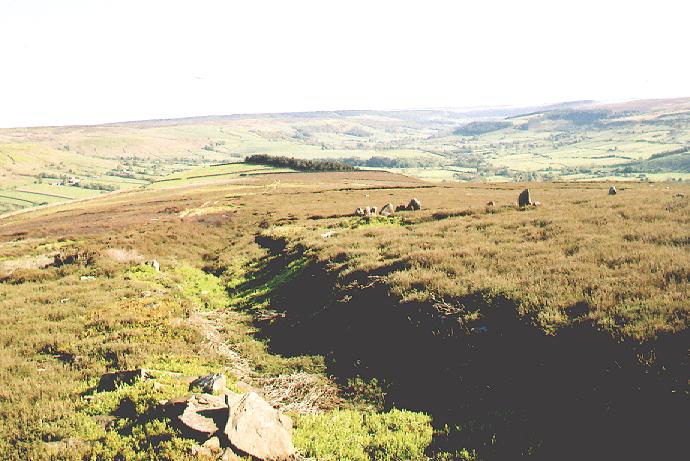
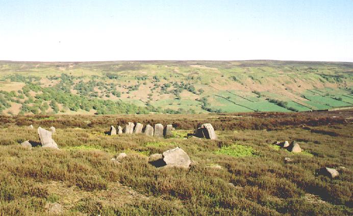
Yet another site known as the Bride stones. Bride was a popular lass back in the day. To get to the Bride stones, you can either continue a mile or so in a southerly direction from Bills Dyke or you can hike up the side of the dale using one of the many footpaths. The hike up is great and I discovered a standing stone in a field that has not been marked or recorded. Before you reach top of Nab End Moor take some time to explore to the rocks strewn around the rise of the hill. I think I may have found at least two large boulders that have cupmarks (I'll send my photos to the very knowledgable, Greame C. to see what he thinks). The circle itself is just below the cairn summit and lays beside a well marked track (an extension of the Billys Dyke path). The circle itself is a cairn circle with many good size stone still in situ It is 9 meters in diameter with the tallest stones standing at 1 1/2 meters. Despite it being beside a well made track, it is obvious that no-one comes here, there is a distinct lack of new age debris and coins rammed into crevices. With the brow of the hill to it's back, the circle looks out due south over a spit of land known as Nab End. It is a triangular spit flanked on one side by Tripsdale and the other by Bilsdale. In the far distance another mound is visible on the horizon ?Coniser Howl. One of the South Westerly stones has markings that appear to be man made, again I need to get this verified before I crow about it. Burl would give it a three, I'll give it a two and a half because it's a lovely place to spend an hour or two. |
Posted by fitzcoraldo 11th April 2002ce Edited 4th September 2003ce |
Miscellaneous |
|
|
Details of site on Pastscape Bronze Age round barrow, formerly identified as a stone circle. (SE 57569790) Stone Circle (NR). (1) Cairn Circle (NR). (2) The "Bride Stones" (SE 576978): A doubtful example of a burial circle, or degenerate henge-monument, named the "Bride Stones", occurs on Nab Ridge. These circles often enclose cremation pits or urn burials and such burials are also found outside the enclosures, as well. They are frequently situated in or near groups of small stony cairns. (3) The name "Bride Stones" probably belongs to this stone circle and not be the cairn (SE 59 NE 11) 50 paces to the north. The feature has been extensively robbed of its stones but appears to consist of a circular bank revetted with stones inside and outside. Three stones on the north and ten stones in the SE quadrant of the inner kerb remain standing, with heights up to one metre. Inside the circle old and recent holes have been dug but there are no records of any finds. The circle resembles a ring-work or henge-circle such as those excavated on Great Ayton Moor (Scarborough Arch Soc Report No 7 1967. Enclosures C and D (NZ 51 SE 1) but such kerbs of close-set stones are often found in barrows such as Hobtrusch Rook (SE 69 SE 3). It is more likely to be a mutilated tumulus and Elgee noted (after he had published his Early Man in NE Yorkshire in 1930 where he described it as a stone circle) that it resembled the kerb of a barrow. (4) Correctly described by Hayes. The circle was clearly originally formed by an unbroken faced 'wall' in conjunction with closely set orthostats such as is commonly found in the great Cumberland type stone circles. While the overall dimension of 12m here precludes any further comparison with the latter, the remains as they stand favour some form of burial ring rather than a cairn kerb. Published survey (25") revised. (5) Set on a south-facing slope at SE 57569790 are the well-defined remains of a circular stone-walled enclosure measuring 13.0m diameter over a partly robbed and collapsed rubble wall averaging 2.0m wide. The inner face of the wall in the E quadrant is formed of several large contigious boulders set upright. Three similar appear in the N. The outer face (less evident but still extant and covered by thick heather) where best preserved in the NE consists of large boulders contigiously laid but horizontally. Elsewhere the facing stones have fallen over. There is no trace of an entrance. (The obvious place for one in the S is too overgrown and mutilated to say if there was one here or not). The interior is not levelled and follows the natural slope of the hill. This may be due to heavy peat built-up but the inner facing stones in the N suggest that this site was never levelled. This is not a stone circle and not a modern feature (ie sheepfold, stock pond, etc.). Surveyed at 1:10,000 (on field document). (6) SE 576979. "Bridge stones(sic) round cairn and stone circle. Scheduled. (7) SE 5756 9790. Round barrow 900m NNE of Oak House. Scheduled RSM No 25548. (8) -------------------------------------------------------------------------------- SOURCE TEXT -------------------------------------------------------------------------------- ( 1) Ordnance Survey Map (Scale / Date) OS 25" 1930 ( 2) Ordnance Survey Map (Scale / Date) OS 6" 1958 ( 3) General reference Hist of Helmsley (J McDonell) 1963 36-7 389 (Bronze AgeArch - R H Hayes) ( 4) General reference Letter and plan R H Hayes 27.5.73 ( 5) Field Investigators Comments F1 RE 06-DEC-73 ( 6) Field Investigators Comments F2 ISS 09-APR-75 ( 7) General reference DOE(IAM) AMs Eng 1978 49 ( 8) General reference English Heritage Scheduling Amendment 17/11/94 |
 Posted by Chance
10th July 2012ce |
|
Elgee thought that this site "guards a burial". Whellan considers it "the remains of a Druidical temple on Stoadfast Hill". |
Posted by fitzcoraldo 20th May 2004ce |