The Modern Antiquarian
Log in
|
Register
Home
Latest Posts
Forums
Maps
Help
Browse Sites
News
Blog
Contributors
The Books
Select
-
Belgium
Denmark
Eire
France
Germany
Greece
Italy
The Netherlands
Norway
Portugal
Republic of Malta
Spain
Sweden
Switzerland
United Kingdom
Wales
Anglesey
Porth Trecastell
Promontory Fort
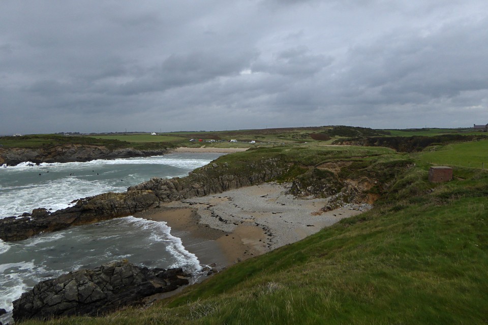
Porth Trecastell (Promontory Fort) on The Modern Antiquarian, the UK & Ireland's most popular megalithic community website. 6 images, plus information on many more ancient sites nearby and across the UK & Ireland.
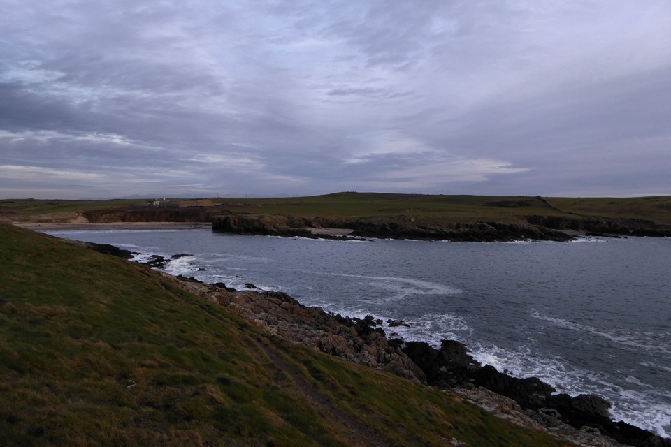
Image © A. Brookes (24.9.2016)
Nearest Town:
Llangefni (14km NE)
OS Ref (GB):
SH33247059 /
Sheet: 114
Latitude:
53° 12' 21.08" N
Longitude:
4° 29' 49.99" W
Added by
thesweetcheat
Images (6)
0 discussions
Start a topic
Show |
Hide
Web searches for Porth Trecastell
Flickr
Google
Google Images
The Megalithic Portal
Bing
Stone Pages
Streetmap.co.uk
Wikipedia
Show map
(inline Google Map)
- Sites within 20 km -
-
Barclodiad-y-Gawres (0.35km W) (98 posts)
Mynydd Bach (Aberffraw) (0.54km W) (13 posts)
Traeth Fawr (3.38km ESE) (16 posts)
Ty Newydd (3.44km NNE) (45 posts)
Lain Wen Farm Inscribed Stone (4.59km NNE) (7 posts)
Llyn Cerrig-bach (6.49km NW) (5 posts)
Din Dryfol (6.59km ENE) (30 posts)
Twyn y Parc (6.69km ESE) (3 posts)
Malltraeth (7.63km E) (19 posts)
Craig yr Allor (7.81km NNE) (1 post)
Fynnon Gwenfaen (8.73km W) (4 posts)
Graiglas Barrow (9.3km ENE) (1 post)
Henblas (9.43km ENE) (29 posts)
Graiglas (9.47km ENE) (8 posts)
Trefor (10.11km NNE) (0 posts)
Treiorwerth (10.14km N) (1 post)
Presaddfed (10.39km N) (38 posts)
Stanley Mill (10.53km WNW) (7 posts)
Shop Farm (10.69km NNW) (6 posts)
Trearddur (11.9km WNW) (5 posts)
Llangaffo (12.24km E) (2 posts)
Trefignath (12.44km WNW) (78 posts)
Maen Hir, Tregwhelydd (12.51km N) (6 posts)
Llangristiolus (12.75km ENE) (6 posts)
Ty Mawr (12.98km WNW) (29 posts)
Bodowyr (13.21km E) (75 posts)
Bryn Gwyn (13.43km E) (50 posts)
Porth Dafarch (13.64km WNW) (11 posts)
Castell Bryn-Gwyn (13.76km E) (25 posts)
Kiltierney (13.94km SW) (0 posts)
Dinas (Trearddur) (14.03km WNW) (6 posts)
Pont Sarn-las (14.07km E) (2 posts)
Caer Leb (14.37km E) (18 posts)
Trefwri Standing Stone (West) (14.38km E) (16 posts)
Bedd Branwen (14.57km N) (11 posts)
Trefwri Standing Stone (East) (14.58km E) (11 posts)
Penrhosfeilw (14.7km WNW) (57 posts)
Perthi Duon (15.18km E) (24 posts)
Gorsedd Gwlwm (15.2km WNW) (9 posts)
Bod Deiniol (15.5km N) (4 posts)
Hirdrefaig (15.72km ENE) (8 posts)
Llanfaethlu (15.74km NNW) (21 posts)
Castell Trefadog (15.84km NW) (6 posts)
Brynsiencyn (15.93km E) (2 posts)
Caer Idris (16.35km E) (1 post)
Holyhead Mountain Hut Group (16.54km WNW) (44 posts)
Caer y Twr (16.83km WNW) (24 posts)
Gogarth Bay (16.93km WNW) (25 posts)
Tyddyn Bach Standing Stone (17km ENE) (21 posts)
Bryn Celli Ddu Gorsedd (17.2km ENE) (17 posts)
Llech Golman (17.26km NE) (19 posts)
Bryn Celli Ddu (17.4km ENE) (173 posts)
Dinas Dinlle (17.67km ESE) (52 posts)
Pen-y-Gelli (17.71km E) (2 posts)
Carreg Leidr (17.82km NE) (17 posts)
Maen Chwyf (17.89km NE) (8 posts)
Maenaddwyn (17.96km NE) (17 posts)
Llys Einion (18.03km NNE) (6 posts)
Llanddyfnan (18.56km ENE) (8 posts)
Maen Morddwyd (18.64km E) (8 posts)
Bryn-yr-Hen-Bobl (18.67km E) (31 posts)
Plas Newydd Burial Chamber (18.71km E) (55 posts)
Bodfan Menhir (18.75km ESE) (17 posts)
Dinas (Y Felinheli) (18.91km E) (5 posts)
Ty’n Pwll (19.25km ENE) (1 post)
Glynllifon (19.51km ESE) (1 post)
Pen-yr-Orsedd (South) (19.68km NNW) (15 posts)
Maen Llwyd (Plas Newydd) (19.85km ESE) (17 posts)
Maen y Goges (19.88km NNE) (4 posts)
- Facilities within 20 km -
-
Cwningar (Holiday Cottage: 0.3 km NNW)
Oriel Ynys Môn (Museum: 14 km NE)
Pizzeria La Gondola (Restaurant: 14.7 km NW)
- Add -
-
Add news
Add an image
Add fieldnotes
Add folklore
Add miscellaneous
Add a link
Add a nearby facility
Add an alternative name/spelling
Images
(click to view fullsize)
Add an image
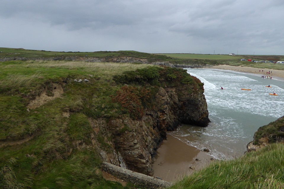
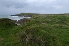 Image © A. Brookes (24.9.2016)
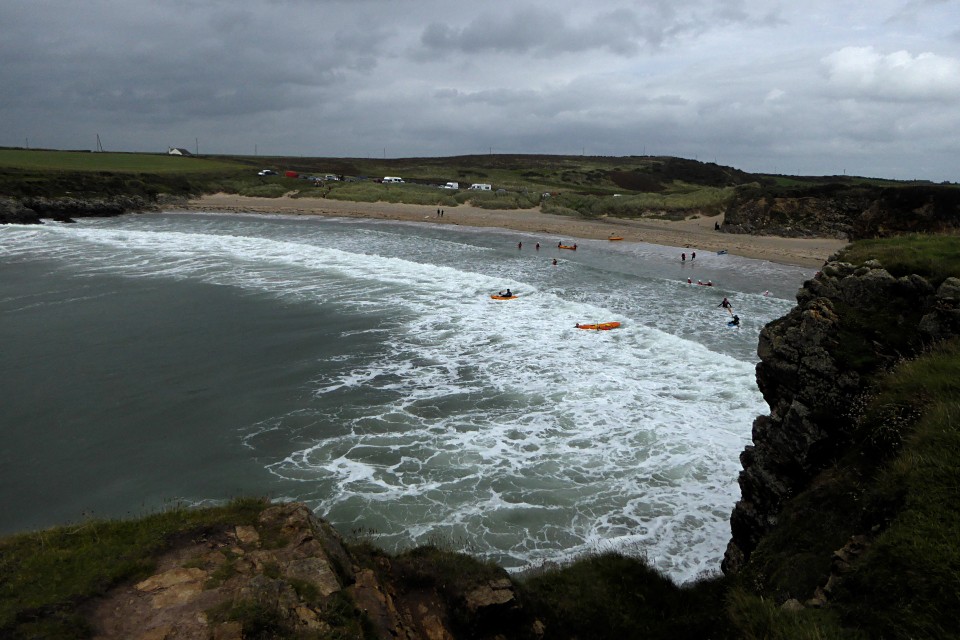