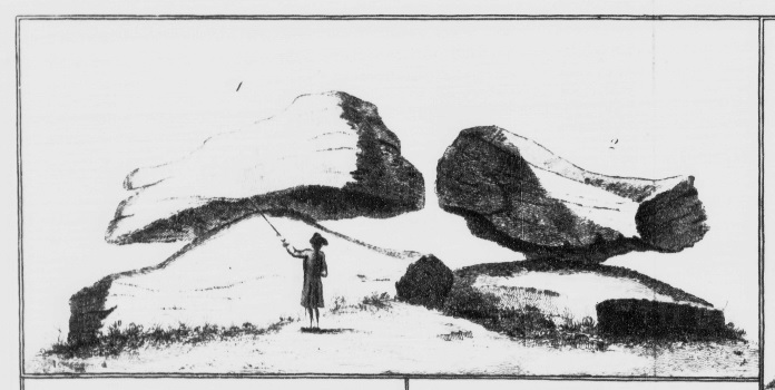
The first druidical remain which I shall mention, is called the Rocking-Stone, and two different views thereof are exhibited at No. 1 and 2 of the etched plate attending these remarks.
It is situated so as to be a boundary mark between the two town-ships, Golcar and Slaighthwait in the parish of Huddresfield, on what is called Golcar-Hill, and gives the name of Hole-Stone Moor to the adjoining grounds.
The size of it is about ten feet and half long, nine feet four or five inches broad, and five feet three inches thick. It rests on so small a center, that at one particular point, a man may cause it to rock, though it has been damaged a little in this respect by some masons, who endeavoured to discover the principle on which so large a weight was made to move.
From 'Druidical Remains in or near the Parish of Halifax in Yorkshire, discovered and explained by the Rev. John Watson, MAFSA and Rector of Stockport in Cheshire', read at the Society of Antiquaries, Nov. 21, 1771. (Archaeologia v.2).
The grid reference is where the stone is marked on the 1880 map.

 Posted by Rhiannon