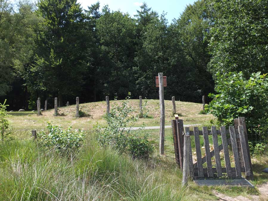
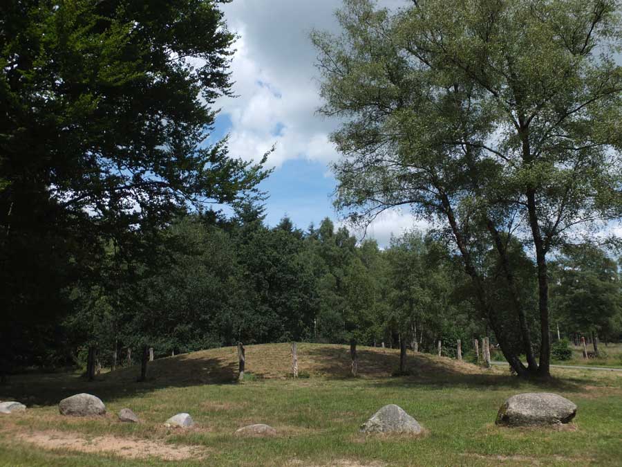
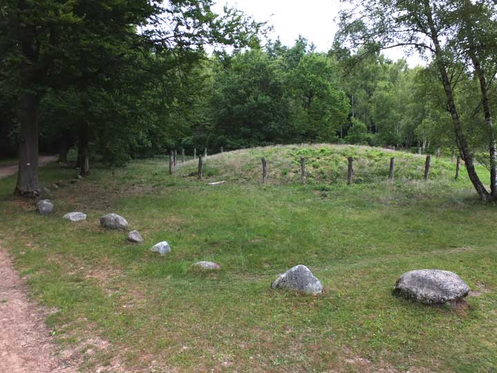
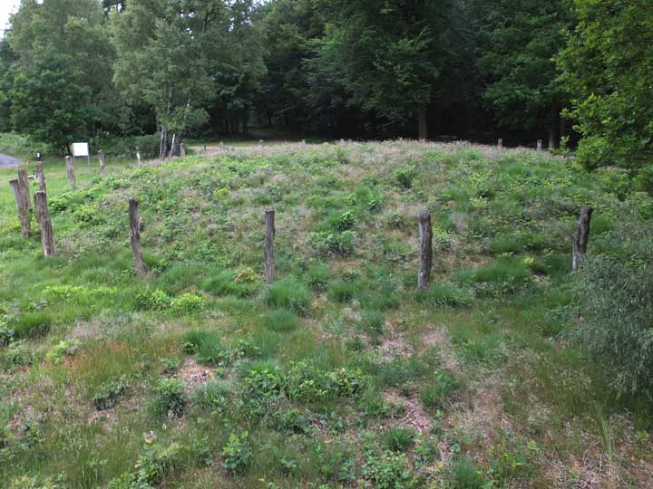
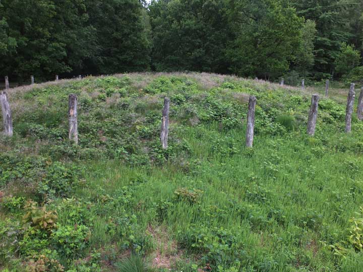
Yet another Galgenberg, this one located amongst the heath and woodlands of the Sleenerzand reserve, just south of Hunebed D49. And it's a huge burial mound, over 20 metres wide by between 3 and 4 metres in height.
Although it lies just a kilometre beyond the more famous hunebed D49 (the Papeloze Kerk), the way is not obvious. I have never actually seen instructions for finding the way there from this starting point and there is no signage to guide you. But the map below will take you there with ease.
Start at Campground/Recreation Center Rijmaaran, just beside the Voshaar No 21 bus halt (top right on the map below), follow the 'Hunebed' signs, and make your way to the Papeloze Kerk. Although the path slants off to the left at this juncture, walk round to the far side of the hunebed and continue in the same direction as before, now along a much narrower but fairly obvious forest footpath for another 100 metres, until it intersects with a wide forest road (blue marker).
Turn left, and follow this road for about 350 metres until the trees on the right give way to a prominent clearance (an ancient Celtic Field). Immediately past the far edge of this clearing (yellow marker), another wide forest road heads to the right: follow this for about 300 metres till you reach a tarmacked cycle track.
Finally, turn left and follow the cycle track for 200 metres until it emerges from the trees and curves around the base of the Galgenberg (red marker).
A plaque beside the Galgenberg states that:
Research conducted in 1934 and 1938 showed that this burial mound was raised in three phases. This took place in the Bronze Age, between 2000 and 1200 BCE.
A ditch had been dug around the mound of the first period, a wreath of posts surrounded the mound base of the second and third periods. Several graves were uncovered.
The central grave of the second period is among the richest in Drenthe. Besides bronze objects this grave contained two golden (ear) spirals. Although the research did not yield any concrete evidence, it is very likely that a gallows stood on the hill in the Middle Ages. The name of the mound suggests this.
It is possible that the relatively recent human skeleton found in a nearby burial mound is from an executed person. In 1996, the post wreath of the Iatest period was reinstalled.

 Artistic / Interpretive:
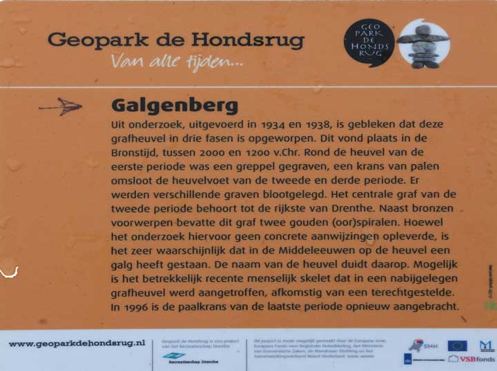
 Posted by LesHamilton