I don't read too much into symbolism. Generally speaking. However perhaps there is a degree inherent in citing Wales' glory as her abundance of mountains, rivers and coastline. Interdependent components of the hydrologic cycle. A triumvirate, if you will, one pretty much responsible for life on Earth when one stops to think about such things; as I'm pretty sure we should all more often do so. Yeah, intrinsic to existence, utilitarian, yet nevertheless infused with an aesthetic that has long haunted the susceptible such as I. Maybe you, too?
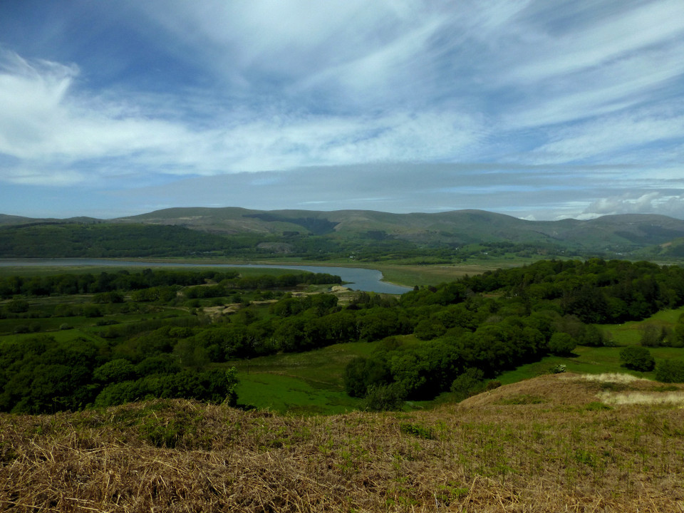
I think it's fair to say that Wales' rivers and mountains share a fundamentally closer infinity (as coastline is obviously not always 'within scope'), the latter channelling precipitate run off to define the former. From the iconic Afon Glaslyn, cascading from its legendary source beneath Yr Wyddfa to a conflux with the Afon Mawddach within its sublime estuary... to the River Dee (the Brythonic "River of the Goddess") flowing to Chester, via Llyn Tegid, from an obscure inception upon the slopes of Dduallt... Wales possesses its fair share of iconic rivers. Primus inter pares, as scholars would say, is probably the River Severn (Afon Hafren), the UK's longest watercourse, rising upon the incomparable 'Mother of Rivers' that is Pumlumon, close by the birthplace of the Wye (Afon Gwy), the latter arguably our most serpentine? Nonetheless it is the Afon Dyfi which gets my vote, all things considered. Sourced and nurtured within the epic, primordial bosom of Aran Fawddwy, the tumultuous birth of the nascent water course perfectly complemented by the final, stately procession to merge with Cardigan Bay 23 miles hence.
Which - finally - brings me to Trum Gelli following a morning drive from an overnight sojourn - as you do - upon said Pumlumon. Set at the south-western extremity of Y Tarrenau overlooking the Afon Dyfi's exquisite journey's end at Aberdyfi, the 1,754ft 'Ridge of the Grove' is, to be fair, not where the thoroughly modern mind would expect to find the locale's premier Bronze Age funerary monuments. Granted, I don't consider myself to be of this ilk; but then again, despite all the bollocks spouted by archaeologists proffering pet theories, what does the thoroughly modern mind really know of the Bronze Age mindset? It would appear there is a conundrum to be considered here. Hey, could it be that my preamble has a bearing and that the view from the summit was all important, an attempt to cement an association between life/death/rebirth... as symbolised by the nurturing waters of the Afon Dyfi merging with the sea prior to repeating the cycle, the process - to go 'round again'? OK, mere supposition, but intriguing nonetheless; and given credence by the location of a similar disposition of monuments upon Allt-llwyd, overlooking the end game of the Afon Dysynni to the north-west? Perhaps placement in relation to water really did have great symbolic meaning back in the day? The mountain/river duology or... even better, as here... the mountain/river/sea sacred trilogy?
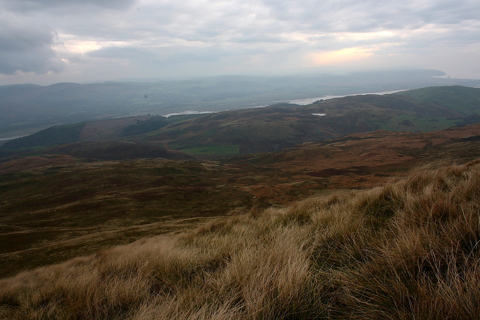
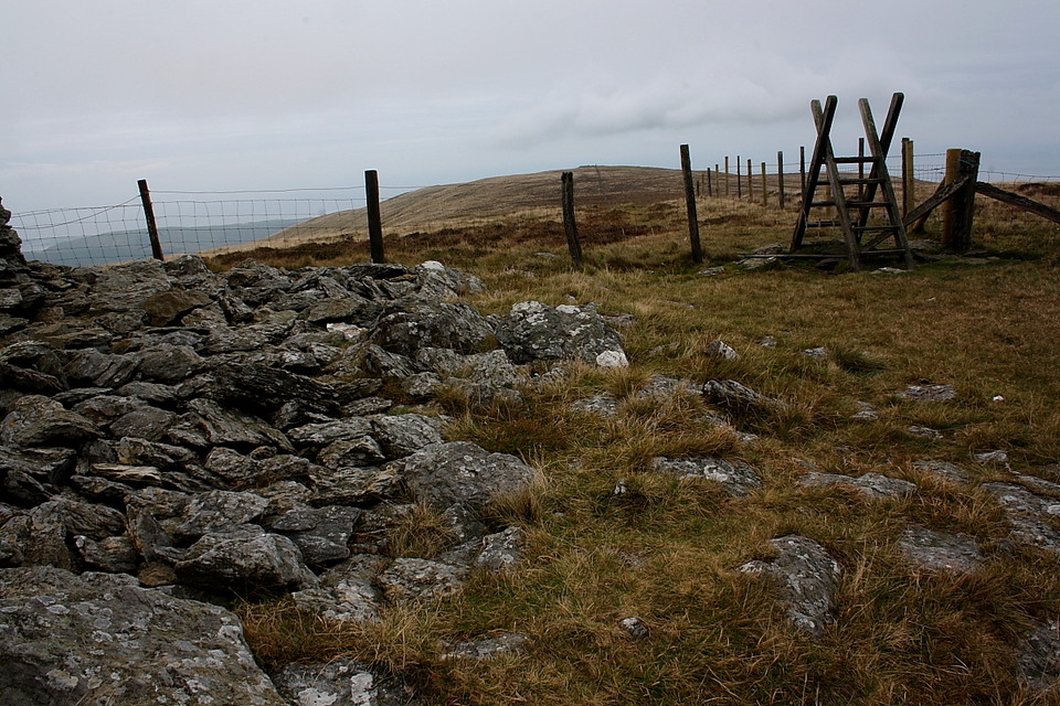
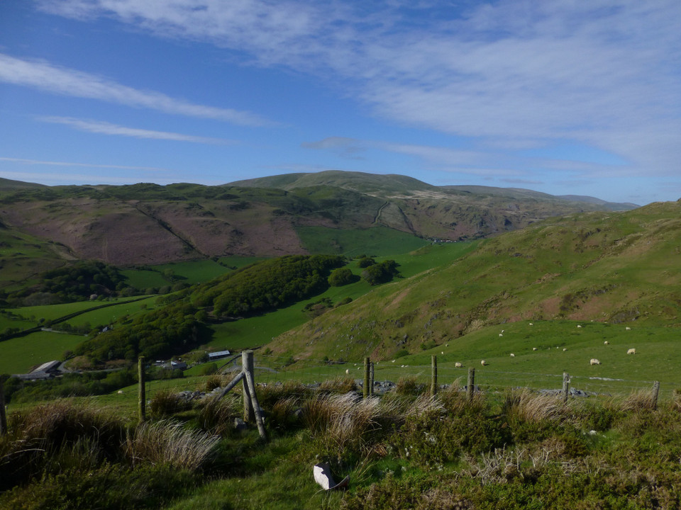
Now I first became aware of the potential significance of Trum Gelli's archaeology through a '3m cairns' reference in Dave Ing's 'Hill Walks in Mid Wales' (ISBN 1-85058-433-8). Checking the veracity of this has, to be fair, taken quite a while. But there you are. Although I would, in retrospect, recommend that interested travellers start from the (now 'retired'?) chapel within Cwm Maethlon (Happy Valley) to the south-west and make their ascent via Bryn Dinas, I end up coming from the east. It is possible (even for me) to park a car upon the hairpin bend at Pant-yr-or, west of Cwrt, whence a by-way climbs away to the north-west, accessing the excellent little cairn circle of Eglwys Gwyddelod before heading off west toward Bryn Dinas. This track is unfortunately also the legal preserve of those odd, noisy people whom appear to enjoy the mad adrenaline rush of riding a motor bike at 1mph. But there you are. Whooah! Crazy, far out dudes! It takes all sorts, doesn't it? Anyway, the track is an enjoyable stomp in its own right according excellent, sweeping views across Cwm Maethlon and Mynydd-y-Llyn (the lake in question being the curious 'Bearded Lake', Llyn Barfog) to the wondrous Aberdyfi and, beyond again, Pumlumon.
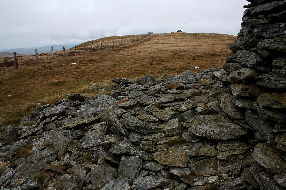
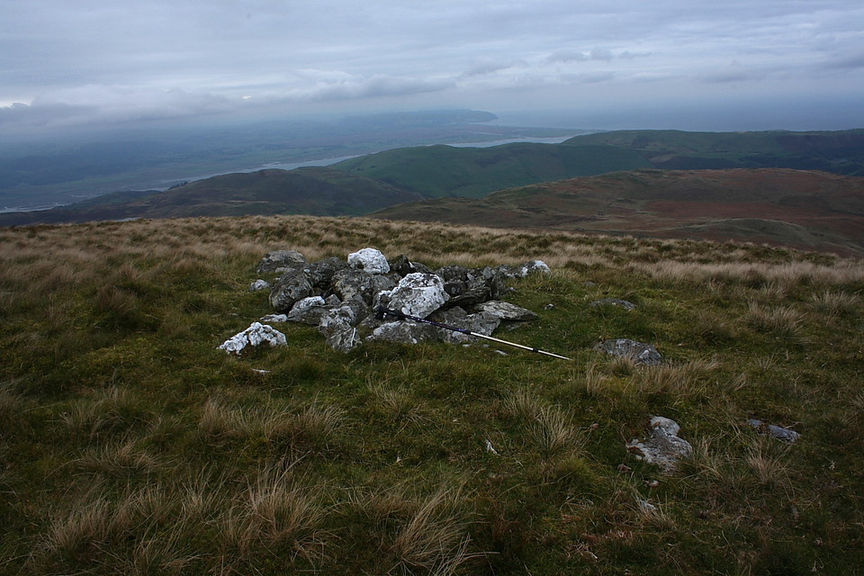
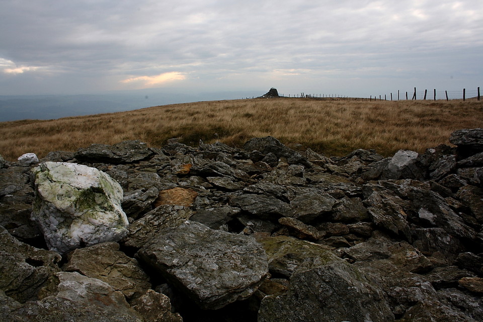
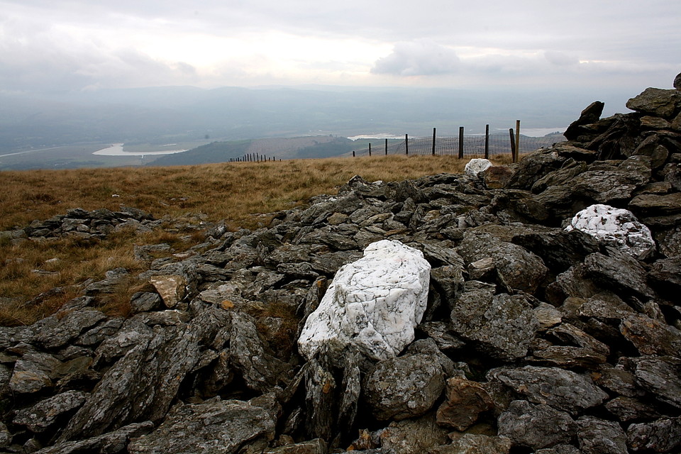
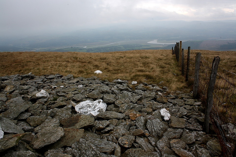
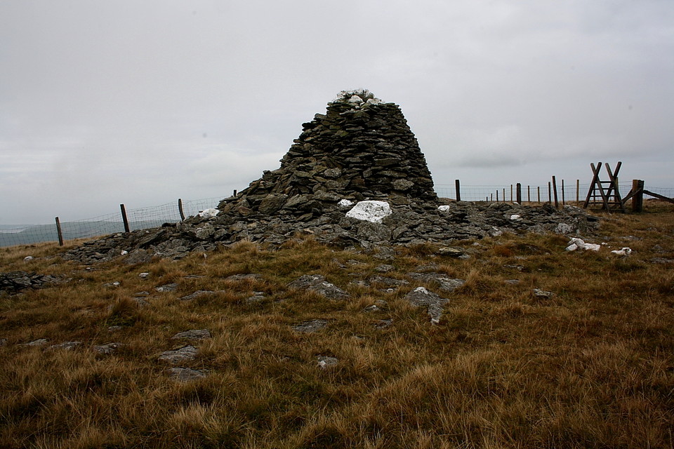
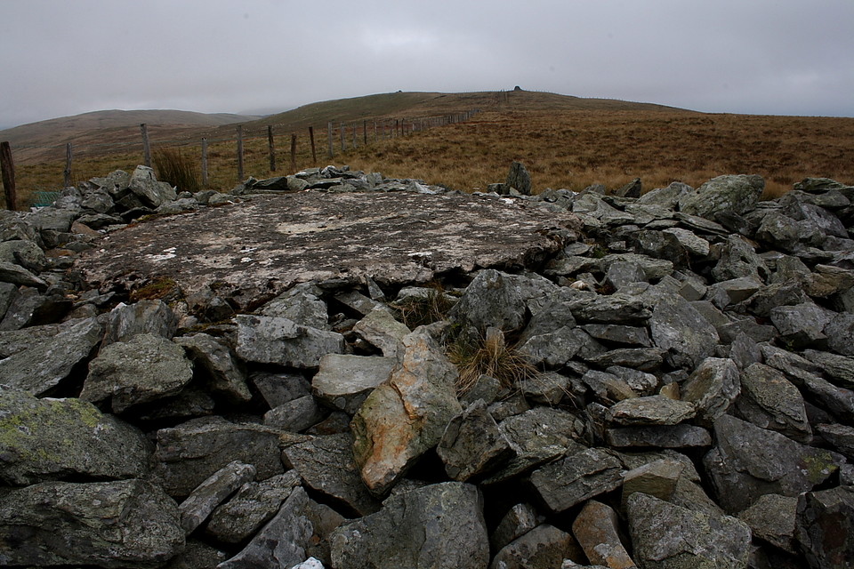
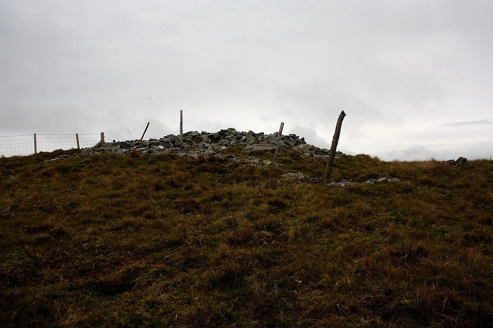
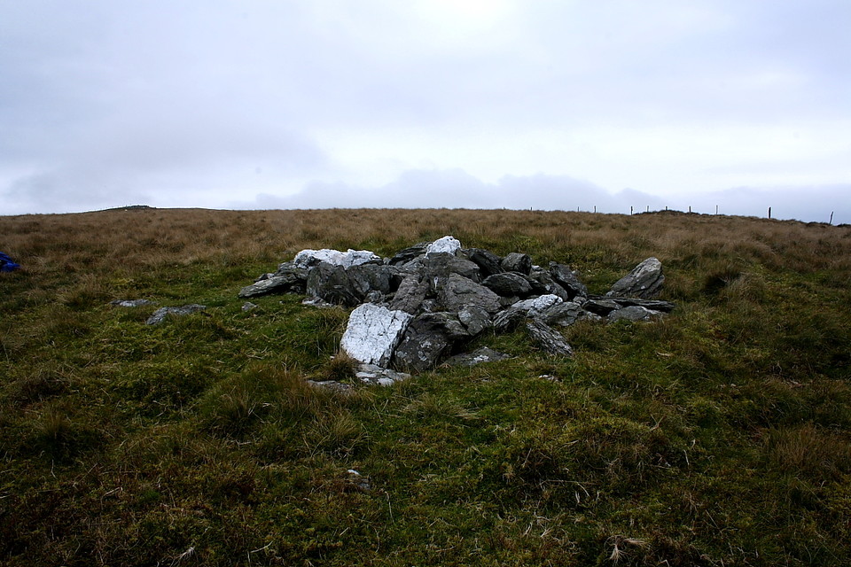
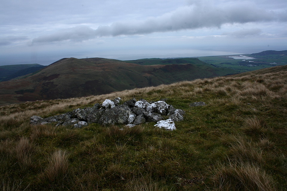
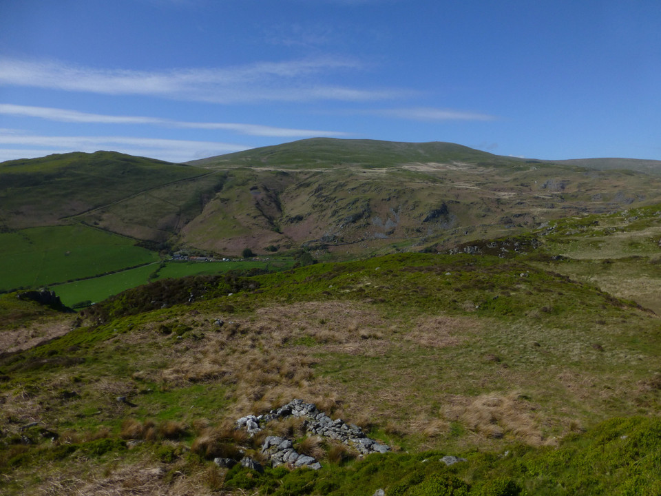
At the col before Bryn Dinas the track swings to the northwest. I therefore leave it here at the fence junction and head for the southern slopes of Allt Gwyddgwion rising above, the route just to the left of an overgrown cairn featuring remnants of a possible - nay, surely probable? - cist. The path, such as it is, heads straight for Trum Gelli so Citizens Cairn'd wishing to check out Allt Gwyddgwion's two cairns are advised to following the ascending fence line instead. The first, over to the left, is a small yet tidy monument. However that upon the crest [SH65150123] at a further fence intersection is, aside from a concrete 'capstone', actually rather good, complete with what I take to be the remains of a kerb still in situ. According to Coflein [RCAHMW, 14/11/2007] it measures "approximately 10 metres square and 1.5 metres high", the concrete slab perhaps the base of a former temporary OS trig pillar? Curiously they clearly don't seem to know for sure. Whatever, the watery vistas to be enjoyed from here are, quite frankly, majestic. Perhaps unsurprisingly.
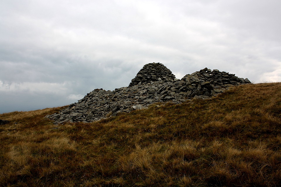
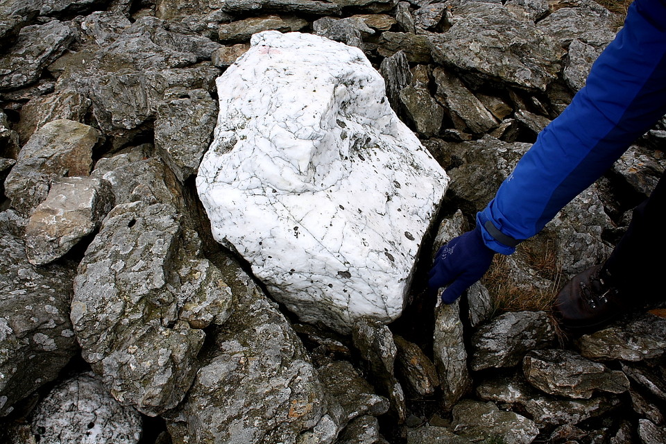
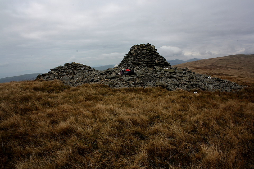
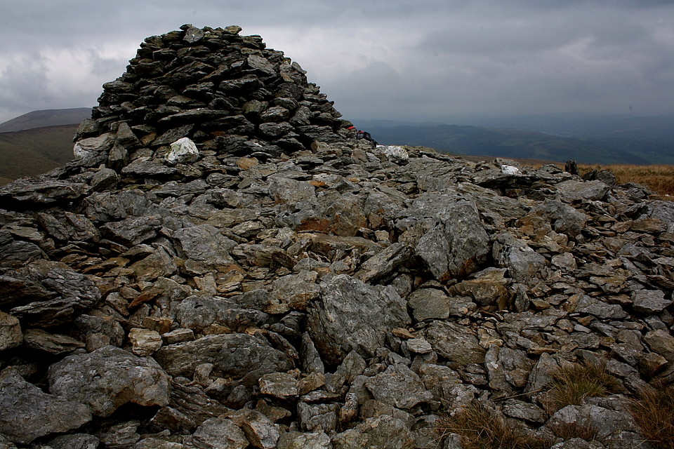
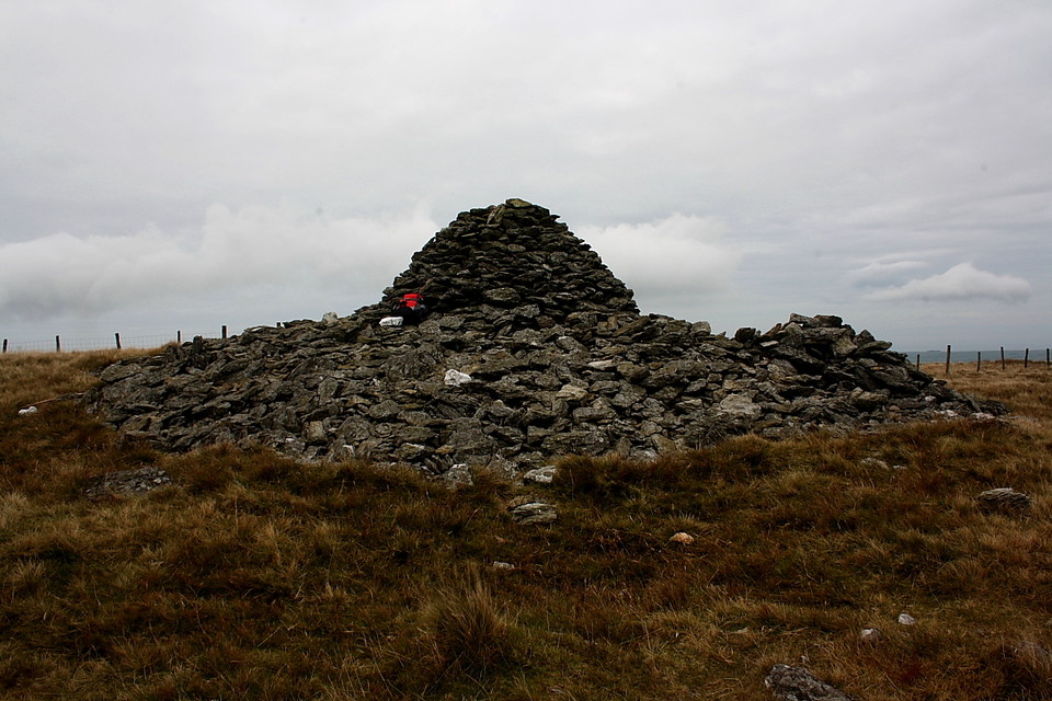
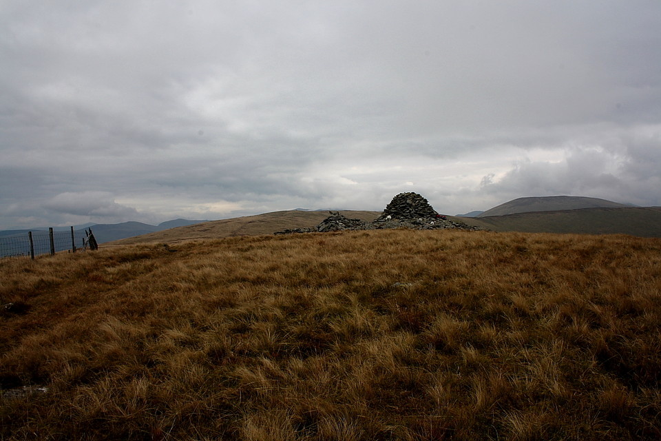
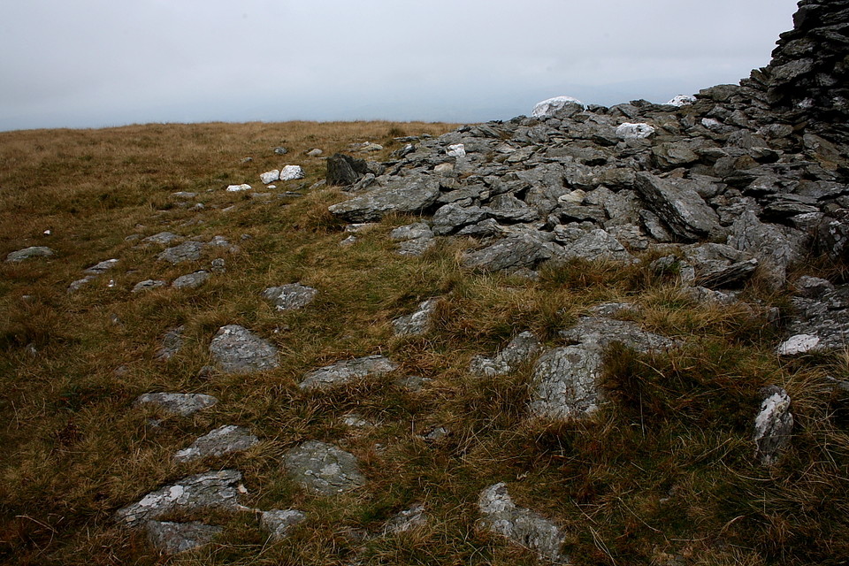
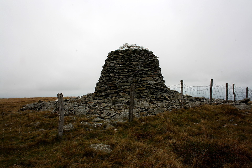
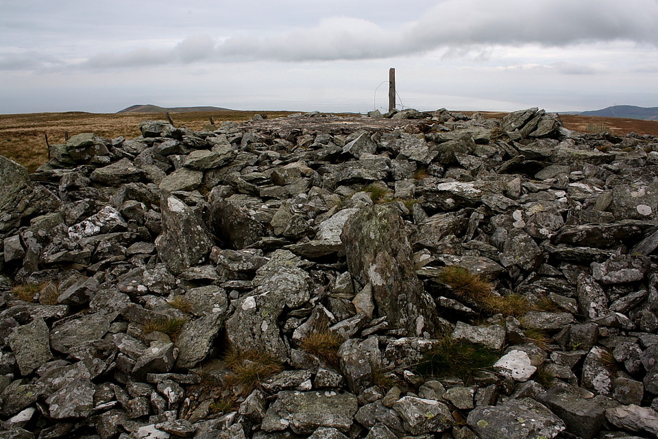
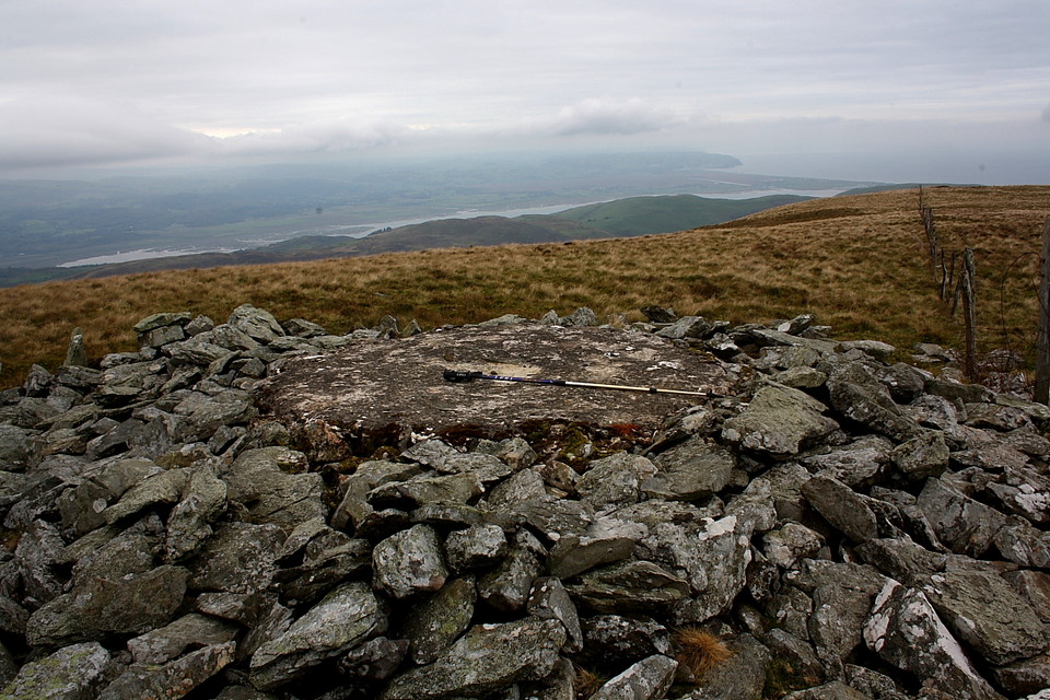
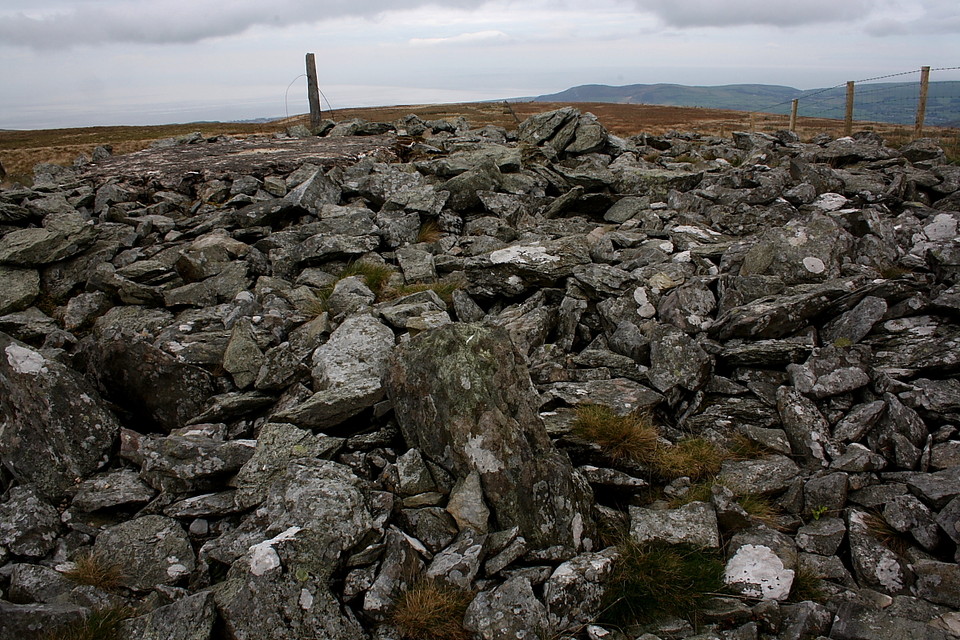
The ridge continues approx north-east to finally grant an audience with Trum Gelli's brace of summit monuments. These are in a different league altogether, the southern, just beyond a stile, surmounted by a (presumably) modern beehive very much in the style of Drygarn Fawr topping the Cwmdeuddwr Hills not that far to the south. The underlying footprint is substantial - very much so - and, furthermore, embedded with strategically placed blocks of quartzite. I get the impression some degree of reconstruction has taken place, but nevertheless the effect is aesthetically pleasing to the eye.
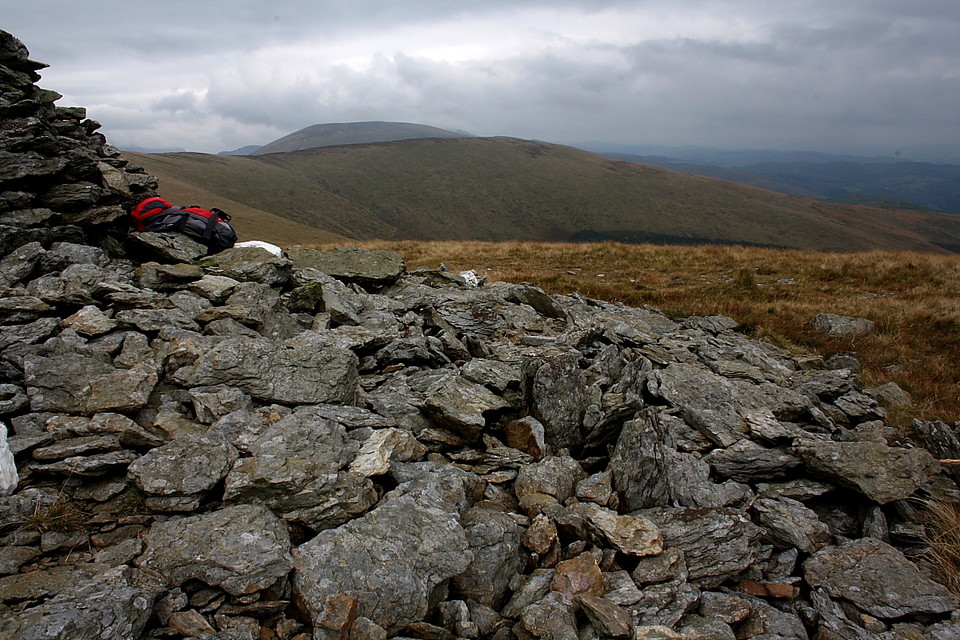
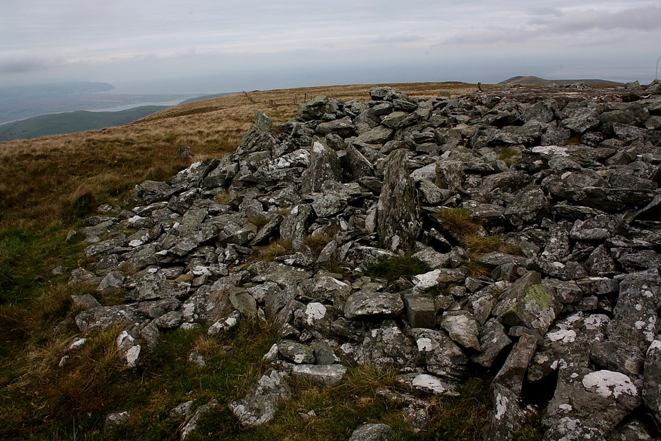
The northern [SH6561801554], at the actual summit (or so it would appear) is more 'ragged', yet - or perhaps because of this - my favourite of the quartet. Once again the footprint is very substantial, more so than its southern neighbour, perhaps since it possesses a smaller beehive. The onward view across Cwm Ffernol toward Tarrenhendre is excellent, the cwm itself featuring woodland.... although I couldn't decide if this represented forestry or perhaps the vestiges of the original namechecked 'grove'? Coflein gives dimensions as "5m wide, 2.5m in height" [S.D. Lowden, Archaeophysica, 1/6/2006] although their records do appear a little confused at the present time.
As I sit and contemplate H2O-related stuff - fortunately none sees fit to fall upon my head - I elect to enjoy an extra 30 mins up here by not reprising my ascent route in reverse, so to speak, instead descending steeply southwards more-or-less straight down to the byway far below. Suffice to say it is a mistake, the latter regions of this, er, route proving to be malevolent, deep bog. Schoolboy error and most certainly not the water association I was looking for, but there you are. Guess that's one way to retain the child inside. Albeit a rather soggy, smelly one. Whatever, I decide to undertake my own symbolic gesture, my personal homage to the principles of hydrology... by 'closing the loop' and following the Afon Dyfi back into its nursery upon The Arans. I spend the night at Bwlch-y-Groes.


 Posted by GLADMAN