The Modern Antiquarian
Log in
|
Register
Home
Latest Posts
Forums
Maps
Help
Browse Sites
News
Blog
Contributors
The Books
Select
-
Belgium
Denmark
Eire
France
Germany
Greece
Italy
The Netherlands
Norway
Portugal
Republic of Malta
Spain
Sweden
Switzerland
United Kingdom
Scotland
Highland (Mainland)
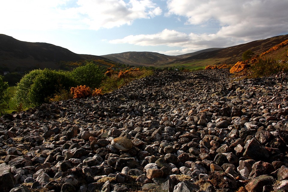
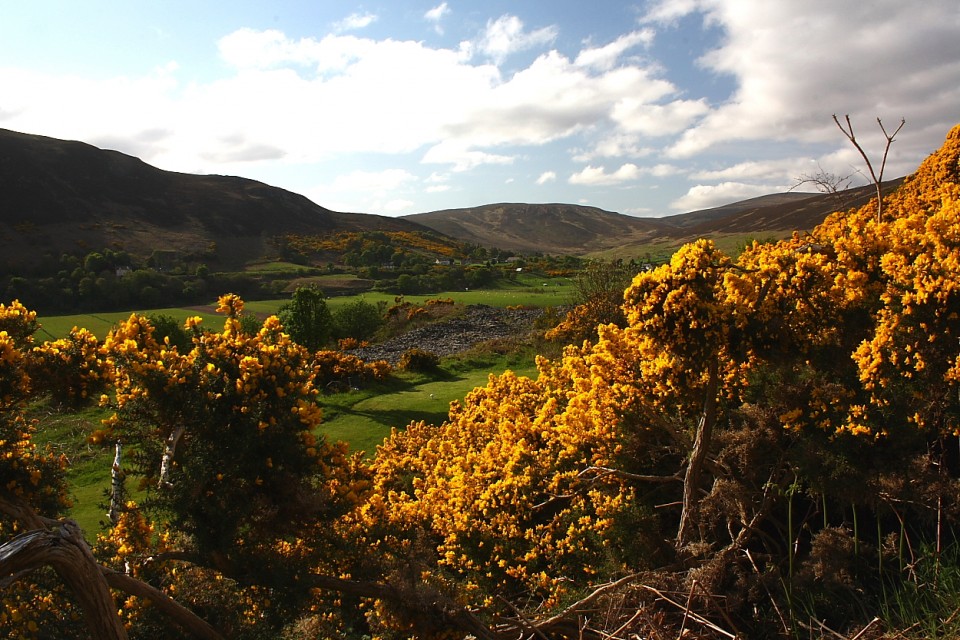
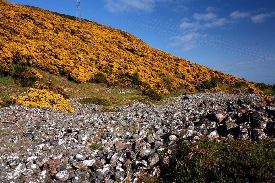
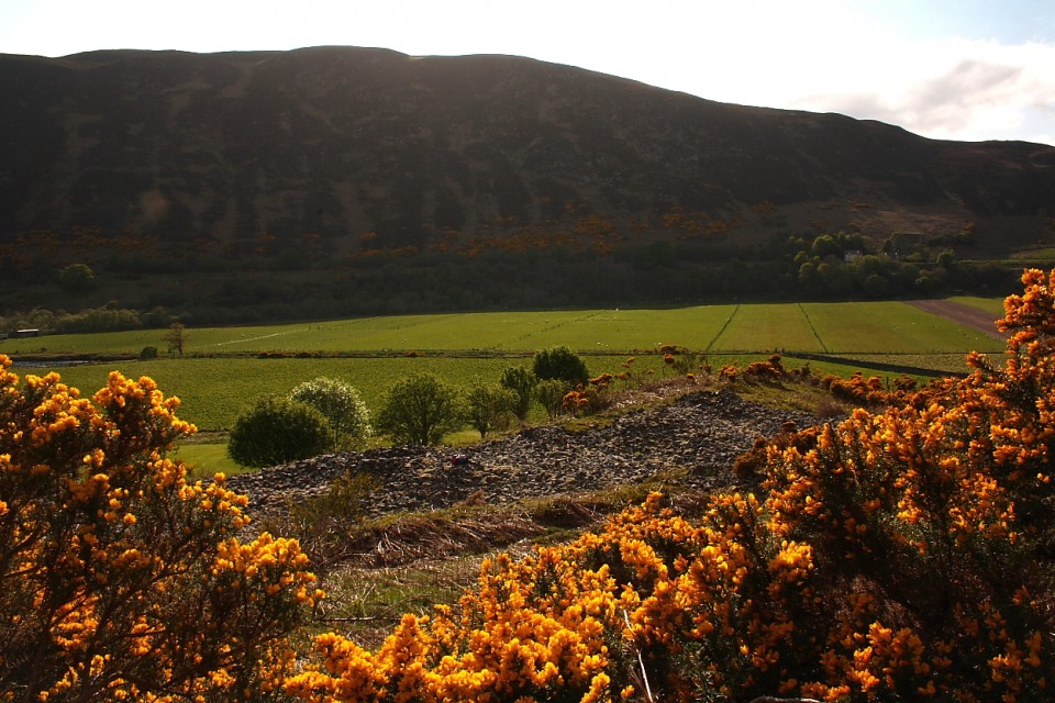
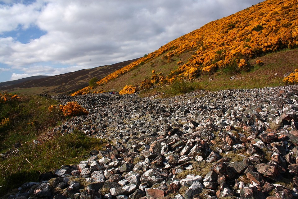
Carn Laggie
Long Cairn
Carn Laggie (Long Cairn) on The Modern Antiquarian, the UK & Ireland's most popular megalithic community website. 11 images, 1 fieldnote, plus information on many more ancient sites nearby and across the UK & Ireland.
Image © thelonious
Nearest Town:
Dornoch (35km SSW)
OS Ref (GB):
ND023165 /
Sheet: 17
Latitude:
58° 7' 36.39" N
Longitude:
3° 39' 32.41" W
Added by
thelonious
Images (11)
Fieldnotes (1)
0 discussions
Start a topic
Show |
Hide
Web searches for Carn Laggie
Flickr
Google
Google Images
MAGIC
The Megalithic Portal
Bing
Stone Pages
Streetmap.co.uk
Wikipedia
Show map
(inline Google Map)
- Sites within 20 km -
-
Caen Burn, Strath of Kildonan (1.65km WNW) (35 posts)
Salscraggie Cairn (2.65km W) (9 posts)
Kilphedir (3.51km W) (9 posts)
Green Table (3.6km ENE) (0 posts)
Kilphedir (3.75km WNW) (16 posts)
Eldrable (4.33km W) (1 post)
Ousdale Burn (5.34km ENE) (22 posts)
Torrish Burn (5.93km W) (8 posts)
Torrish Burn (6.24km W) (5 posts)
Strath of Kildonan (7.08km W) (4 posts)
Gailiable (7.56km W) (4 posts)
Balvalaich (8.16km W) (7 posts)
Clach Mhic Mhios, Glen Loth (8.4km WSW) (24 posts)
Langwell (8.9km NE) (7 posts)
Carn Bran (9.05km WSW) (17 posts)
Glen Loth (9.33km WSW) (10 posts)
Borgue Langwell (9.46km ENE) (9 posts)
Ben Uarie (9.57km WSW) (18 posts)
Kilearnan Hill (9.64km W) (1 post)
Lothbeg Bridge (9.72km SW) (13 posts)
Kilearnan (10.37km W) (10 posts)
Craig Halligarry (10.51km W) (8 posts)
Allt Preas Bhealaich (10.92km NNW) (3 posts)
Carn Liath, Strath of Kildonan (11.21km W) (6 posts)
Clach Na H-Uaighe (12.12km W) (1 post)
The Craggan (12.16km WSW) (3 posts)
Kintradwell (12.57km SW) (20 posts)
Suisgill Lodge (13.72km W) (1 post)
Cos Ceumach (13.72km SW) (1 post)
Ach An Fhionnfhuraidh (14.19km W) (0 posts)
Upper Borgue (14.44km NE) (5 posts)
Upper Borgue (14.61km NE) (4 posts)
Learable Hill (14.75km W) (20 posts)
Learable Hill (14.85km W) (4 posts)
Learable Hill (14.85km W) (6 posts)
Carn Nam Buth (14.98km W) (7 posts)
Suisgill (16.14km W) (14 posts)
Balantrath (18.61km NE) (4 posts)
Kinbrace Burn (18.81km W) (7 posts)
Loedebest Wood (19.1km NE) (5 posts)
Dunbeath Broch (19.12km NE) (15 posts)
Loedebest West (19.24km NE) (8 posts)
Dunbrae (19.29km NE) (2 posts)
Carn Liath (19.43km NE) (13 posts)
Loedebest (19.44km NE) (2 posts)
Kinbrace Hill (19.66km WNW) (22 posts)
Cnoc Na Maranaich (19.8km NE) (6 posts)
Cnoc Na Maranaich (19.84km NE) (15 posts)
Cnoc Na Maranaich (19.85km NE) (6 posts)
- Add -
-
Add news
Add an image
Add fieldnotes
Add folklore
Add miscellaneous
Add a link
-
Add a site
Add a nearby facility
Add an alternative name/spelling
Images
(click to view fullsize)
Add an image
Fieldnotes
Add fieldnotes
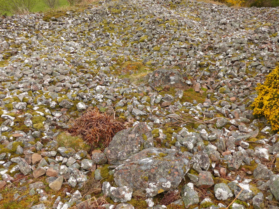
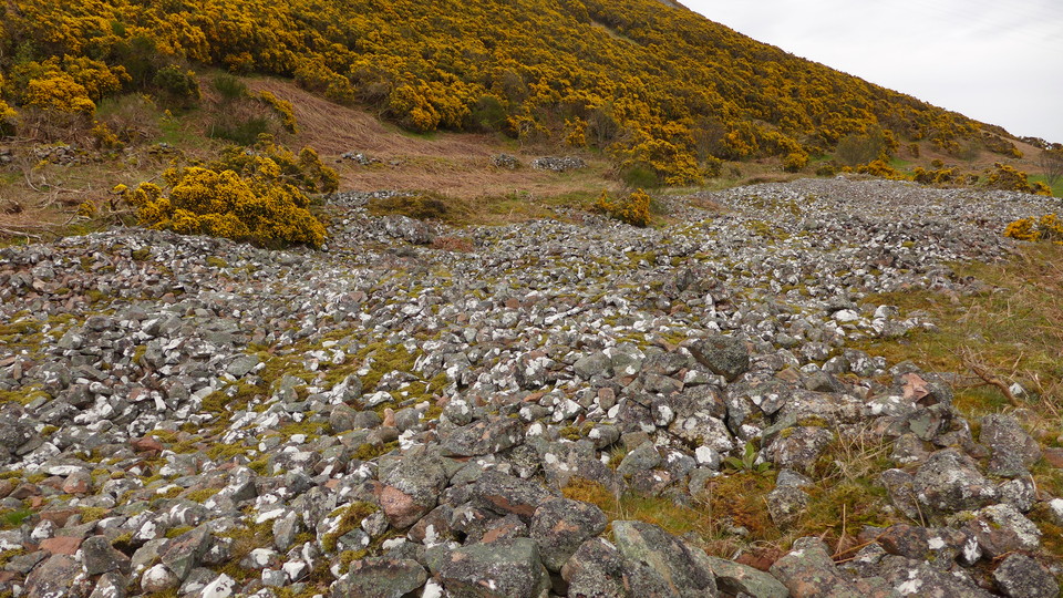
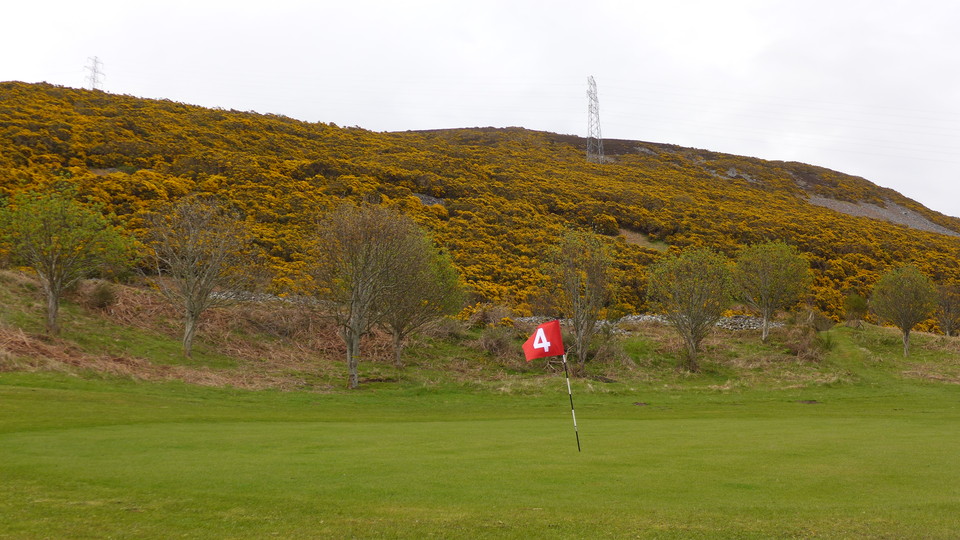
10/05/2015 - If you fancy a trip along Strath of Kildonan to visit the many fantastic sites there, this one is a good way to start your day off. Easy access across the golf course just outside Helmsdale. It's a nice location and a decent long cairn.
Comments (0)
|
Add a comment
|
Permalink
Posted by
thelonious
16th May 2015ce

 Posted by thelonious