|
|

|
|
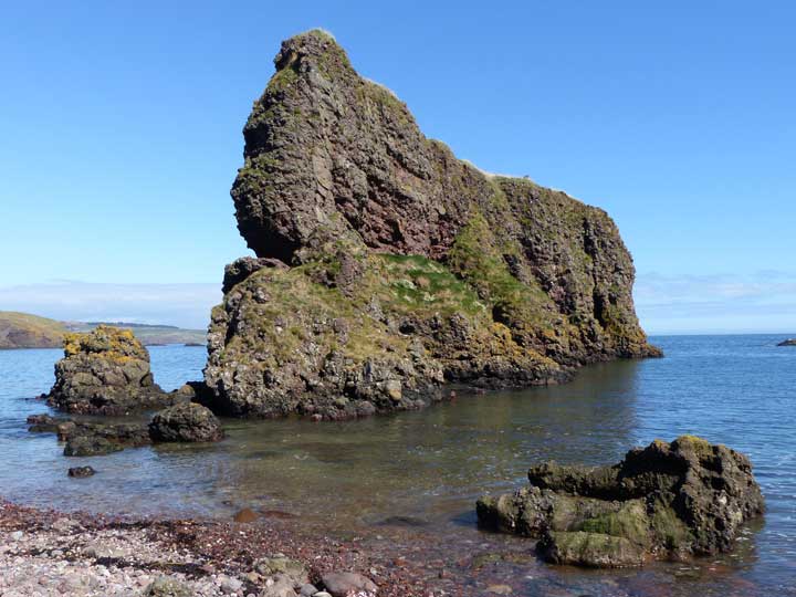
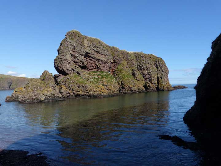
DunnicaerPromontory Fort
|
||||||||||||||||||||||||
|
|
|
News |
|
|
Video showing how the Dunnicaer Settlement may have looked https://www.youtube.com/watch?v=rGLFr8cXb6Q |
 Posted by LesHamilton
30th May 2019ce |
|
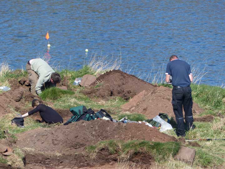
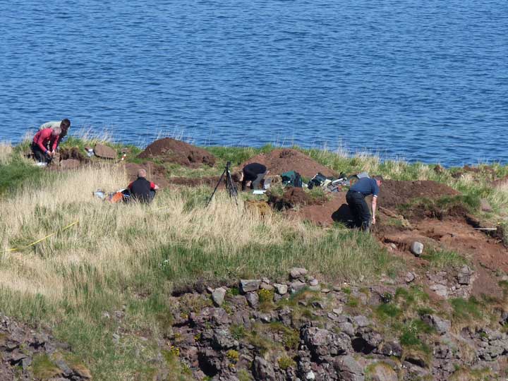
Second Excavation At Historic Sea Side Stack More info : http://www.bbc.co.uk/news/uk-scotland-north-east-orkney-shetland-36053300 |
15th April 2016ce |
|
Archaeologists unearth 'oldest Pictish fort in Scotland' on Aberdeenshire sea stack Radiocarbon dating shows the Dunnicaer fort to have belonged to the 3rd/4th centuries CE. This report appeared in Herald Scotland on July 28, 2015.. |
Posted by LesHamilton 28th July 2015ce Edited 28th July 2015ce |
Images (click to view fullsize) |
|
|
Fieldnotes |
|
|
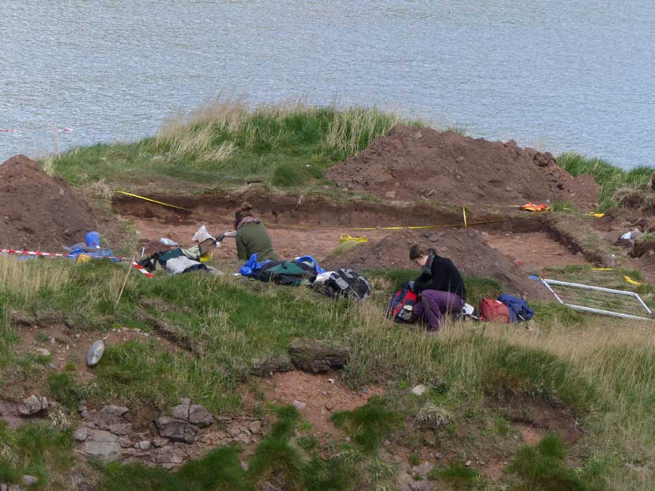
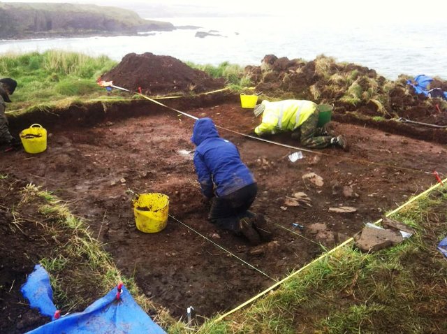
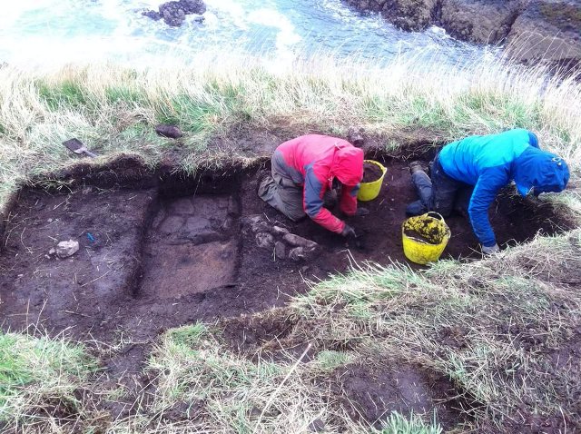
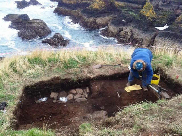
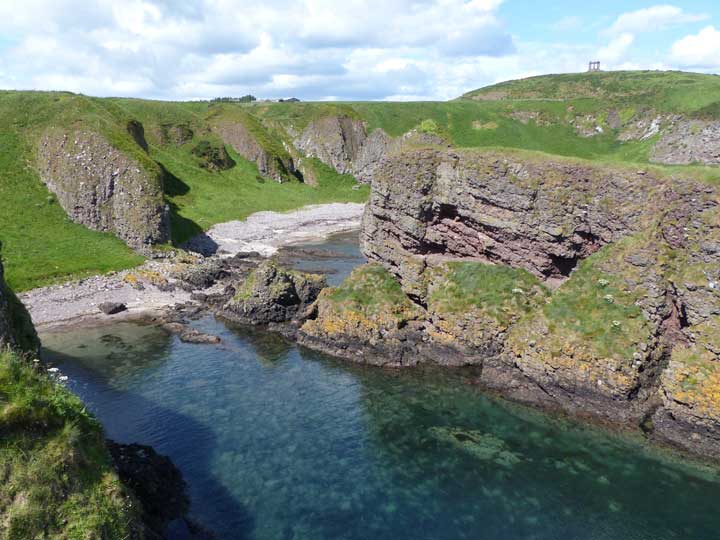
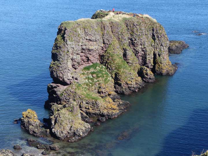
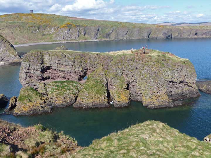
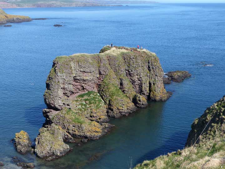
Visited: April 17, 2015 During April 2015, a team of archaeologists from Aberdeeen University uncovered what they believed to be the remains of a Pictish Promontory Fort on this sea stack, some 700 metres north of Dunnottar Castle. Early indications were that they had discovered the remains of a house, a fireplace and ramparts. A glance at this Google Map of the area leaves one in little doubt that the Dunnicaer Stack was once attached to the mainland, probably by a long-fallen natural arch. In all probability, like the crags at the western end of the neighbouring beach, which are already cut through by a natural arch, Dunnicaer was similarly connected to the shore in Pictish times. This would have provided relatively easy access to the fort via a ridge from the west. But in the centuries since, the arch has crumbled, isolating the stack which is now inaccessible without specialist equipment. To visit the site, park at Dunnottar Castle, but instead of taking the steps down to the castle entrance, head left along the clifftops. You have the choice of a good, fairly direct track, or a narrow walkers path that hugs the cliff edge. From the point where you draw level with the Dunnicaer Stack, gentle grassy slopes lead down to the shore. |
Posted by LesHamilton 17th April 2015ce Edited 11th March 2023ce |
Links |
|
Dunnicaer - An Archaeological Investigation"On the coast of Aberdeenshire lies the spectacular Dunnottar Castle, a 7th century Pictish power centre. Nearby is Dunnicaer, an unassuming and substantially eroded sea stack. Dunnicaer contains evidence to suggest it was an even earlier power center of the Picts. This film explores the investigations conducted by Aberdeen University into the site, and helps uncover it's mysterious past....." |
 Posted by thelonious
29th May 2019ce |