The Modern Antiquarian
Log in
|
Register
Home
Latest Posts
Forums
Maps
Help
Browse Sites
News
Blog
Contributors
The Books
Select
-
Belgium
Denmark
Eire
France
Germany
Greece
Italy
The Netherlands
Norway
Portugal
Republic of Malta
Spain
Sweden
Switzerland
United Kingdom
County Cork
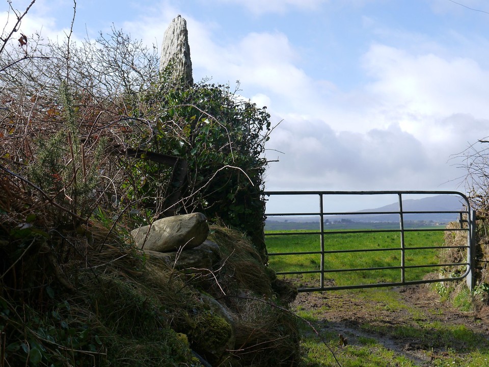
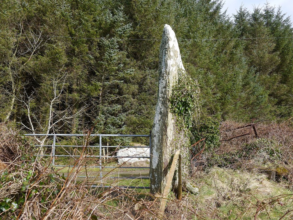
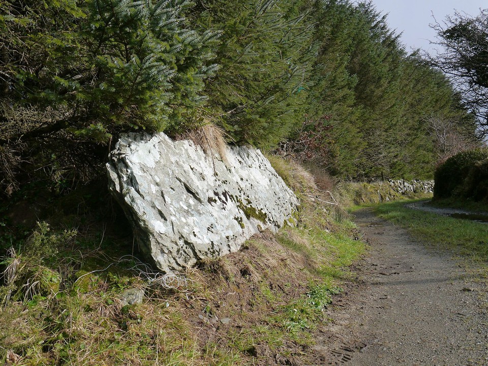
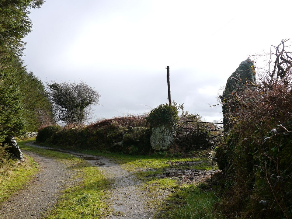
Lissaclarig West
Stone Row / Alignment
Lissaclarig West (Stone Row / Alignment) on The Modern Antiquarian, the UK & Ireland's most popular megalithic community website. 7 images, plus information on many more ancient sites nearby and across the UK & Ireland.
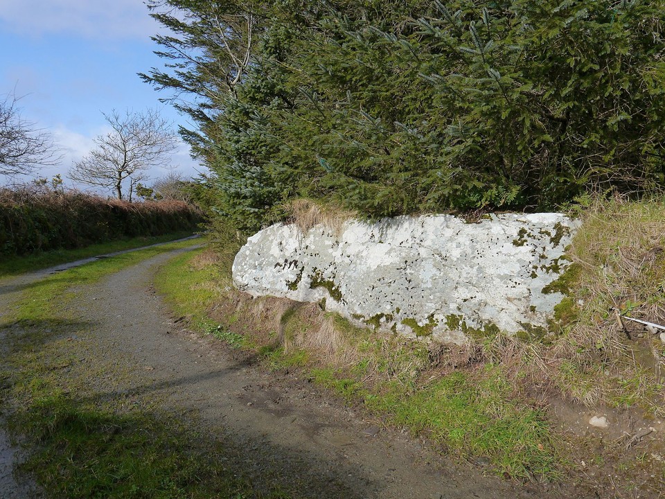
Image © Michael Mitchell
Nearest Town:
Ballydehob (5km WSW)
OS Ref (IE):
W040367 /
Sheet: 88
Latitude:
51° 34' 29.53" N
Longitude:
9° 23' 5.69" W
Added by
Meic
Images (7)
0 discussions
Start a topic
Show |
Hide
Web searches for Lissaclarig West
Flickr
Google
Google Images
The Megalithic Portal
Bing
Stone Pages
Wikipedia
Show map
(inline Google Map)
- Sites within 20 km -
-
Murrahin North (0.82km WSW) (8 posts)
Murrahin North (1.11km WSW) (13 posts)
Cappaghmore (1.89km NW) (6 posts)
Lyre (2.24km E) (6 posts)
Foherlagh (2.46km E) (8 posts)
Ballybane (The Rock of the Rings) (2.97km WNW) (4 posts)
Ballybane West NW (2.97km WNW) (5 posts)
Skeagh (3.19km E) (3 posts)
Hollyhill (3.32km SE) (5 posts)
Lisheen Lower (5.22km S) (4 posts)
Cloghboola (5.36km E) (5 posts)
Bawnishall (5.96km ENE) (3 posts)
Dromourneen (6.36km NNW) (2 posts)
Inishbeg (6.44km SE) (5 posts)
Abbeystrowry (6.69km E) (5 posts)
Rathruane More (7.58km WSW) (6 posts)
Cappaghnacallee (7.64km WSW) (1 post)
Rathruane Beg (7.69km W) (4 posts)
Lissangle (8.13km NE) (5 posts)
Caherogullane (8.21km NW) (5 posts)
Kilbronoge (8.22km WSW) (12 posts)
Maulinward (8.61km WNW) (6 posts)
Maulinward (8.61km WNW) (6 posts)
Cullomane East (8.61km NNW) (6 posts)
Cullomane East (8.61km NNW) (3 posts)
Cullomane East (8.61km NNW) (7 posts)
Parkana (8.63km NW) (3 posts)
Cullomane East (8.7km NNW) (4 posts)
Cullomane East (8.7km NNW) (3 posts)
Coolnagarrane (8.72km E) (2 posts)
Cullomane (8.8km NNW) (10 posts)
Dromore School (9.19km N) (3 posts)
Inchybegga (9.22km N) (2 posts)
Ballycommane (9.39km WNW) (3 posts)
Ballycommane (9.39km WNW) (2 posts)
Cullomane West (9.47km NW) (10 posts)
Coolcoulaghta (9.47km W) (5 posts)
Keilnascarta SE (9.52km NW) (5 posts)
Baurgorm SW (9.6km NW) (1 post)
Keilnascarta (9.61km NW) (5 posts)
Barnabah (9.69km ESE) (2 posts)
Keilnascarta NW (9.69km NW) (6 posts)
Derreengreanagh (9.72km NW) (11 posts)
Scartbaun (9.99km NW) (1 post)
Mount Corrin (10.03km W) (7 posts)
Ballymacrown (10.32km SE) (6 posts)
Baurgorm (10.33km NNW) (11 posts)
Rathcool (10.37km WSW) (6 posts)
Gortnascreeny (10.51km N) (5 posts)
Scartbaun (10.68km NW) (5 posts)
Trawlebane 2 (10.82km NNW) (5 posts)
Trawlebane 1 (10.89km NNW) (7 posts)
Knocknaveagh (11.04km NW) (4 posts)
Dunbeacon (11.07km W) (6 posts)
Trawlebane (11.09km NNW) (15 posts)
Dunbeacon (11.53km W) (20 posts)
Skull Stone (11.64km WSW) (5 posts)
Toughraheen (12.44km NNE) (1 post)
Baurnahulla (12.78km NE) (3 posts)
Rooska East (12.86km WNW) (6 posts)
Inis Earcain (Sherkin Island) (12.95km SSW) (1 post)
Beach (13.06km WNW) (1 post)
Inis Earcain (Sherkin Island) (13.07km SSW) (2 posts)
Dromclogh (13.33km WNW) (5 posts)
Glanbannoo Upper (13.54km N) (7 posts)
Glanbannoo Upper (13.83km N) (3 posts)
Knockdrum (14.33km E) (12 posts)
Gurranes (14.42km E) (25 posts)
Cloonygorman (14.55km N) (3 posts)
Shronacarton (15.38km NE) (6 posts)
Garranes North (15.53km NNE) (6 posts)
Shandrum Beg (16.02km NNW) (5 posts)
Kilickaforavane (16.05km SSW) (2 posts)
Cappanaboul (16.49km NNW) (7 posts)
Gurteenaduige (16.78km ENE) (8 posts)
Derryarkane (17.02km N) (0 posts)
Killinga (17.24km ENE) (6 posts)
Clodagh (17.27km NE) (19 posts)
Reavouler (17.47km ENE) (14 posts)
Arderawinny (17.49km WSW) (10 posts)
Clodagh Row (17.55km NE) (12 posts)
Ardrah (17.94km N) (20 posts)
Gorteanish (18.18km W) (14 posts)
Gortnacowly (18.22km N) (15 posts)
Carrigillihy (18.23km E) (9 posts)
Carrigillihy (18.3km E) (6 posts)
Breeny More (18.5km N) (30 posts)
Ballyroe (18.53km ENE) (8 posts)
Cullenagh (18.78km NE) (11 posts)
Dunmanus (18.8km WSW) (3 posts)
Kealkil (18.83km N) (45 posts)
Altar (19.16km WSW) (19 posts)
Toormore (19.35km WSW) (15 posts)
Barnagowlane West (19.42km NNE) (9 posts)
Goulacullin (19.48km NNE) (4 posts)
Dunmanus East (19.66km WSW) (3 posts)
Killacoosane (19.76km E) (6 posts)
Cullenagh (19.88km NE) (9 posts)
- Add -
-
Add news
Add an image
Add fieldnotes
Add folklore
Add miscellaneous
Add a link
-
Add a site
Add a nearby facility
Add an alternative name/spelling
Images
(click to view fullsize)
Add an image
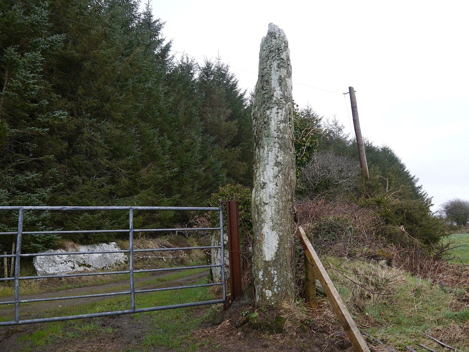
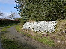 Image © Michael Mitchell
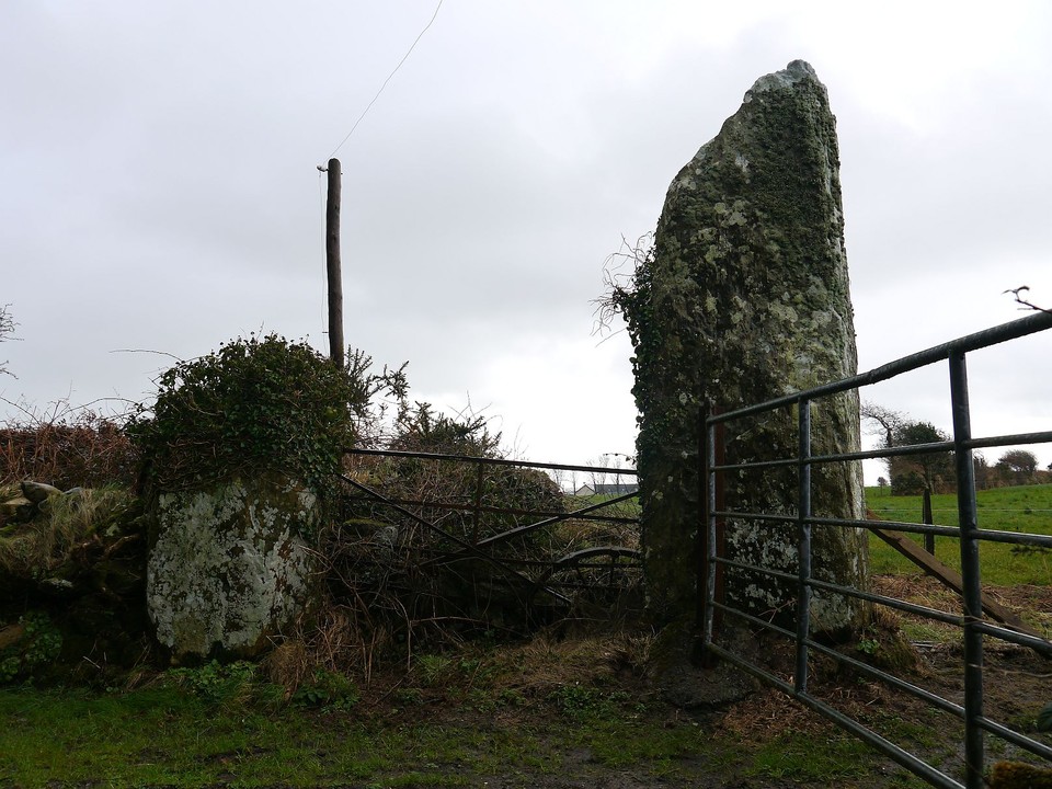