The Modern Antiquarian
Log in
|
Register
Home
Latest Posts
Forums
Maps
Help
Browse Sites
News
Blog
Contributors
The Books
Select
-
Belgium
Denmark
Eire
France
Germany
Greece
Italy
The Netherlands
Norway
Portugal
Republic of Malta
Spain
Sweden
Switzerland
United Kingdom
County Cork
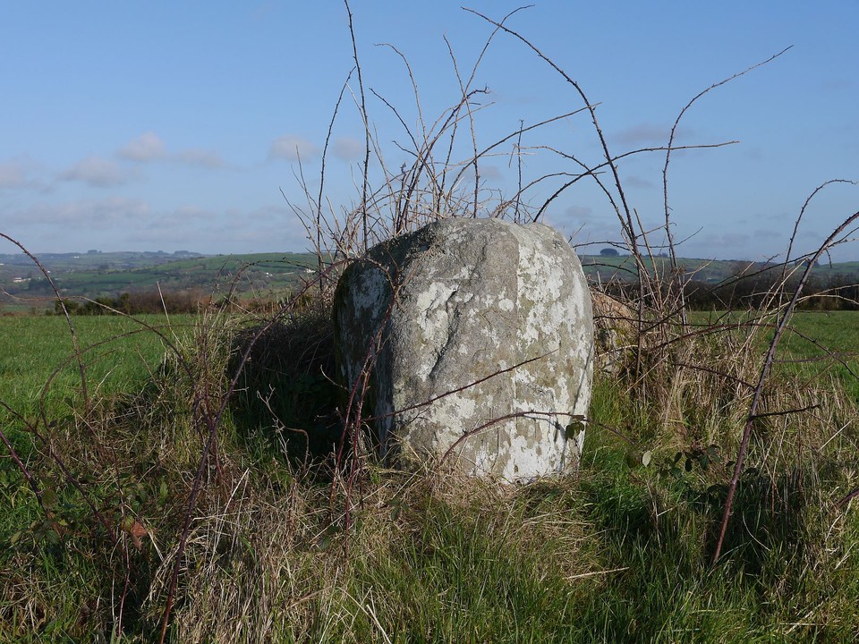
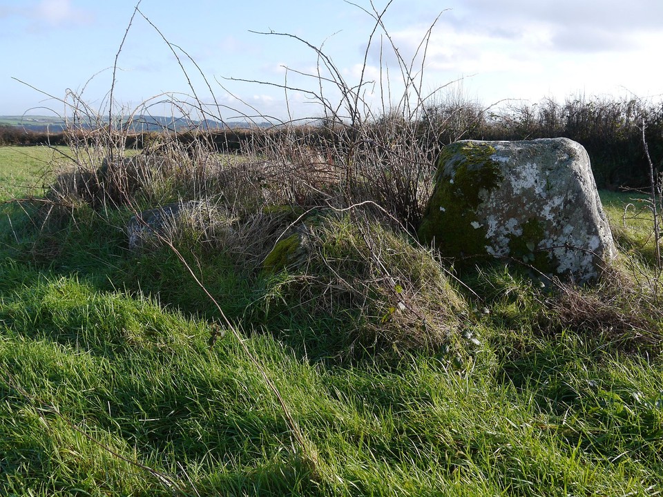
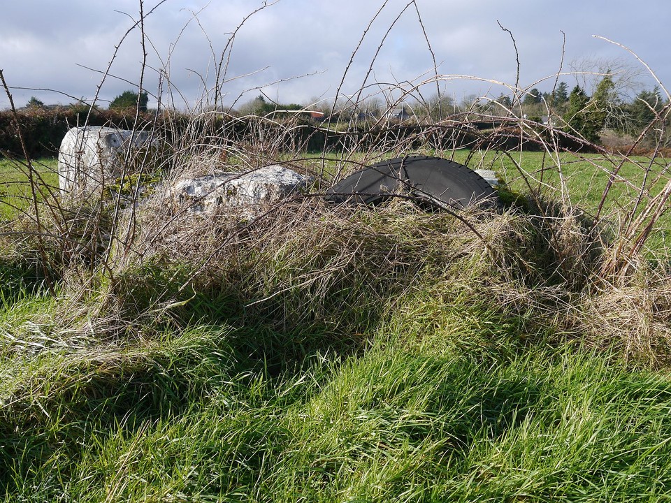
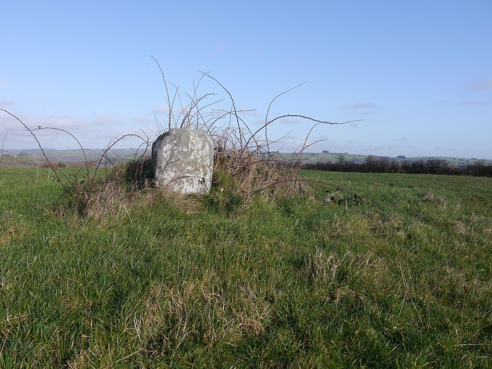
Toom
Stone Row / Alignment
Toom (Stone Row / Alignment) on The Modern Antiquarian, the UK & Ireland's most popular megalithic community website. 4 images, plus information on many more ancient sites nearby and across the UK & Ireland.
Image © Michael Mitchell
Nearest Town:
Dunmanway (6km SW)
OS Ref (IE):
W285553 /
Sheet: 86
Latitude:
51° 44' 44.4" N
Longitude:
9° 2' 7.25" W
Added by
Meic
Images (4)
0 discussions
Start a topic
Show |
Hide
Web searches for Toom
Flickr
Google
Google Images
The Megalithic Portal
Bing
Stone Pages
Wikipedia
Show map
(inline Google Map)
- Sites within 20 km -
-
Behagullane (1.64km WNW) (1 post)
Kinneigh (2.42km ENE) (5 posts)
Kinneigh (3.33km NE) (4 posts)
Nedinagh West (4.09km SW) (3 posts)
Ballyhalwick (4.59km SW) (3 posts)
Moneygaff West (5.77km NNE) (5 posts)
Dunmanway North (6.03km WSW) (5 posts)
Derrynasafagh (6.74km WSW) (3 posts)
Inchincurka (6.79km WNW) (15 posts)
Knockanereagh (7.11km NNW) (8 posts)
Lackanashinagh (7.27km NE) (0 posts)
Caherkirky (7.73km SE) (11 posts)
Milleennagun (7.9km S) (12 posts)
Milleennagun (7.92km S) (3 posts)
Reanacaheragh (8.09km NNE) (0 posts)
Lettergorman (North) (8.19km S) (25 posts)
Knockaunnagorp (8.39km N) (0 posts)
Coolaclevane (8.39km N) (3 posts)
Coolaclevane (8.59km N) (3 posts)
Farrannahineeny (8.89km WNW) (16 posts)
Laravoolta 2 (9.01km ENE) (3 posts)
Laravoolta 1 (9.08km ENE) (2 posts)
Knocks (East) (9.23km ESE) (7 posts)
Knockawaddra W (9.43km S) (17 posts)
Knockawaddra E (9.44km S) (15 posts)
Inchireagh (9.53km W) (11 posts)
Derrynacaheragh (9.57km W) (2 posts)
Coolnaconarty (9.63km SSE) (9 posts)
Knocks N (9.75km SSE) (20 posts)
Killaneer (9.96km ENE) (3 posts)
Knocks (10.16km SSE) (2 posts)
Knockane (10.18km NNE) (8 posts)
Garranereagh (10.39km NE) (4 posts)
Inchinattin (10.41km SSE) (2 posts)
Barnadivane (10.42km NNE) (0 posts)
Knocks (10.63km SSE) (13 posts)
Coolmountain (10.77km W) (7 posts)
Glanbrack (10.86km S) (15 posts)
Hornhill (10.89km NE) (8 posts)
Hornhill (10.93km NE) (5 posts)
Maulatanvally (11.08km S) (8 posts)
Rossnakilla (11.09km NNE) (9 posts)
Rossnakilla (11.09km NNE) (0 posts)
Bengour West (11.1km ENE) (6 posts)
Knocks S (11.12km SSE) (18 posts)
Maulatanavally (11.29km S) (26 posts)
Knocknaneirk SW (11.31km NE) (17 posts)
Knockatlowig (11.52km SE) (10 posts)
Bengour East (11.56km NE) (6 posts)
Knocknaneirk NE (11.79km NE) (13 posts)
Garryglass (11.82km SSW) (3 posts)
Garrygalss (11.83km SSW) (0 posts)
Carrigagrenane NE (11.87km S) (7 posts)
Farnanes (11.96km WSW) (9 posts)
Letter (site E) (12.27km ESE) (11 posts)
Sarue (12.39km SSE) (7 posts)
Carrigagrenane SW (12.45km S) (9 posts)
Clearagh (12.58km NE) (2 posts)
Ahaghilla (12.66km SE) (13 posts)
Cullenagh (12.74km WSW) (9 posts)
Cashelisky (12.87km ESE) (9 posts)
Cullenagh (13.77km WSW) (11 posts)
Ballyvackey (13.98km SE) (30 posts)
Clodagh Row (14.05km WSW) (12 posts)
Teergay (14.1km N) (8 posts)
Clodagh (14.31km WSW) (19 posts)
Reavouler (14.31km SW) (14 posts)
Reanascreena (14.42km S) (46 posts)
Turnaspidogy (14.79km WNW) (8 posts)
Goulacullin (15.12km WSW) (4 posts)
Tullig Stone (15.13km SSW) (3 posts)
Templebryan (15.26km ESE) (0 posts)
Freahanes (15.28km SSE) (7 posts)
Currabeha (South) (15.35km NE) (7 posts)
Laughtneill (15.44km ENE) (9 posts)
Templebryan (15.54km ESE) (23 posts)
Shronacarton (15.58km WSW) (6 posts)
Cousane (16km W) (4 posts)
Currabeha (North) (16.31km NE) (7 posts)
Kylefinchin 2 (16.42km NNW) (5 posts)
Killinga (16.46km SSW) (6 posts)
Kylefinchin (16.57km NNW) (1 post)
Currahy (16.66km WNW) (4 posts)
Bellmount Upper SW (16.72km ENE) (9 posts)
Derryduff (16.75km SSE) (4 posts)
Ballyvoge 1 (16.86km NNW) (6 posts)
Dooneens (16.86km W) (4 posts)
Garranes North (16.95km WSW) (6 posts)
Gortyleahy (16.96km N) (4 posts)
Bellmount Upper NE (16.97km ENE) (9 posts)
Ballyroe (17.09km SSW) (8 posts)
Tinneel (17.12km SSE) (8 posts)
Cousane (17.2km W) (10 posts)
Gurteenaduige (17.88km SSW) (8 posts)
Baurnahulla (17.93km SW) (3 posts)
Dooneens (17.97km W) (9 posts)
Maughanaclea NE (18.06km W) (9 posts)
Cools (18.18km NNW) (3 posts)
Inchinlinane (18.19km NNW) (5 posts)
Carrigaphooca (18.2km N) (7 posts)
Rosnascalp (18.25km NNE) (4 posts)
Coorleigh South (18.44km SE) (9 posts)
Lack More (18.54km NW) (9 posts)
Bohonagh (18.62km SSE) (45 posts)
Bealick (18.64km NNE) (3 posts)
Barnagowlane West (18.73km WSW) (9 posts)
Darrary (18.76km ESE) (4 posts)
Burgatia (18.76km SSE) (5 posts)
Lisnagun (18.78km ESE) (7 posts)
Western Pap (18.92km W) (9 posts)
Ahaglaslin (19.1km SSE) (3 posts)
Rosscarbery (19.2km SSE) (4 posts)
Derryfineen (19.21km NW) (5 posts)
Reananarree (19.25km NW) (3 posts)
Keamcorravooly (19.25km WNW) (11 posts)
Derryfineen (19.3km NW) (6 posts)
Keamcorravooly (19.32km WNW) (4 posts)
Cappaboy Beg (19.38km W) (2 posts)
Cappaboy Beg (19.38km W) (3 posts)
Reananerree (19.38km NW) (11 posts)
Cappaboy Beg SE (19.41km W) (7 posts)
Curraheen (19.51km S) (3 posts)
Cappaboy Beg (19.55km W) (2 posts)
Maughanaclea Centre (19.55km W) (7 posts)
Cappaboy Beg (19.65km W) (4 posts)
Gortnacowly (19.65km WSW) (15 posts)
Lissacresig 1 (19.69km NNW) (4 posts)
Lissacresig 2 (19.69km NNW) (5 posts)
Lissacresig 3 (19.69km NNW) (4 posts)
Lettergorman (South) (19.79km S) (39 posts)
Gorteennakilla (19.89km WNW) (6 posts)
- Add -
-
Add news
Add an image
Add fieldnotes
Add folklore
Add miscellaneous
Add a link
-
Add a site
Add a nearby facility
Add an alternative name/spelling
Images
(click to view fullsize)
Add an image
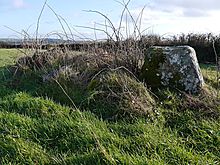 Image © Michael Mitchell