The Modern Antiquarian
Log in
|
Register
Home
Latest Posts
Forums
Maps
Help
Browse Sites
News
Blog
Contributors
The Books
Select
-
Belgium
Denmark
Eire
France
Germany
Greece
Italy
The Netherlands
Norway
Portugal
Republic of Malta
Spain
Sweden
Switzerland
United Kingdom
Scotland
Highland (Mainland)
Kilcoy
Chambered Cairn
Kilcoy (Kilcoy North and Kilcoy South) (Chambered Cairn) on The Modern Antiquarian, the UK & Ireland's most popular megalithic community website. 12 images, plus information on many more ancient sites nearby and across the UK & Ireland.
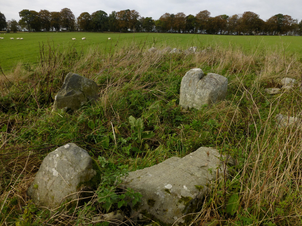
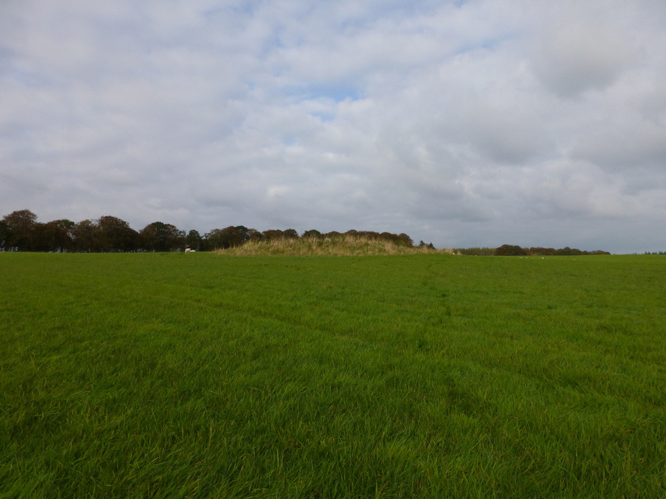
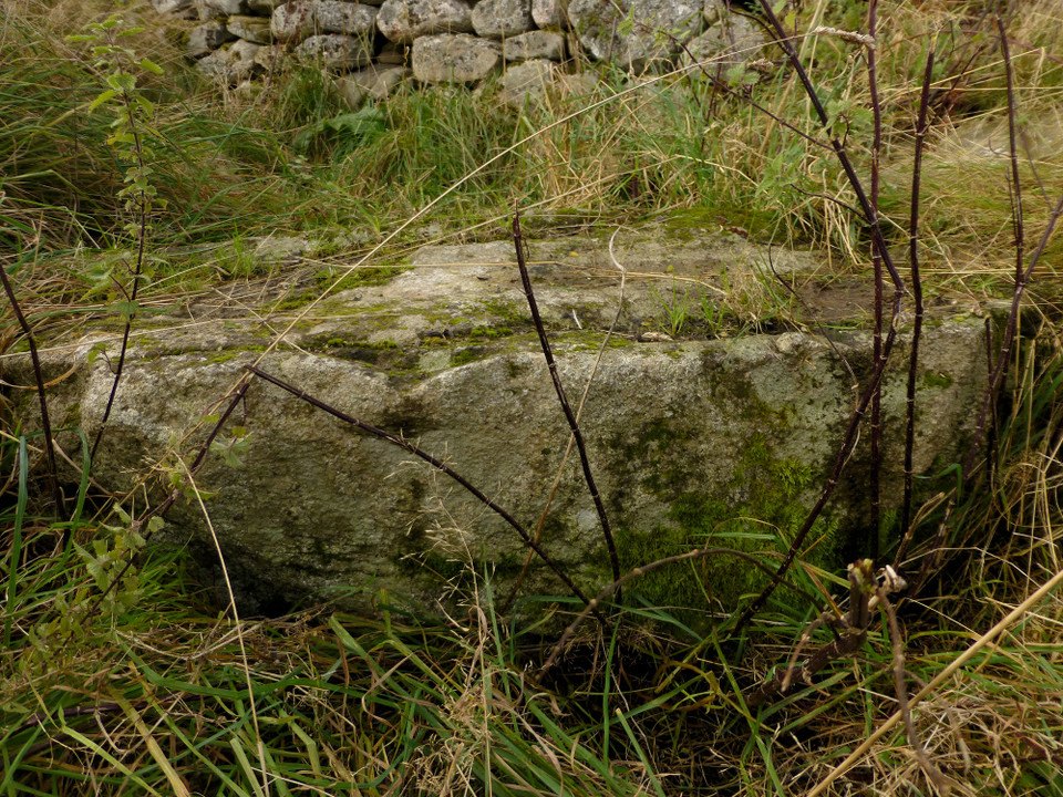
Image © A. Brookes (14.10.2014)
Also known as:
Kilcoy North and Kilcoy South
Nearest Town:
Dingwall (8km NNW)
OS Ref (GB):
NH570516 /
Sheet: 26
Latitude:
57° 31' 55.11" N
Longitude:
4° 23' 19.31" W
Added by
thesweetcheat
Images (12)
0 discussions
Start a topic
Show |
Hide
Web searches for Kilcoy
Flickr
Google
Google Images
MAGIC
The Megalithic Portal
Bing
Stone Pages
Streetmap.co.uk
Wikipedia
Show map
(inline Google Map)
- Sites within 20 km -
-
Cairn Irenan (0.72km WNW) (14 posts)
Mains of Kilcoy (0.73km ENE) (15 posts)
Carn Glas (Mains of Kilcoy) (0.89km ENE) (16 posts)
Cairnside (1.33km WNW) (6 posts)
Muir of Allangrange (2.22km W) (6 posts)
Muir of Conan (2.52km W) (9 posts)
Muir Of Conan (2.57km W) (9 posts)
Tarradale (2.73km SW) (16 posts)
Redcastle (3.06km ESE) (4 posts)
Balvaird (3.1km W) (9 posts)
Bishop Kinkell (3.1km W) (7 posts)
Croftcrunie (4.07km ENE) (5 posts)
Cononbridge (4.41km WNW) (5 posts)
Muir of Ord (4.68km WSW) (3 posts)
The Temple (Tore) (4.87km ENE) (6 posts)
Windhill (5.09km SW) (13 posts)
Mulchaich (5.24km N) (14 posts)
Arpafeelie (5.39km E) (4 posts)
Drummondreach (6.07km N) (7 posts)
Culbokie (6.54km NNE) (10 posts)
Balnaguie (6.55km ENE) (18 posts)
Brahan House (6.64km W) (5 posts)
Arcan Mains (6.94km W) (7 posts)
Dun Mor (Beauly) (7.22km SW) (13 posts)
The Clootie Well (7.25km ENE) (11 posts)
Brahan Wood (7.46km W) (6 posts)
Bogallan Wood (7.5km E) (11 posts)
Easter Moniack (7.71km S) (7 posts)
Carn Mor (7.72km NNE) (16 posts)
The Giant's Grave (7.97km S) (8 posts)
Belmaduthy (8.67km ENE) (12 posts)
Corffhouse (8.81km SW) (7 posts)
Cnoc Udais (8.99km WSW) (14 posts)
James's Temple (8.99km ENE) (11 posts)
Balblair (9.18km SW) (4 posts)
Cabrich (9.39km SSW) (10 posts)
Craig Phadrig (9.41km ESE) (15 posts)
Leachkin (9.51km ESE) (6 posts)
Bealachnancorr (9.52km W) (18 posts)
Findon Cottage (9.52km NNE) (11 posts)
Knockfarrel (9.52km WNW) (35 posts)
Breachloch Hill (9.53km NE) (3 posts)
Dun Fhamhair (9.66km WSW) (11 posts)
Cnoc Ravoch (9.67km NNW) (10 posts)
Ord Hill (9.69km E) (10 posts)
Phoineas (9.74km SSW) (13 posts)
Castle Spynie (9.96km SSW) (14 posts)
Creag A' Chaisteil (9.98km E) (11 posts)
Fodderty (10.43km WNW) (7 posts)
Fodderty 2 (10.46km WNW) (4 posts)
Cnoc A Moine (nr Beauly) (10.68km WSW) (11 posts)
Craigiehowe (10.76km ENE) (1 post)
Dun Chliabhain (10.78km WSW) (18 posts)
Craigiehowe 2 (10.82km ENE) (3 posts)
Craigiehowe (10.88km ENE) (7 posts)
Eagle Stone (10.99km W) (5 posts)
Belladrum (North) (10.99km SW) (8 posts)
Craigiehowe 3 (11km ENE) (6 posts)
Tomnahurich (11.29km ESE) (2 posts)
Heights of Brae (11.35km WNW) (12 posts)
Belladrum Home Farm (11.36km SSW) (15 posts)
Dun Garbhlaich (11.5km WSW) (10 posts)
Loch Kinellan (11.53km W) (8 posts)
Clach-na-Cudainn (11.56km E) (7 posts)
Meg's Stone (11.6km SSW) (4 posts)
Preas Mairi (11.64km W) (7 posts)
Tom Na Croiseige (11.72km SSW) (9 posts)
Culbo (11.86km NE) (6 posts)
Bottacks (11.99km WNW) (1 post)
Lower Bog (12.11km SSW) (10 posts)
Beaufort (12.16km SW) (6 posts)
Cnoc An Teampuill (12.19km N) (7 posts)
Woodhead Round (12.31km NE) (10 posts)
Woodhead Long Cairn (12.37km NE) (4 posts)
Bruiach (12.4km SW) (25 posts)
Culburnie (12.55km SW) (18 posts)
Ormond Castle (12.74km ENE) (14 posts)
Breakachy Burn (12.9km WSW) (6 posts)
Dun Mor (Breakachy) (12.93km WSW) (19 posts)
Wester Brae, Black Isle (13.02km NE) (6 posts)
Stonyfield (13.34km E) (21 posts)
Torbreck (13.39km ESE) (26 posts)
Culduthel (13.42km ESE) (9 posts)
Clach Bhan (13.44km SSW) (4 posts)
Balnacrae (13.49km NW) (19 posts)
Kinchyle of Dores (13.69km SE) (16 posts)
Achilty (13.89km W) (11 posts)
Boblainy (14.28km SW) (7 posts)
Brae Farm (14.35km NE) (5 posts)
Brae Farm (14.41km NE) (5 posts)
Swordale (14.56km N) (10 posts)
Loch Achilty (14.7km W) (4 posts)
Druidtemple (14.93km ESE) (32 posts)
Carn Liath (15.04km N) (15 posts)
Culloden (15.08km E) (12 posts)
Carn Glas, Achvraid (15.45km ESE) (24 posts)
Caiplich Prehistoric Settlement (15.51km S) (4 posts)
Cullernie (15.92km E) (11 posts)
Aldourie (15.98km SE) (7 posts)
Drumashie Moor 2 (16.03km SE) (6 posts)
Caisteal Rollach (16.35km ESE) (9 posts)
Drumashie Moor 3 (16.4km SE) (9 posts)
Drumashie Moor (16.47km SE) (4 posts)
Drumashie Moor (16.51km SE) (3 posts)
Newton of Petty (16.63km E) (12 posts)
Moniack Castle (16.69km SSW) (1 post)
Drumashie Moor 1 (16.75km SE) (6 posts)
Saint Columba's Font (16.87km SSE) (4 posts)
Black Wood Of Leys West (17.07km ESE) (6 posts)
Drummossie Muir (17.14km ESE) (6 posts)
Novar House (17.15km NNE) (12 posts)
Fountainhead (17.42km ESE) (6 posts)
Tomfat West (17.46km ESE) (8 posts)
Cnoc Nan Taibhsean (17.67km NE) (5 posts)
Black Wood (17.68km ESE) (4 posts)
Tomfat Plantation (17.78km ESE) (13 posts)
Black Wood Of Leys West (17.81km ESE) (6 posts)
Black Wood Of Leys East (18.04km ESE) (21 posts)
Clach An Airm (18.59km ESE) (8 posts)
Cloughmor (18.66km ESE) (3 posts)
Culchunaig (18.66km E) (9 posts)
Daviot (18.77km E) (16 posts)
Merchant's Stone (18.82km SE) (5 posts)
Callachy Hill (19km ENE) (11 posts)
Midtown (19.09km ESE) (9 posts)
Caird's Cave (19.09km ENE) (7 posts)
Mains of Gask (19.14km ESE) (37 posts)
Feabuie (19.15km E) (7 posts)
Baile Na Creige (19.16km ESE) (5 posts)
Dun Davie (19.24km ESE) (14 posts)
Midtown (West) (19.37km SE) (24 posts)
Glenurquhart (19.57km ENE) (8 posts)
Culdoich (19.65km E) (3 posts)
West Town (19.67km SE) (11 posts)
The Grey Cairn (19.71km ENE) (15 posts)
Miltown of Clava (19.78km E) (26 posts)
Clava Cairns (19.96km E) (201 posts)
- Facilities within 20 km -
-
Plough Inn (Pub: 16.6 km ENE)
Rosemarkie Caravan and... (Camping Site: 17.7 km ENE)
Crofters Cafe Bar (Pub: 17.8 km ENE)
Culloden Visitor Centr... (Restaurant: 18.7 km E)
- Add -
-
Add news
Add an image
Add fieldnotes
Add folklore
Add miscellaneous
Add a link
Add a nearby facility
Add an alternative name/spelling
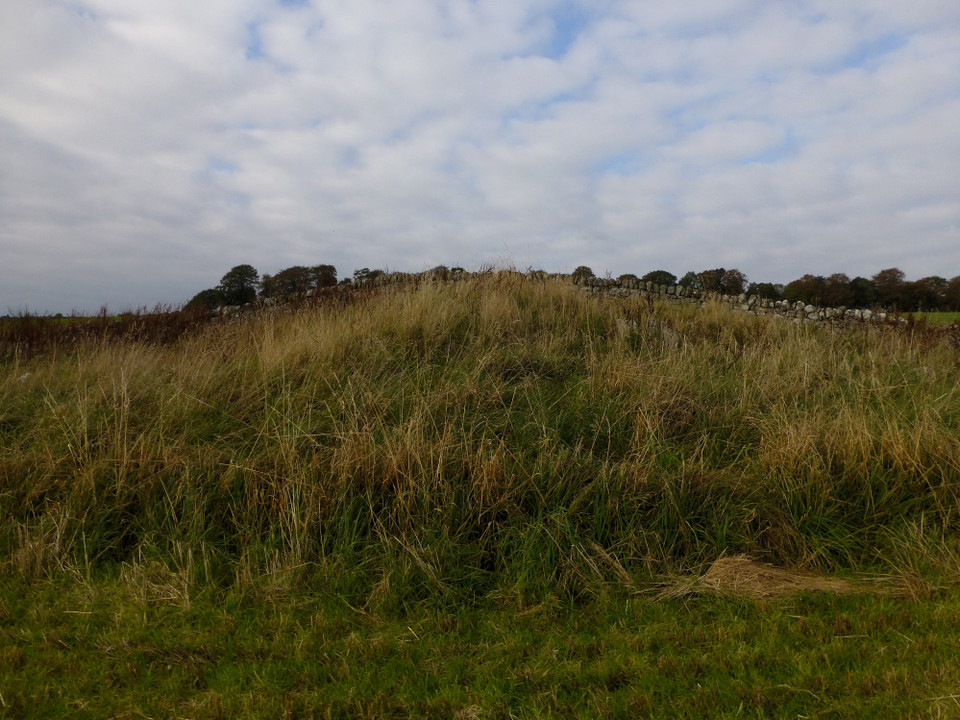
Images
(click to view fullsize)
Add an image
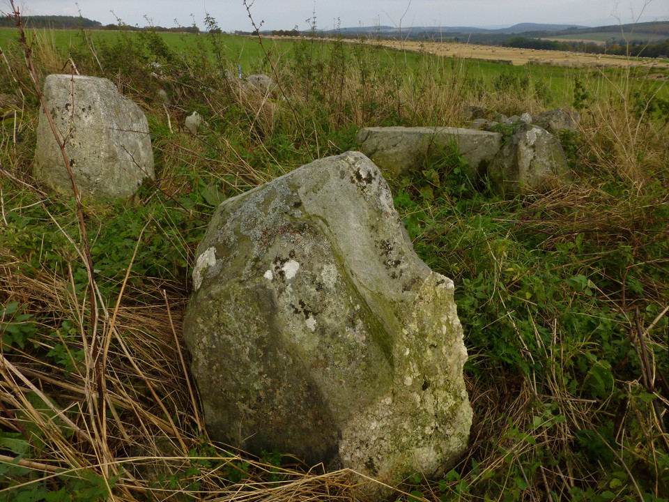
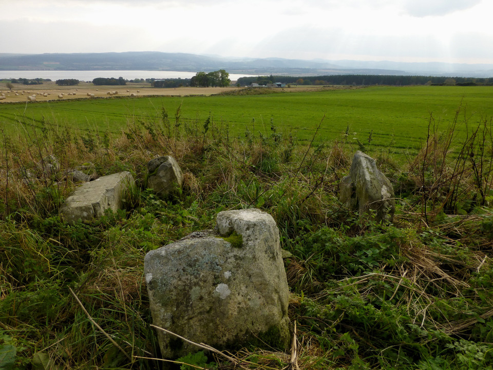
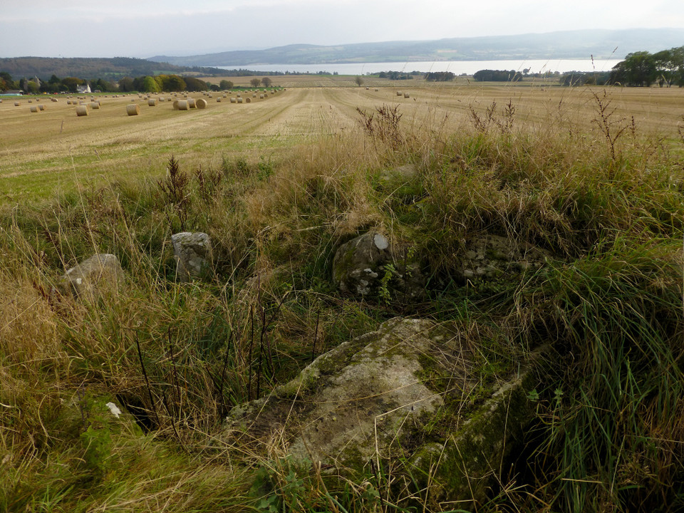
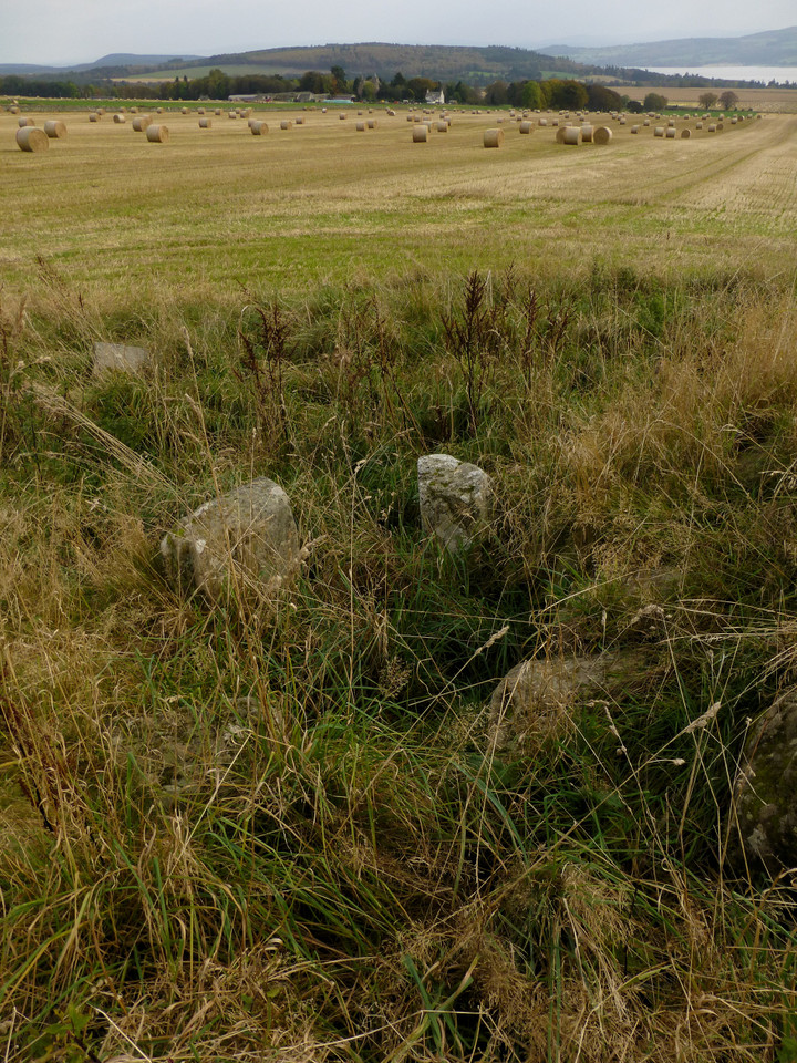
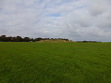 Image © A. Brookes (14.10.2014)
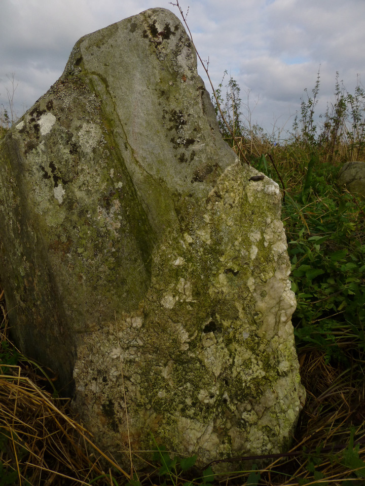
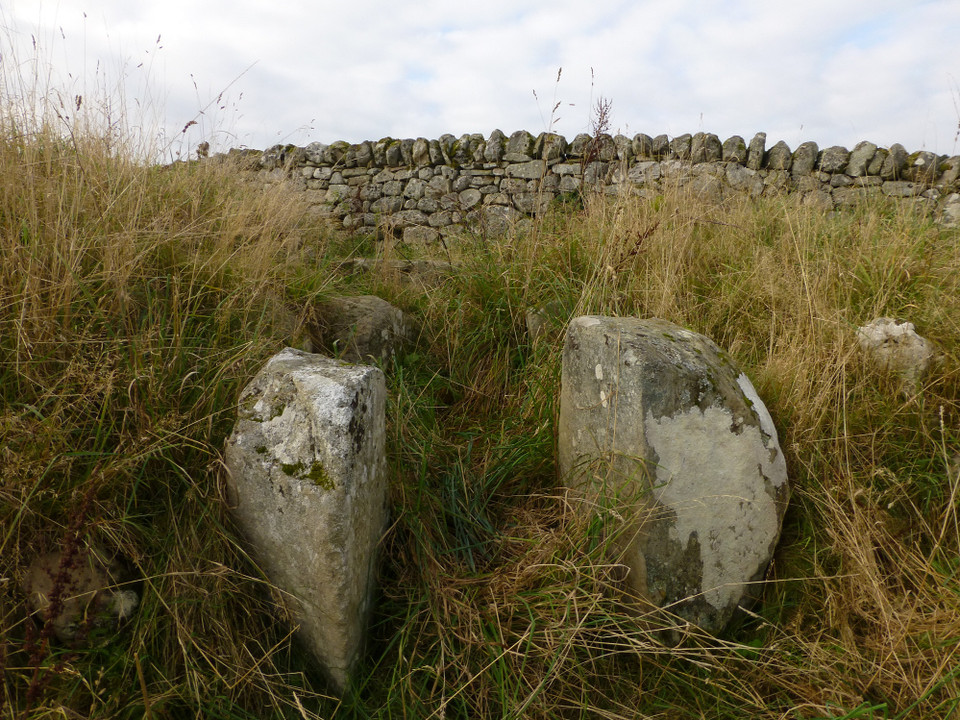
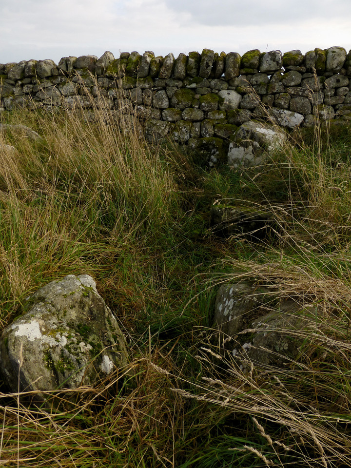