The Modern Antiquarian
Log in
|
Register
Home
Latest Posts
Forums
Maps
Help
Browse Sites
News
Blog
Contributors
The Books
Select
-
Belgium
Denmark
Eire
France
Germany
Greece
Italy
The Netherlands
Norway
Portugal
Republic of Malta
Spain
Sweden
Switzerland
United Kingdom
England
Southern England
West Sussex
Lavington Common
Barrow / Cairn Cemetery
Lavington Common (Barrow / Cairn Cemetery) on The Modern Antiquarian, the UK & Ireland's most popular megalithic community website. 3 images, plus information on many more ancient sites nearby and across the UK & Ireland.
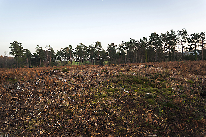
Image © A R Cane
Nearest Town:
Arundel (14km SE)
OS Ref (GB):
SU943184 /
Sheet: 197
Latitude:
50° 57' 24.18" N
Longitude:
0° 39' 25.95" W
Added by
A R Cane
Images (3)
0 discussions
Start a topic
Show |
Hide
Web searches for Lavington Common
Flickr
Google
Google Images
MAGIC
The Megalithic Portal
Bing
Stone Pages
Streetmap.co.uk
Wikipedia
Show map
(inline Google Map)
- Sites within 20 km -
-
Little Bury (0.7km W) (2 posts)
Gallows Hill (1.48km WNW) (8 posts)
Duncton Down (3.21km ESE) (1 post)
Barlavington Down (3.55km SE) (2 posts)
Heyshott Down (4.17km WSW) (5 posts)
Waltham Down (4.29km SSW) (7 posts)
Lord's Piece (5.37km E) (11 posts)
Glatting Beacon (5.67km SE) (7 posts)
Court Hill (6.49km SW) (8 posts)
Barkhale (6.58km SE) (10 posts)
Barkhale Wood barrow (7.12km SE) (2 posts)
Halnaker Hill (9.09km SSW) (7 posts)
War Dyke (9.76km ESE) (8 posts)
The Trundle (9.82km SW) (23 posts)
Iping Common (9.97km W) (24 posts)
Boxgrove (9.98km SSW) (11 posts)
Rewell Wood Barrow (10.87km SE) (3 posts)
Hammer Wood (11.19km W) (1 post)
The Devil's Ditch (11.74km SW) (8 posts)
The Devil's Jumps (11.91km WSW) (10 posts)
Rackham Banks (12.31km E) (9 posts)
The Burgh (12.7km ESE) (5 posts)
Goose Hill Camp (12.71km WSW) (16 posts)
Springhead Hill (13.2km E) (5 posts)
Bow Hill Camp (13.44km WSW) (4 posts)
Stoughton Down (13.47km WSW) (17 posts)
Stoughton Down (13.6km WSW) (2 posts)
Burpham Camp (13.76km ESE) (6 posts)
Kingley Vale (14.4km WSW) (16 posts)
Kithurst Hill (14.47km E) (10 posts)
Chantry Hill (15.62km E) (3 posts)
Sullington Warren (15.64km E) (8 posts)
Bevis's Thumb (15.83km WSW) (16 posts)
Harrow Hill (16.11km E) (12 posts)
Sullington Hill (16.24km E) (5 posts)
Torberry Hill (16.45km W) (6 posts)
Blackpatch Flint Mines (17.79km ESE) (5 posts)
Petersfield Heath (19.2km W) (38 posts)
Church Hill Flint Mines (19.63km E) (3 posts)
- Add -
-
Add news
Add an image
Add fieldnotes
Add folklore
Add miscellaneous
Add a link
-
Add a site
Add a nearby facility
Add an alternative name/spelling
Images
(click to view fullsize)
Add an image
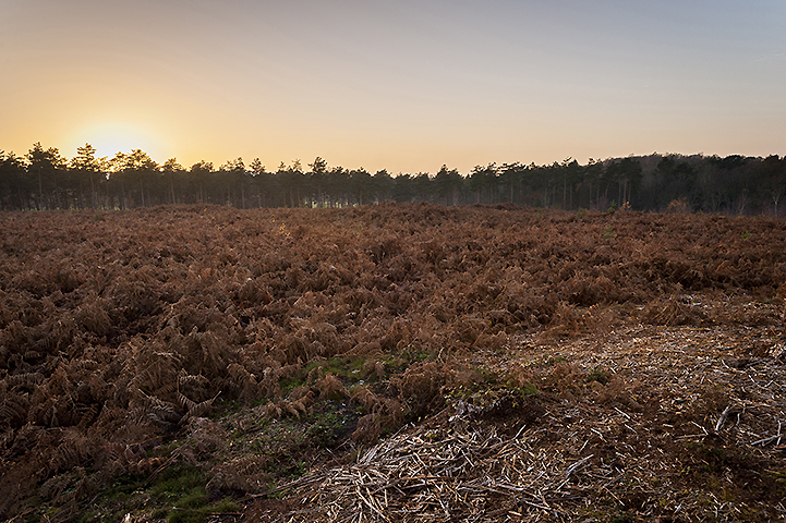
 Image © A R Cane
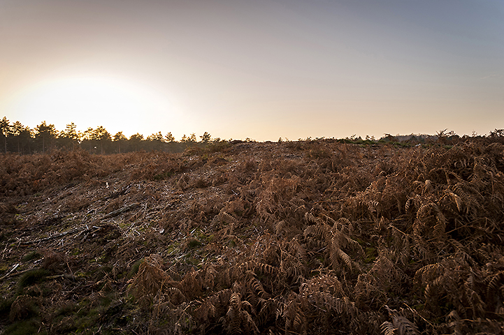