The Modern Antiquarian
Log in
|
Register
Home
Latest Posts
Forums
Maps
Help
Browse Sites
News
Blog
Contributors
The Books
Select
-
Belgium
Denmark
Eire
France
Germany
Greece
Italy
The Netherlands
Norway
Portugal
Republic of Malta
Spain
Sweden
Switzerland
United Kingdom
County Kerry
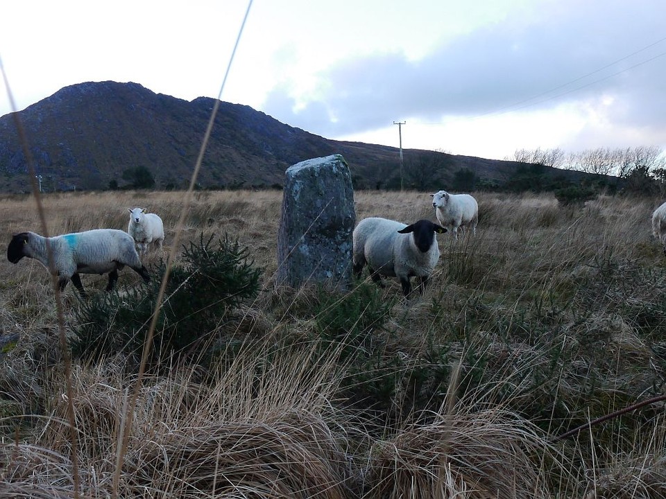
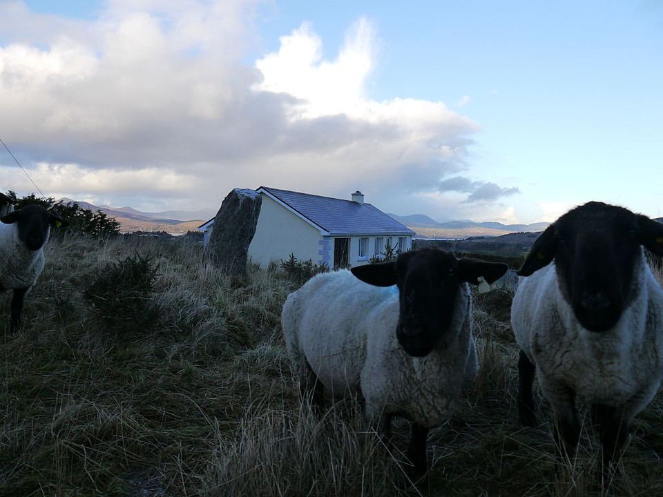
Lehid
Standing Stone / Menhir
Lehid (Standing Stone / Menhir) on The Modern Antiquarian, the UK & Ireland's most popular megalithic community website. 3 images, plus information on many more ancient sites nearby and across the UK & Ireland.
Image © Michael Mitchell
Nearest Town:
Sneem (11km WNW)
OS Ref (IE):
V785607 /
Sheet: 84
Latitude:
51° 47' 8.07" N
Longitude:
9° 45' 39.46" W
Added by
Meic
Images (3)
0 discussions
Start a topic
Show |
Hide
Web searches for Lehid
Flickr
Google
Google Images
The Megalithic Portal
Bing
Stone Pages
Wikipedia
Show map
(inline Google Map)
- Sites within 20 km -
-
Lehid (0.2km ENE) (1 post)
Drombohilly Wedge Tomb (0.51km E) (2 posts)
Drombohilly (0.51km ENE) (32 posts)
Lehid (0.56km SW) (2 posts)
Reenkilla (3.44km SSW) (5 posts)
Uragh West (4.6km ENE) (12 posts)
Cashelkeelty SE (4.75km SW) (13 posts)
Cashelkeelty NW (4.89km SW) (12 posts)
Clogherane (4.99km SSE) (3 posts)
Clogherane (5.1km SSE) (3 posts)
Uragh (5.4km ENE) (38 posts)
Uragh North (5.82km ENE) (14 posts)
Shronebirrane (6.13km SSW) (22 posts)
Glashananinnaun (7.8km SW) (5 posts)
Kilcaskan (9.01km SE) (5 posts)
Ardgroom Outward (9.46km SW) (34 posts)
Kildromalive (10.11km SE) (5 posts)
Ballynahowen (10.77km ESE) (15 posts)
Dromroe (10.79km ENE) (24 posts)
Cappaleigh North (10.83km SE) (4 posts)
Drumlave (11.05km SE) (11 posts)
Coomgira (11.39km S) (6 posts)
Leitrim Beg (11.52km ESE) (21 posts)
Killenough (12.38km ESE) (5 posts)
Tullakeel (13.02km WNW) (4 posts)
Derryleagh (13.76km WNW) (3 posts)
Crossterry East (14.07km E) (7 posts)
Rossacoosane (14.15km NNE) (1 post)
Cloontreem (14.87km SW) (15 posts)
Rodeen 1 (14.89km SW) (3 posts)
Ballycrovane (14.94km WSW) (18 posts)
Barraboy Mountain S (14.95km E) (9 posts)
Barraboy Mountain N (14.95km E) (6 posts)
Dromtine (15.06km WNW) (4 posts)
Canrooska (15.22km E) (25 posts)
Barraboy Mountain (15.24km ENE) (4 posts)
Barraboy Mountain (15.24km ENE) (3 posts)
Rodeen 2 (15.25km SW) (5 posts)
Rodeen 3 (15.27km SW) (4 posts)
Kilmackowen (15.31km SW) (9 posts)
Kilmackowen (15.32km SW) (17 posts)
Kenmare (15.73km NE) (26 posts)
Derrynacoolagh (15.96km ENE) (2 posts)
Derrynablaha 7 (16.08km NNW) (1 post)
Derrynablaha 3 (16.11km NNW) (2 posts)
Derrynablaha 10 (16.11km NNW) (0 posts)
Derrynablaha 6 (16.14km NNW) (2 posts)
Derrynablaha 5 (16.14km NNW) (4 posts)
Milleens (16.15km ENE) (4 posts)
Milleens (16.16km ENE) (3 posts)
Hag of Beara (16.54km WSW) (9 posts)
Derrynablaha 028 (16.75km NNW) (1 post)
Derrynablaha F (16.77km NNW) (3 posts)
Derrynablaha 11 (16.83km NNW) (3 posts)
Derrynablaha 11 (16.85km NNW) (0 posts)
Derreeny 1 (16.85km NNW) (1 post)
Derrynablaha D (16.88km NNW) (2 posts)
Derrynablaha (16.88km NNW) (2 posts)
Derrymihin West (16.91km SW) (3 posts)
Derreeny 3 (16.96km NNW) (1 post)
Derreeny 2 (16.96km NNW) (1 post)
Derreeny 4 (16.96km NNW) (0 posts)
Derreeny 5 (17.06km NNW) (1 post)
Staigue Cashel (17.52km W) (21 posts)
Staigue Bridge (17.68km W) (13 posts)
Staigue (17.68km W) (0 posts)
Feaghna (18.41km ENE) (10 posts)
Derreenataggart West (18.55km SW) (31 posts)
Coulagh (18.58km SW) (1 post)
Derreenataggart Middle (18.71km SW) (2 posts)
Coulagh (19.09km SW) (5 posts)
Dromatouk (19.17km ENE) (1 post)
Dromatouk (19.17km ENE) (3 posts)
Dromatouk (19.44km ENE) (22 posts)
Dromatouk (19.6km ENE) (8 posts)
Dromatouk (19.63km NE) (10 posts)
- Add -
-
Add news
Add an image
Add fieldnotes
Add folklore
Add miscellaneous
Add a link
-
Add a site
Add a nearby facility
Add an alternative name/spelling
Images
(click to view fullsize)
Add an image
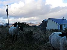 Image © Michael Mitchell