The Modern Antiquarian
Log in
|
Register
Home
Latest Posts
Forums
Maps
Help
Browse Sites
News
Blog
Contributors
The Books
Select
-
Belgium
Denmark
Eire
France
Germany
Greece
Italy
The Netherlands
Norway
Portugal
Republic of Malta
Spain
Sweden
Switzerland
United Kingdom
Northern Ireland
County Down
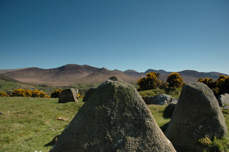
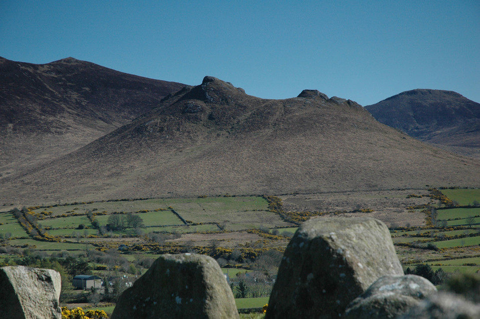
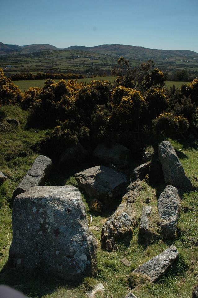
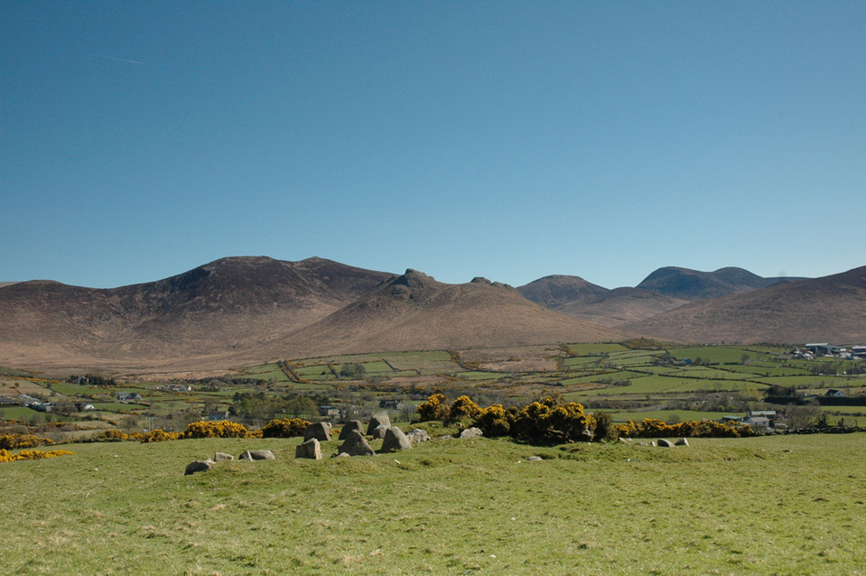
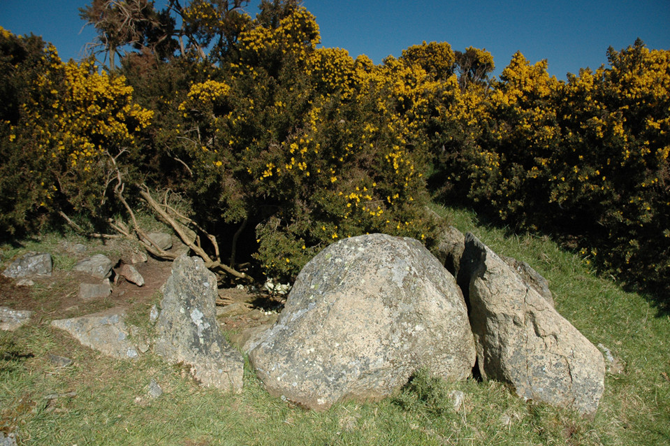
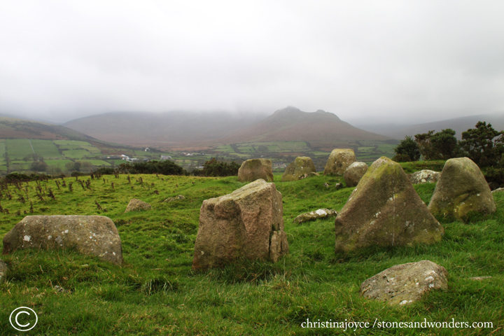
Goward Chamber Cairn
Chambered Cairn
Goward Chamber Cairn (Chambered Cairn) on The Modern Antiquarian, the UK & Ireland's most popular megalithic community website. 6 images, plus information on many more ancient sites nearby and across the UK & Ireland.
Image © ryaner
OS Ref (GB):
J238296 /
Sheet: 29
Latitude:
54° 12' 1.01" N
Longitude:
6° 6' 9.7" W
Added by
Schlager Man
Images (6)
0 discussions
Start a topic
Show |
Hide
Web searches for Goward Chamber Cairn
Flickr
Google
Google Images
Megalithomania
Bing
Stone Pages
Streetmap.co.uk
Wikipedia
Show map
(inline Google Map)
- Sites within 20 km -
-
Goward (0.14km WNW) (0 posts)
Goward Cairn (0.3km N) (1 post)
Goward (1.52km NNE) (20 posts)
Mullaghmore (5.08km WSW) (0 posts)
Murphy's Fort, Mullaghmore (5.17km WSW) (1 post)
Carn Hill (5.71km ENE) (0 posts)
Carn Mountain (6.2km ESE) (0 posts)
Tamary Cairns (6.37km W) (0 posts)
Carnadranna (6.61km WSW) (2 posts)
Barnmeen (7.45km W) (4 posts)
Carnbane (8.11km ENE) (0 posts)
Mayo 1 (8.33km WSW) (4 posts)
Drumena (8.49km ENE) (8 posts)
Mayo 2 (8.66km WSW) (5 posts)
The King's Grave, Tollymore Pk (9.52km ENE) (0 posts)
Tamnaharry (9.84km WSW) (0 posts)
Knockiveagh (9.88km WNW) (6 posts)
Moneyslane (10.4km N) (0 posts)
Slieve Commedagh (10.79km E) (6 posts)
Rush's Cove (11.11km SE) (2 posts)
Moyad (11.12km SE) (5 posts)
Rostrevor Standing Stone (11.41km SSW) (6 posts)
Saval More (Field Stone) (11.66km W) (1 post)
Saval More Graveyard Stones (11.74km W) (4 posts)
Crobane (11.78km WSW) (3 posts)
Summit of Slieve Donard (12.1km E) (9 posts)
Slieve Donard Lesser Cairn (12.17km E) (8 posts)
Slieveemartin Cairn (12.41km SSW) (0 posts)
Burren (12.47km WSW) (6 posts)
Knockshee (13.56km S) (3 posts)
Warrenpoint Standing Stone (13.79km SW) (4 posts)
Ballyrogan Giant's Grave (14.17km SE) (2 posts)
Kilfeaghan (14.19km S) (13 posts)
Ballintur (14.53km S) (0 posts)
Legananny (14.68km NNE) (22 posts)
Ballyedmond Cairn (14.78km S) (0 posts)
The Long Stone (14.99km ESE) (5 posts)
Dunnaman (15.34km SE) (7 posts)
Ballyveaghbeg (15.45km ESE) (0 posts)
Wateresk Standing Stone (15.91km ENE) (6 posts)
Kilkeel (16.2km SE) (9 posts)
Wateresk Dolmen (16.23km ENE) (9 posts)
The Mother Church of Mourne (16.43km SE) (1 post)
Drummiller (16.44km W) (2 posts)
Clontygora - Court Tomb (17.24km WSW) (38 posts)
Drumnahare (17.45km WNW) (3 posts)
Slieve Croob (17.65km NNE) (6 posts)
The Three Sisters (17.68km WNW) (0 posts)
Loughanhatten (17.84km SSE) (1 post)
Corrakit (17.97km SW) (0 posts)
Ballymacdermot (18.14km WSW) (27 posts)
Coolnacran (19.01km WNW) (4 posts)
Cross (19.31km WSW) (8 posts)
Ravensdale Park (19.53km SW) (10 posts)
Clermont Cairn (19.67km SW) (0 posts)
- Facilities within 20 km -
-
Greenbank (Bed & Breakfast: 12.4 km NNW)
- Add -
-
Add news
Add an image
Add fieldnotes
Add folklore
Add miscellaneous
Add a link
-
Add a site
Add a nearby facility
Add an alternative name/spelling
Images
(click to view fullsize)
Add an image
 Image © ryaner