The Modern Antiquarian
Log in
|
Register
Home
Latest Posts
Forums
Maps
Help
Browse Sites
News
Blog
Contributors
The Books
Select
-
Belgium
Denmark
Eire
France
Germany
Greece
Italy
The Netherlands
Norway
Portugal
Republic of Malta
Spain
Sweden
Switzerland
United Kingdom
England
Northern England
Lancashire
Wild Bank Hill
Round Cairn
Wild Bank Hill (Hollingworthall Moor) (Round Cairn) on The Modern Antiquarian, the UK & Ireland's most popular megalithic community website. 1 image, plus information on many more ancient sites nearby and across the UK & Ireland.
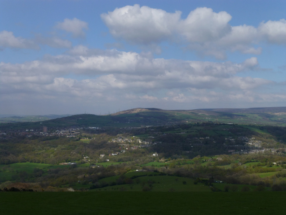
Image © A. Brookes (19.4.2014)
Also known as:
Hollingworthall Moor
Nearest Town:
Hyde (5km SW)
OS Ref (GB):
SJ98879800 /
Sheet: 109
Latitude:
53° 28' 42.18" N
Longitude:
2° 1' 1.3" W
Added by
thesweetcheat
Images (1)
0 discussions
Start a topic
Show |
Hide
Web searches for Wild Bank Hill
Flickr
Google
Google Images
MAGIC
The Megalithic Portal
Bing
Stone Pages
Streetmap.co.uk
Wikipedia
Show map
(inline Google Map)
- Sites within 20 km -
-
Horse Clough (6.23km SE) (17 posts)
Ludworth Intakes (6.69km SSE) (15 posts)
Cown Edge (6.85km SE) (8 posts)
Brown Low (7.09km S) (8 posts)
Pots and Pans Stone (7.28km NNE) (11 posts)
Chisworth (7.32km SE) (15 posts)
Mellor Hilltop (9.11km S) (4 posts)
Saddleworth Bowl Barrow (9.43km NNW) (4 posts)
Ravenstone Rocks (10.18km NNE) (2 posts)
Royd Edge and Oldfield Hill Earthworks, Meltham (10.6km ENE) (3 posts)
Jacksons Barrow (11.19km N) (7 posts)
Kinderlow (14.07km ESE) (23 posts)
Cock Crowing Stone (14.11km NE) (3 posts)
The Old Bull Ring (14.49km NE) (1 post)
Kiln Knoll (14.5km SSE) (5 posts)
Whaley Bridge Stone (16.51km SSE) (7 posts)
Murder Stone (16.89km S) (23 posts)
Roosdyche (17.27km SSE) (21 posts)
Green Low (17.82km ESE) (29 posts)
Reed Hill (18.11km S) (23 posts)
Slate Pit Wood Cairnfield (18.29km NE) (3 posts)
Mag Low (18.49km SE) (5 posts)
Ladder Hill (18.89km SSE) (9 posts)
Further Harrop (18.93km S) (11 posts)
Charles Head (18.96km S) (11 posts)
Lord's Seat (18.99km ESE) (30 posts)
Honley Old Wood Cairnfield (19.35km NE) (1 post)
Nab Head (19.78km SSW) (9 posts)
Mam Tor (19.91km ESE) (73 posts)
Mam Tor barrows (19.92km ESE) (14 posts)
Devil's Footprint Stone (19.99km NE) (4 posts)
- Facilities within 20 km -
-
Crowden-in-Longdendale... (Youth Hostel: 8.3 km ENE)
Edale YHA (Youth Hostel: 19.4 km ESE)
- Add -
-
Add news
Add an image
Add fieldnotes
Add folklore
Add miscellaneous
Add a link
Add a nearby facility
Add an alternative name/spelling
Images
(click to view fullsize)
Add an image
 Image © A. Brookes (19.4.2014)