The Modern Antiquarian
Log in
|
Register
Home
Latest Posts
Forums
Maps
Help
Browse Sites
News
Blog
Contributors
The Books
Select
-
Belgium
Denmark
Eire
France
Germany
Greece
Italy
The Netherlands
Norway
Portugal
Republic of Malta
Spain
Sweden
Switzerland
United Kingdom
Scotland
Highland (Mainland)
Lower Bog
Chambered Cairn
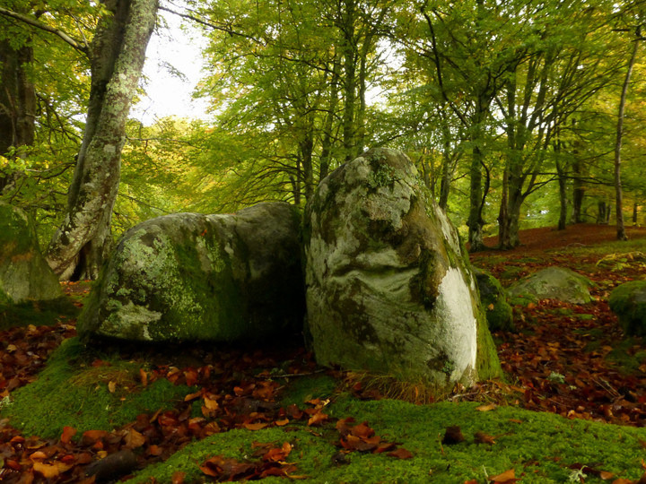
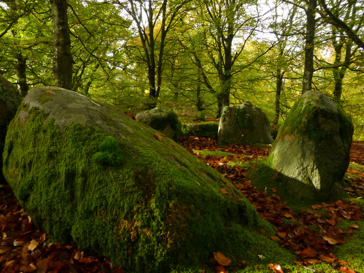
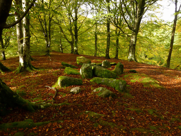
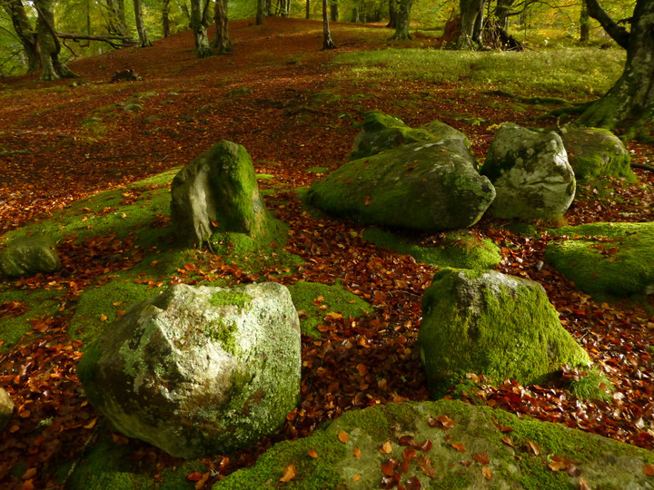
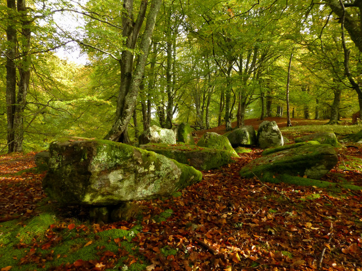
Lower Bog (Allt Eoghainn/Lowerbog) (Chambered Cairn) on The Modern Antiquarian, the UK & Ireland's most popular megalithic community website. 10 images, plus information on many more ancient sites nearby and across the UK & Ireland.
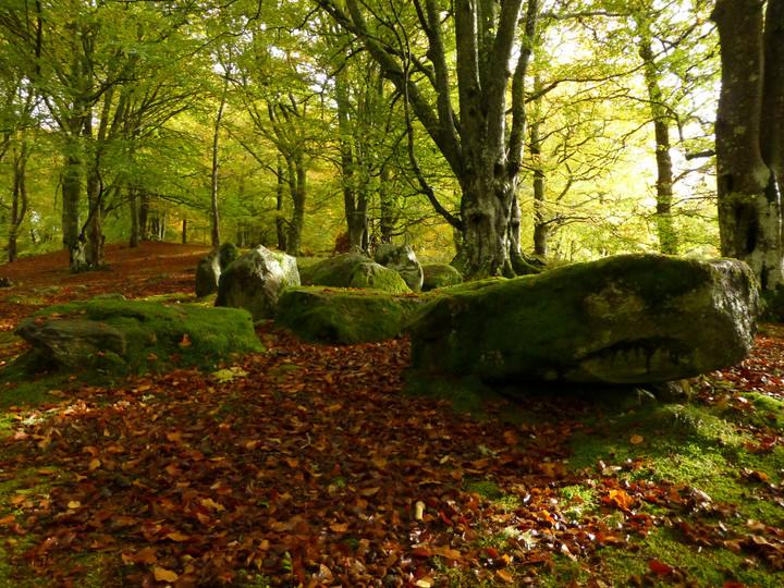
Image © A. Brookes (22.10.2013)
Also known as:
Allt Eoghainn
Lowerbog
Nearest Town:
Inverness (14km ENE)
OS Ref (GB):
NH52364038 /
Sheet: 26
Latitude:
57° 25' 47.22" N
Longitude:
4° 27' 33.64" W
Added by
thesweetcheat
Images (10)
0 discussions
Start a topic
Show |
Hide
Web searches for Lower Bog
Flickr
Google
Google Images
MAGIC
The Megalithic Portal
Bing
Stone Pages
Streetmap.co.uk
Wikipedia
Show map
(inline Google Map)
- Sites within 20 km -
-
Meg's Stone (1.19km WNW) (4 posts)
Belladrum Home Farm (1.42km WNW) (15 posts)
Tom Na Croiseige (1.45km WNW) (9 posts)
Belladrum (North) (1.96km WNW) (8 posts)
Clach Bhan (2.1km WSW) (4 posts)
Phoineas (2.38km NNE) (13 posts)
Castle Spynie (2.43km NE) (14 posts)
Bruiach (2.65km W) (25 posts)
Cabrich (2.72km NNE) (10 posts)
Beaufort (3.1km W) (6 posts)
Boblainy (3.13km WSW) (7 posts)
Culburnie (3.54km W) (18 posts)
Corffhouse (4.53km NW) (7 posts)
Balblair (4.55km NW) (4 posts)
Moniack Castle (4.7km S) (1 post)
The Giant's Grave (4.83km NE) (8 posts)
Easter Moniack (4.84km NE) (7 posts)
Caiplich Prehistoric Settlement (4.88km ESE) (4 posts)
Dun Mor (Beauly) (6.88km NNW) (13 posts)
Cnoc A Moine (nr Beauly) (6.94km WNW) (11 posts)
Dun Chliabhain (7.33km WNW) (18 posts)
Saint Columba's Font (7.38km ESE) (4 posts)
Dun Fhamhair (7.75km WNW) (11 posts)
Windhill (7.94km N) (13 posts)
Dun Mor (Breakachy) (8.14km W) (19 posts)
Dun Garbhlaich (8.43km WNW) (10 posts)
Breakachy Burn (8.43km W) (6 posts)
Aldourie (8.83km E) (7 posts)
Muir of Ord (9.31km N) (3 posts)
Carn Daley (9.43km SSW) (7 posts)
Clachmhor (9.58km SSW) (5 posts)
Culnakirk (9.61km SSW) (2 posts)
Tarradale (9.69km NNE) (16 posts)
Kinchyle of Dores (9.91km E) (16 posts)
Cnoc Udais (10.34km NW) (14 posts)
Redcastle (10.56km NE) (4 posts)
Craig Mony (11.16km S) (11 posts)
Leachkin (11.21km ENE) (6 posts)
Merchant's Stone (11.33km E) (5 posts)
Drumashie Moor 2 (11.45km E) (6 posts)
Drumashie Moor (11.54km E) (4 posts)
Drumashie Moor 1 (11.54km E) (6 posts)
Balvaird (11.6km N) (9 posts)
Drumashie Moor (11.63km E) (3 posts)
Caisteal An Dunriachaidh (11.74km ESE) (35 posts)
Loch Nan Geadas (11.87km ESE) (4 posts)
Muir Of Conan (11.89km N) (9 posts)
Torbreck (11.99km ENE) (26 posts)
Drumashie Moor 3 (12.02km E) (9 posts)
Kilcoy (12.11km NNE) (12 posts)
Muir of Conan (12.2km N) (9 posts)
Muir of Allangrange (12.47km N) (6 posts)
West Town (12.49km E) (11 posts)
Bishop Kinkell (12.51km N) (7 posts)
Cairn Irenan (12.53km NNE) (14 posts)
Mains of Kilcoy (12.58km NNE) (15 posts)
Craig Phadrig (12.58km ENE) (15 posts)
Carn Glas, Achvraid (12.69km E) (24 posts)
Cairnside (12.69km NNE) (6 posts)
An Torr, Strathnacro (12.72km SW) (9 posts)
Midtown (West) (12.76km E) (24 posts)
Carn Glas (Mains of Kilcoy) (12.8km NNE) (16 posts)
Loch Ceo Glais (13.12km SE) (16 posts)
Arcan Mains (13.29km NNW) (7 posts)
Arpafeelie (13.51km NE) (4 posts)
Tomnahurich (13.61km ENE) (2 posts)
Culduthel (13.84km ENE) (9 posts)
Torness (14.05km SE) (11 posts)
Eastertown (14.08km E) (3 posts)
Stac Dearg (14.2km E) (5 posts)
Brahan House (14.35km NNW) (5 posts)
Midtown (14.4km E) (9 posts)
Baile Na Creige (14.53km E) (5 posts)
Croftcrunie (14.53km NE) (5 posts)
Cononbridge (14.82km N) (5 posts)
Brahan Wood (14.93km NNW) (6 posts)
Tomfat West (15.05km E) (8 posts)
Loch Ruthven (15.06km ESE) (4 posts)
Clach-na-Cudainn (15.06km ENE) (7 posts)
Castle Kitchie (15.26km SSE) (6 posts)
Black Wood Of Leys West (15.29km E) (6 posts)
Cloughmor (15.31km E) (3 posts)
The Temple (Tore) (15.39km NE) (6 posts)
Creag Innis an Daimh Dhuibh (15.41km SE) (15 posts)
Bogallan Wood (15.57km NE) (11 posts)
Tomfat Plantation (15.66km E) (13 posts)
Black Wood (16.08km E) (4 posts)
Clach An Airm (16.12km E) (8 posts)
Mains of Gask (16.14km E) (37 posts)
Druidtemple (16.16km ENE) (32 posts)
Black Wood Of Leys West (16.19km E) (6 posts)
Dun Dearduil North (16.4km SSE) (22 posts)
Loch Ruthven (16.47km ESE) (3 posts)
Dun Dearduil South (16.47km SSE) (16 posts)
Ord Hill (16.47km ENE) (10 posts)
Bealachnancorr (16.47km NW) (18 posts)
Creag Bhuide (16.54km E) (11 posts)
Carn Bheithin (16.55km E) (7 posts)
Preas Mairi (16.6km NW) (7 posts)
Black Wood Of Leys East (16.65km E) (21 posts)
Tordarroch Fort (16.75km E) (13 posts)
Ceapmoal (16.84km SE) (6 posts)
Tordarroch (16.85km E) (9 posts)
Caisteal Rollach (16.9km ENE) (9 posts)
Stonyfield (16.94km ENE) (21 posts)
Dun Scriben (17.07km S) (12 posts)
Tordarroch (17.12km E) (54 posts)
Mulchaich (17.23km NNE) (14 posts)
Corrimony (17.24km SW) (62 posts)
Farr Church (17.28km E) (8 posts)
Croftcroy (17.33km E) (11 posts)
Drummossie Muir (17.35km ENE) (6 posts)
Torr Shelly (17.38km SE) (7 posts)
Fountainhead (17.39km E) (6 posts)
Carn Na Croiche (17.47km ESE) (10 posts)
The Clootie Well (17.57km NE) (11 posts)
Tynrich (17.58km ESE) (7 posts)
Balnaguie (17.68km NE) (18 posts)
Creag A' Chaisteil (17.8km ENE) (11 posts)
Loch Kinellan (17.96km NW) (8 posts)
Brin School (17.96km E) (11 posts)
James's Temple (18km NE) (11 posts)
Mony's Stone (18.01km WSW) (6 posts)
Drummondreach (18.11km NNE) (7 posts)
Creagan an Tuirc (18.13km E) (14 posts)
Knockfarrel (18.19km NNW) (35 posts)
Dhuallow (18.31km ESE) (8 posts)
Achilty (18.42km WNW) (11 posts)
Aberarder (18.42km ESE) (12 posts)
Loch Achilty (18.46km WNW) (4 posts)
Eagle Stone (18.51km NW) (5 posts)
Culbokie (18.65km NNE) (10 posts)
Carn Mor (18.75km ESE) (5 posts)
Craigiehowe (18.91km ENE) (1 post)
Craigiehowe 2 (18.95km ENE) (3 posts)
Craigiehowe (18.97km ENE) (7 posts)
Fodderty 2 (19.08km NNW) (4 posts)
Fodderty (19.1km NNW) (7 posts)
Craigiehowe 3 (19.35km NE) (6 posts)
Dun Davie (19.47km E) (14 posts)
Belmaduthy (19.73km NE) (12 posts)
Carn Mor (19.83km NNE) (16 posts)
- Add -
-
Add news
Add an image
Add fieldnotes
Add folklore
Add miscellaneous
Add a link
Add a nearby facility
Add an alternative name/spelling
Images
(click to view fullsize)
Add an image
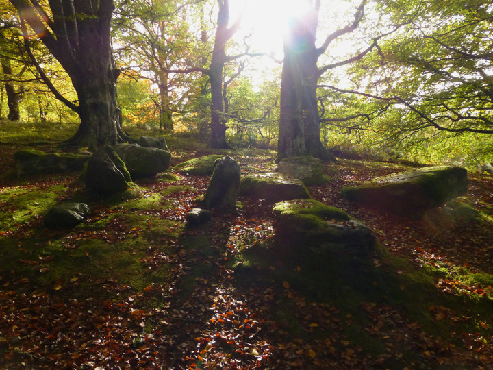
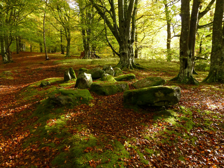
 Image © A. Brookes (22.10.2013)
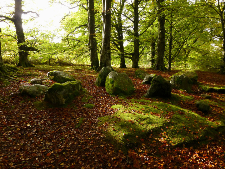
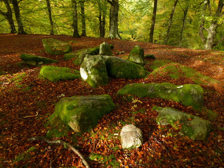