|
|

|
|
The Grey ManNatural Rock Feature
|
||||||||||||||||||||||||
|
|
|
Images (click to view fullsize) |
|

|
Fieldnotes |
|
|
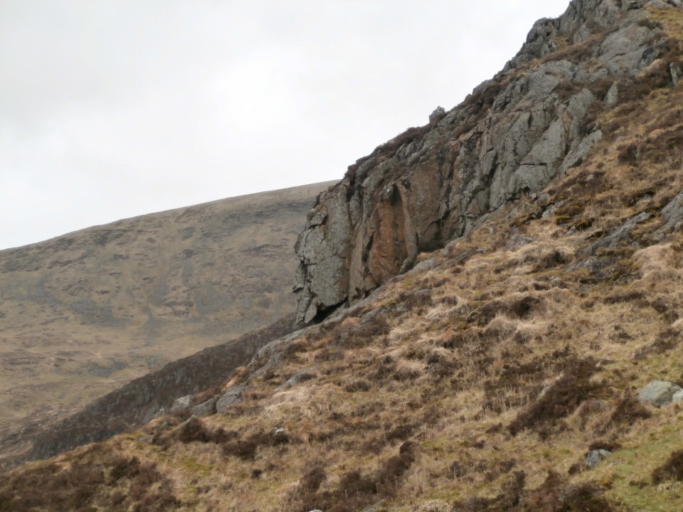
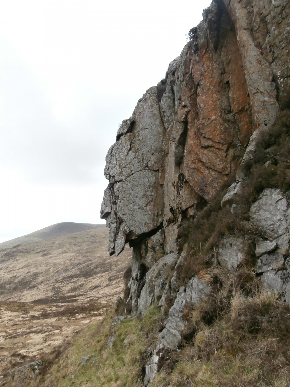
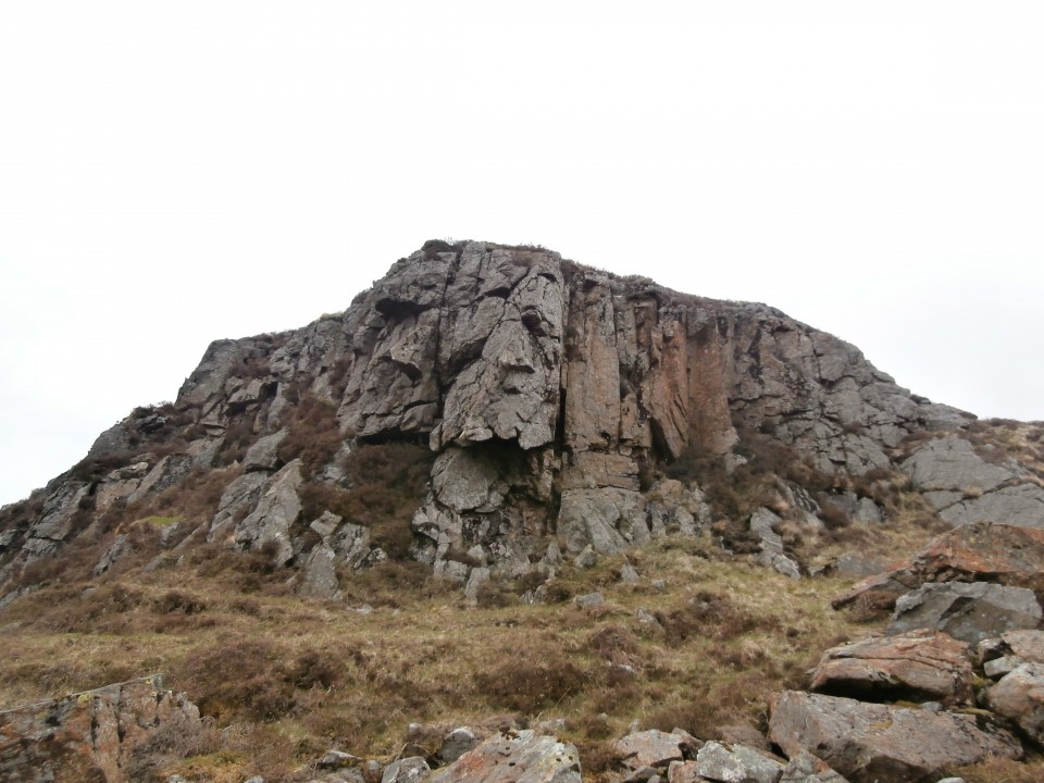
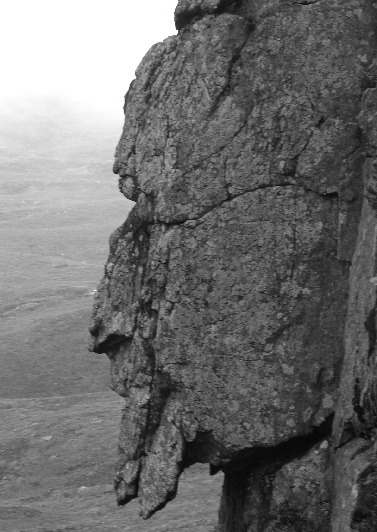
Visited 16.05.15. The Grey Man is a mimetolith c. 1 mile SE of Merrick summit. A mimetolith is a natural rock which resembles something else, in this case, a bearded face in profile. The Grey Man lives at NX43658450, in the middle of nowhere. To find him requires competent map and compass work or GPS navigation. It is a 10 mile walk in the Galloway hills so good walking boots, a good fitness level and good weather would be recommended. Avoid the Merrick path which starts at Bruce's Stone, continue down the road, cross a bridge and bear left onto the Loch Valley path. The path is defined but boggy in places, continuing upwards towards Loch Valley, then Loch Neldricken. From here head N over boggy ground towards the small Loch Arrow. Continue N to climb Craig Neldricken. Loch Enoch lies straight ahead, a substantial body of water. When you reach the loch head turn L round the shore. Look out for a valley between two rigs, heading SW. Hug the R side of the valley until you emerge into the expansive Rig of the Gloon. The Grey Man should be on the rock face on your R, silhouetted on Benyellary. The optical illusion works best viewing the rock face from the E. The view from the W is less convincing. I retraced my steps to return, however it is possible to head for the summit of The Merrick and return by the Benyellary and Culsharg Bothy route given a long day and plenty of energy. Directions: From Newton Stewart town centre take the A714 Girvan road. Follow the A714 for 8.5 miles until you reach Bargrennan. Take the R turn for Glentrool village. Drive past Glentrool Village, take the R turn for Loch Trool & Bruce’s Stone. Follow this narrow road for 4 miles until you reach the Bruce’s Stone/Merrick Car Park. The public road ends here and it becomes a rough track. |
Posted by markj99 8th October 2018ce Edited 27th October 2020ce |
|
September 2013 This is a difficult walk in whatever point you start from and these particular Galloway Hills are an unforgiving bunch. Our route took us in from the car park at Kirriereoch, a good march into the hinterland on former forestry tracks, then out onto the great long whaleback of Kirriereoch Hill via a series of ever diminishing and deteriorating sheep paths. About 1800 feet up Kirriereoch a tremendous stone wall begins. The stones are enormous. We saw one which was the size of a small car. Story says the wall was meant to delineate the old Ayrshire - Galloway county border and the wall appears to be of some great age. After the superhuman effort put into its construction it is a pity so few people have ever seen it. After topping Kirriereoch Hill we took a steep descent following a much smaller wall which wound us down 1500 feet to the tiny lochan of Loch Twachtan (careful now!). Twachtan's population of trout have been completely isolated since the last Ice Age by a few steep waterfalls. Time limits meant we only had twenty minutes to catch the allotted number of specimens for a Fishery Research Project we've been involved in for a number of years. We hit the fishy target at 19 minutes paused for breath, a five minute breather, a sandwich and some juice. Then with our work done we pressed on to the social part of the journey, we were going to visit on The Grey Man of Merrick. Progress across the morass between Twachtan, Munshalloch and the Howe of The Cauldron was very slow. Legs plunged deep into peat bog and despite clinging to the winding stone wall for guidance, low cloud sometime erased all views, the weather closed in and at times we thought we were past the crag we wanted to see. But we needed to hit Loch Enoch first. Loch Enoch had its own distinctive and unique family of trout until the end of the 19th Century when Victorian-Era Acid Rain killed the loch (and many other Galloway Lochs). This loch was restocked over the latter half of the 20th Century and has recovered well. After edging round the shining gravel shores of Enoch we hit another wall and struck off towards the Grey Man. After a few hundred yards we took the small path off to the right and our target drew into sight. The Grey Man is a spectacular feature. It works from both sides and its scale is spectacular. Return took us down past Loch Neldricken and Loch Valley to Loch Trool and the second car. Oops did I mention you'd need to do a 2-car job to take this one in? You don't actually need to... but it is advisable. Good luck y'all! |
 Posted by Howburn Digger
12th November 2013ce Edited 14th September 2014ce |