|
|

|
|
Easter HeadCairn(s)
|
||||||||||||||||||||||||
|
|
|
Images (click to view fullsize) |
|
|
Fieldnotes |
|
|
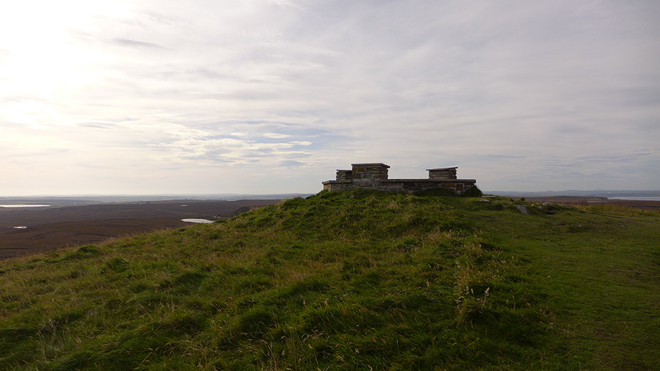
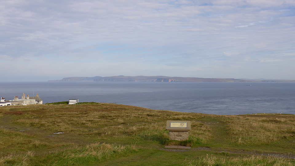
27/09/2015 – Felt a bit fed up midweek, so as we had the next Monday off, we decided to revisit Dunnet Head for the weekend. I’d been before but after seeing thesweetcheat’s photo on here a few years back I couldn't remember if I’d actually been to the top. Still it’s a fine place and well worth another trip, so off we went. We took the train up. It’s a nice journey and my neck was aching a little by the time we reached Thurso from looking out for all the old stuff we could see from the window. I gave a little nod to Citizen Cairn'd as we went through Strath of Kildonan. Even saw a few of its cairns as we went by. Started the walk from Dunnet the next day. A lovely circuit up the road to the Lighthouse then looped back west along the clifftops to Dunnet. About 12 miles and a really fine walk. The cairn, at the high point of Dunnet Head, has been built over by a viewing area, so it’s not in great shape but the location is amazing. We were lucky with the weather and the view over to Orkney was great. Hoy looking so near. My GPS told me as I sat by the cairn that Ring of Brodgar was only 38km away in a straight line, not that you can see it from here but it felt close. A fine visit and well worth going to if you are in the area. We took the train home the following day. It always seems longer on the way back. |
 Posted by thelonious
29th September 2015ce Edited 29th September 2015ce |
|
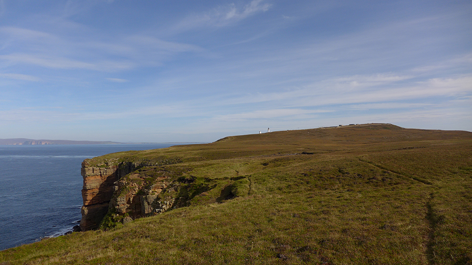
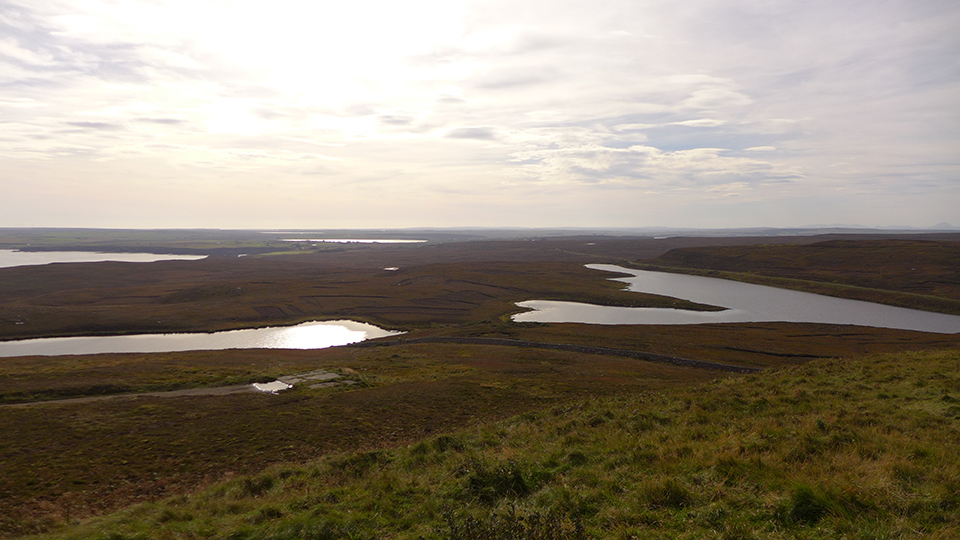
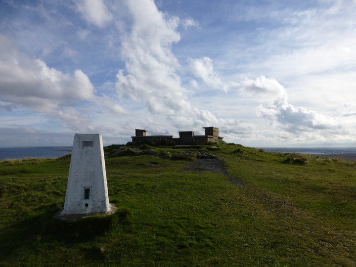
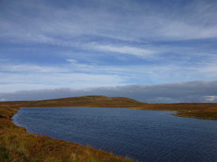
Visited 16 October 2013. We take the Thurso-John o'Groats bus as far as Brough (pronounced to rhyme with "loch"), then it's a simple road walk of three miles to Easter Head, the most northerly part of Dunnet Head. I had completely underestimated the distance from the map (doh), so it becomes a bit of a rush to get up here. The quiet road climbs steadily, winding its way past a selection of heather-imprisoned lochs, bright mirrors in a dark and impenetrable setting. The highest point of the headland, where the cairn is, is visible the whole way, but doesn't seem to get any closer for quite a long while. Eventually we round the corner and the lighthouse suddenly comes into sight. A car-parking area is available, which attracts several blink-and-they're-gone other visitors during the time we're here. The cairn itself has sadly disappeared under a circular seating/toposcope thing, but this place is well worth the effort of the visit on a clear day for the views of the Orkney Islands across the Pentland Firth, almost close enough to touch. As the helpful, albeit cairn-destroying, panels inform us, we can see Hoy, Scapa Flow (which brings schoolboy memories of the sinking of the Royal Oak by Gunter Prien's U-47), as well as the cliff fort of Holburn Head, Ben Loyal, Cape Wrath to the west and Duncansby Head to the east, amongst other things. We have about three quarters of an hour before the repeat journey back to catch the bus, during which time the wind whips up a frenzy, even on this mild and sunny afternoon. The headland is dotted with abandoned concrete buildings of a military-looking type, casting an air of post-apocalyptic decay onto the scene. I'm sure the weather was all lovely and tropical in the Bronze Age when the cairn was built, but this feels as close to the ends of the Earth as anywhere right now. Perhaps they felt that too, some days. Until we make it across to the Orkneys one day, this is as far north as we get. For all the howling wind, I find it a wrench to leave here. |
 Posted by thesweetcheat
27th October 2013ce |
Miscellaneous |
|
|
Round cairn on the summit of Easter Head, the northern headland of Dunnet Head, making this presumably the most northerly prehistoric site in mainland Britain. Sadly the cairn has been covered by a modern viewpoint seating area. Canmore's successive listings tell the story: This is a small cairn of low elevation with a diameter of approximately 16ft. A surveyor's cairn has been erected on the top. |
Posted by thesweetcheat 27th October 2013ce |