|
|

|
|
Craig y Dinas CairnfieldBarrow / Cairn Cemetery
|
||||||||||||||||||||||||
|
|
|
Images (click to view fullsize) |
|
|
Fieldnotes |
|
|
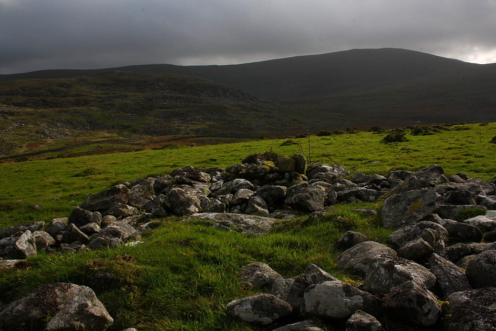
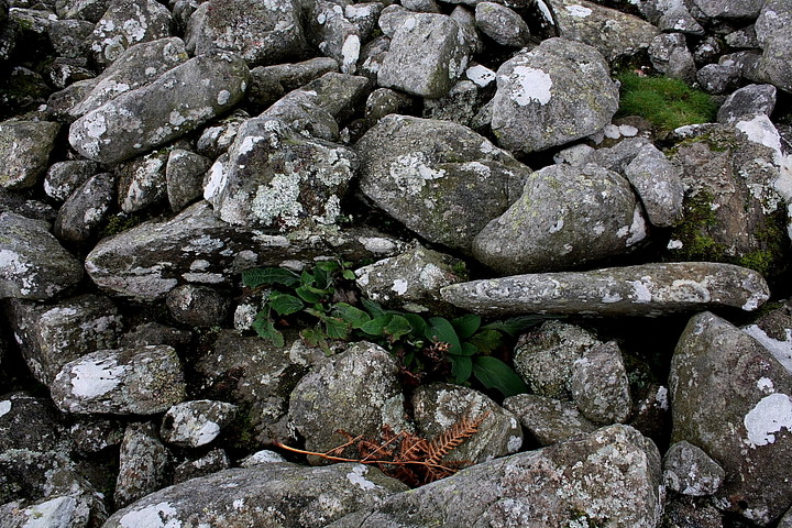
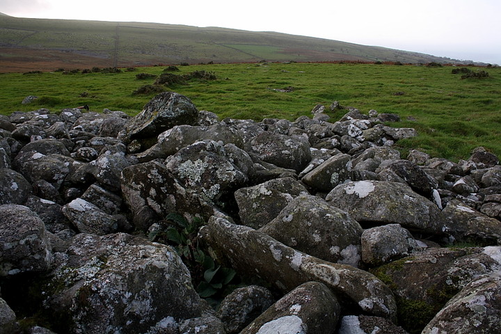
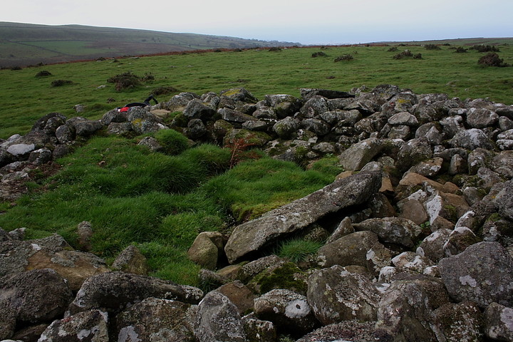
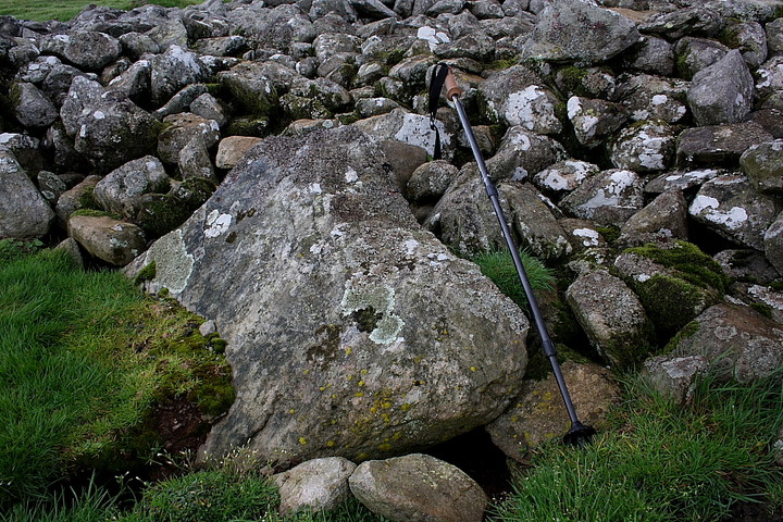
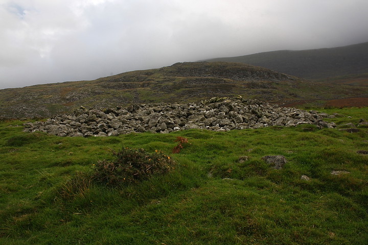
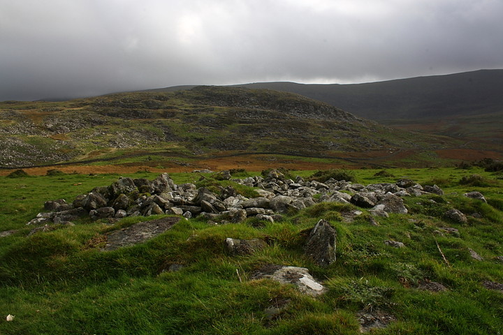
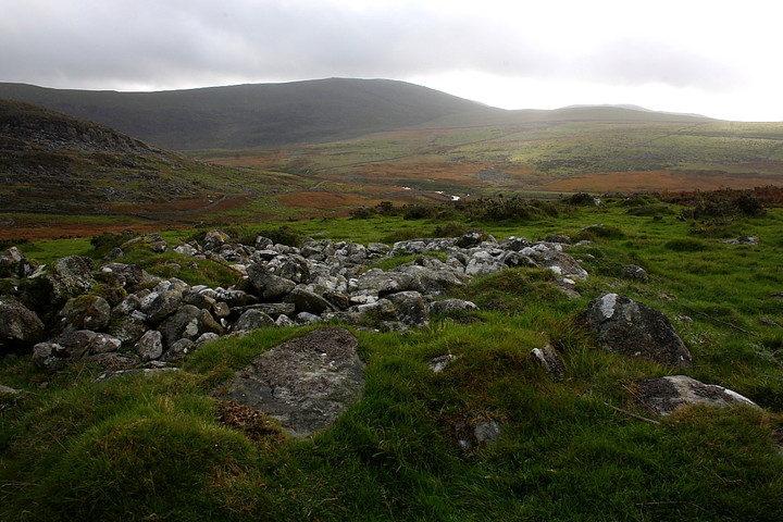
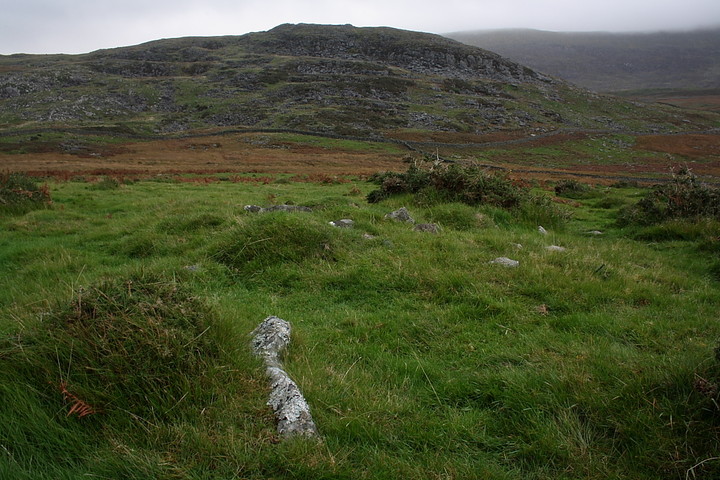
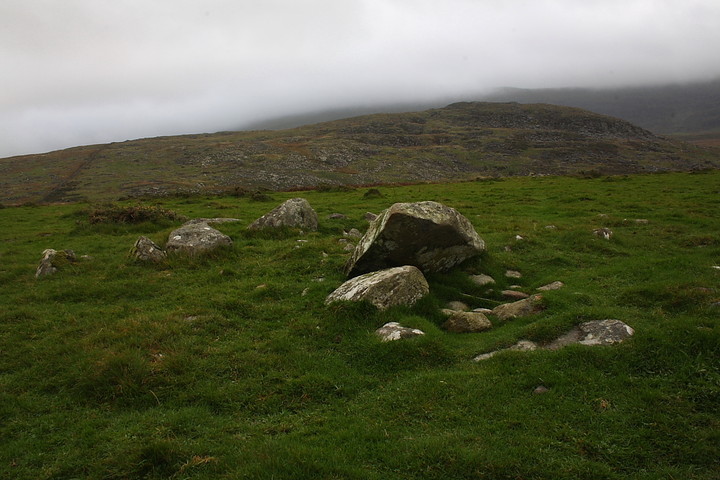
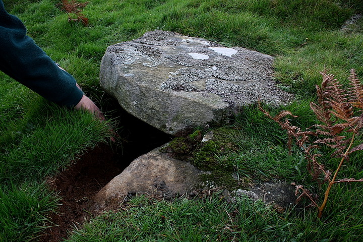
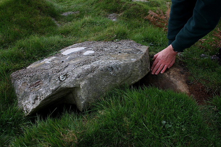
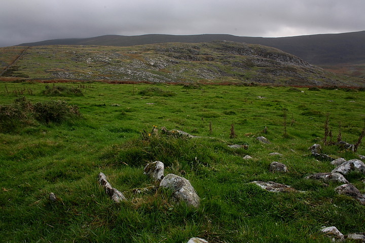
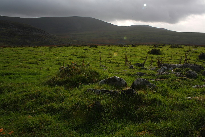
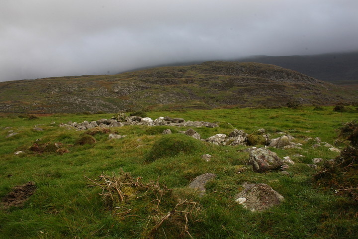
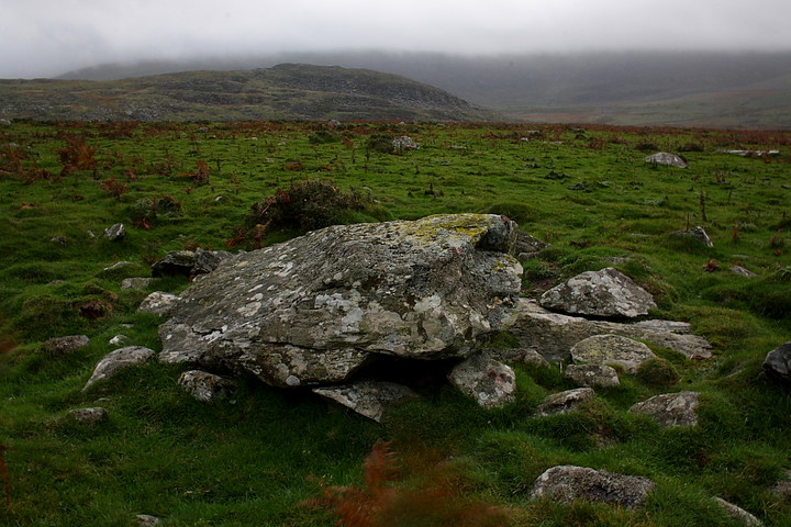
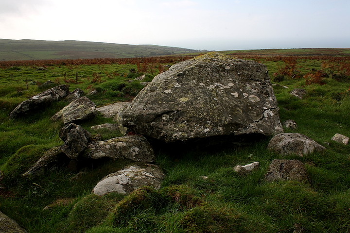
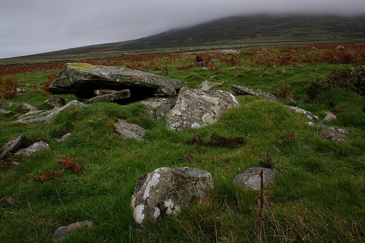
Another cold, grey, not to mention wet Gwynedd day is summarily kick-started into life - hey, seized firmly by the collar and thrown headlong down the stairs - by the cacophonic dawn chorus generated by the local birds at Fferm y'Rynys, a mile or so beneath the great Capel Garmon chambered cairn. Needless to say I do not concur with our feathery friends' concept of 'dawn', not with darkness still pervading this uncompromising, enigmatic landscape I've come to know so well over the years. Still, saves on alarm clock batteries, I guess. And no doubt they are far more perceptive of the idiosyncrasies of this Earth than I. So, in short order I'm heading south-west across The Migneint toward the coastline of Ardudwy, the estuary of the Afon Dwyryd a cadenza of autumnal colour, tones muted by the soft, overcast light. Further south the gaunt, brutal profile of Harlech Castle overwhelms the traveller's senses with its sheer four-square solidity. Finally, a little way beyond the school house of Dyffryn Ardudwy (with attendant dolmens - has it really been 11 years?) the ram-rod straight Fford Gors heads into the hills toward Cors y Gedol Hall, ancestral home of the Vaughan family, no less. Parking is to be had in a drystone enclosure immediately prior to the terminal gate (small charge - £1 as I recall, perhaps incorrectly? I'd encourage visiting Heads to respect this arrangement since it is quite a handy facility). Stoneheads new to the area may wish to divert along the short stretch of tarmac to the right in order to visit the nearby, rather fine Cors y Gedol burial chamber.... I, however, take the unmade track heading approx east, the great hill / mini mountain of Moelfre dominating the left hand flank of the valley despite apparent decapitation by low cloud. Now I last came this way a'cycling in 1998 (en-route to the enigmatic Pont Ysgethin) and, to be fair, unless you happen to enjoy plodding along walled tracks a mountain bike would be advantageous if you happen to have one to hand. Unfortunately I do not, it consequently being a relief to discern the rocky north-south ridge, upon which resides the Craig y Dinas hill fort, eventually taking centre stage ahead. It looks worth the effort. Beyond a gate unfenced pasture borders the track to the south allowing me to take an apparent short cut toward the ancient fortress. It's not, as it transpires (a short cut, that is).... but suffice to say the choice is fortuitous. Now this being Y Rhinogydd, possessing some of Wales' roughest terrain, there is no paucity of surface rock, nearby clearance cairns standing as tangible reminders of the local farmer's ongoing struggle to eke a living from this brutal landscape. As a result the remains of a further cairn initially do not register as perhaps they might have elsewhere... until I notice the large central block, that is, not to mention what might be interpreted as the remnants of a retaining kerb. In other words, features suggestive of constructive planning as opposed to clearance. However since the 1:25K OS map shows nothing I decide to reserve judgement and continue my journey to the hill fort rising beyond to the east.... only to stumble upon a veritable cornucopia of cairns 100 yards further on. Hey, count 'em. Far too many for my limited arithmetic. Granted, a number of these cairns do indeed appear to lack any structural detail, so implying field clearance; however with base content seemingly 'fused' to the ground, I would argue they are not modern, having been in situ for some considerable time. Others, however, stand in association with orthostats, more still with stone piles bearing apparent evidence of central structures subsumed within. I wander south in a daze and locate a very large round cairn (relative to the others) with a central depression partly covered by a stone slab, as well as elements of what looks very much like a retaining kerb. Still more cairns possess apparent 'cap stones' supported upon upright stones buried in the acidic soil, the resulting voids now clearly home to local creatures. Still not sure - cynic that I am, or perhaps not convinced by my own perceptions - unequivocal evidence is nevertheless soon forthcoming courtesy of a cairn retaining the remnants of a 'Dartmoor-esque' triple kerb. Blimey. I do declare (finally) that here we have an extensive Bronze Age cairnfield overlooked by an ethereal upland fort.... cunningly camouflaged in plain sight, so to speak. As I stand and ponder what I've found the summit of Moelfre, rising to the north, divests itself of its cloud mantle to reveal the presence of a very large cairn indeed. Yeah, it all begins to make sense, what with the Afon Ysgethin, engaged in its short journey from the high southern peaks to the coast, flowing to the immediate south. This cairn-field is so extensive I clearly need more time... but that would mean sacrificing a visit to the hill fort. Morever I decide an aerial view would be beneficial. And where better than upon the ramparts of Craig y Dinas itself? OK, upon Moelfre itself. But that's another story. |
 Posted by GLADMAN
12th January 2014ce Edited 14th January 2014ce |
Miscellaneous |
|
|
I must confess the existence of this extensive grouping of cairns to the west of the hillfort Craig y Dinas came as a complete surprise to me, nothing being shown on either the 1:25K or 1:50K OS map. It would appear there are also numerous hut circles /settlement features in the vicinity, too. The relevant Coflein record is apparently based upon an oblique aerial image, the size of the main cairn here (at co-ordinates I've given for the site) clearly suggestive of a prehistoric origin, as opposed to later clearance. Hopefully the ground level detail I've been able to capture collectively makes a strong supporting case for the existence of some ritual monuments set within clearance piles of undetermined age. According to Coflein the main round cairn is: "Stone cairn, c.9m diameter, visible on oblique cover. Probable prehist. ritual monument. Part of larger cairnfield." As regards the cairnfield: "Extensive cairnfield c.169mx173m (mapped) which can be traced for some 530m N/S. Likely Prehist. origins mixed with U med clearance. Open pasture gently slopes to SW." Note also the placement of a very large cairn near of the summit of Moelfre to the approx north-east..... |
Posted by GLADMAN 2nd November 2013ce Edited 3rd November 2013ce |