The Modern Antiquarian
Log in
|
Register
Home
Latest Posts
Forums
Maps
Help
Browse Sites
News
Blog
Contributors
The Books
Select
-
Belgium
Denmark
Eire
France
Germany
Greece
Italy
The Netherlands
Norway
Portugal
Republic of Malta
Spain
Sweden
Switzerland
United Kingdom
Wales
Carmarthenshire
Top Castle
Hillfort
Top Castle (Eglwyscummin) (Hillfort) on The Modern Antiquarian, the UK & Ireland's most popular megalithic community website. 5 images, plus information on many more ancient sites nearby and across the UK & Ireland.
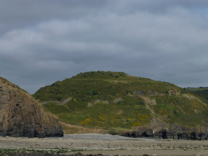
Image © A. Brookes (20.9.2013)
Also known as:
Eglwyscummin
Nearest Town:
Tenby (9km SSW)
OS Ref (GB):
SN19450773 /
Sheet: 158
Latitude:
51° 44' 19.09" N
Longitude:
4° 36' 54.9" W
Added by
thesweetcheat
Images (5)
0 discussions
Start a topic
Show |
Hide
Web searches for Top Castle
Flickr
Google
Google Images
The Megalithic Portal
Bing
Stone Pages
Streetmap.co.uk
Wikipedia
Show map
(inline Google Map)
- Sites within 20 km -
-
Morfa Bychan (2.66km E) (26 posts)
Morfa Bychan long cairn (2.7km E) (5 posts)
Gilman Camp (3.34km E) (13 posts)
Amroth Mesolithic forest (3.95km WSW) (2 posts)
Crug Swllt (4.89km NW) (2 posts)
Newhouse (5.07km WNW) (1 post)
The Longstone (5.11km W) (7 posts)
Parc y Garreg (5.6km WNW) (8 posts)
Coygen Camp (9.05km ENE) (4 posts)
Llain-Y-College (9.42km NE) (2 posts)
Gumfreston (10.91km SW) (2 posts)
Hoyle's Mouth Cave (11.07km SW) (5 posts)
St Canna's Stone (11.13km NNW) (4 posts)
Little Hoyle Cave (11.42km SW) (3 posts)
Eithin Fach (11.45km NE) (3 posts)
Glan-y-Mor (11.66km ENE) (7 posts)
Potter's Cave (Caldey Island) (11.79km SSW) (1 post)
Nanna's Cave (11.89km SSW) (2 posts)
Redstone Cross (12.08km WNW) (1 post)
Bryn Dwyrain (12.1km NW) (1 post)
West Beacon (Caldey Island) (13.05km SSW) (2 posts)
Lower Court (13.25km NE) (0 posts)
Meini Llwydion (Llangynog) (13.45km ENE) (14 posts)
Lydstep Mesolithic forest and footprints (13.64km SW) (5 posts)
Faenor Gaer (13.7km WNW) (1 post)
Castle Park (14.2km WSW) (1 post)
Norchard Beacon (14.34km SW) (1 post)
Castell Cogan (14.64km ENE) (3 posts)
Skomar Camp (14.89km SW) (8 posts)
Cross Hands (15.15km NNW) (1 post)
Cefn Brafle (15.19km NNW) (4 posts)
Llansteffan Castle (15.88km ENE) (20 posts)
Maen Melyn (15.92km ENE) (2 posts)
Dan y Coed and Woodhouse (16.1km WNW) (3 posts)
Old Castle Head (16.21km SW) (2 posts)
Bwlch Y Seiri (16.38km NE) (1 post)
Twlc y Filiast (16.56km ENE) (20 posts)
Pleasant View (16.9km N) (1 post)
Kings Quoit (16.97km SW) (28 posts)
Nolais (17.54km N) (1 post)
Gwal-y-Filiast (18.01km NNW) (43 posts)
Coynant Maenhir (18.1km NW) (5 posts)
Pant-yr-Odyn (18.32km NW) (1 post)
Rhos Maen Hir (18.52km NW) (4 posts)
Maenpica (18.52km NW) (4 posts)
Maen Hir (18.57km NNW) (6 posts)
Is-coed (18.9km ENE) (12 posts)
Castell Y Gaer (19km NE) (2 posts)
Crug Bach (19.2km N) (1 post)
Meini Gwyr (19.56km NW) (34 posts)
Maen Llwyd (Llandyfaelog) (19.62km ENE) (8 posts)
Yr Allor (19.64km NW) (7 posts)
Castell Garw (19.72km NW) (1 post)
Meini Llwydion (Llwyn Du) (19.73km ENE) (7 posts)
Pen-yr-Heol (19.76km ENE) (1 post)
Glandymawr (19.87km NW) (7 posts)
Maenau Llwydion (Llangain) (19.97km ENE) (1 post)
- Facilities within 20 km -
-
Tenby Tourist Informat... (Tourist Information: 9.3 km SSW)
- Add -
-
Add news
Add an image
Add fieldnotes
Add folklore
Add miscellaneous
Add a link
Add a nearby facility
Add an alternative name/spelling
Images
(click to view fullsize)
Add an image
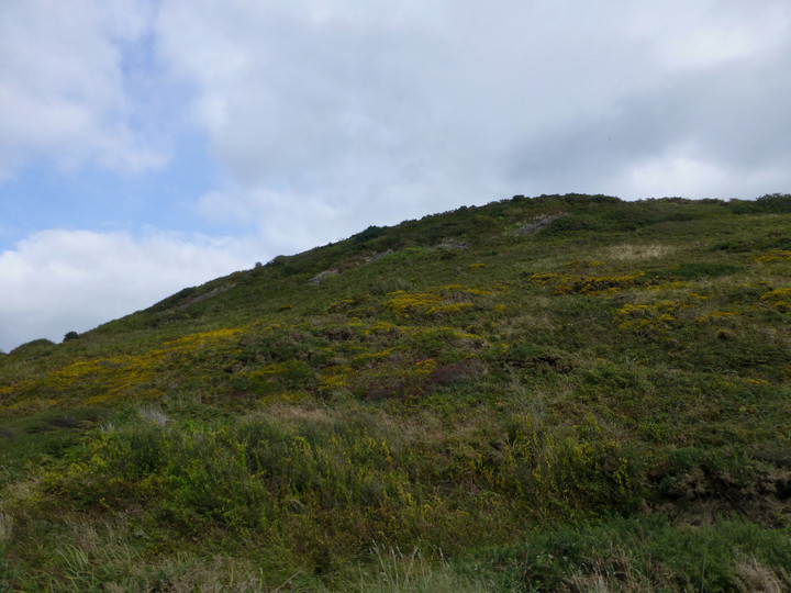
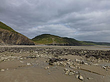 Image © A. Brookes (20.9.2013)
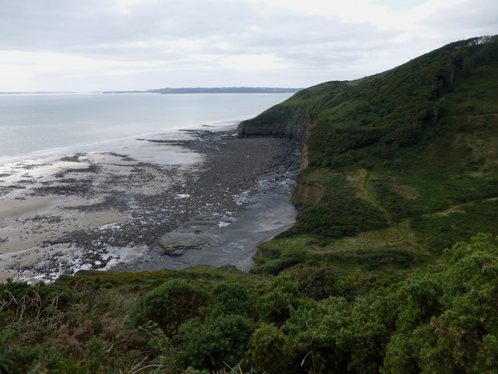