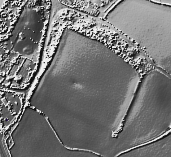
The Modern Antiquarian
Log in
|
Register
Home
Latest Posts
Forums
Maps
Help
Browse Sites
News
Blog
Contributors
The Books
Select
-
Belgium
Denmark
Eire
France
Germany
Greece
Italy
The Netherlands
Norway
Portugal
Republic of Malta
Spain
Sweden
Switzerland
United Kingdom
England
Southern England
Warwickshire
Burrow Hill
Hillfort
Burrow Hill (Corley Camp) (Hillfort) on The Modern Antiquarian, the UK & Ireland's most popular megalithic community website. 1 image, 1 weblink, plus information on many more ancient sites nearby and across the UK & Ireland.
Image © Open Source Environment Agency LIDAR
Also known as:
Corley Camp
Nearest Town:
Bedworth (6km ENE)
OS Ref (GB):
SP30458510 /
Sheet: 140
Latitude:
52° 27' 45.19" N
Longitude:
1° 33' 6.38" W
Added by
thesweetcheat
Images (1)
Links (1)
0 discussions
Start a topic
Show |
Hide
Web searches for Burrow Hill
Flickr
Google
Google Images
MAGIC
The Megalithic Portal
Bing
Stone Pages
Streetmap.co.uk
Wikipedia
Show map
(inline Google Map)
- Sites within 20 km -
-
Hartshill Barrow (9.29km N) (12 posts)
Oldbury Camp (9.63km N) (3 posts)
Coleshill Temple (12.17km W) (1 post)
Fenny Drayton (13.22km NNE) (8 posts)
Abbey Farm Barrow (13.67km ENE) (2 posts)
Brinklow (14.39km E) (17 posts)
High Cross Henge (14.79km ENE) (1 post)
Knightlow Hill - The Wroth Stone (15.1km ESE) (14 posts)
Beausale Camp (16.02km SSW) (1 post)
Wigston Parva (16.92km ENE) (4 posts)
Sharnford Barrow (17.17km ENE) (1 post)
Wappenbury (17.36km SE) (2 posts)
Sutton Cheney Barrows (18.97km NE) (12 posts)
- Add -
-
Add news
Add an image
Add fieldnotes
Add folklore
Add miscellaneous
Add a link
-
Add a site
Add a nearby facility
Add an alternative name/spelling
Images
(click to view fullsize)
Add an image
Links
Add a link
Pastscape
Pastscape description of the fort, of interest due to the stone-faced construction of the ramparts.
Comments (0)
|
Add a comment
|
Permalink
Posted by
thesweetcheat
15th January 2013ce