|
|

|
|
GodsburyEnclosure
|
||||||||||||||||||||||||
|
|
|
Images (click to view fullsize) |
|

|
Fieldnotes |
|
|
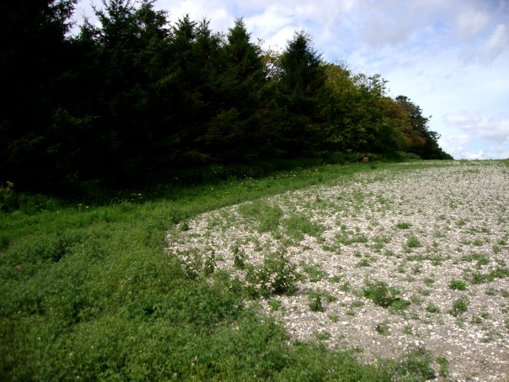
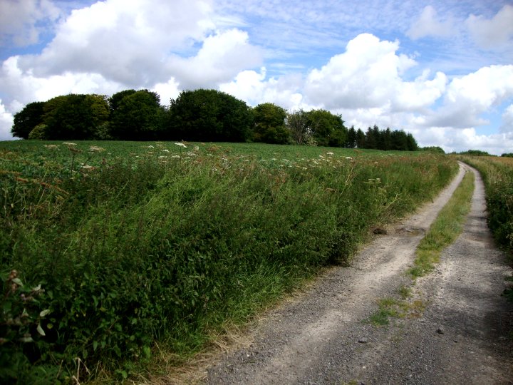
Fieldnotes - Visited Late July 2012 Like a lot of prehistoric sites, Godbury lays a forgotten relic of the past. An Iron Age enclosure, it was probably used in cattle breeding as a corral or way station between summer and winter pasture. Whatever it's original purpose, the area is now ploughed up and planted with wheat or peas. Only the old drovers tracks, with their wide hollows remain to indicate what use this rural part of the old west once was. I travelled up to the site by the byway which runs next to it, having skirted the bottom of the hill after visiting Old Hat Barrow. I encountered the tenant farmer at the bottom of the hill and asked a few questions about the area. He seemed mystified as to why I wanted to visit such a place but was happy enough for me to carry on with my exploration so long as I didn't get in the way of the harvest of disturb his birds. He couldn’t tell me anything about the site or the surrounding fields. I asked about Falstone Pond but he reckoned that the pond had dried up years back when the underground aqua fore had been tapped and the water extracted. Seems that this had also reduced parts of the River Bourne to a stream too. Godbury itself was much overgrown with scrub and decaying trees. The perimeter was planted very close with peas and after working my way round half the site, I decided it would be a thankless task to go any further into the enclosure. Defiantly a site that is best visited in the winter months when the vegetation has died back and the earthwork is more visible. I was going to have a look at the barrow on Easton Clump, but after seeing the extent of the vegetation, I decided against it at this time. |
 Posted by Chance
8th August 2012ce |
Miscellaneous |
|
|
Details of site on Pastscape An Iron Age univallate enclosure, known as Guthredesburg in AD 921. (SU 2176 5775) Godsbury (Guthredes Burg) (NR) (1) Known as 'Guthredesburg' in the Saxon charter of AD 921 and as Gosbury in 1773. (2) A roughly circular univallate earthwork enclosure of 1 1/2 acres. I A ? (3) The oval earthwork, which occupies a commanding hilltop postition, comprises a bank up to 1.2 metres high externally and 0.5 metres internally. There is no discernible trace of a ditch and the entrance is not obvious on the south side (the northern part of the earthwork being under standing corn). The interior is covered by vegetation; nothing visible on OSAPs. Probably an IA enclosure, still known as "Godsbury". Published survey 1:2/500 revised. (4) -------------------------------------------------------------------------------- SOURCE TEXT -------------------------------------------------------------------------------- ( 1) Ordnance Survey Map (Scale / Date) OS 6" 1926 ( 2) General reference EPNS, 16, Wilts, 1939, 346. (Gover, Mawer and ( 3) General reference V C H Wilts, 1, pt 1, 1957, 264. (L V Grinsell) ( 4a) General reference OSAPs 71/476 86, 87 ( 4) Field Investigators Comments F1 MJF 27-JUN-72 |
Posted by Chance 27th July 2012ce Edited 27th July 2012ce |