The Modern Antiquarian
Log in
|
Register
Home
Latest Posts
Forums
Maps
Help
Browse Sites
News
Blog
Contributors
The Books
Select
-
Belgium
Denmark
Eire
France
Germany
Greece
Italy
The Netherlands
Norway
Portugal
Republic of Malta
Spain
Sweden
Switzerland
United Kingdom
County Cork
Peakeen
Passage Grave
Peakeen (Passage Grave) on The Modern Antiquarian, the UK & Ireland's most popular megalithic community website. 6 images, plus information on many more ancient sites nearby and across the UK & Ireland.
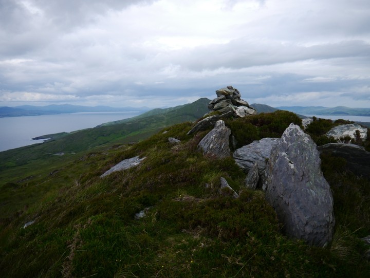
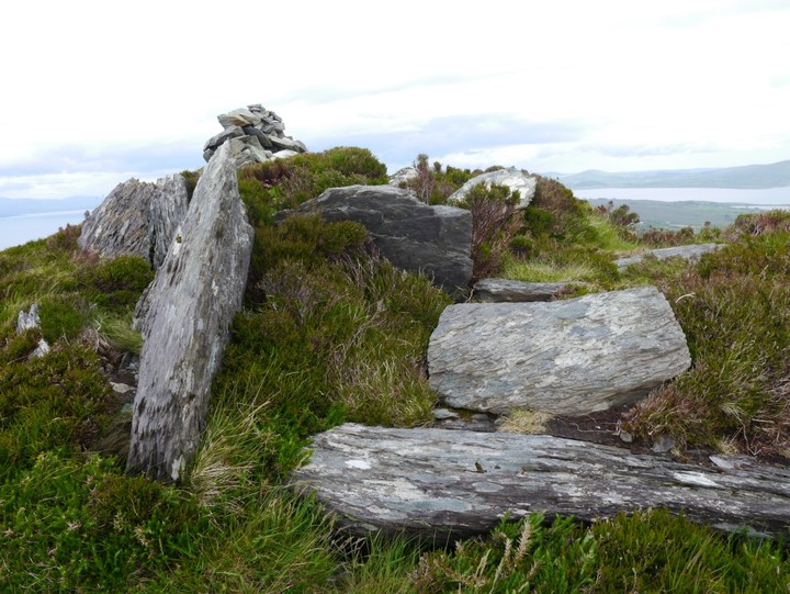
Image © Michael Mitchell
Nearest Town:
Goleen (11km SSE)
OS Ref (IE):
V804388 /
Sheet: 88
Latitude:
51° 35' 21.22" N
Longitude:
9° 43' 33.37" W
Added by
Meic
Images (6)
0 discussions
Start a topic
Show |
Hide
Web searches for Peakeen
Flickr
Google
Google Images
The Megalithic Portal
Bing
Stone Pages
Wikipedia
Show map
(inline Google Map)
- Sites within 20 km -
-
Farranamanagh (2.13km E) (6 posts)
Kilcrohane (2.26km ESE) (9 posts)
Farranamanagh (2.5km E) (2 posts)
Caherurlagh (4.37km SW) (6 posts)
Gorteanish (5.65km ENE) (14 posts)
Dunmanus (7.27km ESE) (3 posts)
Dunmanus East (7.53km ESE) (3 posts)
Toormore (9.47km ESE) (15 posts)
Ballydivlin (9.63km SSE) (4 posts)
Altar (10.19km ESE) (19 posts)
Coomgira (10.71km NNW) (6 posts)
Arderawinny (10.74km ESE) (10 posts)
Drumlave (11.64km N) (11 posts)
Cappaleigh North (11.82km N) (4 posts)
Dunbeacon (12.26km ENE) (20 posts)
Ballyvoge Beg (12.3km S) (8 posts)
Lissagriffin (12.3km S) (4 posts)
Kildromalive (12.76km N) (5 posts)
Dunbeacon (12.76km ENE) (6 posts)
Killenough (12.91km NNE) (5 posts)
Leitrim Beg (13.04km NNE) (21 posts)
Dough (13.08km S) (7 posts)
Ballynahowen (13.36km NNE) (15 posts)
Kilcaskan (13.55km N) (5 posts)
Derrymihin West (13.69km W) (3 posts)
Mount Corrin (13.75km ENE) (7 posts)
Rodeen 2 (14.2km WNW) (5 posts)
Rodeen 3 (14.56km WNW) (4 posts)
Skull Stone (14.72km E) (5 posts)
Rodeen 1 (14.75km WNW) (3 posts)
Coolcoulaghta (14.82km ENE) (5 posts)
Rathcool (14.84km E) (6 posts)
Derreenataggart Middle (14.89km W) (2 posts)
Cloontreem (14.89km WNW) (15 posts)
Mallavoge (15.09km S) (4 posts)
Rooska East (15.25km ENE) (6 posts)
Derreenataggart West (15.84km W) (31 posts)
Rathruane Beg (15.92km E) (4 posts)
Rathruane More (16.12km E) (6 posts)
Kilmackowen (16.19km WNW) (17 posts)
Kilmackowen (16.33km WNW) (9 posts)
Fanahy (16.43km W) (4 posts)
Clogherane (16.86km NNW) (3 posts)
Clogherane (16.97km NNW) (3 posts)
Shronebirrane (17.31km NW) (22 posts)
Kilbronoge (17.38km E) (12 posts)
Dromclogh (17.76km ENE) (5 posts)
Teernahillane (17.77km W) (1 post)
Teernahillane (17.77km W) (3 posts)
Ballycommane (17.79km ENE) (3 posts)
Ballycommane (17.79km ENE) (2 posts)
Cappaghnacallee (17.96km E) (1 post)
Gour (18.13km W) (10 posts)
Knockoura (18.21km W) (2 posts)
Teernahillane (18.22km W) (9 posts)
Teernahillane (18.23km W) (4 posts)
Beach (18.69km ENE) (1 post)
Ardgroom Outward (19.1km NW) (34 posts)
Reenkilla (19.21km NNW) (5 posts)
Maulinward (19.29km ENE) (6 posts)
Maulinward (19.29km ENE) (6 posts)
Glashananinnaun (19.6km NW) (5 posts)
Cashelkeelty NW (19.61km NW) (12 posts)
Cashelkeelty SE (19.68km NW) (13 posts)
Keilnascarta SE (19.82km ENE) (5 posts)
Keilnascarta (19.85km ENE) (5 posts)
Coulagh (19.85km W) (1 post)
Keilnascarta NW (19.88km ENE) (6 posts)
Parkana (19.97km ENE) (3 posts)
- Add -
-
Add news
Add an image
Add fieldnotes
Add folklore
Add miscellaneous
Add a link
-
Add a site
Add a nearby facility
Add an alternative name/spelling
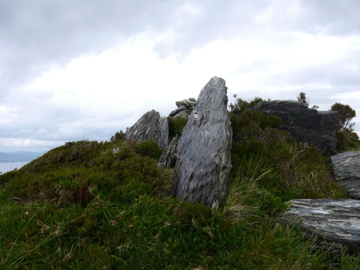
Images
(click to view fullsize)
Add an image
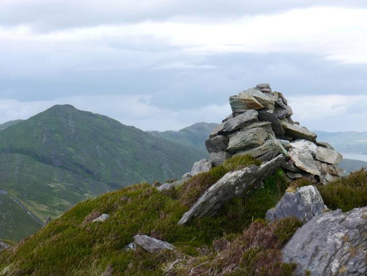
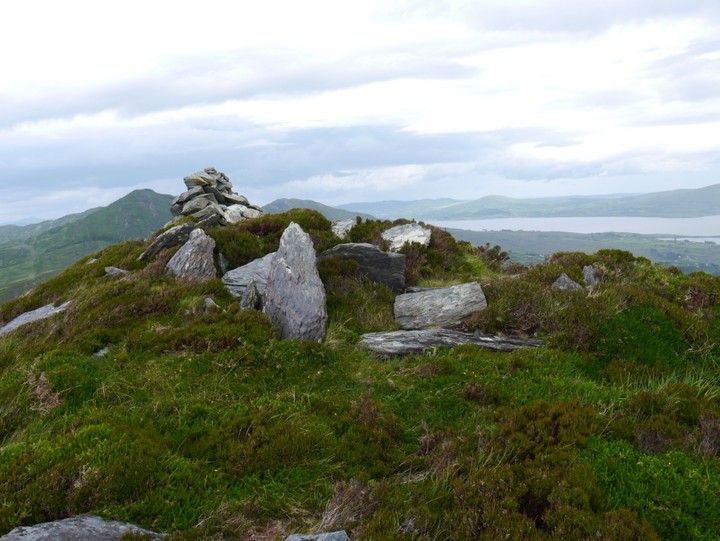
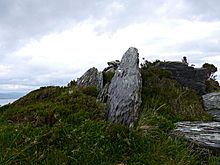 Image © Michael Mitchell
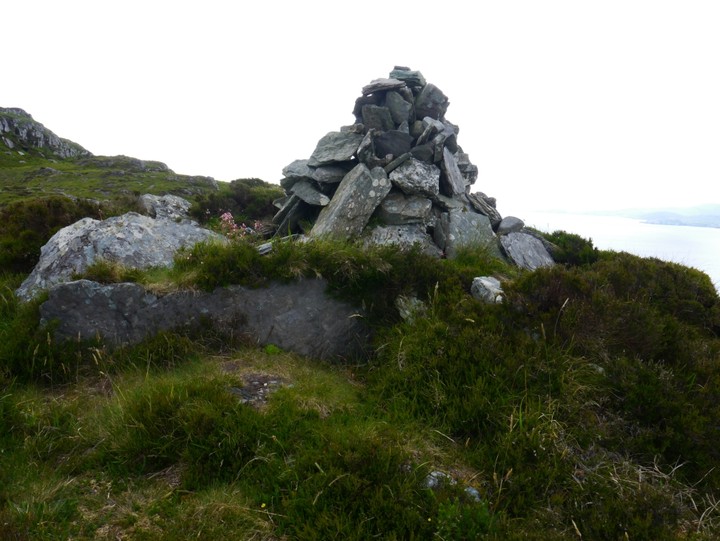