The Modern Antiquarian
Log in
|
Register
Home
Latest Posts
Forums
Maps
Help
Browse Sites
News
Blog
Contributors
The Books
Select
-
Belgium
Denmark
Eire
France
Germany
Greece
Italy
The Netherlands
Norway
Portugal
Republic of Malta
Spain
Sweden
Switzerland
United Kingdom
County Louth
Barnaveddoge
South Stone
Standing Stone / Menhir
South Stone (Standing Stone / Menhir) on The Modern Antiquarian, the UK & Ireland's most popular megalithic community website. 2 images, plus information on many more ancient sites nearby and across the UK & Ireland.
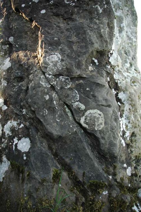
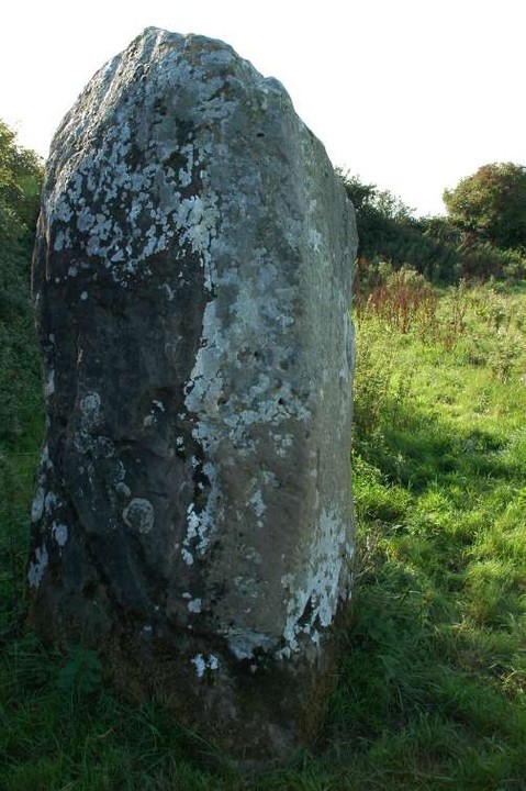
Image © ryaner
Nearest Town:
Ardee (4km W)
OS Ref (IE):
O003892 /
Sheet: 36
Latitude:
53° 50' 33.18" N
Longitude:
6° 28' 33.64" W
Added by
FourWinds
Images (2)
0 discussions
Start a topic
Show |
Hide
Web searches for South Stone
Flickr
Google
Google Images
The Megalithic Portal
Bing
Stone Pages
Wikipedia
Show map
(inline Google Map)
- Sites within 20 km -
-
Barnaveddoge Mound (0.14km WNW) (0 posts)
North Stone (0.36km ENE) (0 posts)
Roestown (1.83km WSW) (0 posts)
Knockdinnin (2.46km E) (0 posts)
Mullameelan (4.08km WSW) (0 posts)
Blakestown (4.5km WSW) (0 posts)
Mullaghash (5.1km SW) (3 posts)
Mullaghash (5.1km SW) (2 posts)
Corracon (5.37km SW) (0 posts)
Purcellstown (5.8km WSW) (0 posts)
Hurlstone (6.21km WSW) (6 posts)
Mount Oriel (6.25km SSW) (3 posts)
White Mountain (6.45km SW) (0 posts)
Belpatrick (6.88km SW) (0 posts)
Dunmore (7.29km SW) (0 posts)
Paddock (7.68km ESE) (15 posts)
Kilbride (Talbotstown Lower By.) (7.83km SE) (6 posts)
Rathbran More (8.98km SW) (6 posts)
Skeaghmore (9.39km E) (0 posts)
Standing Stone (9.59km NNE) (0 posts)
Drumshallon (9.65km ESE) (0 posts)
Crannog (9.78km NNE) (0 posts)
Piperstown (10.06km ESE) (1 post)
The Stuck Stone (10.07km SW) (0 posts)
The Well of The White Cow (10.35km WNW) (3 posts)
Fieldstown (10.46km ESE) (7 posts)
Mullagharoy (10.49km SW) (4 posts)
Slieve Beagh (11.14km SW) (13 posts)
Mellifont (11.22km SSE) (0 posts)
Walshestown (11.72km E) (0 posts)
Rathmaiden (12.59km SSW) (0 posts)
Labanstown (12.99km E) (0 posts)
Townley Hall Souterrain (13.25km SSE) (0 posts)
Townley Hall Barrow (13.32km SSE) (0 posts)
Milltown (13.38km ESE) (0 posts)
Littlegrange (13.62km SSE) (9 posts)
Monknewtown (13.68km SSE) (2 posts)
Monknewtown II (13.69km SSE) (3 posts)
Monknewtown Pond (13.88km S) (4 posts)
Davidstown Barrow (14.1km SW) (0 posts)
Oldbridge (14.56km SE) (7 posts)
Hill of Slane Souterrain (14.65km SSW) (0 posts)
Cuchulains Stone (Rathiddy) (14.68km N) (8 posts)
Hill of Slane Barrow (14.71km SSW) (1 post)
Rathkenny (14.87km SW) (8 posts)
Cloghalea (15.02km SSE) (6 posts)
Stanley Hill (15.18km SSW) (0 posts)
Dowth Henge (15.29km SSE) (10 posts)
Gallows Hill (15.37km SSW) (0 posts)
Dowth Mound I (15.41km SSE) (0 posts)
Dowth II (15.51km SSE) (1 post)
Dowth I (15.52km SSE) (68 posts)
Dowth (15.52km SSE) (4 posts)
Dunany Point (15.56km ENE) (1 post)
Termonfeckin (15.73km ESE) (0 posts)
Knowth (15.75km S) (120 posts)
Gernonstown (15.75km SSW) (2 posts)
Gernonstown (15.77km SSW) (5 posts)
Dowth Mound II (15.96km SSE) (0 posts)
Dowth Mound III (15.99km SSE) (0 posts)
Knock (16.06km WSW) (2 posts)
Drumgonnelly (16.3km NW) (3 posts)
Dardisrath (16.31km E) (0 posts)
Newgrange (16.44km SSE) (128 posts)
Newgrange K & L (16.47km S) (10 posts)
The Great Circle (16.48km S) (23 posts)
Newgrange Standing Stone C (16.48km S) (6 posts)
Newgrange Cursus (16.48km SSE) (2 posts)
Hedgerow Stone (16.72km SSE) (2 posts)
Drumirril (16.77km NW) (6 posts)
Newgrange Tumulus A (16.8km SSE) (3 posts)
Tullagee (17.02km NW) (1 post)
Newgrange Tumulus B (17.02km SSE) (3 posts)
Drogheda (17.19km ESE) (0 posts)
Rossnaree (17.41km S) (3 posts)
Clogher Head (17.65km E) (1 post)
Cortial (17.68km NNW) (5 posts)
Johnstown (17.75km SSW) (0 posts)
Tullyallen Lough (17.79km WNW) (0 posts)
Mullagha (17.87km SW) (6 posts)
Drumcah (18.09km NW) (3 posts)
Stackallan (18.21km SW) (2 posts)
Bey More (18.74km SE) (0 posts)
Ballinloughan (18.76km NNE) (1 post)
Nobberbeg (19.01km WSW) (6 posts)
Rahans Lough (19.08km W) (0 posts)
Drumsinnot (19.15km NNW) (8 posts)
Castletown (19.24km N) (0 posts)
Castletown - Souterrain (19.24km N) (0 posts)
Castletown - Standing Stone (19.35km N) (4 posts)
Longford (19.37km SSE) (0 posts)
Monalty Lough (19.39km WNW) (0 posts)
Painestown (19.61km SSW) (0 posts)
Baltray (19.87km ESE) (12 posts)
- Add -
-
Add news
Add an image
Add fieldnotes
Add folklore
Add miscellaneous
Add a link
-
Add a site
Add a nearby facility
Add an alternative name/spelling
Images
(click to view fullsize)
Add an image
 Image © ryaner