|
|

|
|
Castell FlemishHillfort
|
||||||||||||||||||||||||
|
|
|
Images (click to view fullsize) |
|
|
Fieldnotes |
|
|
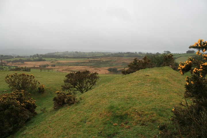
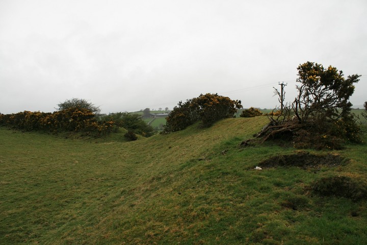
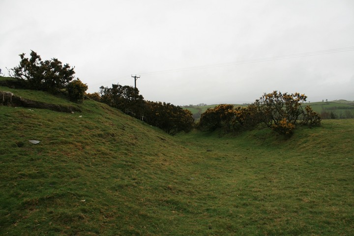
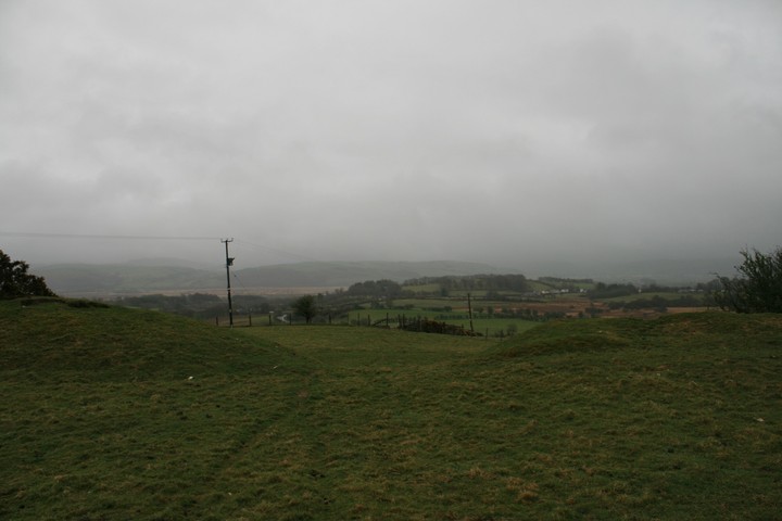
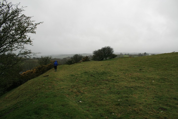
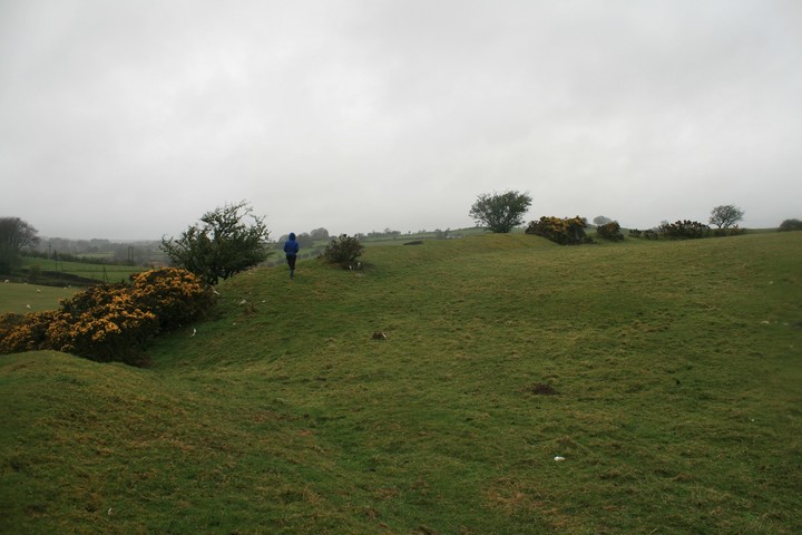
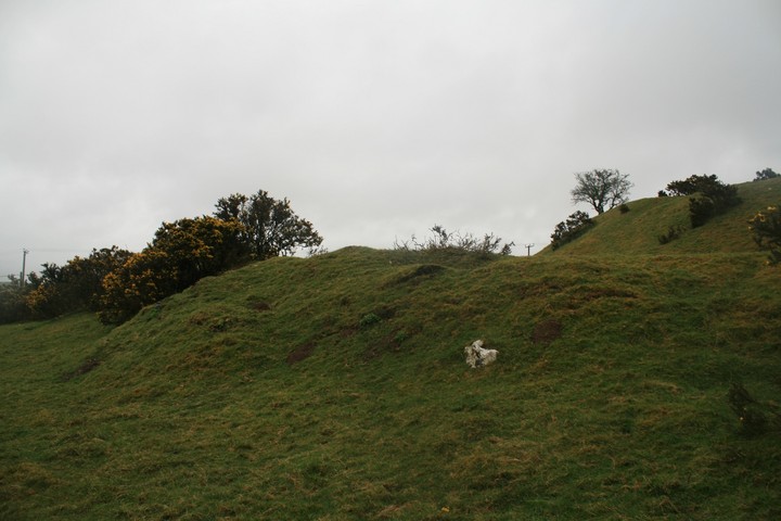
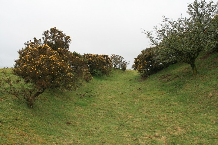
I parked in the small layby off the A485 about fifty yards east from the hill fort, sadly it was persisting it down so we waterproofed ourselves and mozied on back up the road. Also after my directional cock up earlier I wasn't in the mood for niceties so I didn't ask for permission to get in, instead we gracefully leaped the barbed wire fence, well as graceful as wellied feet can any way, it's only a short stroll from the fence, in fact the forts most extreme northern defences seem to be cut into by the road side embankment....shocking. I wondered, then doubted whether any Dutch speaking Belgians had ever lived here, surely they would have been native Welsh iron age folk like anywhere in the country. We kicked a few lambs out of the way, they're only food after all, no, not really, I'm as soft as any vacant minded veggie. In fact it was the lambs that nearly made us turn back rather than any irate farmer, but we remained unchecked for the entire visit, it was early, raining and misty. We started our circuit of the forts defences, noting at least two entrances east and southwest. As we passed by the southwestern gate I wondered if on a clear day we could see Sunnyhill camp the other side of Tregaron about three miles distant. Eric leads the way round the perimeter, he knows we don't leave till we've seen the entire round, and he knows this is just the first of many sites to be got to in the two days we've given ourselves out in the comparative wilds of south Wales, in fact this one of three hill forts is just on the way to where we're going. Just on the way, sadly, a longer visit with a football, kite or other child friendly activity would be better I know. This post appears as part of the weblog entry Trio on the way
|
 Posted by postman
11th April 2012ce Edited 11th April 2012ce |
Folklore |
|
|
Archaeologia Cambrensis for 1889 has a translation of the 12th century confirmation charter of Strata Florida abbey. It mentions 'the Grange which is called Castell y Flemmis', so the name is clearly an old one. The c19th notes offer an explanation for the name: "a considerable encampment, supposed to have been formerly thrown up and occupied by the Flemings of Pembrokeshire". Maybe that theory about the name draws onGiraldus Cambrensis's report of people from Flanders being settled in Wales. Baring-Gould mentions another name in his 'Lives of the British Saints': Vuarth Caraun / Buarth Caron - meaning Caron's cattle-fold. He says "at" Castell Fflemish, near Tregaron. But what else round here would act as a good cattle-fold? It must surely refer to the fort? Caron is the patron of nearby Tregaron (Plwyf Caron).If you wanted, you could see mixed up in the story a barrow and a christianised site? The local tradition, still curent, varies - that he was a prince, a brave chieftain, or a bishop - but it agrees in saying he was buried where the church tower now stands, and that over his grave a large mound was raised. We have here evidently traditions of two distinct persons, a chieftain and an ecclesiastic, who have become mixed up in the popular mind.Back in Tregaron on the other side of the Teifi, there was and is his well: His Holy Well there, Ffynnon Garon, was at Eastertide, in days gone by, a centre of great attraction for the young of both sexes. On Easter Eve crowds of children resorted thither, each one bringing a small mug or cup and a quantity of brown sugar, and drank copious draughts of the water sweetened with sugar. On Easter Day, or Low Sunday, the swains met their sweethearts at the spot, and made them gifts of white bread (bara can), which they ate, washing it down with the crystal spring water in token of affection. |
 Posted by Rhiannon
2nd May 2013ce Edited 2nd May 2013ce |
Miscellaneous |
|
|
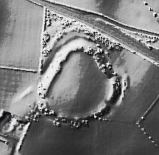
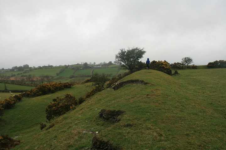
A strongly sited, pear-shaped, bivallate hillfort about 90m N/S by 84m E/W internally, occupying a summit at the eastern end of a long ridge, which commands extensive views in all directions except to the west. The main defence is a single strong rampart; it is tallest at the north where it stands 1.6m above the interior and up to 4m above the ditch bottom externally . This main rock-cut ditch is traceable again on the east side, flanking the main gate where it is still 0.80m deep, and around the south side. On the north side is a second, outer ditch, separated from the inner rampart by a flat, revetted terrace. The east gate is flanked by traces of an outer rampart, beyond the main inner ditch. All around the innermost face of the rampart are traces of a quarry ditch. A wet area in the south-east part of the interior may have been an original spring or pond serving the fort. On the inner face of the rampart on the west side traces of an inner stone revetment are exposed. No traces of stone revetment survive on the outer face of the main rampart, however, this is severely eroded in places, particularly on the west side. On this west side, close to the summit of the rampart, erosion has exposed a clay capping to the rampart above a stone rubble and clay rampart core. The most interesting revetment survives on the eroded outer face of the second rampart on the north side, actually a terraced outwork. Here are traces (surviving despite livestock erosion) of a massive stone revetment which includes a high proportion of quartz blocks. It is interesting to note that this impressively-fronted outwork faces west towards the most restricted vista from the fort, where the fort disappears from view after only a few hundred metres. This is the route that the present day east-west road follows past the fort and it is conceivable that the quartz-fronted outwork overlooked the main public approach to the fort, and the Cors Caron landscape, by people from outside the area. The main east gate, whilst impressively constructed and commanding extensive views east across Cors Caron, is not so similarly elaborated as the north-west perimeter of the fort. For one aerial picture http://www.coflein.gov.uk/en/site/303559/images/CASTELL+FLEMISH+HILLFORT%2C+TY%27N-YR-EITHIN%2C+NEAR+TREGARON/ |
Posted by postman 20th January 2012ce Edited 20th January 2012ce |