One of my first ever forays upon the Welsh hills - upon any hills, to be fair - was an ascent of Cefn y Capel from the Llynnau Mymbyr way back in 1990. Can't recall the reasoning behind what seemed a massively daring adventure at the time (ah bless).... but clearly it struck a chord with the naive young chap. It's therefore with a fair degree of nostalgia - a sure sign of advancing age - that I park in the lay-by opposite the western extremity of the aforementioned twin lakes, that is just east of the access track for Garth Farm campsite. If my memory - not to mention dodgy arithmetic - serves me correctly, a blue six bar gate allows passage through the substantial drystone wall bordering the A4086, so accessing the exceedingly steep southern flanks of the extreme eastern Glyderau, this the massif's last 'hurrah' prior to assisting the south-eastern Carneddau in shepherding the unruly Afon Llugwy toward Betws-y-Coed.
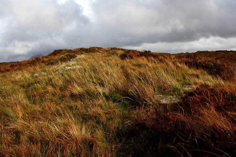
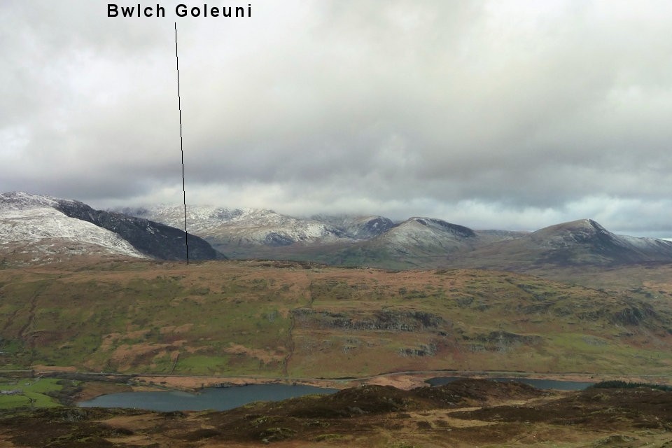
Despite the relatively low altitude (for these parts) the angle of attack is such that reaching Bwlch Goleuni is by no means an easy skate. A minimalist's dream 'path' is depicted upon the 1:25K map... however 'up' is as good orienteering advice as any. Several gnarled trees seem to mock my laboured efforts - exertions not assisted by driving rain - with their intransigent refusal to submit to the inevitable effects of Newton's laws. Hey, why move when you've the best seat in the arboreal house overlooking Dyffryn Mymbyr, the exceptional retrospective views more than capable of taking my breath away. Assuming I had any left, that is. As I finally approach the bwlch the hammering downpour begins to falter before subsequently taking a rain-check. Appropriately enough. Now the long mound I've come to see is somewhat reticent, by no means immediately obvious. I like that. Clearly the people had class. Nevertheless I soon spot an arrangement of recumbent stones upon a suitably 'long' mound to the right of the path, the former recalled from TSC's misc post. That'll be it, then. It is.
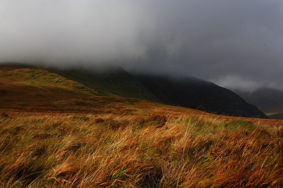
The primary thing that strikes me about the monument is its complete subservience to... well... everything else in the upland plane. Surely whomever was interned here - assuming this is indeed a kosher prehistoric site - was well aware of his/her(?) limited walk-on part... of their supporting role in the great scheme of things. 'Understated' is the word I'm looking for, I think. If not, it'll do. To emphasise the point great swathes of opaque vapour momentarily rarefy to reveal the angular, dark crags of Gallt yr Ogof rising to the north-west, the brutal mass of Y Carneddau to the north and the rocky-spined Moel Siabod looming across Dyffryn Mymbyr to the south. Both the latter possess their own funerary cairns, the former, as those familiar with the vernacular may have surmised, a prominent cave. The traveller assumes said cave has already been checked out for occupation by slumbering heroes / heroines? Haven't done so myself, although the peak is a fine viewpoint, even with the incomparable dragon-back of Tryfan nearby.
As I hang out upon the long grass which subsumes long mound into surrounding hillside I reckon I experience - at least in some limited sense - a true intimacy between biological organism and natural environment. Yeah, relative scale overawes me, further lashing rain sweeping along the valley batters me, swirling cloud initially unnerves me.... but I do not feel out of place. Perhaps this reprises something of the vibe which drove those that erected this monument to do so here, if only in a somewhat trite 21st century manner? Sunshine breaks through cloud and it becomes a major drag to eventually vacate this wondrous place. However guess I must visit the iconic Dinas Emrys one day. The Bwlch Goleuni long mound might not have influenced national identity in the manner of that great hill fortress... but, for me, it accords precious insight into the way the early settlers of this hostile landscape interacted with their environment.
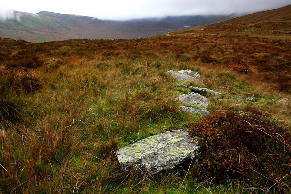
Not necessarily a barrow, but a prehistoric "long mound" according to Coflein:
An elongated isolated mound aligned east - west. The mound is 24 m in length. At the east end the mound is 10 m wide and 1 m high with a slight hollow in the center of the highest point. The west end appears much eroded. What survives is 3 m wide and only 0.2 m in height. Some apparently in situ stone work may be the remains of some form of stone structure at this end of the mound.


 Artistic / Interpretive:
 Posted by GLADMAN
 Posted by thesweetcheat