The Modern Antiquarian
Log in
|
Register
Home
Latest Posts
Forums
Maps
Help
Browse Sites
News
Blog
Contributors
The Books
Select
-
Belgium
Denmark
Eire
France
Germany
Greece
Italy
The Netherlands
Norway
Portugal
Republic of Malta
Spain
Sweden
Switzerland
United Kingdom
County Kerry
Dromatouk
Standing Stones
Dromatouk (Standing Stones) on The Modern Antiquarian, the UK & Ireland's most popular megalithic community website. 10 images, plus information on many more ancient sites nearby and across the UK & Ireland.
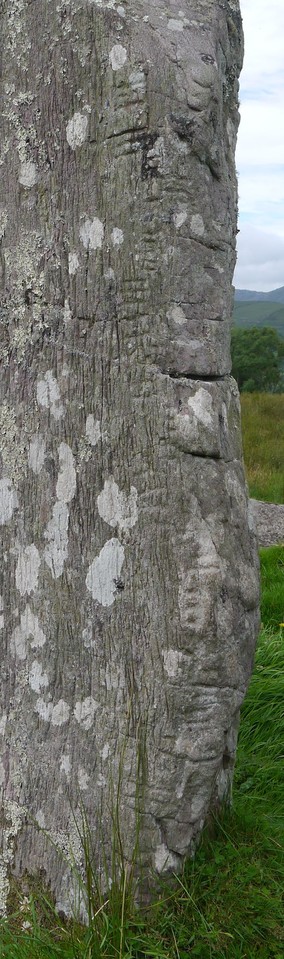
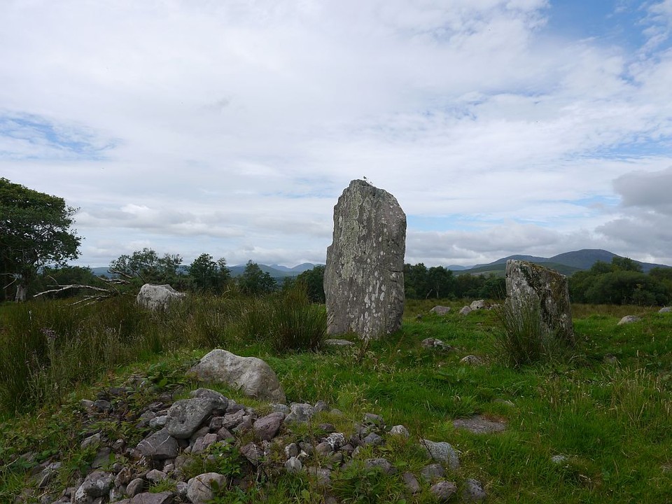
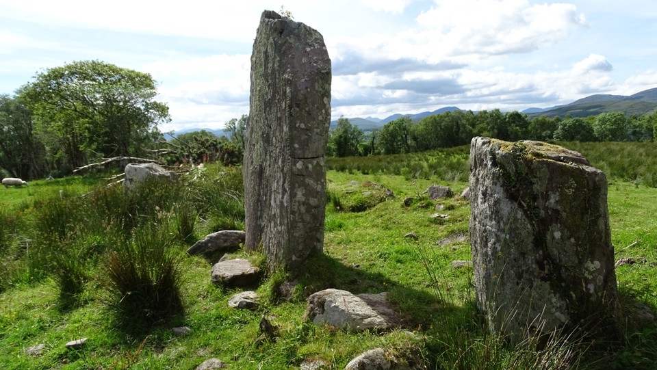
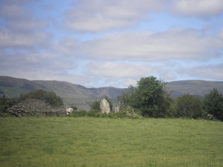
Image © Michael Mitchell
Nearest Town:
Killarney (19km N)
OS Ref (IE):
V951713 /
Sheet: 78
Latitude:
51° 53' 3.02" N
Longitude:
9° 31' 25.25" W
Added by
bawn79
Images (10)
0 discussions
Start a topic
Show |
Hide
Web searches for Dromatouk
Flickr
Google
Google Images
The Megalithic Portal
Bing
Stone Pages
Wikipedia
Show map
(inline Google Map)
- Sites within 20 km -
-
Dromatouk (0.19km SE) (8 posts)
Dromatouk (0.22km SSW) (22 posts)
Dromatouk (0.5km SW) (1 post)
Dromatouk (0.5km SW) (3 posts)
Kenmare (4.42km WSW) (26 posts)
Cullaba Lake (5.36km ESE) (5 posts)
Gurteen (5.58km E) (24 posts)
Gurteen (5.64km E) (12 posts)
Derrynacoolagh (5.76km S) (2 posts)
Feaghna (7.56km SSE) (10 posts)
Milleens (7.67km S) (4 posts)
Milleens (7.71km S) (3 posts)
Dromroe (8.94km SW) (24 posts)
Inchinanagh (9.9km E) (6 posts)
Rossacoosane (10.47km W) (1 post)
Barraboy Mountain (10.57km S) (4 posts)
Barraboy Mountain (10.57km S) (3 posts)
Barraboy Mountain S (11.3km S) (9 posts)
Barraboy Mountain N (11.3km S) (6 posts)
Crossterry East (11.75km S) (7 posts)
Borlin Valley Standing Stone (11.81km E) (7 posts)
Derrynafinchin (13.04km ESE) (1 post)
Derrynafinchin (13.2km ESE) (16 posts)
Canrooska (13.58km S) (25 posts)
Uragh North (13.82km SW) (14 posts)
Uragh (14.24km SW) (38 posts)
Grousemount (14.67km E) (3 posts)
Uragh West (15.04km SW) (12 posts)
Illane (15.11km ESE) (7 posts)
Mill Little (15.18km SE) (28 posts)
Maughanasilly (15.73km ESE) (23 posts)
Maughsilly (15.77km ESE) (1 post)
Cappaboy Beg NW (16.36km ESE) (6 posts)
Gortafludig (17.16km E) (0 posts)
An Screathan Mór (17.58km E) (3 posts)
Cappaboy Beg (18.05km ESE) (4 posts)
Cappaboy Beg (18.13km ESE) (2 posts)
Cappaboy Beg SE (18.17km ESE) (7 posts)
Cappaboy Beg (18.23km ESE) (2 posts)
Cappaboy Beg (18.23km ESE) (3 posts)
Western Pap (18.27km E) (9 posts)
Keamcorravooly (18.85km E) (4 posts)
Breeny More (18.86km ESE) (30 posts)
Keamcorravooly (18.87km E) (11 posts)
Kealkil (18.87km ESE) (45 posts)
Dooneens (18.94km E) (9 posts)
Derrynablaha 7 (19.1km W) (1 post)
Derreeny 1 (19.16km W) (1 post)
Drombohilly (19.16km SW) (32 posts)
Gorteennakilla (19.23km E) (6 posts)
Cahermuckee (19.27km ESE) (5 posts)
Drombohilly Wedge Tomb (19.27km SW) (2 posts)
Derreeny 2 (19.28km W) (1 post)
Derreeny 4 (19.28km W) (0 posts)
Derreeny 3 (19.28km W) (1 post)
Derrynablaha F (19.31km W) (3 posts)
Derreeny 5 (19.32km W) (1 post)
Derrynablaha 3 (19.39km W) (2 posts)
Derrynablaha 10 (19.39km W) (0 posts)
Derrynablaha D (19.44km W) (2 posts)
Derrynablaha (19.44km W) (2 posts)
Derrynablaha 028 (19.46km W) (1 post)
Lehid (19.47km SW) (1 post)
Lumnagh More (19.48km ENE) (0 posts)
Derrynablaha 5 (19.58km W) (4 posts)
Derrynablaha 6 (19.58km W) (2 posts)
Lehid (19.63km SW) (3 posts)
Derrynablaha 11 (19.79km W) (3 posts)
Lissyvigeen (19.81km N) (40 posts)
Cappanaboul (19.88km SE) (7 posts)
Derrynablaha 11 (19.88km W) (0 posts)
- Add -
-
Add news
Add an image
Add fieldnotes
Add folklore
Add miscellaneous
Add a link
-
Add a site
Add a nearby facility
Add an alternative name/spelling
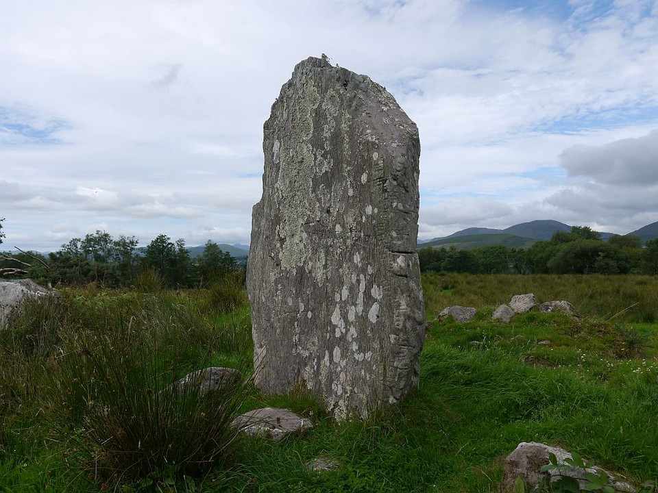
Images
(click to view fullsize)
Add an image
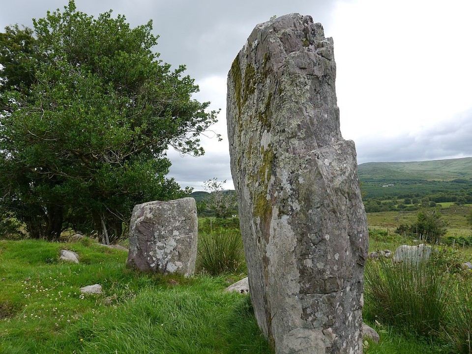
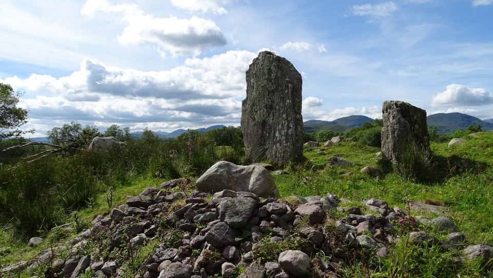
 Image © Michael Mitchell
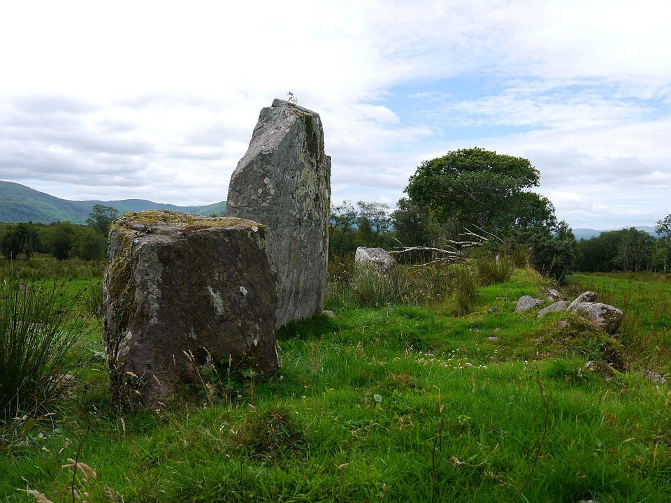
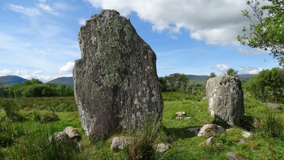