The Modern Antiquarian
Log in
|
Register
Home
Latest Posts
Forums
Maps
Help
Browse Sites
News
Blog
Contributors
The Books
Select
-
Belgium
Denmark
Eire
France
Germany
Greece
Italy
The Netherlands
Norway
Portugal
Republic of Malta
Spain
Sweden
Switzerland
United Kingdom
England
Southern England
East Sussex (inc. Brighton and Hove)
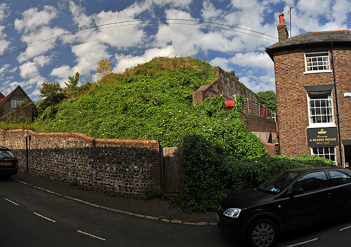
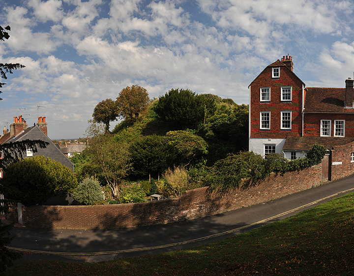
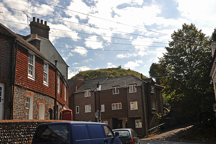
Brack Mount
Artificial Mound
Brack Mount (Artificial Mound) on The Modern Antiquarian, the UK & Ireland's most popular megalithic community website. 3 images, plus information on many more ancient sites nearby and across the UK & Ireland.
Image © A R Cane
This site is of disputed antiquity. If you have any information that could help clarify this site's authenticity, please post below or
leave a post in the forum
.
Nearest Town:
Lewes (1km WSW)
OS Ref (GB):
TQ414102 /
Sheet: 198
Latitude:
50° 52' 24.19" N
Longitude:
0° 0' 35.75" E
Added by
A R Cane
Images (3)
0 discussions
Start a topic
Show |
Hide
Web searches for Brack Mount
Flickr
Google
Google Images
MAGIC
The Megalithic Portal
Bing
Stone Pages
Streetmap.co.uk
Wikipedia
Show map
(inline Google Map)
- Sites within 20 km -
-
The Tump, Lewes (0.61km SSE) (27 posts)
Cliffe Hill (1.87km ENE) (5 posts)
Offham Hill (2.19km WNW) (8 posts)
Ranscombe Camp (2.68km E) (12 posts)
Saxon Down (3.1km ENE) (3 posts)
Mount Caburn (3.26km E) (29 posts)
Kingston Barrow Cemetery (3.89km SW) (5 posts)
Castle Hill (Woodingdean) (4.94km SW) (5 posts)
Plumpton Plain (5.13km W) (5 posts)
Money Burgh (6.59km SSE) (1 post)
Firle Beacon (8.11km ESE) (12 posts)
Firle Beacon (8.33km E) (2 posts)
Cross dyke in Great Wood (8.33km WSW) (0 posts)
Bowl Barrow in Great Wood (8.61km WSW) (0 posts)
Ditchling Beacon (8.64km W) (10 posts)
Pudding Bag Wood Bowl Barrow (8.82km WSW) (3 posts)
Pudding Bag Wood Prehistoric Linear Boundary (8.9km WSW) (2 posts)
Beacon Hill (9.05km SW) (1 post)
Hollingbury Hillfort (9.48km WSW) (23 posts)
Bostal Hill (9.74km ESE) (14 posts)
Whitehawk Camp (9.87km WSW) (13 posts)
Tegdown Hill Barrows (10.06km W) (2 posts)
Peacehaven Heights (10.15km SSE) (1 post)
Berwick Mound (11.64km E) (4 posts)
Long Burgh (11.73km ESE) (12 posts)
Alfriston Church (12.86km ESE) (14 posts)
High and Over (12.99km ESE) (5 posts)
Burlough Castle (13.07km E) (1 post)
Wolstonbury Bowl Barrow (13.15km W) (10 posts)
Wolstonbury Platform Barrow (13.15km W) (1 post)
Wolstonbury Cross Ridge Dyke (13.15km W) (2 posts)
Wolstonbury Barrows (13.15km W) (1 post)
The Goldstone (13.33km WSW) (18 posts)
Wolstonbury (13.54km W) (34 posts)
Windover Cursus (14.41km E) (5 posts)
Windover Long Mound (14.41km E) (7 posts)
Newtimber Hill (14.46km W) (2 posts)
The Long Man of Wilmington (14.49km E) (76 posts)
Windover Hill (14.55km E) (15 posts)
North Hill (14.56km W) (3 posts)
Seaford Head Bowl Barrow (14.73km SE) (4 posts)
Wilmington Hill (14.98km E) (5 posts)
Hunter's Burgh (14.98km E) (12 posts)
Seaford Head (15.04km SE) (15 posts)
Devil's Dyke (West Sussex) (15.07km W) (14 posts)
Litlington (15.42km ESE) (0 posts)
Fulking Hill (16.66km W) (1 post)
Brighton bypass Henge (16.7km WSW) (1 post)
Rest And Be Thankful (17.73km WSW) (6 posts)
Coombe Hill (17.84km E) (17 posts)
Edburton Hill (18.05km W) (3 posts)
Thundersbarrow Hill (18.53km WSW) (7 posts)
Bourne Hill (18.58km E) (3 posts)
Babylon Down (18.69km E) (2 posts)
Baily's Hill (18.84km ESE) (5 posts)
Foxholes Brow (19.12km E) (3 posts)
Foxholes (19.46km E) (3 posts)
Beachy Brow (19.76km ESE) (4 posts)
- Facilities within 20 km -
-
Barbican House Museum ... (Museum: 0.2 km S)
The Jugg's Arms (Pub: 2.9 km SW)
Trevor Arms (Pub: 4.7 km E)
The Jack and Jill Inn (Pub: 12.1 km W)
George Inn (Pub: 12.8 km ESE)
The Giant's Rest (Pub: 14.4 km E)
Devils Dyke Hotel (Hotel: 15.6 km W)
The Hungry Monk (Restaurant: 17.3 km ESE)
Truleigh Hill (Youth Hostel: 19.2 km W)
- Add -
-
Add news
Add an image
Add fieldnotes
Add folklore
Add miscellaneous
Add a link
-
Add a site
Add a nearby facility
Add an alternative name/spelling
Images
(click to view fullsize)
Add an image