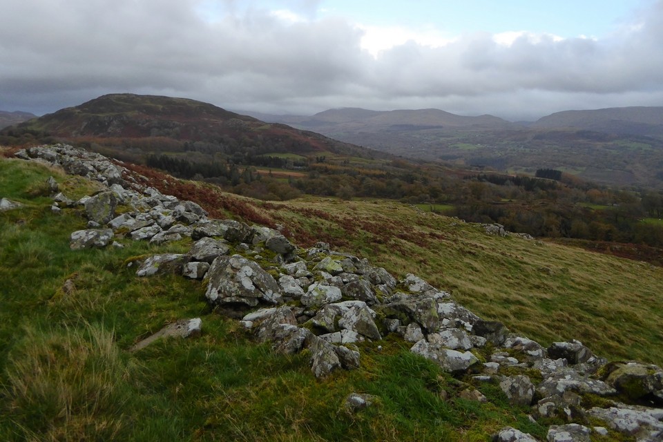
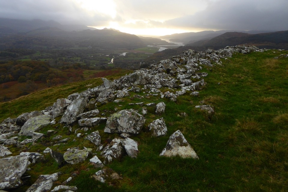
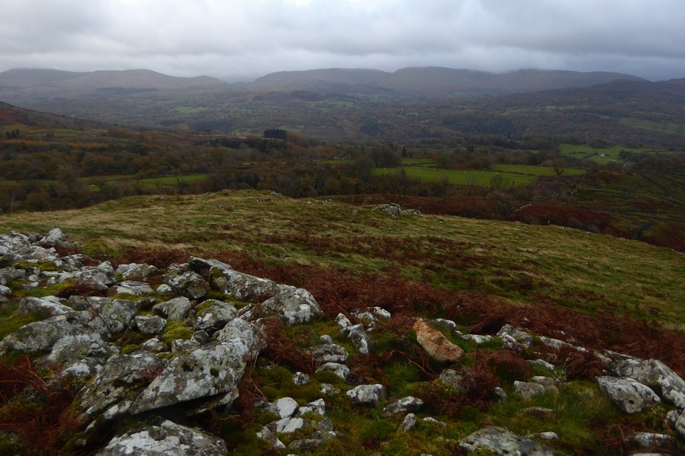
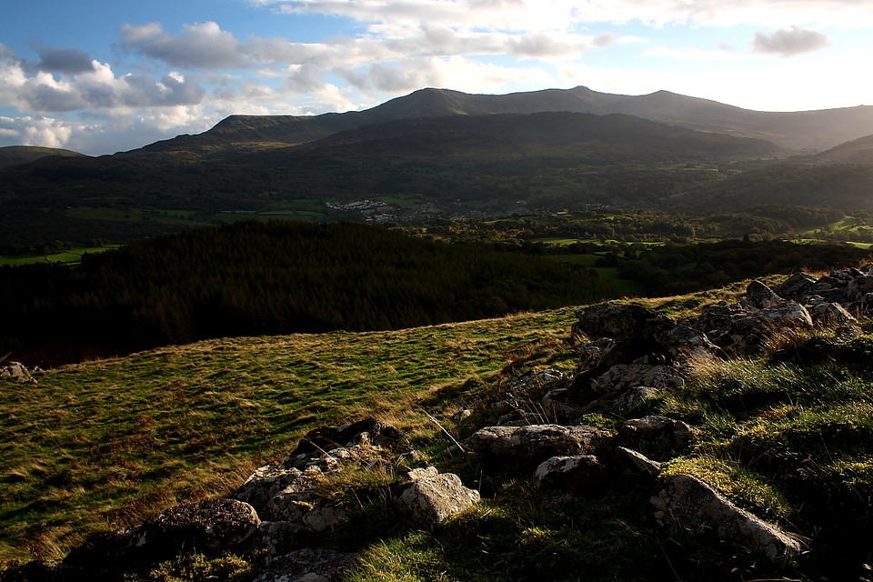
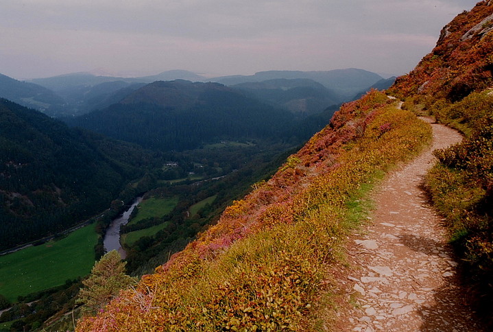
Although (arguably) not as dramatically sited as the enclosures (count 'em) upon Foel Offrwm to the east, the hill fort located upon Foel Faner nevertheless occupies a position to die for.... literally, perhaps, if you happened to be unfortunate enough to have tried to storm it back in its heyday. Cadair Idris is the dominating factor here, the legendary mountain massif emphatically claiming the southern/south-western skyline, the sublime Mawddach Estuary duly ensuring the lower regions are equally pleasing to the eye.
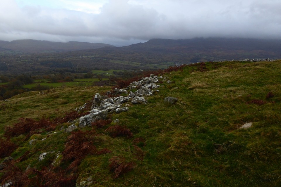
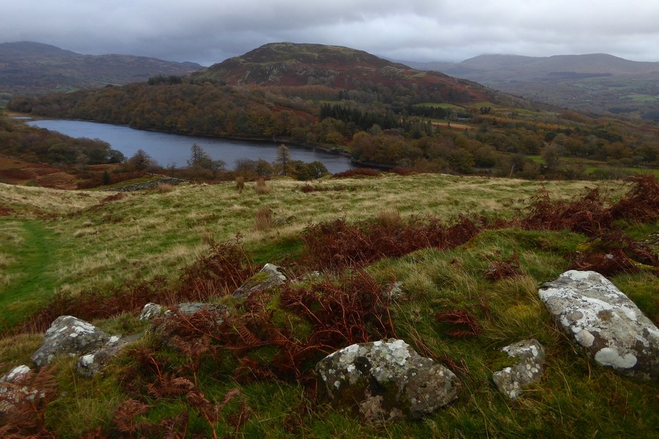
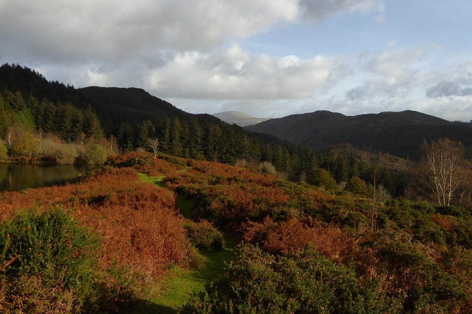
Unlike the aforementioned Foel Offrwm, access to Foel Faner is relatively straightforward, prospective visitors presented with the luxury of a way-marked route known as 'The Precipice Walk' serviced by its own car park. Should you decide to follow the 'high level option' along Foel Cynwch - as I would recommend - the reason for the moniker will become all too obvious, the hillside falling more or less vertically to the Afon Mawddach and A470 below to the west (unfortunately the latter is currently in a bit of a mess, courtesy of very ongoing road improvements). The walk is worth the effort in its own right, to be honest, particularly if you aren't that confident in your upland navigational abilities... or simply getting on a bit! Tell me about it. However if this doesn't appeal there is a 'lakeside walk' beside Llyn Cynwych which will get you there just the same. As it happens I take that on the way back to the car.
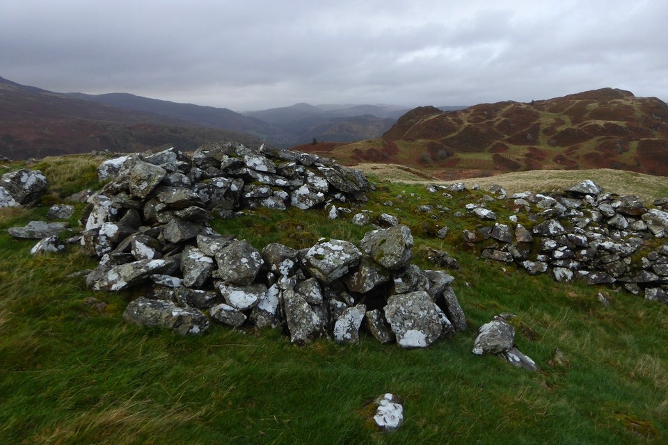
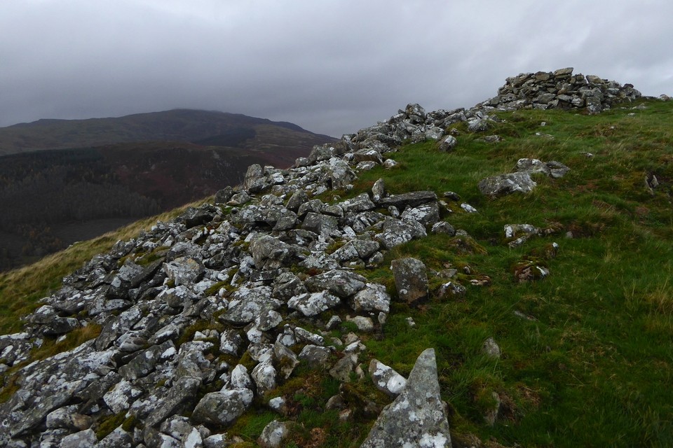
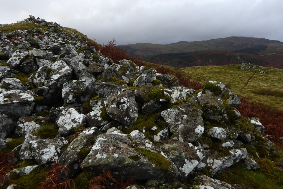
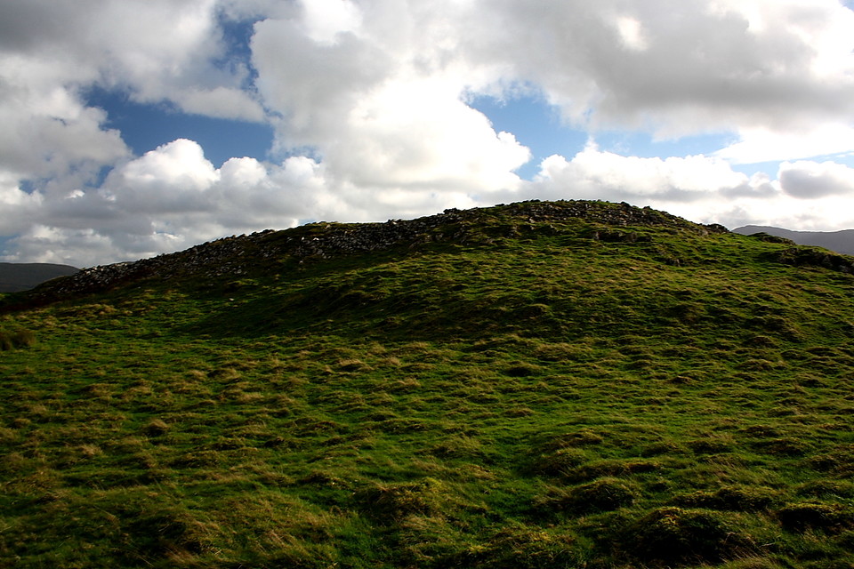
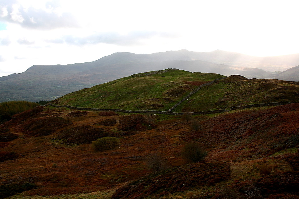
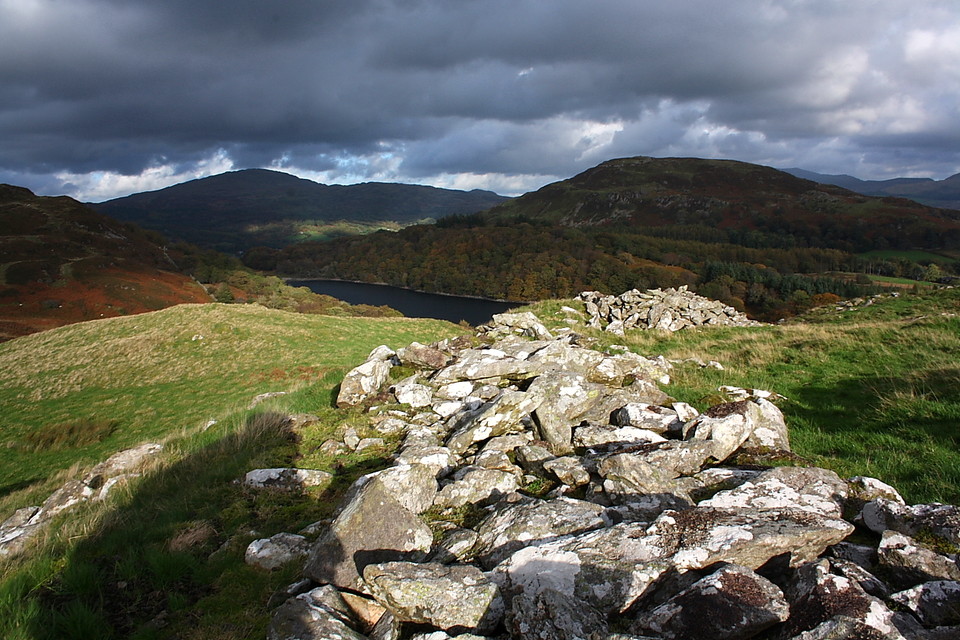
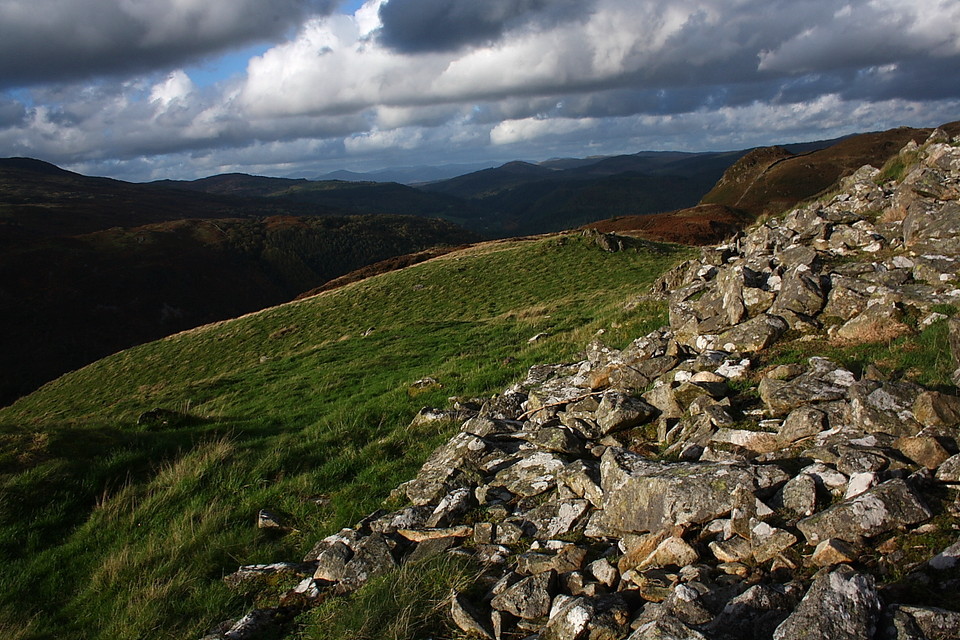
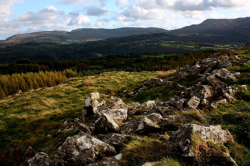
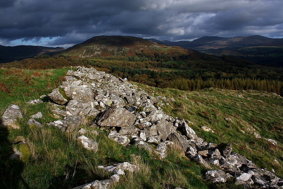
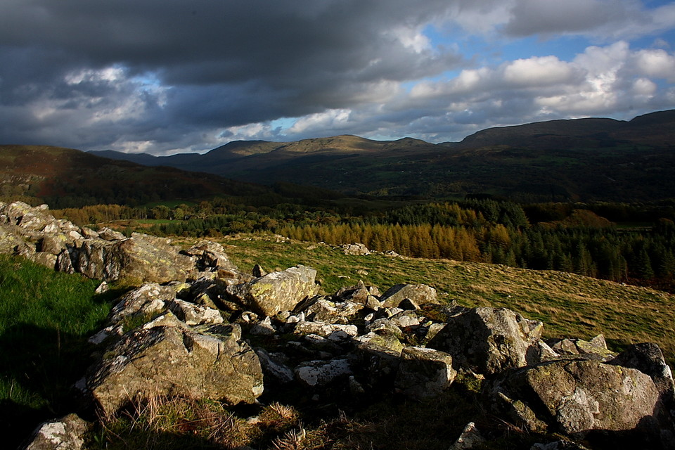
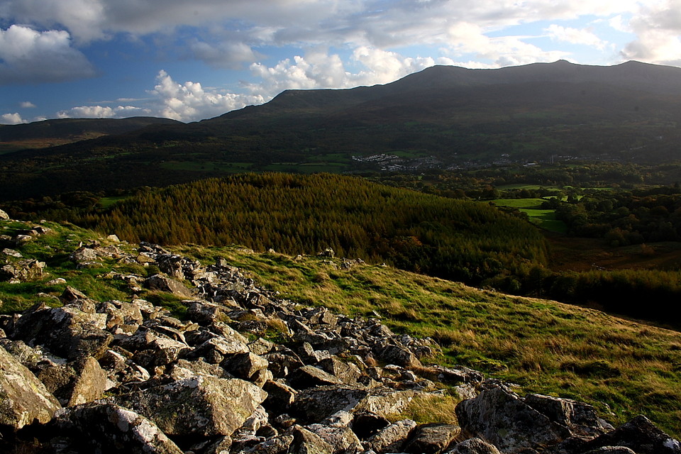
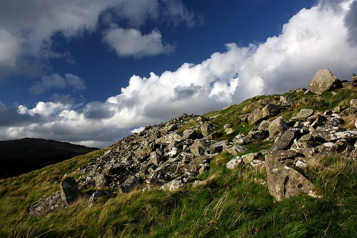
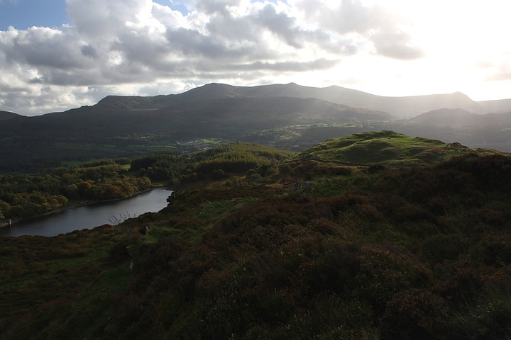
I've only a couple of hours to spare before the hills are once again subsumed into that total darkness rarely, if ever, experienced in suburbia.... so I'm obliged to get a move on so as to make best use of the golden light which has rendered this morning's dull, monochromatic grey but a distant memory. The hill fort crowning Foel Faner lies to the immediate (approx) south-west of Foel Cynwch and is well seen from the latter, with Cadair Idris towering above and beyond. It is an impressive sight. A short, somewhat rough descent and re-ascent later (serves me right for taking a short cut) I am within the Iron Age enclosure, gazing across Llyn Cynwch to Foel Offrwm and today's earlier haunts. The univallate dry stone defences are pretty substantial, although not overly so, the entrance to the north-east apparently protected by an outwork. That is more or less that in terms of archaeological detail. But it is enough since the views are simply sensational toward Abermawddach, whilst Y Rhinogydd lie resplendent in gold to the west. Sure, there's gold in them thar hills. No, really, there is.... although I assume not a lot of it is left underground nowadays. Yeah, a little way north within Coed-y-Brenin (King's Wood) a minor, dead end road heads north-east from the A470 near the confluence of the Afon Eden and Mawddach. Park at the terminus and follow the track to see the waterfalls of Pistyll Cain and Rhaeadr Mawddach.... and if you're very, very lucky you might just come across a nugget. Right on!
As for myself, spending the dying embers of this wondrous day upon the rampart of Foel Faner is more than ample reward for my efforts, despite said 'embers' being fanned by a very sprightly wind indeed. Hey, in the absence of any golden nuggets let's just say this is another jewel in the proverbial crown of Merioneth. And there are quite a few, are there not? So many, perhaps, that only the likes of Idris himself would've had the neck muscles to wear it.
Occupying the summit of Moel Faner and encircled by the southern section of the popular 'Precipice Walk', north of Dolgellau - and hence commanding some pretty fine views - this is but one of numerous small hillforts in the shadow of Cadair Idris. According to Coflein it is:
'A roughly oval, somewhat polygonal, enclosure, about 70m north-east to slouth-west by 42m. It is defined by a ruinous stone wall, about 2.7-3.0m across. The only entrance faces north-east and is flanked by an additional ditched mound on the north side.....
Source: Bowen & Gresham 'History of Merioneth I (1967), 152-3. John Wiles 04.07.07'


 Artistic / Interpretive:
 Posted by GLADMAN