The Modern Antiquarian
Log in
|
Register
Home
Latest Posts
Forums
Maps
Help
Browse Sites
News
Blog
Contributors
The Books
Select
-
Belgium
Denmark
Eire
France
Germany
Greece
Italy
The Netherlands
Norway
Portugal
Republic of Malta
Spain
Sweden
Switzerland
United Kingdom
Scotland
Stirling
Stronend
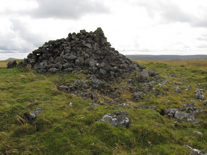
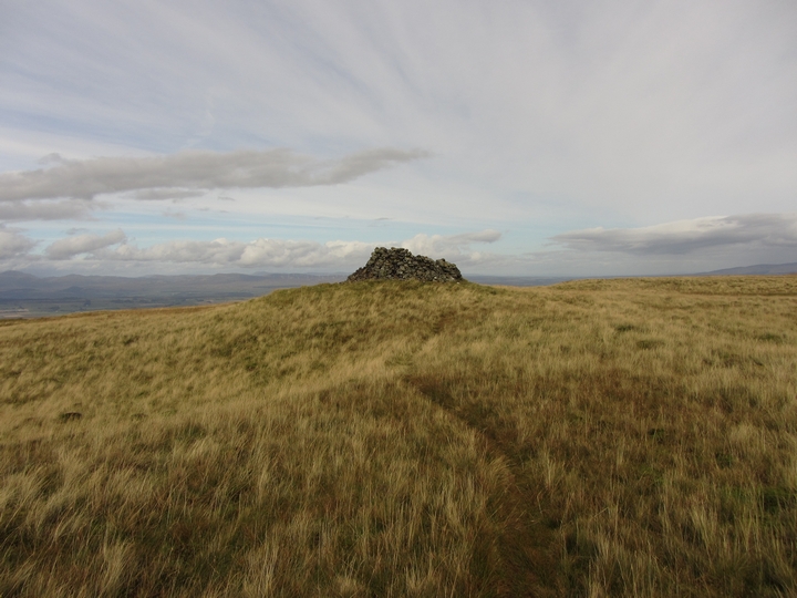
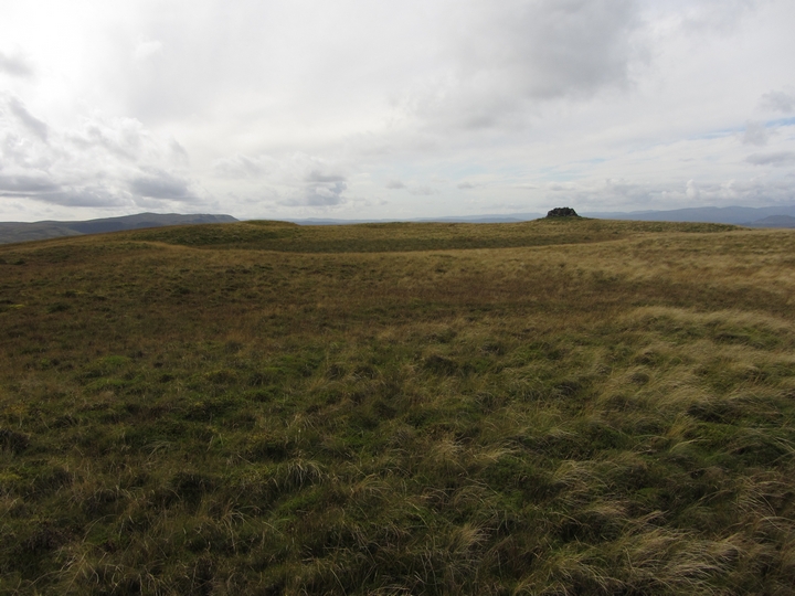
Cairn(s)
Stronend (Cairn(s)) on The Modern Antiquarian, the UK & Ireland's most popular megalithic community website. 4 images, 1 fieldnote, 1 weblink, plus information on many more ancient sites nearby and across the UK & Ireland.
Image © thelonious
Nearest Town:
Kilsyth (14km SE)
OS Ref (GB):
NS629894 /
Sheet: 57
Latitude:
56° 4' 39.53" N
Longitude:
4° 12' 11.11" W
Added by
thelonious
Images (4)
Fieldnotes (1)
Links (1)
0 discussions
Start a topic
Show |
Hide
Web searches for Stronend
Flickr
Google
Google Images
MAGIC
The Megalithic Portal
Bing
Stone Pages
Streetmap.co.uk
Wikipedia
Show map
(inline Google Map)
- Sites within 20 km -
-
Dunbeg (3.39km SW) (6 posts)
Dunmore (3.83km SW) (12 posts)
Broughmore Wood (4.41km W) (6 posts)
Waterhead Standing Stones (6.16km SE) (8 posts)
Carleatheran (6.26km ENE) (5 posts)
Buchlyvie (6.5km WNW) (1 post)
Leckie Broch Carving 1 & 2 (7.82km NE) (2 posts)
Leckie (7.82km NE) (2 posts)
Craighead (10.72km NE) (1 post)
Broadgate Farm (11.64km SSW) (6 posts)
Strathblane (11.9km SW) (7 posts)
The Peace Stone (11.98km WNW) (9 posts)
Ghost's Knowe (12.32km E) (2 posts)
Dumgoyach Stones (12.92km SW) (9 posts)
St Mirren's Well (13.58km ESE) (8 posts)
Craigmaddie Muir (13.67km SSW) (6 posts)
The Auld Wifes Lifts (13.73km SSW) (24 posts)
Menteith (13.97km WNW) (45 posts)
Corrie (14.47km W) (6 posts)
Blarnaboard (14.64km W) (15 posts)
Doon Hill (14.74km WNW) (8 posts)
Tulloch Knowe (14.74km NE) (2 posts)
The Auld Knowe (15.56km N) (5 posts)
Stirling, King's Park (15.76km ENE) (3 posts)
Glenhead Stone Row (16.68km NE) (17 posts)
Randolphfield Stones (16.81km ENE) (9 posts)
Stockie Muir (17.04km WSW) (15 posts)
Glenhead Standing Stone (17.08km NE) (10 posts)
Auchenlaich Cairn (17.98km N) (22 posts)
The Camp Stone (18.1km NNE) (1 post)
Dunmore Hill (18.36km NNW) (12 posts)
Cairnhowit (18.84km SW) (5 posts)
Hill of Airthrey Fairy Knowe (18.9km ENE) (7 posts)
Lang Cairn (18.9km WSW) (17 posts)
Abbey Craig (18.97km ENE) (5 posts)
Pathfoot Stone (19.12km ENE) (10 posts)
Shiels of Gartlea (19.12km WSW) (5 posts)
The Judge's Cairn (19.57km NE) (5 posts)
Airthrey Stone (19.75km ENE) (14 posts)
Whitehill (19.8km SW) (11 posts)
The Cochno Stone (19.8km SW) (25 posts)
- Facilities within 20 km -
-
Settle Inn (Pub: 17.1 km ENE)
Drouthy Neebors (Pub: 17.1 km ENE)
Willy Wallace Hostel (Youth Hostel: 17.2 km ENE)
- Add -
-
Add news
Add an image
Add fieldnotes
Add folklore
Add miscellaneous
Add a link
-
Add a site
Add a nearby facility
Add an alternative name/spelling
Images
(click to view fullsize)
Add an image
Fieldnotes
Add fieldnotes
26/09/2011
Nice walk to see this cairn and the one on Carleatheran, about 6km east of it. Parked car at NS 652922, just at bridge. Walked up track passed Ballochleam (means Hollow of the Dead) and onto hills. Great views from the cairns but bit wet underfoot.
Comments (0)
|
Add a comment
|
Permalink
Posted by
thelonious
3rd October 2011ce
Links
Add a link
RCAHMS archive
Archaeological Notes
Comments (0)
|
Add a comment
|
Permalink
Posted by
thelonious
3rd October 2011ce

 Posted by thelonious