The Modern Antiquarian
Log in
|
Register
Home
Latest Posts
Forums
Maps
Help
Browse Sites
News
Blog
Contributors
The Books
Select
-
Belgium
Denmark
Eire
France
Germany
Greece
Italy
The Netherlands
Norway
Portugal
Republic of Malta
Spain
Sweden
Switzerland
United Kingdom
Wales
Powys
Montgomeryshire
Black Bank
Hillfort
Black Bank (Hillfort) on The Modern Antiquarian, the UK & Ireland's most popular megalithic community website. 3 images, plus information on many more ancient sites nearby and across the UK & Ireland.
Image © A. Brookes (8.8.2011)
Nearest Town:
Welshpool (4km W)
OS Ref (GB):
SJ26370759 /
Sheet: 126
Latitude:
52° 39' 38.17" N
Longitude:
3° 5' 19.51" W
Added by
thesweetcheat
Images (3)
Miscellaneous (1)
0 discussions
Start a topic
Show |
Hide
Web searches for Black Bank
Flickr
Google
Google Images
The Megalithic Portal
Bing
Stone Pages
Streetmap.co.uk
Wikipedia
Show map
(inline Google Map)
- Sites within 20 km -
-
Beacon Ring (1.79km SSE) (15 posts)
Maen Llog (3.86km WSW) (7 posts)
Crowther's Camp (4.01km NW) (2 posts)
Beechfield (4.09km E) (2 posts)
Sarn-y-Bryn-Caled (Destroyed) (5.2km WSW) (3 posts)
Sarn-y-Bryn-Caled (5.42km WSW) (2 posts)
Gaer Fawr (Welshpool) (6.62km WNW) (20 posts)
Cefyn y Castell (7.03km NE) (21 posts)
New Pieces Enclosure, Breiddin Hill (7.24km NNE) (4 posts)
Caus Castle (7.34km ENE) (14 posts)
Breiddin Hill Camp (7.48km NNE) (11 posts)
Golfa (8.55km WSW) (1 post)
Dyffryn Lane (8.58km SW) (3 posts)
Castle Ring (Rorrington) (8.6km ESE) (2 posts)
Pen-y-Foel (8.66km WSW) (3 posts)
Maen Beuno (8.72km SW) (7 posts)
Cefn-yr-allt (9km SW) (1 post)
The Hoarstones (9.75km ESE) (58 posts)
The Cow Stone (9.78km SE) (9 posts)
Stapeley Hill (9.84km SE) (17 posts)
Y Gaer (Meifod) (9.94km WNW) (1 post)
Crosswood (10.01km N) (6 posts)
Mitchell's Fold (10.02km SE) (117 posts)
Mitchell's Fold cairn (10.14km SE) (5 posts)
Collfryn (10.63km NW) (1 post)
Whetstones (10.72km SE) (5 posts)
Whetstones Cairn (10.85km SE) (4 posts)
Pant Brwynog (11.46km SE) (2 posts)
Bryn Mawr (11.54km NNW) (3 posts)
Corndon Hill (11.63km SE) (47 posts)
Ffridd Faldwyn (11.66km SSW) (12 posts)
Pennerley Barrows (11.87km ESE) (10 posts)
Cefn-Cyfronydd (12km W) (3 posts)
Callow Hill Camp (12.34km E) (2 posts)
Castle Ring (Shelve) (12.68km E) (11 posts)
Roundton (12.96km SE) (3 posts)
Long Hill (12.97km NW) (1 post)
Cwm Mawr Stone Axe Factory (13.23km SE) (4 posts)
The Stiperstones (13.73km ESE) (28 posts)
Soldier's Mount (13.89km NW) (1 post)
The Rossett (14.13km S) (5 posts)
Llanymynech Hill (14.49km NNW) (13 posts)
Pentre Camp (Llangyniew) (14.72km W) (1 post)
Earl's Hill and Pontesford Hill (14.75km E) (28 posts)
Heath Mynd (15.28km SE) (8 posts)
Blodwel Rock (15.3km N) (7 posts)
St Mary's Well (15.99km WSW) (4 posts)
Roveries Hill (16.26km SE) (2 posts)
Cothercott Hill (16.41km E) (5 posts)
Castle Ring (Ratlinghope) (17.12km ESE) (10 posts)
Nesscliffe Hill Camp (17.24km NE) (25 posts)
Castle Ring tumulus (17.5km E) (7 posts)
Caer Din (17.84km SSE) (1 post)
Mynydd-y-Bryn (18.95km NW) (0 posts)
Llwyn Bryn Dinas (19.33km NW) (11 posts)
The Long Mynd (19.83km ESE) (1 post)
Shooting Box barrows (19.93km ESE) (18 posts)
Robin Hood's Butts (Shropshire) (19.96km E) (12 posts)
- Facilities within 20 km -
-
Welshpool Tourist Info... (Tourist Information: 3.8 km WSW)
- Add -
-
Add news
Add an image
Add fieldnotes
Add folklore
Add miscellaneous
Add a link
-
Add a site
Add a nearby facility
Add an alternative name/spelling
Images
(click to view fullsize)
Add an image
Miscellaneous
Add miscellaneous
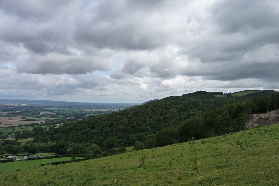
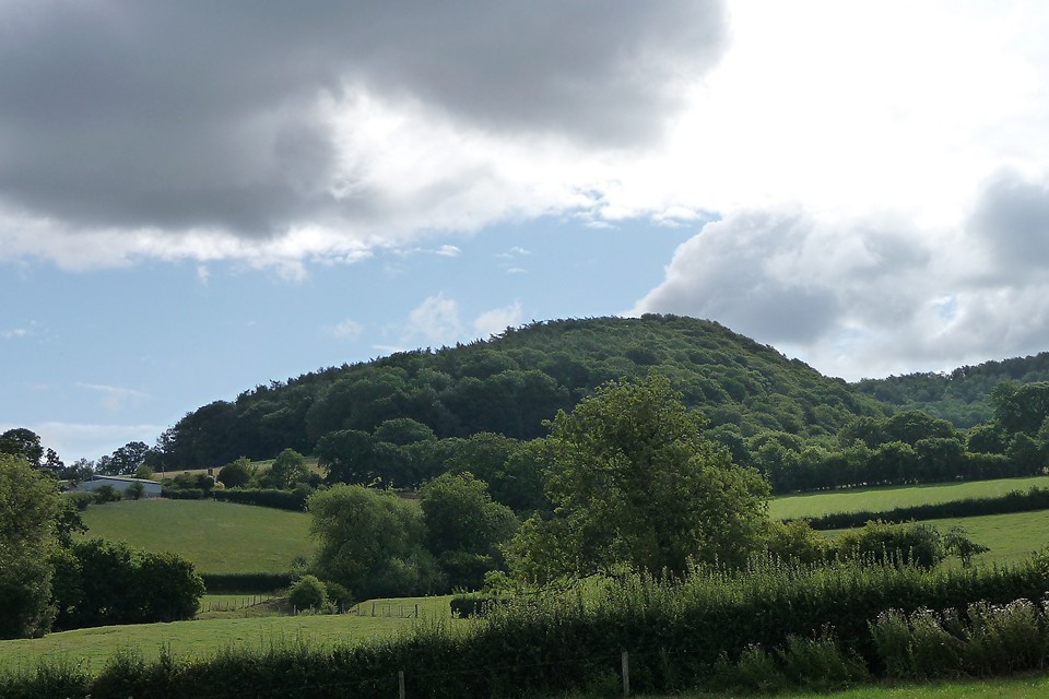
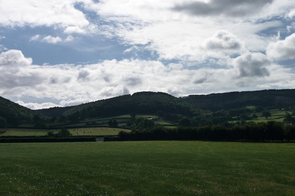
Small promontory hillfort, covered in trees. Coflein description:
A sub-oval enclosure, c.74m E-W by 39m, occupying the W end of a sharp E-W ridge, cut off by a ditch to the E, elsewhere defined by scarps, with a possible W entrance.
Comments (0)
|
Add a comment
|
Permalink
Posted by
thesweetcheat
29th July 2011ce

 Posted by thesweetcheat