The Modern Antiquarian
Log in
|
Register
Home
Latest Posts
Forums
Maps
Help
Browse Sites
News
Blog
Contributors
The Books
Select
-
Belgium
Denmark
Eire
France
Germany
Greece
Italy
The Netherlands
Norway
Portugal
Republic of Malta
Spain
Sweden
Switzerland
United Kingdom
County Kerry
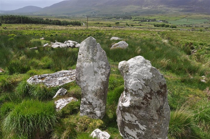
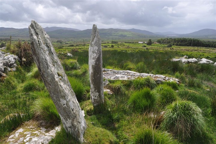
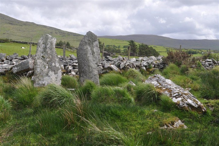
Gortnagulla
Stone Row / Alignment
Gortnagulla (Stone Row / Alignment) on The Modern Antiquarian, the UK & Ireland's most popular megalithic community website. 3 images, plus information on many more ancient sites nearby and across the UK & Ireland.
Image © Charles Coughlan
OS Ref (IE):
Latitude:
51° 59' 30.19" N
Longitude:
10° 4' 29.35" W
Added by
bogman
Images (3)
0 discussions
Start a topic
Show |
Hide
Web searches for Gortnagulla
Flickr
Google
Google Images
Bing
Stone Pages
Wikipedia
Show map
(inline Google Map)
- Sites within 20 km -
-
Caherlehillan North (0km N) (3 posts)
Caherlehillan South (0.26km SSW) (4 posts)
Caherlehillan (0.56km SSW) (2 posts)
Toon (1.67km SSW) (6 posts)
Ballynahow Beg (4.86km WSW) (3 posts)
Kealduff (331) (5.4km ENE) (4 posts)
Kealduff (334) (5.49km ENE) (1 post)
Kealduff (337) (5.49km ENE) (1 post)
Kealduff (333) (5.53km ENE) (1 post)
Coomasaharn (5.76km ENE) (3 posts)
Kilcaskan (6.02km WSW) (1 post)
Coolnaharagill Upper (6.71km NE) (2 posts)
Keeltrasna (8.6km W) (3 posts)
Cahersiveen (11.92km WSW) (3 posts)
Cahergal (13.15km WSW) (8 posts)
Leacanabuile (13.39km WSW) (6 posts)
Oghermong (14.08km SW) (1 post)
Dromod (15.31km S) (3 posts)
Doonmanagh (Puicin an Chairn) (16km NW) (12 posts)
Minard (16.19km NW) (4 posts)
Lugnagappul (16.41km NNW) (3 posts)
Ardamore (16.63km NW) (5 posts)
Ardamore (16.63km NW) (14 posts)
Aghacaribble 1 (16.64km NW) (8 posts)
Dromtine (16.72km ESE) (4 posts)
Graigue (16.78km NW) (11 posts)
Kinard East (16.87km NW) (2 posts)
Foheraghmore (17.55km NW) (4 posts)
Derryleagh (17.85km ESE) (3 posts)
Glanleam (18.22km WSW) (2 posts)
Tullakeel (18.43km ESE) (4 posts)
Gallaunmore (19.25km WNW) (2 posts)
Waterville (19.58km SSW) (3 posts)
Derrynablaha 11 (19.73km E) (0 posts)
Derrynablaha 11 (19.82km E) (3 posts)
- Add -
-
Add news
Add an image
Add fieldnotes
Add folklore
Add miscellaneous
Add a link
-
Add a site
Add a nearby facility
Add an alternative name/spelling
Images
(click to view fullsize)
Add an image