The Modern Antiquarian
Log in
|
Register
Home
Latest Posts
Forums
Maps
Help
Browse Sites
News
Blog
Contributors
The Books
Select
-
Belgium
Denmark
Eire
France
Germany
Greece
Italy
The Netherlands
Norway
Portugal
Republic of Malta
Spain
Sweden
Switzerland
United Kingdom
England
Southern England
Dorset
The Isle of Purbeck
Warren Heath
Round Barrow(s)
Warren Heath (Round Barrow(s)) on The Modern Antiquarian, the UK & Ireland's most popular megalithic community website. 1 image, 1 fieldnote, plus information on many more ancient sites nearby and across the UK & Ireland.
Image © Mike Rowland 06/04/11
Nearest Town:
Bere Regis (4km NNW)
OS Ref (GB):
SY854909 /
Sheet: 194
Latitude:
50° 43' 0.97" N
Longitude:
2° 12' 24.59" W
Added by
formicaant
Images (1)
Fieldnotes (1)
0 discussions
Start a topic
Show |
Hide
Web searches for Warren Heath
Flickr
Google
Google Images
MAGIC
The Megalithic Portal
Bing
Stone Pages
Streetmap.co.uk
Wikipedia
Show map
(inline Google Map)
- Sites within 20 km -
-
Yon Barrow (2.27km NNE) (3 posts)
End Barrow (2.33km NW) (1 post)
Turner's Puddle Heath (2.58km W) (3 posts)
Throop Clump (3.26km W) (3 posts)
Dead Woman's Stone (3.27km W) (1 post)
Black Hill (3.57km NW) (12 posts)
Woodbury Hill (3.8km N) (11 posts)
Woolsbarrow (4.11km ENE) (10 posts)
Broomhill and Bere Wood (4.27km N) (2 posts)
Stand Barrow (4.57km NNW) (1 post)
Double Barrow (5.15km WNW) (4 posts)
Heather Cottage (5.19km SW) (3 posts)
Woodman's Cross (5.23km S) (3 posts)
Rawles Barrow (5.31km N) (1 post)
Baylea Farm Barrow (5.48km SSE) (5 posts)
Bolton's Barrow (5.52km N) (1 post)
Muddox Barrow (5.7km NNW) (1 post)
Bloxworth Down (5.83km NNE) (6 posts)
Worgret Heath Earthworks (5.88km ESE) (1 post)
Whitcombe Vale (5.95km SW) (4 posts)
Tolpuddle Ball (5.95km WNW) (2 posts)
Worgret Heath (5.98km ESE) (8 posts)
Hawke Barrow (6.04km NNW) (1 post)
The Seven Barrows (6.18km E) (8 posts)
Old Knowle (6.3km WSW) (11 posts)
Pallington Clump (6.39km W) (14 posts)
Coombe Heath (6.43km SSE) (11 posts)
Cold Barrow (6.51km NE) (1 post)
Roke Down (6.53km NW) (3 posts)
Blacknoll Hill (6.64km SW) (8 posts)
Bere Down (6.77km NW) (8 posts)
Drove Hill (6.89km SW) (5 posts)
Tadnoll Barrow (7.11km WSW) (4 posts)
Weatherby Castle (7.14km WNW) (25 posts)
Cowleaze Barrows (7.21km WNW) (3 posts)
Five Barrow Hill (7.24km SE) (5 posts)
Povington Heath twin-barrow (7.27km SE) (1 post)
The White Barrow (8.02km NE) (1 post)
Tinker's Barrow (8.07km WSW) (1 post)
Bulbury Camp (8.08km ENE) (3 posts)
Warehan Logboat (8.2km ESE) (1 post)
Bestwall Quarry (8.22km E) (2 posts)
King's Barrow (8.38km ESE) (2 posts)
Three Lords Barrow (8.62km ESE) (1 post)
Deverel Barrow (8.81km NW) (22 posts)
Povington Barrow (9.15km SE) (1 post)
Stoborough Heath Barrow (9.18km ESE) (1 post)
Thorn Barrow (9.19km SSE) (4 posts)
Five Marys (9.25km SW) (14 posts)
Water Barrows (9.26km SSE) (1 post)
Ferny Barrows (9.37km SSE) (5 posts)
Drinking Barrow (9.39km ESE) (1 post)
Chaldon Herring (9.52km SW) (3 posts)
Icen Barrow (9.77km ESE) (1 post)
Creech Heath Barrows (9.88km ESE) (1 post)
Hyde Hill Barrows (Purbeck) (9.91km ESE) (1 post)
Lord's Barrow (10.24km SW) (5 posts)
Bush Barrow (Lulworth) (10.45km SSW) (4 posts)
Flower's Barrow (10.45km SSE) (45 posts)
Three Barrows (10.69km ESE) (3 posts)
Huck Barrow (10.71km WSW) (4 posts)
Windmill Barrow (10.74km NE) (1 post)
Bindon Hill (10.76km S) (4 posts)
Round Pound (10.79km SSW) (4 posts)
Creech Barrow (10.79km ESE) (3 posts)
Boswell's Plantation (10.88km W) (3 posts)
Puddletown Forest (11.16km W) (3 posts)
Stone Hill Down (11.16km ESE) (4 posts)
Owermoigne Down (11.24km SW) (8 posts)
Hambury Tout (11.28km SSW) (4 posts)
Wardstone Barrow (11.31km SSW) (3 posts)
Arne Hill Barrow (11.8km E) (1 post)
Moigns Down (11.92km SW) (3 posts)
Henbury Barrow (11.94km NE) (1 post)
Chaldon Down (12km SW) (5 posts)
The Rainbarrows (12.01km W) (12 posts)
The Harpstone (12.41km ESE) (14 posts)
Knowle Hill (12.5km ESE) (6 posts)
Spetisbury Rings (12.65km NNE) (19 posts)
Fryer Mayne (12.68km WSW) (3 posts)
Sandy Barrow (West Stafford) (12.8km WSW) (3 posts)
Poxwell (13.14km SW) (11 posts)
Shapwick Barrow (13.28km NE) (3 posts)
South Down (13.33km SW) (6 posts)
Robins Barrow (13.47km W) (1 post)
Corfe Castle (13.54km ESE) (20 posts)
Mayne Stone Circle (13.63km WSW) (5 posts)
Whitcombe Hill (13.75km WSW) (7 posts)
East Hill Barrow (Corfe Castle) (13.87km ESE) (1 post)
Frome Hill Barrows (13.92km WSW) (1 post)
Corfe Common field system (14.4km ESE) (1 post)
Corfe Common (14.47km ESE) (12 posts)
Mount Pleasant (14.49km WSW) (7 posts)
Giant’s Grave (14.49km WNW) (2 posts)
White Horse Hill (14.54km WSW) (5 posts)
Conquer Barrow (14.69km WSW) (5 posts)
Swyre Head (14.77km ESE) (5 posts)
Waterston Ridge (14.79km W) (4 posts)
Whitcombe Barn (14.87km WSW) (4 posts)
Sandy Barrow (14.87km SW) (3 posts)
Goggin's Barrow (15.01km SW) (4 posts)
Flagstones (15.08km WSW) (4 posts)
Fidler's Green (15.12km W) (2 posts)
Straw Barrow (15.31km NE) (2 posts)
Poole Iron Age Port (15.65km E) (1 post)
Conygar Hill (15.68km WSW) (12 posts)
East Hill Barrows (15.71km WSW) (19 posts)
Badbury Rings Barrows (15.85km NE) (29 posts)
West Hill Barrows (16.09km WSW) (5 posts)
Dorchester Palisaded Enclosure (16.15km WSW) (4 posts)
Came Wood Long Barrow (16.3km WSW) (6 posts)
Badbury Rings (16.32km NE) (68 posts)
Broadmayne Bank Barrow (16.36km WSW) (36 posts)
Came Wood (16.36km WSW) (21 posts)
Maumbury Rings (16.38km WSW) (49 posts)
Culliford Tree Barrow (16.4km WSW) (9 posts)
Wolfeton Clump (16.4km W) (4 posts)
Buzbury Rings (16.42km NNE) (19 posts)
The Dorsetshire Gap (16.46km WNW) (1 post)
Rempstone Stone Circle (16.58km E) (74 posts)
Bul Barrow (16.62km NW) (2 posts)
Worth Matravers (16.66km ESE) (4 posts)
Brownsea Island (16.8km E) (4 posts)
Rawston Down (16.83km NNE) (2 posts)
Lyscombe Hill (16.88km WNW) (3 posts)
Nine Barrows Down (16.9km ESE) (30 posts)
Nine Barrows Down Long Barrow (16.9km ESE) (4 posts)
Luton Down long barrow (16.93km NNE) (6 posts)
Herringston Barrow (17.03km WSW) (4 posts)
Poundbury Hillfort (17.05km W) (34 posts)
West Godlingston Heath (17.08km E) (10 posts)
Nettlecombe Tout (17.08km WNW) (8 posts)
Row Barrow (17.16km ESE) (1 post)
Rawlsbury (17.23km NW) (44 posts)
Came Down Golf Club (17.27km WSW) (12 posts)
Chalbury (17.36km WSW) (26 posts)
Bincombe Down (17.38km WSW) (45 posts)
Ibberton Hill (17.44km NW) (2 posts)
Bincombe Down Long Barrow (17.5km WSW) (4 posts)
Wood Hill (17.52km W) (2 posts)
Godlingston Heath (17.7km E) (6 posts)
King Down (17.71km NE) (13 posts)
Canford Heath (17.95km ENE) (2 posts)
Studland Stone Row (18.03km E) (10 posts)
Thorny Barrow (18.24km E) (1 post)
Whitfield (18.25km W) (3 posts)
The Puckstone (18.38km E) (3 posts)
Ringmoor (18.42km NW) (7 posts)
Turnworth Down Round Barrows (18.43km NNW) (4 posts)
Whitfield Farm (18.47km W) (6 posts)
Maiden Castle (Dorchester) (18.51km WSW) (94 posts)
Fishing Barrow (18.56km E) (8 posts)
Maiden Castle Bank Barrow (18.57km WSW) (1 post)
Giant's Grave and Giant's Trencher (18.6km E) (5 posts)
Bradford Barrow (18.65km NE) (4 posts)
The Agglestone (18.69km E) (40 posts)
Lanceborough King Barrow (18.71km WSW) (15 posts)
Godlingston Hill Barrow (18.72km E) (1 post)
Maiden Castle Round Barrow (18.89km WSW) (2 posts)
The Chestnut Farm Group Pimperne (18.93km NNE) (2 posts)
Maiden Castle Long Barrow (18.95km WSW) (5 posts)
Pimperne Down Settlement (19.15km N) (3 posts)
Ridgeway Hill (19.15km WSW) (4 posts)
The Cliff (Tarrant Rawston) (19.24km NNE) (2 posts)
Ulwell Barrow (19.3km E) (4 posts)
Gould's Hill Barrows (19.4km WSW) (22 posts)
Race Down (19.48km NNE) (10 posts)
Branksome Library Stone (19.58km ENE) (15 posts)
Telegraph Clump Long Barrow (19.65km NNE) (2 posts)
Telegraph Clump Barrow Cemetery (19.66km NNE) (2 posts)
Race Down Round Barrows (19.66km NNE) (1 post)
Hod Hill (19.79km N) (29 posts)
Clandon Barrow (19.83km WSW) (11 posts)
- Facilities within 20 km -
-
Scott Arms Hotel (Pub: 15.3 km SE)
Burnbake campsite (Camping Site: 16 km ESE)
The Dorset County Museum (Museum: 16.2 km WSW)
- Add -
-
Add news
Add an image
Add fieldnotes
Add folklore
Add miscellaneous
Add a link
-
Add a site
Add a nearby facility
Add an alternative name/spelling
Images
(click to view fullsize)
Add an image
Fieldnotes
Add fieldnotes
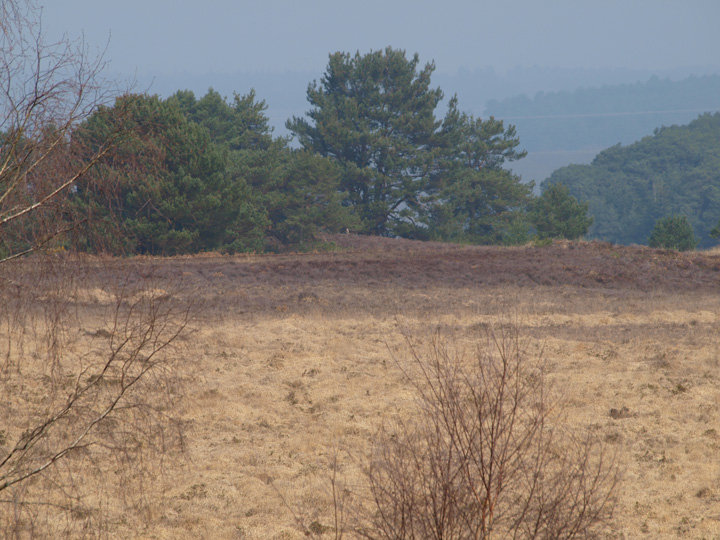
A small, low bowl barrow on Warren Heath, which is on the edge of the Higher Hyde nature reserve. Not the best photo but I had my brother with me and he wanted to see nature stuff - lizards and such so I didn't get a chance to walk to it.
Comments (0)
|
Add a comment
|
Permalink
Posted by
formicaant
10th April 2011ce

 Posted by formicaant