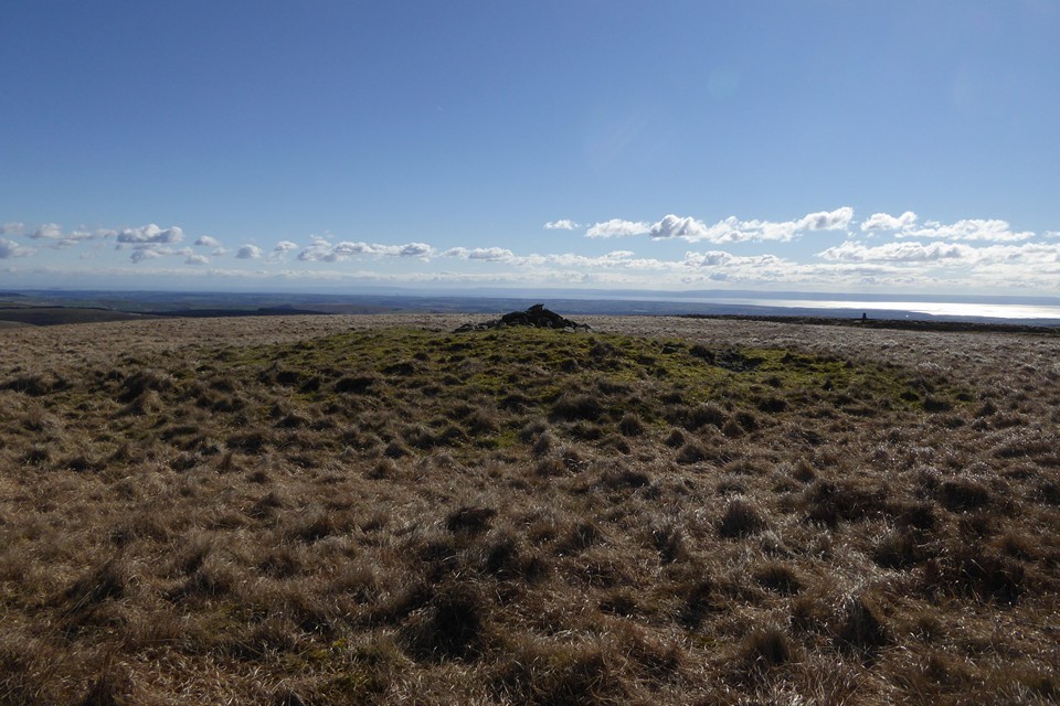
I approach along the western escarpment edge of Mynydd Llangeinwyr from The Werfa barrow, the route overlooking Cwm Garw and Pont y Cymer.. hey, I've been to the Bryngarw Country Park on quite a few occasions in times past - as you do - and often pondered upon the source of the Afon Garw. As you probably don't. Well, here it is. Ta dah! Overlooked by Bronze Age barrows, too.... who'd have thought it, eh?
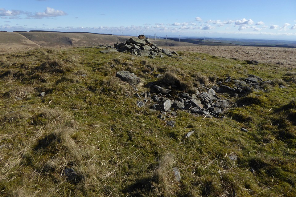
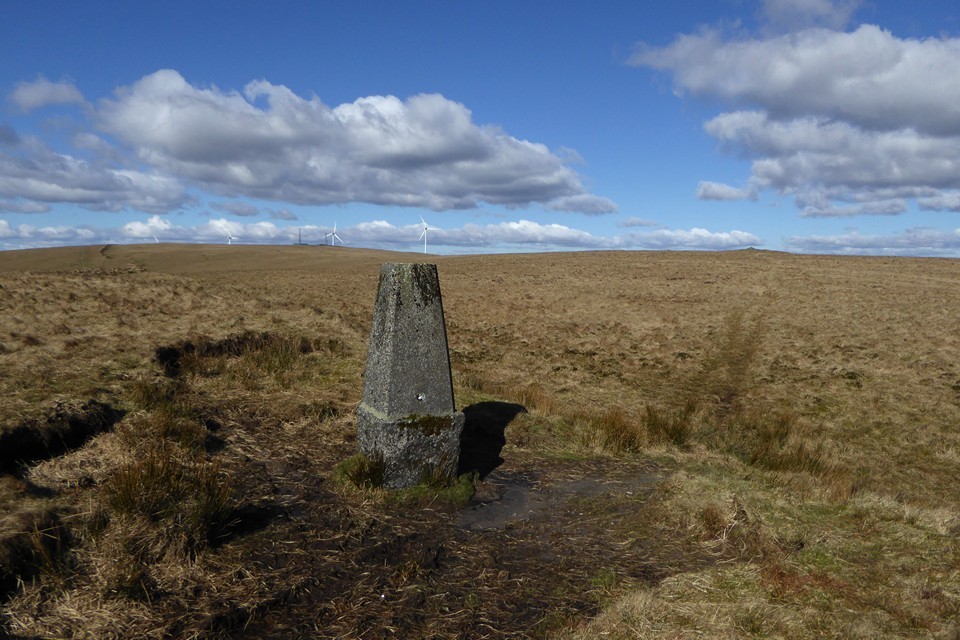
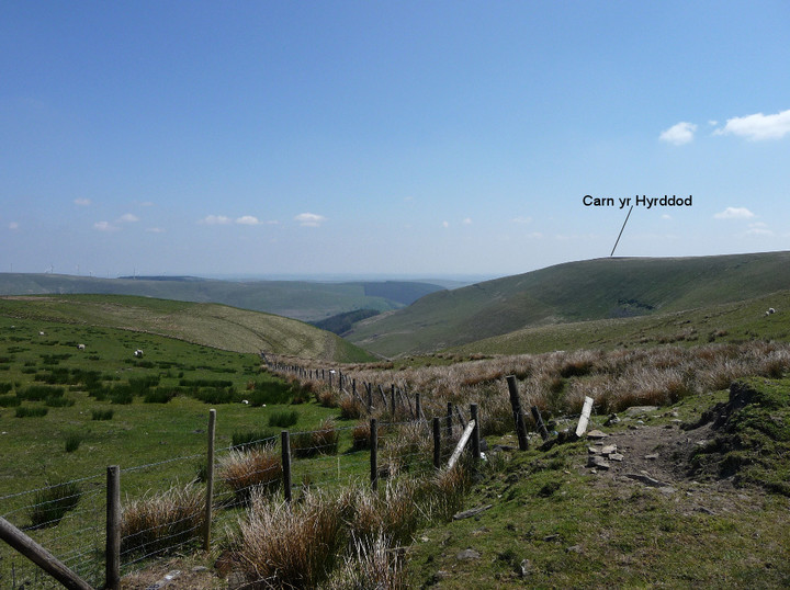
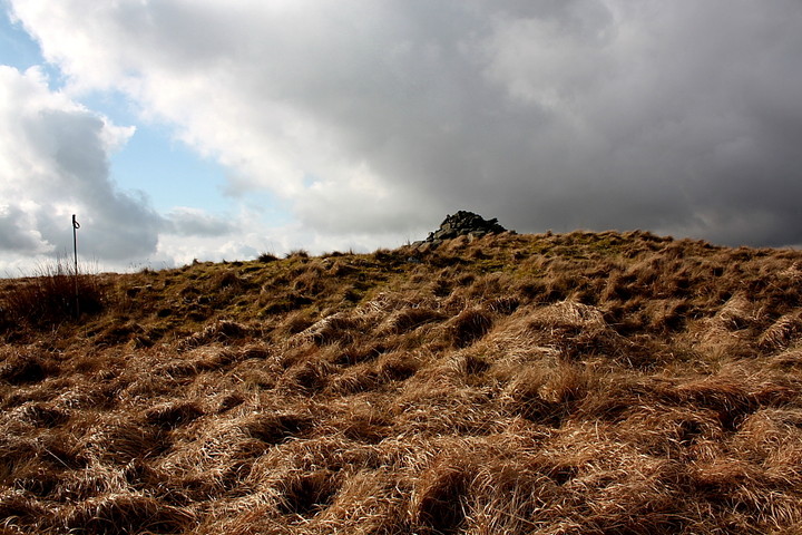
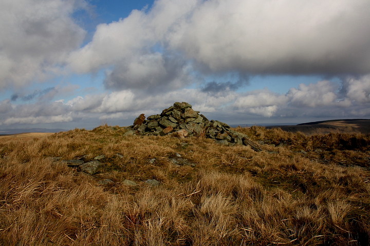
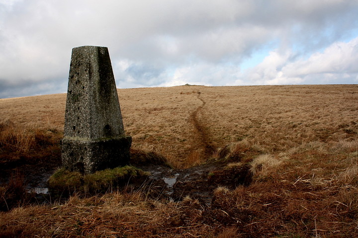
The summit of the mountain is not long coming... or at least the severely undermined OS trig pillar... with Carn-yr-Hyrddod itself visible a little to the approx north across waterlogged terrain. Well, it does rain here. A bit. Coflein is non-committal regarding the perceived age of this scheduled ancient monument; however the Glamorgan/Gwent Archaeological Trust surveyors place it firmly in the Bronze Age - (PRN) 00059m:
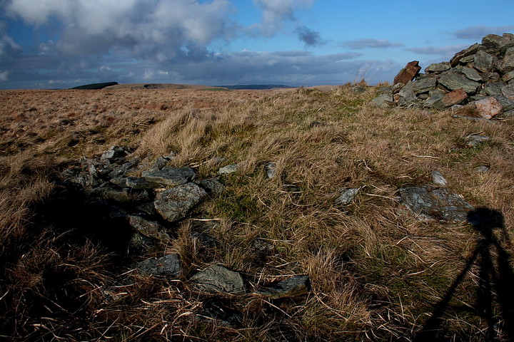
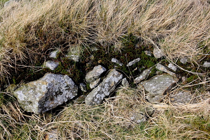
"...The cain stands in a commanding position on the top of the ridge. It is turf-covered, 14m in diameter and 1.7m high. A small cairn has been built on the top and on the south side there are several disturbance hollows, c0.4m deep and 1-3m in diameter. Stones are lying on the surface in these hollows and in the middle of the cairn. On the north side there is a slight ditch c 2m wide and 0.2m deep. (Source 05) GGAT 72 Prehistoric Funerary and Ritual Sites Project".
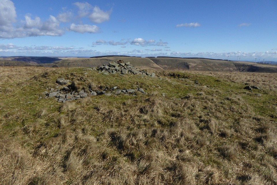
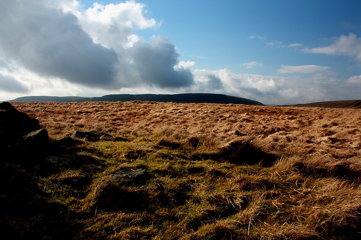
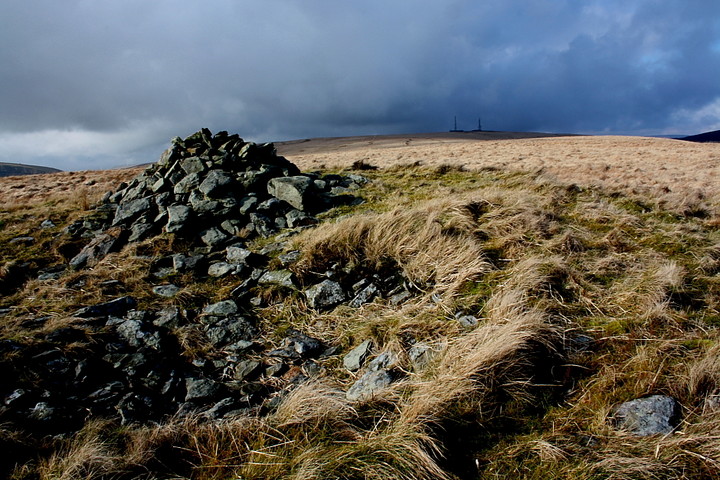
The siting is indeed fine, particularly bearing in mind the industrial pedigree of the area, with a sweeping vista eastwards, across Nant y Moel, toward Mynydd William Meyrick, itself crowned by several Bronze Age cairns. Yeah, there is more to this upland area surrounding The Rhondda than may at first be apparent to the untutored eye, so to speak. Consider the source of the Afon Ogwr (Ogmore) a little to the north, the very same river crossed by idyllic stepping stones beside Ogmore Castle. Perhaps the placing of these cairns wasn't as arbitary as is sometimes supposed? Look (very approximately) north-westwards towards Mynydd Caerau and you will see another heavilly cairned hill near the previously mentioned source of the Afon Garw....
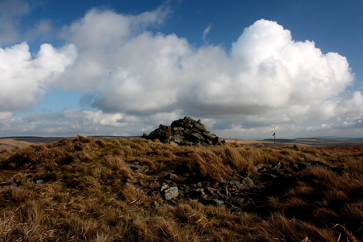
Carn-yr-Hyrddod is much more substantial than I ever supposed. Not that I really 'supposed' anything at all until 30 mins or so previously, of course. It is a great hang, too, the sun bathing the landscape in swathes of golden light and making this the place I want to be right now. OK, the walkers' cairn erected on top of the monument inspires me to 'substitute an 'n' please Bob' to the term, and the couple of trail bikers in the distance deserve a slap for being such ignorant muppets. But, this apart, I'm impressed. As well I should be. However this is Wales and, naturally, it can not last.
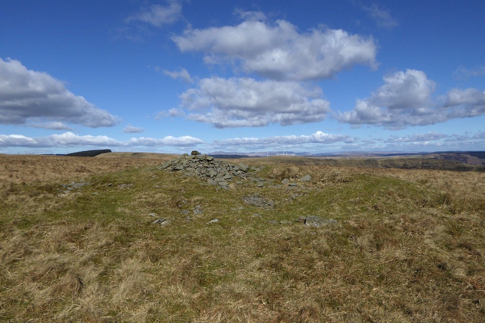
Suddenly I notice a bank of cloud sweeping in from the west(ish)... just time for a compass bearing before I'm engulfed in thick, clammy vapour and the expansive views are distant memories. Yeah, I'd swear I could almost hear the wind mumur 'not so easy now, is it?' It would be right, too. Despite being just below the 'magic' 2,000ft mark, you take these hills lightly at the risk of a much longer walk than you might have otherwise anticipated.


 Posted by GLADMAN