The Modern Antiquarian
Log in
|
Register
Home
Latest Posts
Forums
Maps
Help
Browse Sites
News
Blog
Contributors
The Books
Select
-
Belgium
Denmark
Eire
France
Germany
Greece
Italy
The Netherlands
Norway
Portugal
Republic of Malta
Spain
Sweden
Switzerland
United Kingdom
County Limerick
Castlefarm
Round Barrow(s)
Castlefarm (Round Barrow(s)) on The Modern Antiquarian, the UK & Ireland's most popular megalithic community website. 3 images, 1 fieldnote, plus information on many more ancient sites nearby and across the UK & Ireland.
Image © Bawn79 © 2011
Nearest Town:
Hosspital (2km SE)
OS Ref (IE):
R697376 /
Sheet: 65
Latitude:
52° 29' 20.69" N
Longitude:
8° 26' 46" W
Added by
bawn79
Images (3)
Fieldnotes (1)
0 discussions
Start a topic
Show |
Hide
Web searches for Castlefarm
Flickr
Google
Google Images
The Megalithic Portal
Bing
Stone Pages
Wikipedia
Show map
(inline Google Map)
- Sites within 20 km -
-
Ballynamona (0.92km NNW) (4 posts)
Cloghaunainey (1.47km W) (1 post)
Lodge (1.51km ENE) (4 posts)
Cnoc Aine (2.28km WSW) (6 posts)
Hospital (2.36km E) (2 posts)
Cnoc Aine (2.36km WSW) (7 posts)
Coolalough (2.48km ESE) (2 posts)
Gorteennacreeagh (2.6km SSW) (2 posts)
Gotoon (2.69km SE) (2 posts)
Cnoc Aine (2.94km WSW) (3 posts)
Coolalough (3.1km SE) (2 posts)
Cnoc Aine (3.12km WSW) (1 post)
Cnoc Aine (3.18km WSW) (2 posts)
Rathanny (3.21km S) (7 posts)
Coolalough (3.4km ESE) (5 posts)
Cromwell Hill (3.53km ENE) (7 posts)
Rootiagh (4.01km NNW) (1 post)
Rootiagh (4.17km NNW) (3 posts)
Moohane (4.39km WNW) (4 posts)
Knockroe (4.85km WNW) (3 posts)
Loughgur (5.03km W) (0 posts)
Grillagh (5.18km WSW) (0 posts)
Carraig Aille (5.42km WNW) (4 posts)
Carraig Aille (5.42km WNW) (7 posts)
Knockroe (5.47km ENE) (1 post)
Lough Gur P (5.63km WNW) (1 post)
Lough Gur O (5.68km WNW) (8 posts)
Knockadoon Circles A + B (6.07km W) (1 post)
Knockadoon (6.09km W) (1 post)
Black Sow’s Bed (6.18km W) (6 posts)
Knockadoon Circle K (6.21km W) (5 posts)
Old Hags Chair (6.26km W) (2 posts)
Entrance to Tir Na Og (6.31km WNW) (3 posts)
Grange / Lios, Lough Gur (6.62km W) (87 posts)
Lough Gur Wedge Tomb (6.62km W) (26 posts)
Elton (6.64km S) (6 posts)
Lough Gur C (6.67km W) (17 posts)
Lough Gur D (6.67km W) (6 posts)
Knockfennel (6.7km WNW) (3 posts)
Cloonyconry More (6.84km E) (4 posts)
Knockfennel (6.89km W) (2 posts)
Knockfennel North (6.94km WNW) (4 posts)
The Stone Of The Tree (6.96km W) (6 posts)
Knockfennel (6.97km W) (4 posts)
The Pillar Stone (7.04km W) (8 posts)
Grange Lios (7.09km W) (9 posts)
Bruff (7.18km WSW) (3 posts)
Ballinvana (7.23km S) (2 posts)
Ballingoola A (7.34km WNW) (2 posts)
Ballingoola B (7.48km WNW) (1 post)
Ballingoola (7.55km WNW) (1 post)
Ballingoola C (7.62km WNW) (1 post)
Ballinscaula (7.81km SSW) (6 posts)
Ballinscaula (7.81km SSW) (2 posts)
Ballingoola D (7.83km WNW) (0 posts)
Ballingoola E (7.98km WNW) (1 post)
Tynacocka (8km WSW) (2 posts)
Clogher Hill (8.04km SE) (2 posts)
Rockbarton (8.2km W) (3 posts)
Longstone (8.3km NNE) (2 posts)
Bulgadenhall (8.38km SW) (1 post)
Sarsfields Rock (8.86km ENE) (3 posts)
Cnoc Greine (8.88km NE) (3 posts)
Knocsefin (9.36km NE) (3 posts)
Glenbane (9.7km E) (1 post)
Ballybricken West (10km NW) (3 posts)
Longstone (10.09km ENE) (8 posts)
Longstone (10.09km ENE) (1 post)
Longstone (10.09km ENE) (3 posts)
Ballybricken East (10.19km NW) (2 posts)
Ballybricken East (10.33km NW) (4 posts)
Ballybricken East (10.41km NW) (3 posts)
Knocksefin (10.41km NE) (1 post)
Brufea (10.87km NW) (3 posts)
Knockroe (10.9km NW) (7 posts)
Knockroe (10.92km NW) (2 posts)
Knockroe (10.97km NW) (2 posts)
Carrignacaubeen (11.07km SSE) (2 posts)
Lissard (11.22km ESE) (10 posts)
Liseen (11.22km NE) (3 posts)
Luddenmore (11.38km NW) (3 posts)
Luddenmore (11.38km NW) (5 posts)
Knocktwo (11.53km WSW) (3 posts)
Lissard (11.53km ESE) (3 posts)
Inch (11.66km NW) (5 posts)
Lattin (11.77km E) (3 posts)
Inch St. Lawrence (11.81km NW) (7 posts)
Stonepark (11.83km WNW) (2 posts)
Cush (11.88km SSE) (5 posts)
Cush (12km SSE) (1 post)
Ballyfroota (12.03km SE) (3 posts)
Lattin (12.17km E) (3 posts)
Duntryleague (12.29km ESE) (32 posts)
Duntryleague Cairn (12.29km ESE) (1 post)
Knockeen (12.57km N) (1 post)
Ballingarry (12.65km SE) (1 post)
Cloghast (12.67km SSE) (5 posts)
Ballingarry (12.82km SE) (3 posts)
Ballinculloo (12.89km WSW) (4 posts)
Ballyconry (12.97km E) (6 posts)
Skahard (12.99km NW) (3 posts)
Ballyconry (13.05km E) (2 posts)
Ballyriggin (13.09km SSE) (2 posts)
Rathmore South (13.24km W) (3 posts)
Highpark (13.55km NW) (3 posts)
Highpark (13.57km NW) (1 post)
Ballyriggin (13.58km S) (3 posts)
Highpark (13.65km NW) (4 posts)
Highpark (13.67km NW) (2 posts)
Kilfinnane (13.75km S) (4 posts)
Tuogh (14.03km NNE) (0 posts)
Carraigapuckaun (14.18km SSE) (2 posts)
Kilfinnane (14.86km S) (2 posts)
Corderry (15.03km E) (8 posts)
Ballygeagoge (15.14km S) (1 post)
Ladys Well (15.18km S) (3 posts)
Ballygeagoge (15.65km S) (0 posts)
Bawnacouma (15.74km WNW) (1 post)
Friarstown (15.94km WNW) (6 posts)
Ballygeagoge (16km S) (1 post)
Mortlestown Hill (16.1km S) (5 posts)
Shrough (16.14km E) (16 posts)
Ballinlyna Lower (16.24km S) (1 post)
Knocksouna (16.25km SW) (1 post)
Tory Hill (17.14km W) (2 posts)
Ballynilard (17.26km E) (4 posts)
Clonpet (17.53km E) (1 post)
Ardpatrick (17.78km SSW) (5 posts)
Kilmoylan Upper (18.37km NE) (3 posts)
Springfield (18.43km E) (2 posts)
Baunteen (18.44km ESE) (3 posts)
Baunteen (18.52km ESE) (1 post)
Doonglara (Glenbrohane) (18.98km N) (1 post)
Cahernahallia (19.16km NE) (2 posts)
Cahernahallia (19.16km NE) (1 post)
Darragh Graveyard (19.29km S) (3 posts)
- Add -
-
Add news
Add an image
Add fieldnotes
Add folklore
Add miscellaneous
Add a link
-
Add a site
Add a nearby facility
Add an alternative name/spelling
Images
(click to view fullsize)
Add an image
Fieldnotes
Add fieldnotes
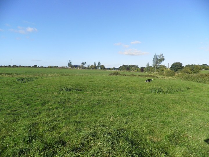
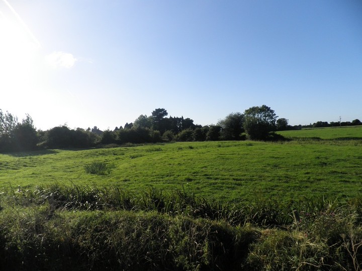
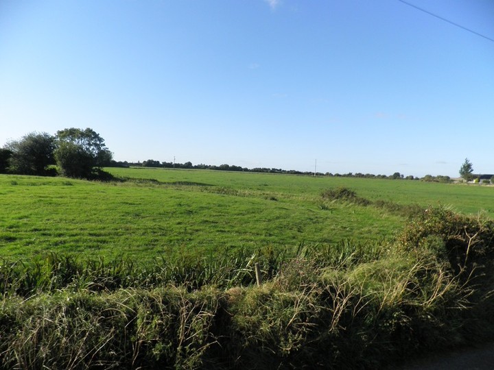
This is one of Limericks "Megabarrows" along with Rathanny, Coolalough and Ballinscaula. The barrow must be about 10-15m in diameter.
Finding it is quiet easy it just north (2 1/2km) of the town of Hospital and right on the side of a small boreen.
Comments (0)
|
Add a comment
|
Permalink
Posted by
bawn79
10th January 2011ce