I’m told there are twenty-three standing stones on Orkney Mainland, and being determined to visit them all I turn to Stembister. It’s been on the radar for a while, and inspired by Wideford’s pictures and fieldnotes I’d attempted a visit before, driving up the track off the A960 and getting as far as the entrance to the farm, before finding I’d have to park in the farmer’s yard should I wish to walk onwards to the stone. Not wanting to intrude, and being a somewhat unsociable creature, I decided then against knocking on the door to request access, and turning the car around decided to find a different approach another day.
That was nearly a year ago, but today I’m back and having examined the 1:25,000 scale O.S. map it looks as if it would be possible to walk along the coastline to reach the stone therefore avoiding having to disturb the farmer. Taking advantage of some brief blue skies amidst the recent showery weather, I drive out to the car park at the wonderfully descriptively named beach at Sandi Sands. There are lovely views out here both to the north and south of this thin spit of land, with the large green mound of Dingie’s Howe, itself an ancient Norse ‘thing’ or parliament, built on the remains of a broch site, dominating the approach to the southern shore of the beach.
Climbing up past the Howe, and following the cliff edge I’m buffeted by a brisk wind as I walk along the vague track that runs next to the fenceline. It’s probably not a route for the fainthearted or anyone afraid of heights as it takes you pretty close to the edge, and I found myself having to keep one eye out for my footing, despite the distractions of the plentiful birdlife, and the desire to spot the pod of Orca’s that have been seen around the coasts of Orkney over the past few days. After negotiating the odd gully, and a quick clamber over a piece of fence which extended out to the cliff edge, the stone itself became visible.
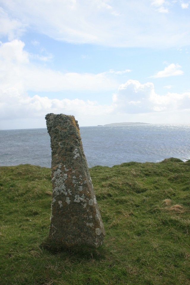
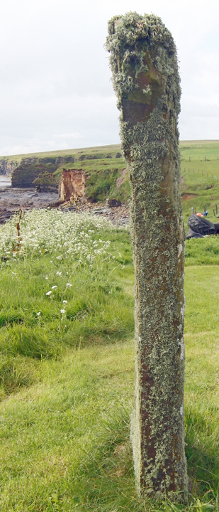
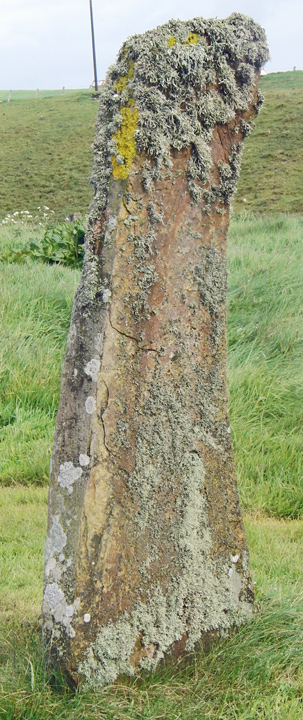
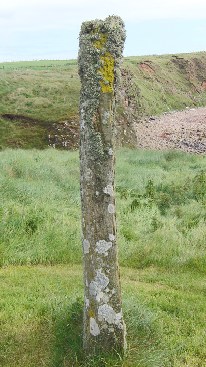
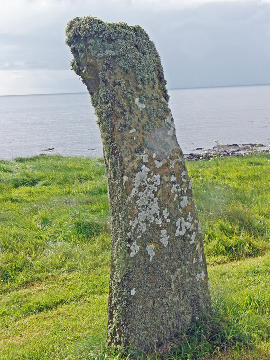
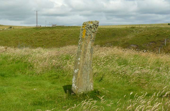
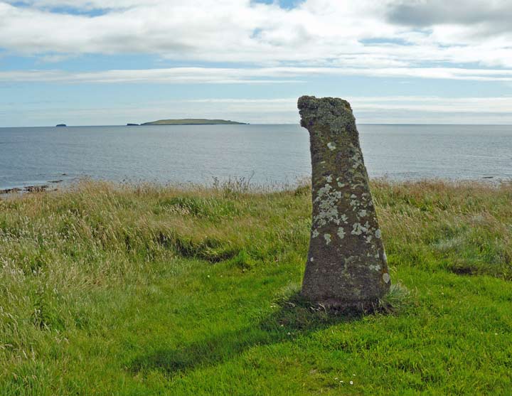
Soon I was there, at a typical slab of Orcadian sandstone around 6’ tall, the tip bent at a jaunty angle, and somehow reminding me of the fin of a whale. The ever present tufts of sea moss ubiquitous on Orcadian megaliths tickle my neck as I sit with my back to the stone looking out to sea. It’s a wonderful view, with the island of Copinsay bold on the horizon, the stone wonderfully placed on its promontory, and reminiscent of the stones I’ve seen on South Ronaldsay in size and shape.
As with many other standing stones there is supposedly folklore surrounding giants attached, the oversized inhabitant of Stembister was said to have flung stones as far as Copinsay, presumably the standing stone here was the result of a duff throw, the name of the farm itself also coming from the old Norse, stein-bolstadr, meaning ‘stone-farm’.
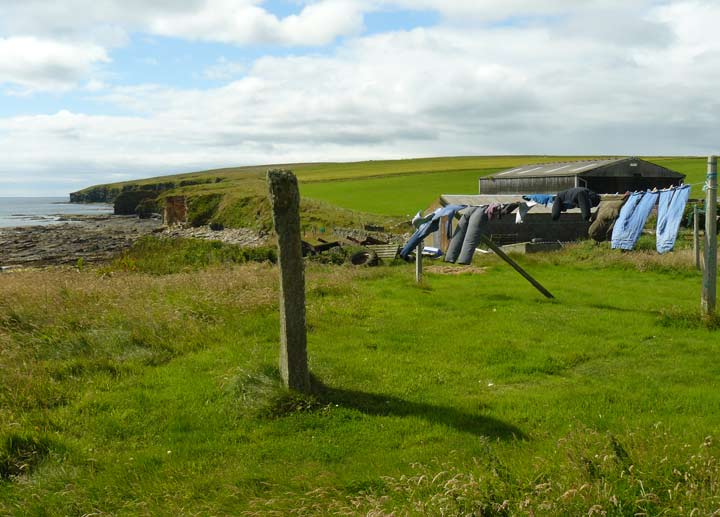
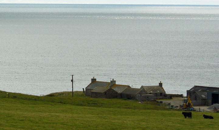
As lovely as the view to the south-east is the same can’t be said of the opposite aspect, with the shabby agricultural outbuildings of the farm a glowering presence, and the farmhouse only a few feet from the stone. Such a close proximity does ruin the atmosphere somewhat, but as long as you fix your eyes out to sea you can forget the trappings of modernity and enjoy the stone, which I do until the clouds I can see sweeping along the coast whisk across me to unload some more rain, forcing me to hurriedly make my damp way back to the car.
Taking the road to Deerness, after the St.Andrew's School junction you come to the Stembister junction in the Upper Sanday district. This road you then follow all the way to the Stembister millstream. Once over this you should find a place to park your vehicle before going on to the farm. Be careful not to disturb the ducks and geese as you pass through farmyard. The stone is on the northern end of the wifey's drying green a short distance in front of the house.
RCAHMS NMRS record no. HY50SW 6 is a N-S aligned stone standing 6'2" high and varying in width from 14½-28". In about 1965 the stone was moved from a rapidly eroding clifftop a few metres inland to its present position (the small packing stones were removed between 1929 and 1964, presumably whilst moving the stone).