The Modern Antiquarian
Log in
|
Register
Home
Latest Posts
Forums
Maps
Help
Browse Sites
News
Blog
Contributors
The Books
Select
-
Belgium
Denmark
Eire
France
Germany
Greece
Italy
The Netherlands
Norway
Portugal
Republic of Malta
Spain
Sweden
Switzerland
United Kingdom
County Cork
Hornhill
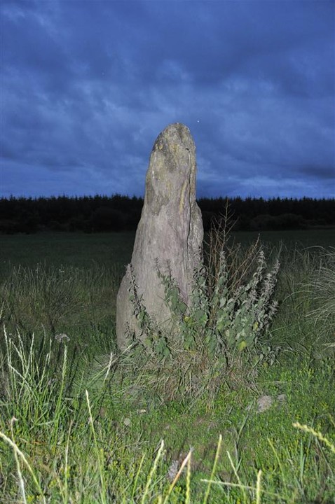
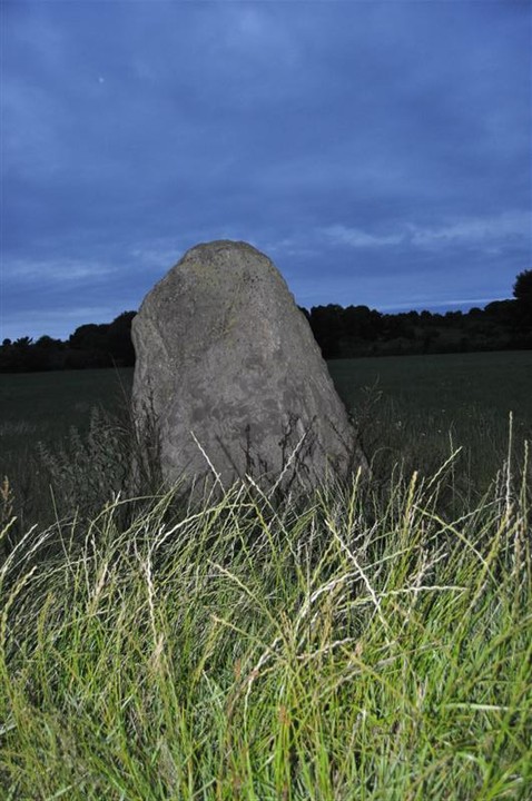
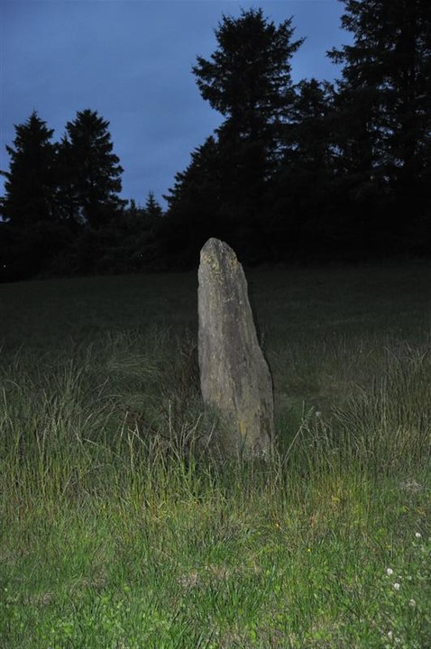
Standing Stones
Hornhill (Standing Stones) on The Modern Antiquarian, the UK & Ireland's most popular megalithic community website. 8 images, plus information on many more ancient sites nearby and across the UK & Ireland.
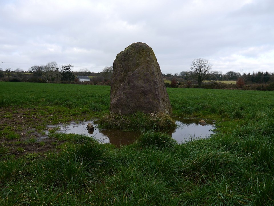
Image © Michael Mitchell
Nearest Town:
Cookstown (7km NE)
OS Ref (IE):
W3669062516 /
Sheet: 86
Latitude:
51° 48' 41.4" N
Longitude:
8° 55' 5.12" W
Added by
bogman
Images (8)
0 discussions
Start a topic
Show |
Hide
Web searches for Hornhill
Flickr
Google
Google Images
The Megalithic Portal
Bing
Stone Pages
Wikipedia
Show map
(inline Google Map)
- Sites within 20 km -
-
Knocknaneirk SW (0.45km ENE) (17 posts)
Garranereagh (0.5km SW) (4 posts)
Hornhill (0.58km ESE) (5 posts)
Knocknaneirk NE (0.93km NE) (13 posts)
Bengour East (1.58km E) (6 posts)
Clearagh (2.71km NNW) (2 posts)
Bengour West (2.72km ESE) (6 posts)
Barnadivane (3.39km W) (0 posts)
Lackanashinagh (3.75km WSW) (0 posts)
Knockane (4.26km W) (8 posts)
Laravoolta 2 (4.43km SSE) (3 posts)
Laravoolta 1 (4.54km SSE) (2 posts)
Currabeha (South) (4.73km ENE) (7 posts)
Reanacaheragh (4.87km W) (0 posts)
Killaneer (5.04km SE) (3 posts)
Rossnakilla (5.33km WNW) (0 posts)
Rossnakilla (5.33km WNW) (9 posts)
Laughtneill (5.41km ENE) (9 posts)
Currabeha (North) (5.71km ENE) (7 posts)
Moneygaff West (6.17km WSW) (5 posts)
Bellmount Upper SW (6.25km ENE) (9 posts)
Bellmount Upper NE (6.51km ENE) (9 posts)
Kinneigh (7.56km SW) (4 posts)
Coolaclevane (7.95km W) (3 posts)
Coolaclevane (7.98km W) (3 posts)
Knockaunnagorp (8.05km W) (0 posts)
Rosnascalp (8.41km N) (4 posts)
Knockanereagh (8.66km WSW) (8 posts)
Kinneigh (8.92km SW) (5 posts)
Knockavullig SW (9.85km NE) (4 posts)
Knockavullig NE (10.11km NE) (2 posts)
Teergay (10.19km WNW) (8 posts)
Bealick (10.41km NNW) (3 posts)
Gortyleahy (10.43km NW) (4 posts)
Behagullane (10.75km WSW) (1 post)
Toom (10.89km SW) (4 posts)
Bealick (11.38km NNW) (0 posts)
Knockawaddra (Muskerry East By.) (11.78km ENE) (9 posts)
Castlelanaght (11.95km E) (6 posts)
Castlelanaght (11.99km E) (31 posts)
Kylefinchin 2 (13.1km WNW) (5 posts)
Kilnagnady standing stone (13.11km E) (2 posts)
Carrigaphooca (13.16km WNW) (7 posts)
Kilnagnady 2 (13.19km E) (1 post)
Knocks (East) (13.52km S) (7 posts)
Kylefinchin (13.53km WNW) (1 post)
Inchincurka (13.63km WSW) (15 posts)
Kilboultragh (13.94km NW) (1 post)
Inchinlinane (14.1km WNW) (5 posts)
Deelish (14.19km N) (4 posts)
Laharankeal (14.23km N) (4 posts)
Ballyvoge 1 (14.25km WNW) (6 posts)
Laharankeal (14.93km N) (1 post)
Nedinagh West (14.97km SW) (3 posts)
Farrannahineeny (15.34km WSW) (16 posts)
Lissacresig 1 (15.35km WNW) (4 posts)
Lissacresig 2 (15.41km WNW) (5 posts)
Lissacresig 3 (15.41km WNW) (4 posts)
Caherkirky (15.46km SSW) (11 posts)
Ballyhalwick (15.47km SW) (3 posts)
Knockavilla (Clashanimud) (15.55km E) (10 posts)
Kilberrihert large wedge tomb damaged (15.73km N) (2 posts)
Caherbaroul (15.77km NNW) (7 posts)
Cools (15.95km WNW) (3 posts)
Lissacresig (16.07km WNW) (3 posts)
Corravreeda (16.17km E) (6 posts)
Gortnalicky (16.66km NW) (1 post)
Dunmanway North (16.7km SW) (5 posts)
Derrynasafagh (17.11km WSW) (3 posts)
Scrahanard (17.16km NW) (15 posts)
Clashmaguire (17.19km NW) (1 post)
Lackaduv (17.39km NW) (5 posts)
Milleennagun (17.5km SSW) (3 posts)
Coolmountain (17.51km WSW) (7 posts)
Milleennagun (17.52km SSW) (12 posts)
Letter (site E) (17.54km S) (11 posts)
Coolnaconarty (17.71km SSW) (9 posts)
Knocks N (18.14km SSW) (20 posts)
Clashmaguire (18.16km NW) (2 posts)
Lettergorman (North) (18.17km SW) (25 posts)
Turnaspidogy (18.18km W) (8 posts)
Cashelisky (18.19km S) (9 posts)
Knocknagappul (18.2km NNW) (3 posts)
Oughtihery E (18.3km NNE) (9 posts)
Parkaghadallaun (18.36km E) (3 posts)
Knocks (18.54km SSW) (2 posts)
Inchireagh (18.65km WSW) (11 posts)
Templebryan (18.7km SSE) (0 posts)
Knockatlowig (18.71km S) (10 posts)
Knocks (18.76km SSW) (13 posts)
Burrane (18.76km ESE) (4 posts)
Knockraheen (18.77km NW) (19 posts)
Knocknagappul (18.9km NNW) (3 posts)
Knockagappul 1 (18.9km NNW) (5 posts)
Cabragh (18.91km NW) (4 posts)
Templebryan (18.92km SSE) (23 posts)
Derrynacaheragh (19.02km WSW) (2 posts)
Knockawaddra E (19.06km SSW) (15 posts)
Inchinattin (19.11km SSW) (2 posts)
Knockawaddra W (19.12km SSW) (17 posts)
Ahaghilla (19.17km S) (13 posts)
Reananarree (19.2km W) (3 posts)
Knocks S (19.31km SSW) (18 posts)
Reananerree (19.34km W) (11 posts)
Cabragh (19.4km NW) (4 posts)
Cabragh N (19.4km NW) (6 posts)
Lack More (19.42km W) (9 posts)
Knocknakilla (19.43km NW) (0 posts)
Carrigonirtane (19.45km NW) (4 posts)
Gortanimill (19.61km WNW) (16 posts)
Oughtihery W (19.71km N) (9 posts)
Carrigonirtane (19.82km NW) (6 posts)
Maulmore (19.83km N) (8 posts)
Derryfineen (19.97km W) (5 posts)
- Add -
-
Add news
Add an image
Add fieldnotes
Add folklore
Add miscellaneous
Add a link
-
Add a site
Add a nearby facility
Add an alternative name/spelling
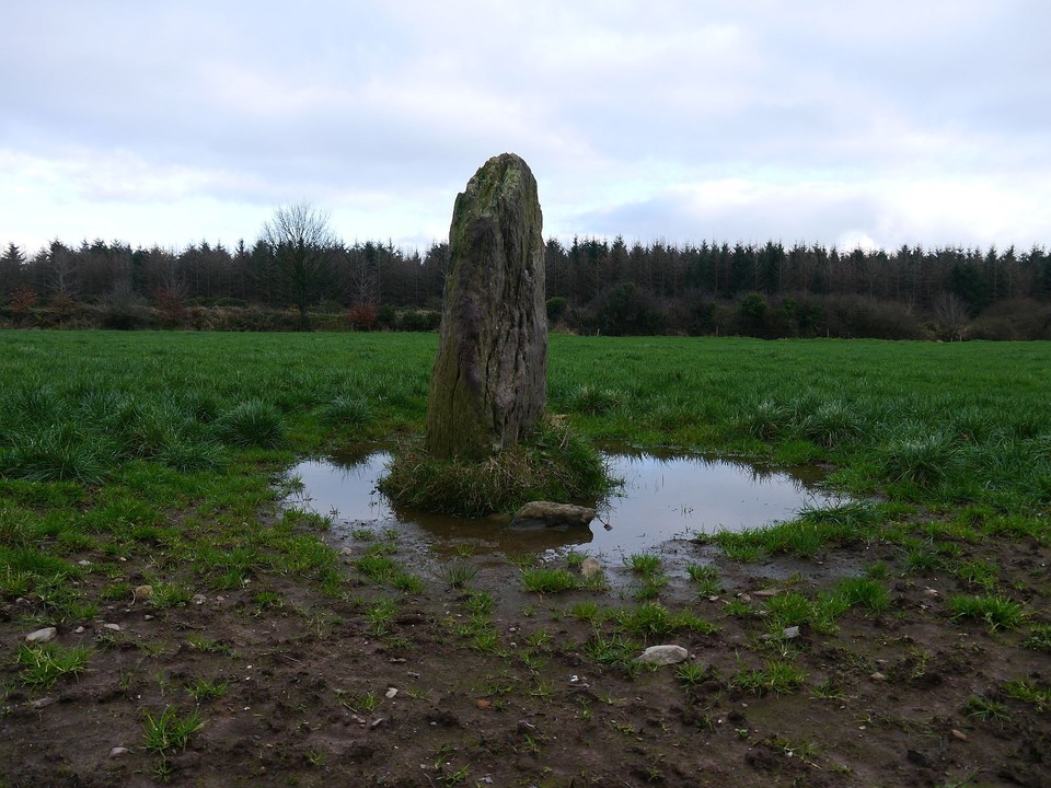
Images
(click to view fullsize)
Add an image
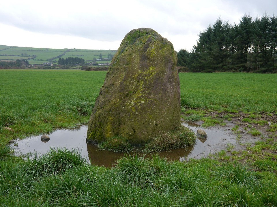
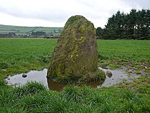 Image © Michael Mitchell
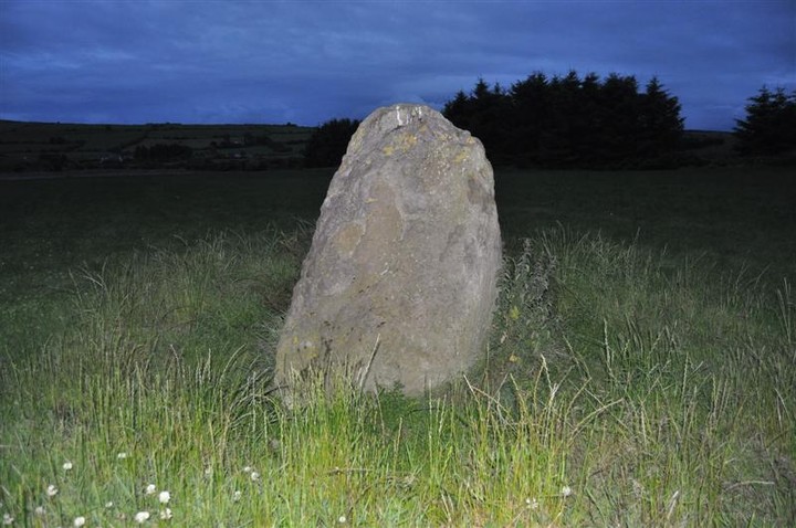