The Modern Antiquarian
Log in
|
Register
Home
Latest Posts
Forums
Maps
Help
Browse Sites
News
Blog
Contributors
The Books
Select
-
Belgium
Denmark
Eire
France
Germany
Greece
Italy
The Netherlands
Norway
Portugal
Republic of Malta
Spain
Sweden
Switzerland
United Kingdom
County Cork
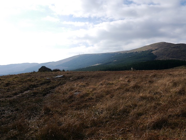
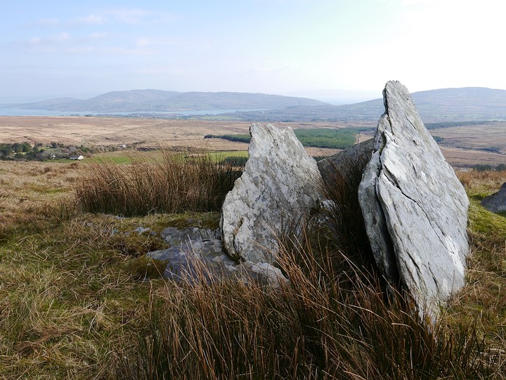
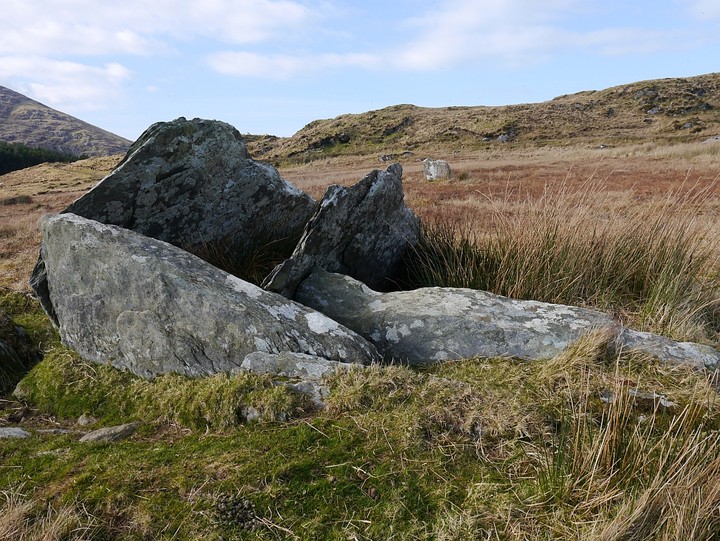
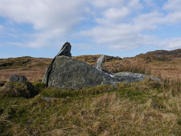
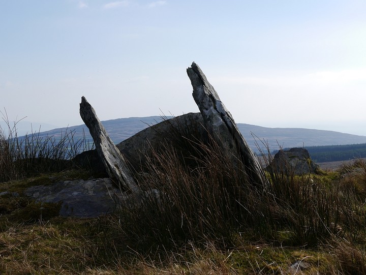
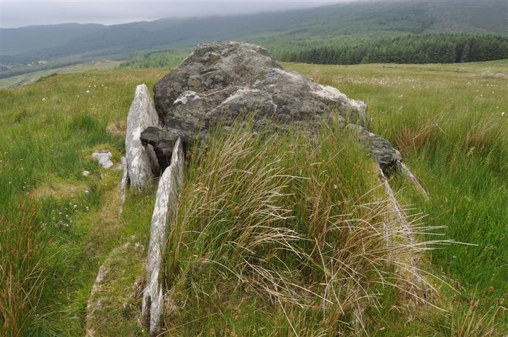
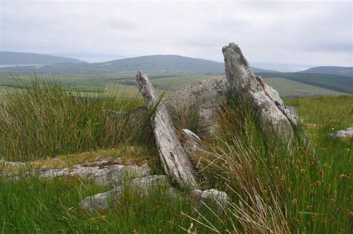
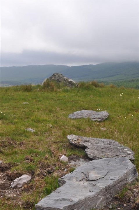
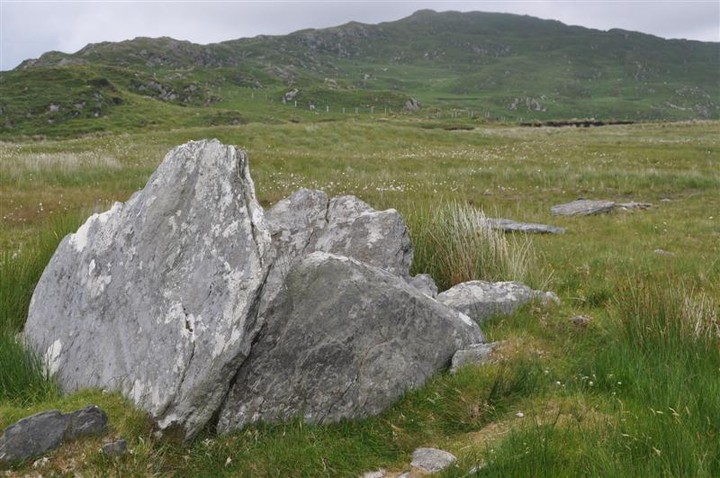
Teernahillane
Wedge Tomb
Teernahillane (Wedge Tomb) on The Modern Antiquarian, the UK & Ireland's most popular megalithic community website. 9 images, plus information on many more ancient sites nearby and across the UK & Ireland.
Image © Michael Mitchell
OS Ref (IE):
Latitude:
51° 39' 12.53" N
Longitude:
9° 58' 7.93" W
Added by
bogman
Images (9)
0 discussions
Start a topic
Show |
Hide
Web searches for Teernahillane
Flickr
Google
Google Images
Bing
Stone Pages
Wikipedia
Show map
(inline Google Map)
- Sites within 20 km -
-
Teernahillane (0.13km NNE) (4 posts)
Teernahillane (0.62km SE) (1 post)
Teernahillane (0.62km SE) (3 posts)
Knockoura (1.8km SSW) (2 posts)
Fanahy (1.97km ESE) (4 posts)
Gour (2.24km SSW) (10 posts)
Derreenataggart West (2.73km ENE) (31 posts)
Ardacluggin (2.75km WNW) (1 post)
Coulagh (2.94km NNW) (5 posts)
Coulagh (3.13km NNW) (1 post)
Ardacluggin (3.38km WNW) (4 posts)
Derreenataggart Middle (3.46km E) (2 posts)
Urhin (3.71km W) (5 posts)
Kealoge (3.77km SW) (3 posts)
Kealoge (4.57km W) (6 posts)
Kilmackowen (5.25km NE) (9 posts)
Kilmackowen (5.28km NE) (17 posts)
Derrymihin West (5.32km ENE) (3 posts)
Rodeen 3 (5.97km ENE) (4 posts)
Cloontreem (6.16km ENE) (15 posts)
Rodeen 2 (6.19km ENE) (5 posts)
Rodeen 1 (6.21km ENE) (3 posts)
Cahermore (6.3km SW) (5 posts)
Ballycrovane (6.8km NNE) (18 posts)
Hag of Beara (6.82km NNW) (9 posts)
Killough West (8.11km SW) (9 posts)
Loughane More (10.79km SW) (6 posts)
Ardgroom Outward (11.28km NE) (34 posts)
Glashananinnaun (12.96km NE) (5 posts)
Coomgira (14.68km ENE) (6 posts)
Shronebirrane (14.69km NE) (22 posts)
Gort na Gainimhe (15.08km WSW) (6 posts)
Cashelkeelty NW (15.64km NE) (12 posts)
Cashelkeelty SE (15.78km NE) (13 posts)
Caherdaniel (15.84km WNW) (4 posts)
Staigue Bridge (15.88km NNW) (13 posts)
Staigue (15.98km NNW) (0 posts)
Darrynane More (16.15km WNW) (8 posts)
Coomnahorna East (16.53km NW) (0 posts)
The Waters (16.82km WSW) (3 posts)
Staigue Cashel (17.11km NNW) (21 posts)
Caherurlagh (17.19km ESE) (6 posts)
Reenkilla (17.22km NE) (5 posts)
Clogherane (17.47km ENE) (3 posts)
Clogherane (17.5km ENE) (3 posts)
Cahernageeha (17.63km WNW) (5 posts)
Peakeen (18.22km E) (6 posts)
Cappaleigh North (18.82km ENE) (4 posts)
Drumlave (18.88km ENE) (11 posts)
Kilcaskan (18.92km ENE) (5 posts)
Coomatloukane North (18.92km WNW) (11 posts)
Coomatloukane (18.97km WNW) (16 posts)
Kildromalive (19.33km ENE) (5 posts)
Lehid (19.94km NE) (2 posts)
Loher (20km WNW) (15 posts)
- Add -
-
Add news
Add an image
Add fieldnotes
Add folklore
Add miscellaneous
Add a link
-
Add a site
Add a nearby facility
Add an alternative name/spelling
Images
(click to view fullsize)
Add an image