The Modern Antiquarian
Log in
|
Register
Home
Latest Posts
Forums
Maps
Help
Browse Sites
News
Blog
Contributors
The Books
Select
-
Belgium
Denmark
Eire
France
Germany
Greece
Italy
The Netherlands
Norway
Portugal
Republic of Malta
Spain
Sweden
Switzerland
United Kingdom
County Cork
Gour
Standing Stones
Gour (Standing Stones) on The Modern Antiquarian, the UK & Ireland's most popular megalithic community website. 9 images, 1 fieldnote, plus information on many more ancient sites nearby and across the UK & Ireland.
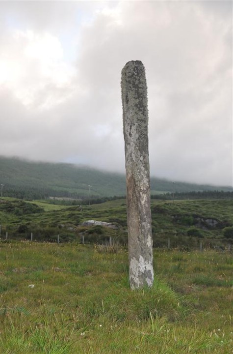
Image © Michael Mitchell
Nearest Town:
Sneem (23km N)
OS Ref (IE):
V6303344253 /
Sheet: 84
Latitude:
51° 38' 3.34" N
Longitude:
9° 58' 42.71" W
Added by
bogman
Images (9)
Fieldnotes (1)
0 discussions
Start a topic
Show |
Hide
Web searches for Gour
Flickr
Google
Google Images
The Megalithic Portal
Bing
Stone Pages
Wikipedia
Show map
(inline Google Map)
- Sites within 20 km -
-
Knockoura (0.45km N) (2 posts)
Teernahillane (1.82km NNE) (3 posts)
Teernahillane (1.82km NNE) (1 post)
Fanahy (2.15km ENE) (4 posts)
Teernahillane (2.24km NNE) (9 posts)
Teernahillane (2.37km NNE) (4 posts)
Kealoge (2.42km WSW) (3 posts)
Derreenataggart West (4.12km NE) (31 posts)
Cahermore (4.24km SW) (5 posts)
Ardacluggin (4.36km NW) (1 post)
Derreenataggart Middle (4.39km ENE) (2 posts)
Urhin (4.84km NW) (5 posts)
Coulagh (5km NNW) (5 posts)
Kealoge (5.06km WNW) (6 posts)
Ardacluggin (5.07km NW) (4 posts)
Coulagh (5.27km N) (1 post)
Derrymihin West (6.48km ENE) (3 posts)
Killough West (6.51km WSW) (9 posts)
Kilmackowen (7.2km NE) (17 posts)
Kilmackowen (7.21km NE) (9 posts)
Rodeen 3 (7.57km NE) (4 posts)
Rodeen 2 (7.72km ENE) (5 posts)
Cloontreem (7.86km NE) (15 posts)
Rodeen 1 (7.88km NE) (3 posts)
Hag of Beara (8.96km N) (9 posts)
Ballycrovane (9.03km NNE) (18 posts)
Loughane More (9.16km WSW) (6 posts)
Ardgroom Outward (13.42km NE) (34 posts)
Gort na Gainimhe (13.88km WSW) (6 posts)
Glashananinnaun (15.09km NE) (5 posts)
The Waters (15.51km WSW) (3 posts)
Coomgira (15.93km ENE) (6 posts)
Caherurlagh (16.58km E) (6 posts)
Shronebirrane (16.6km NE) (22 posts)
Caherdaniel (17.22km NW) (4 posts)
Darrynane More (17.44km WNW) (8 posts)
Cashelkeelty NW (17.68km NE) (12 posts)
Cashelkeelty SE (17.82km NE) (13 posts)
Staigue Bridge (17.86km NNW) (13 posts)
Staigue (17.96km NNW) (0 posts)
Coomnahorna East (18.09km NW) (0 posts)
Peakeen (18.13km E) (6 posts)
Cahernageeha (18.88km WNW) (5 posts)
Staigue Cashel (19.12km NNW) (21 posts)
Reenkilla (19.19km NE) (5 posts)
Clogherane (19.26km NE) (3 posts)
Clogherane (19.29km NE) (3 posts)
- Add -
-
Add news
Add an image
Add fieldnotes
Add folklore
Add miscellaneous
Add a link
-
Add a site
Add a nearby facility
Add an alternative name/spelling
Images
(click to view fullsize)
Add an image
Fieldnotes
Add fieldnotes
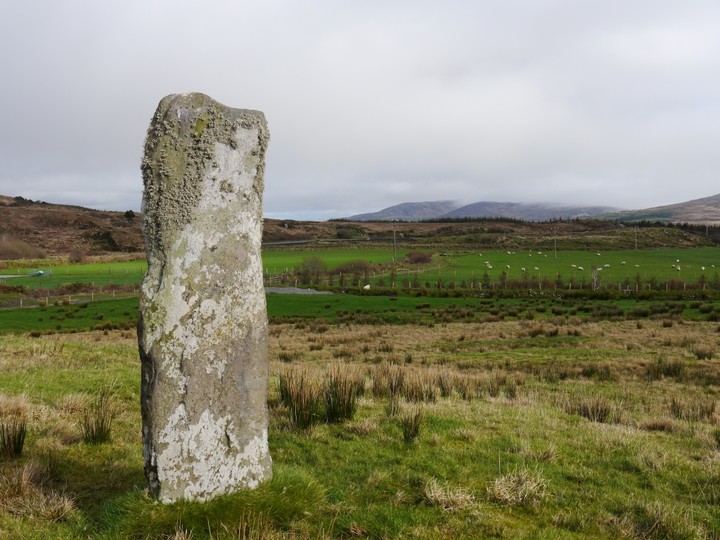
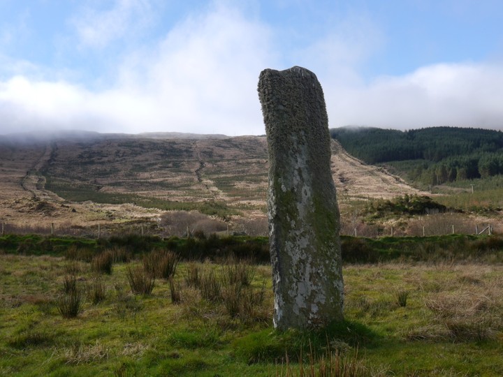
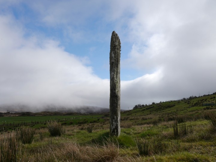
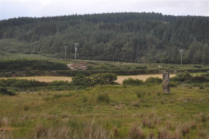
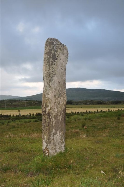
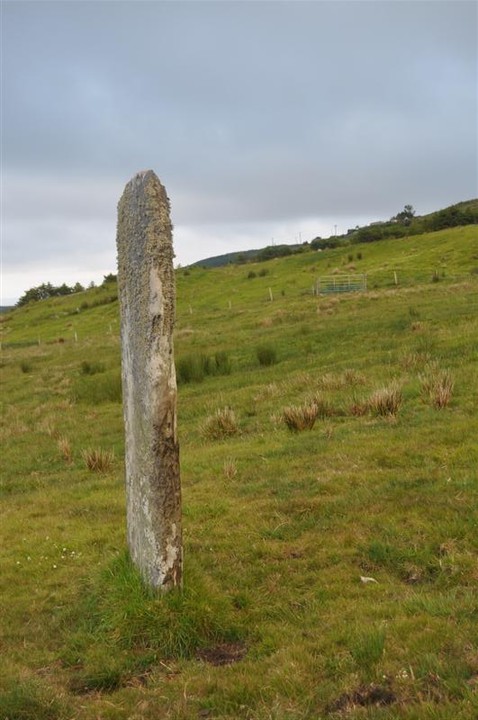
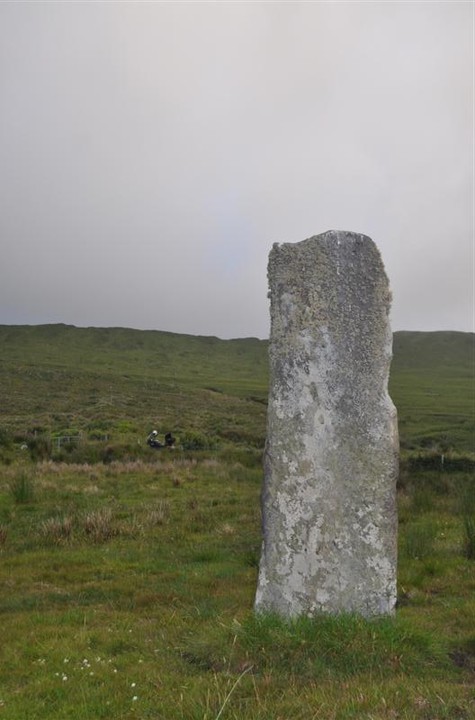
Impressive stone over 2 metres high. Easily seen from the main R572 at Gour Bridge about 4 miles West of Castletownbearhaven.
A layby on the opposite side of the road (just past the stone) and a nearby gate gives easy access.
Comments (0)
|
Add a comment
|
Permalink
Posted by
Meic
26th February 2012ce

 Posted by Meic