The Modern Antiquarian
Log in
|
Register
Home
Latest Posts
Forums
Maps
Help
Browse Sites
News
Blog
Contributors
The Books
Select
-
Belgium
Denmark
Eire
France
Germany
Greece
Italy
The Netherlands
Norway
Portugal
Republic of Malta
Spain
Sweden
Switzerland
United Kingdom
County Mayo
Belladooan
Belladooan on The Modern Antiquarian, the UK & Ireland's most popular megalithic community website. 2 images, plus information on many more ancient sites nearby and across the UK & Ireland.
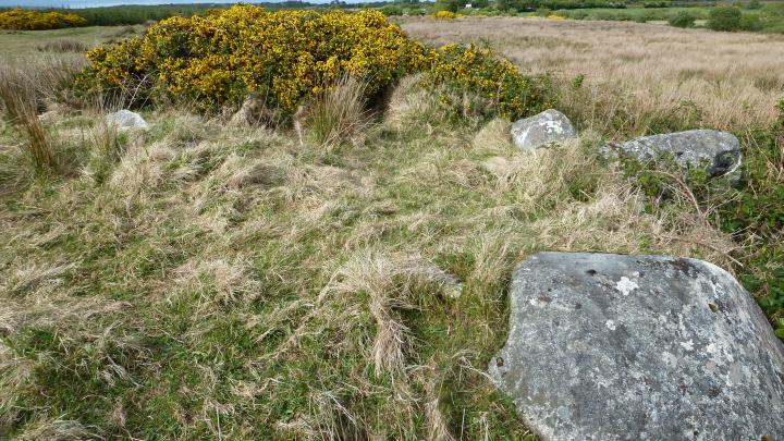
Image © Uwe Häberle 05/2010
Nearest Town:
Killala (8km ENE)
OS Ref (IE):
G120289 /
Sheet: 23
Latitude:
54° 12' 4.98" N
Longitude:
9° 20' 55.13" W
Added by
Nucleus
Images (2)
0 discussions
Start a topic
Show |
Hide
Web searches for Belladooan
Flickr
Google
Google Images
The Megalithic Portal
Bing
Stone Pages
Wikipedia
Show map
(inline Google Map)
- Sites within 20 km -
-
Tawnywaddyduff (Ma. 43) (4.39km SW) (1 post)
Tawnywaddyduff (4.49km SW) (3 posts)
Annagh More (4.75km NW) (1 post)
Lessanny (4.84km SSW) (0 posts)
Tawnywaddyduff (Ma. 39) (5.34km SW) (4 posts)
Tawnywaddyduff (5.36km SW) (3 posts)
Carbad Mor (7.11km ENE) (9 posts)
Rathfran (7.49km ENE) (1 post)
Gortatoor (7.54km N) (6 posts)
Rathfran Wedge Tomb (7.86km NE) (13 posts)
Breastagh (7.96km NE) (9 posts)
Breastagh (8.14km NE) (9 posts)
Rathfran - Stone Circle (8.52km ENE) (9 posts)
Ballyglass (9.25km NW) (5 posts)
Ballyglass (9.59km NW) (13 posts)
Cashel (9.93km NE) (4 posts)
Carrowtrasna (10.1km NE) (8 posts)
Enagh Beg (10.12km S) (3 posts)
Cloonkee (10.18km ESE) (1 post)
Ballyknock W (10.36km NW) (5 posts)
Castletown (W) (10.49km NNE) (10 posts)
Castletown (E) (10.62km NNE) (6 posts)
Rathlackan (10.89km NNE) (15 posts)
Banagher (11.22km NE) (7 posts)
Doonfeeny cross pillar (11.27km NW) (10 posts)
Creevagh (12.27km NNE) (6 posts)
Kilcummin Holy Well (12.5km NE) (5 posts)
Carrowkilleen (12.63km SSW) (6 posts)
Glenulra (12.77km NW) (5 posts)
Carrowgarve South (Ma. 53) (13.38km S) (2 posts)
Behy (13.62km WNW) (17 posts)
Ceide Fields (13.67km WNW) (15 posts)
Downpatrick Head (13.99km N) (7 posts)
Creevy (15.18km S) (2 posts)
Ballina (15.88km ESE) (14 posts)
Belderg (17.95km WNW) (15 posts)
Corroy (19.24km ESE) (1 post)
- Add -
-
Add news
Add an image
Add fieldnotes
Add folklore
Add miscellaneous
Add a link
-
Add a site
Add a nearby facility
Add an alternative name/spelling
Images
(click to view fullsize)
Add an image
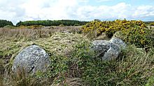 Image © Uwe Häberle 05/2010