15/04/2011 - Parked at the Loch Turret Dam and headed NE uphill to track then north along track to Cairn Choinneachan. I really like this one and the view is pretty brilliant. Good weather, touch windy. Carried on walking with a loop of the loch via Auchnafree Hill, Ben Chonzie and Carn Chois. A good day out.
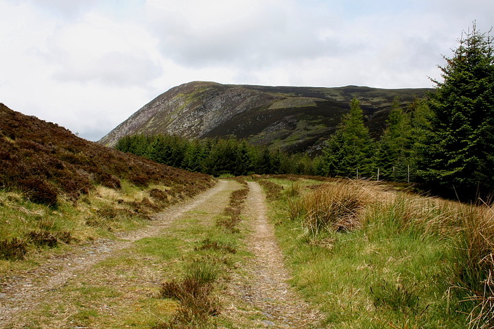
Yesterday's Balmuick visit was the reason I returned to Loch Turret this year, thoughts of climbing Choinneachain Hill to see its ancient cairn placed firmly upon the 'maybe' list, the possibility of acting upon them seemingly deteriorating as rapidly as the weather which assaults the car during the night.
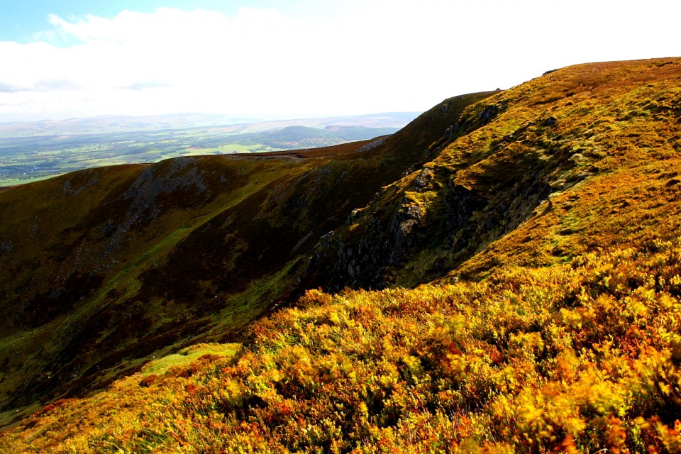
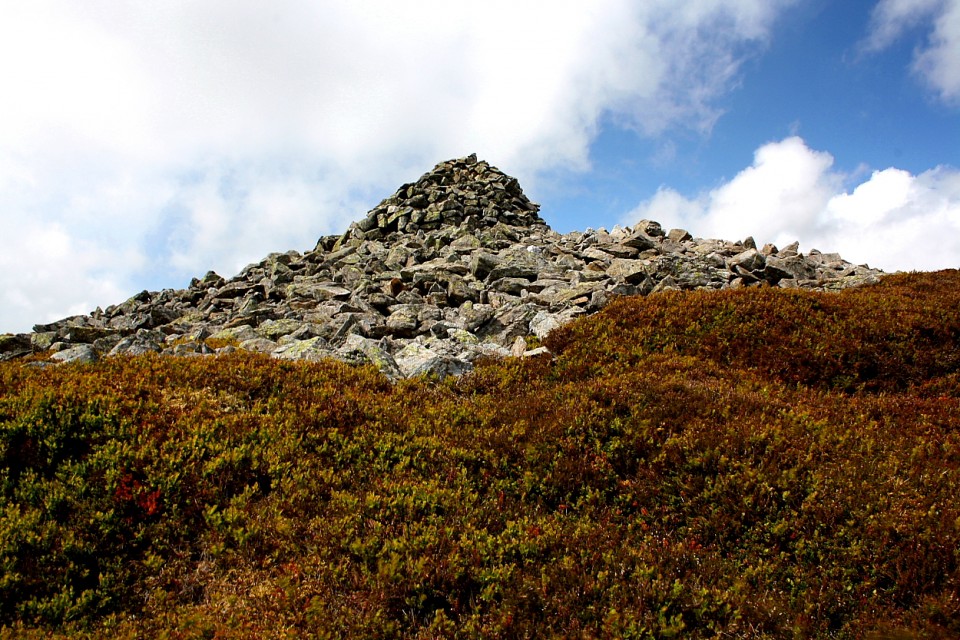
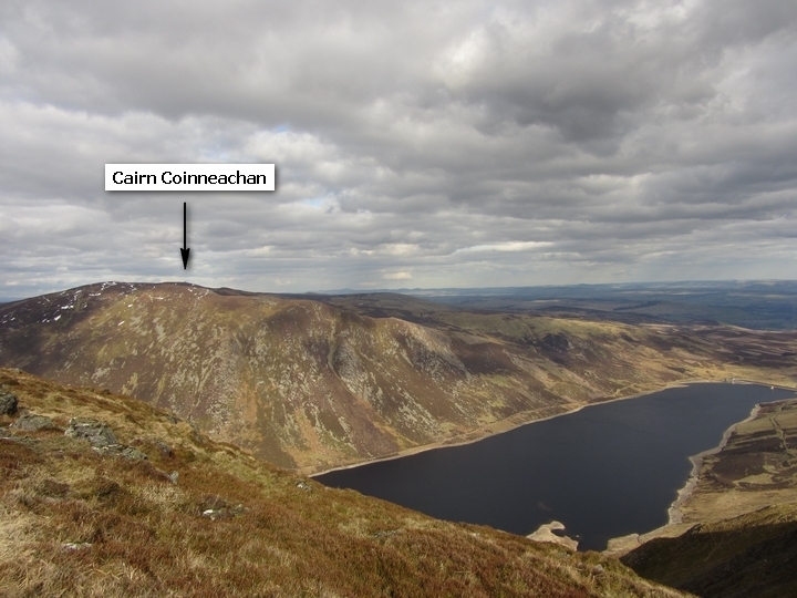
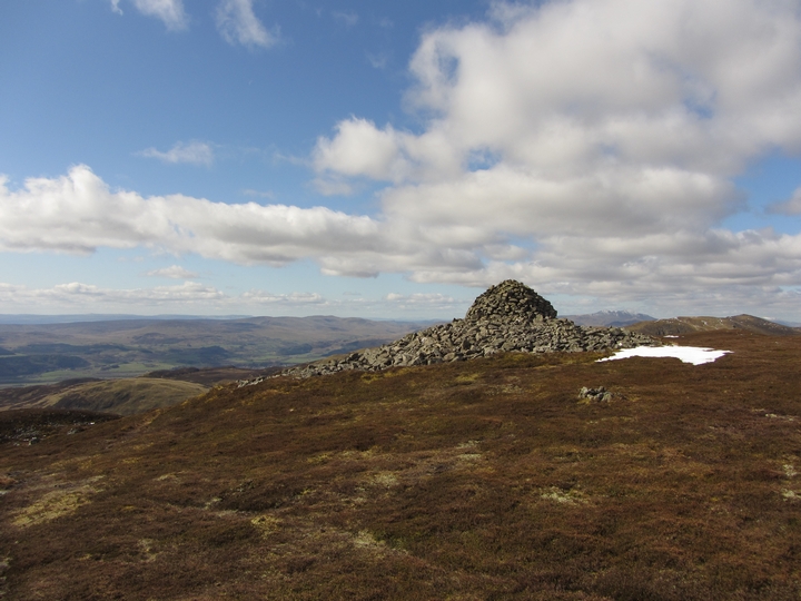
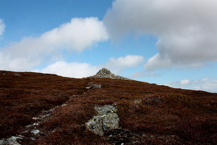
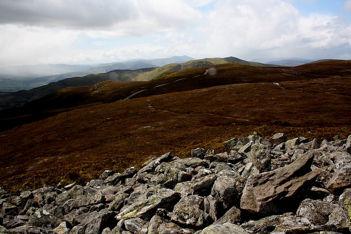
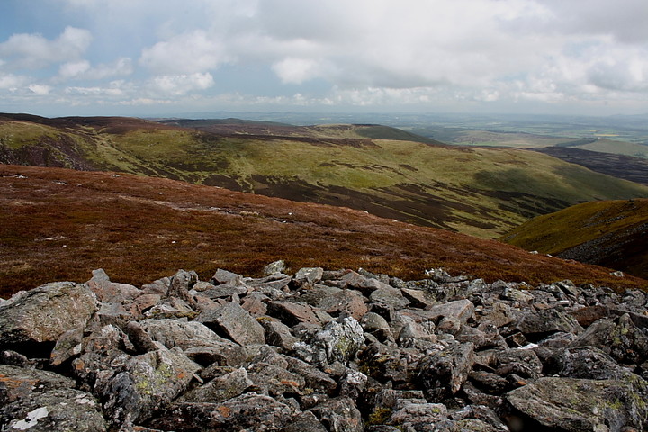
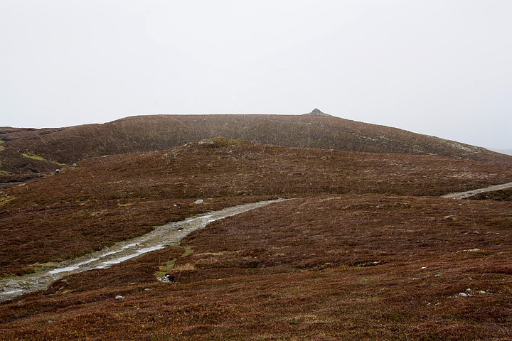
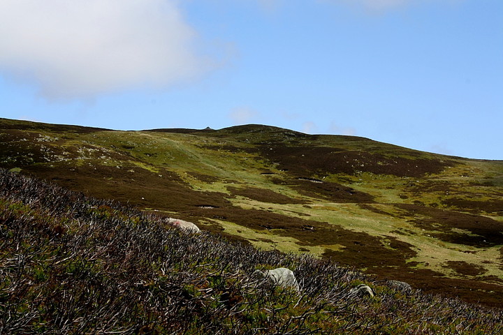
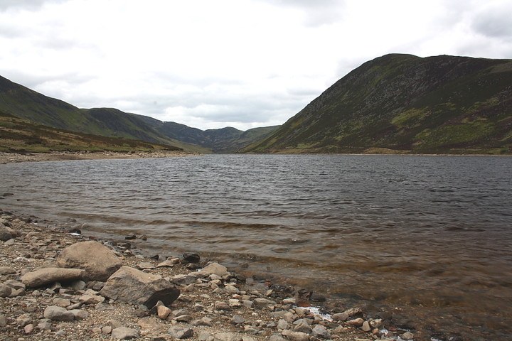
However dawn brings some rays of sunlight - literally - although a patchy, white mantle coating the western flank of Glen Turret does counteract the hopeful vibe somewhat. Hmm. Snow in late May? Thought it was a bit chilly last night, but blamed it on getting old, you know? As the estate warden does his daily 'rounds' I decide to postpone Aberdeen for yet another day and have a go. Onward! For all Sassenachs and Kenneth IV! (well 'Braveheart' wasn't exactly true, either....) The way appears straight forward enough, the Allt Choinneachain having conveniently carved a deep gulley in the mountain, the left hand flank of which - as viewed from the dam - promises a nice, natural line of ascent. Initial impressions, however, are often misleading in this game, the hillside rising above the eastern shore of Loch Turret actually cloaked in a thick covering of knee deep heather concealing hidden drops. Yeah, this is far from an easy skate, despite the mountain's 'modest' (in Scottish terms) 2,582ft altitude. As I jump the Allt Choinneachain, its cascading course leads the eye unerringly northwards towards my objective. The crags of Creag Dhearg are soon reached, complete with what I assume to be a prominent glacial erratic and small (modern) cairn, not to mention superb views of Loch Turret and Ben Chonzie. To the north another, larger cairn crowns the western apex of the mountain. A well built effort, the modern origin of it is sadly betrayed by the lack of any underlying cairn spread. The real deal - Cairn Coinneachan - lies to the approx east, rising beyond wetland, the source of the aforementioned Allt Choinneachain, no less. A winding, substantial track ensures dry feet although, to be honest, it does detract a little from the wildness of this mountain plateau. As if to compensate, a series of increasingly frequent hail showers proceed to provide a violent tailwind for the final approach.
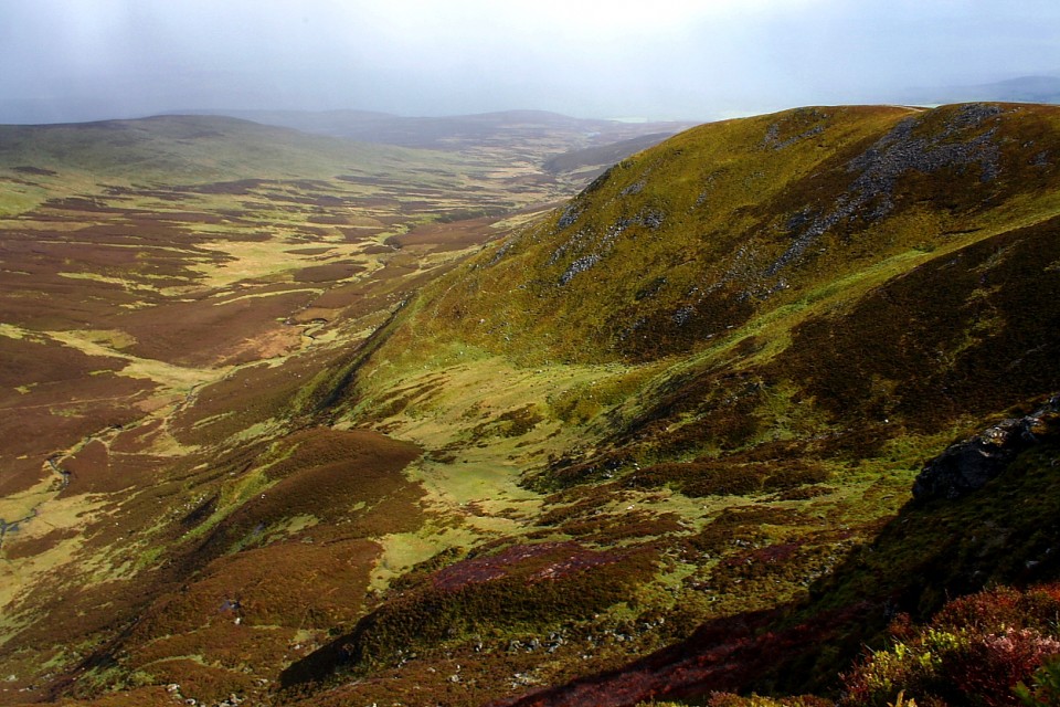
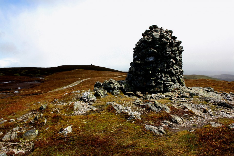
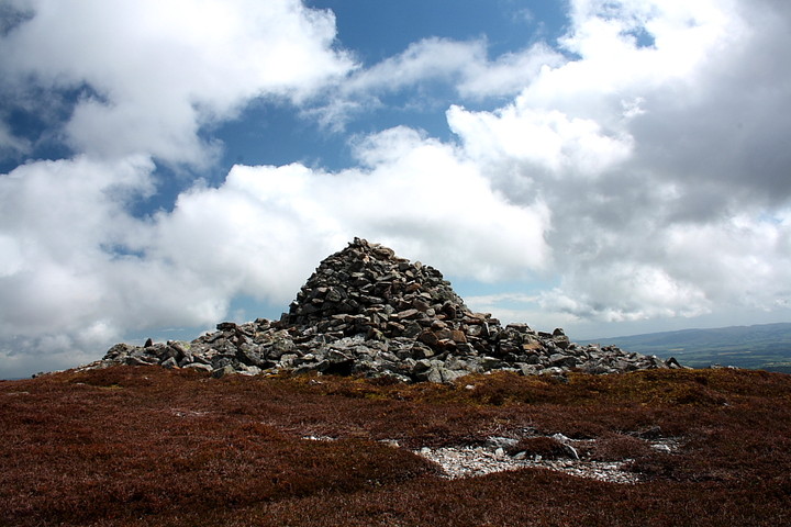
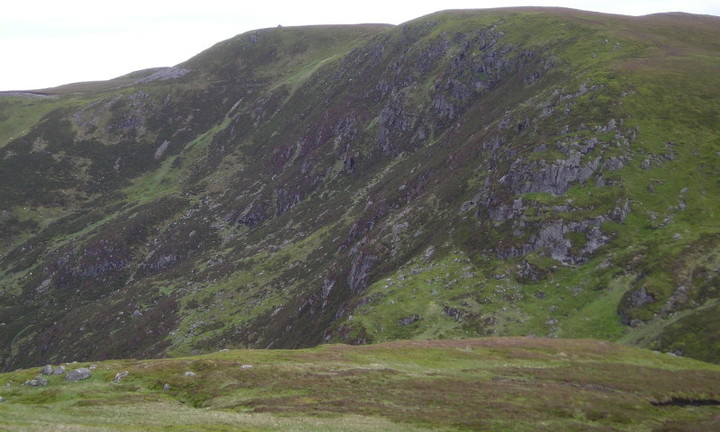
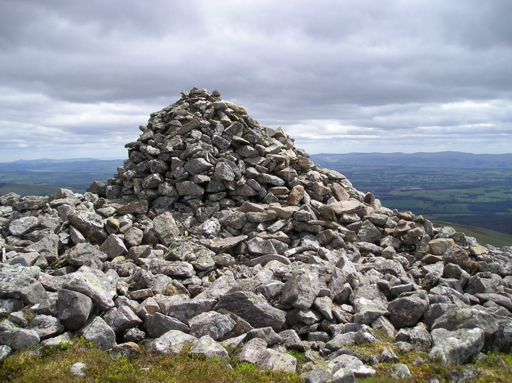
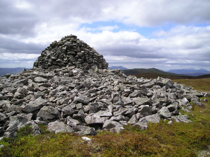
The monument isn't the most impressive I've seen - not by a long chalk - even if the frankly awesome Tinto cairn is discounted. Canmore gives its dimensions as 'A circular cairn 18.0m in diameter with a general height of 1.2m; a shepherd's cairn, 0.20m high, stands on top'. Nevertheless still pretty substantial and interestingly, clearly sited so as to NOT quite give superb views into Corrie Barvick. It's not located at the mountain's summit, either, but a little below, to the approx south-east (the summit itself is crowned by a rather pathetic effort). Nonetheless the view from the cairn across the Creag Chaisean is sensational to these eyes. To the north-east a fine cliff-line, known as Blue Craigs, cradles a waterfall forming the nascent Barvick Burn. Another one. The water association may, of course, be coincidental... but, well.... wouldn't it be great if these cairns were originally sited in reference to life springs?
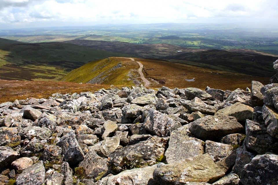
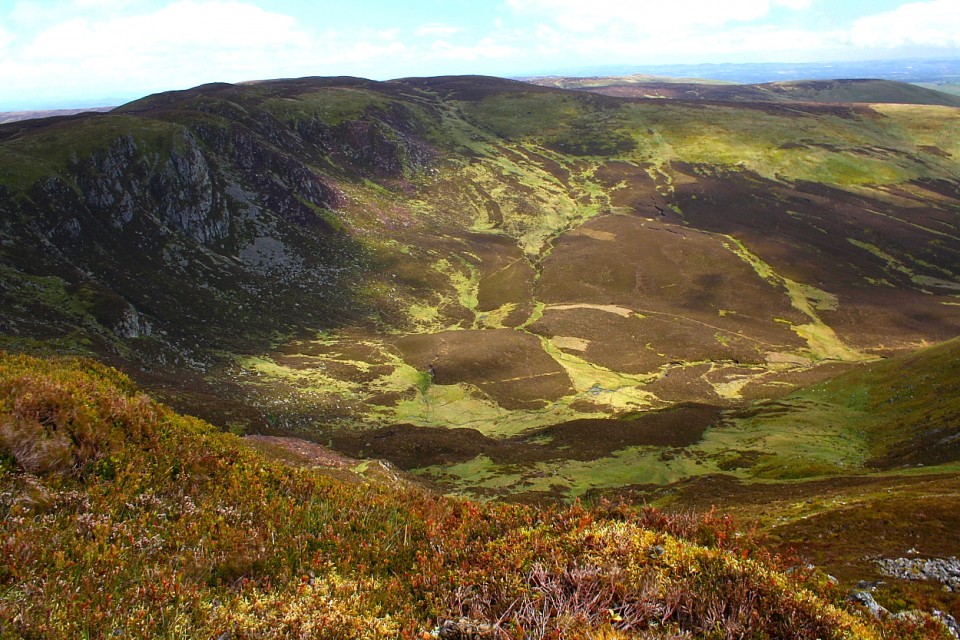
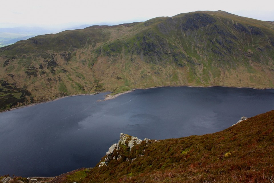
The hail showers morph into a full on snow storm... but what an atmosphere this mountain top cairn possesses, the 'shepherd's cairn' perched upon the significant footprint of its ancient forerunner providing at least some lee shelter. Eventually I begin my descent, via the obvious track crossing Creag Chaisean, which would also provide a somewhat easier alternative ascent than mine. Looking back, the Cairn Coinneachan stands in silhouetted profile above the beautiful glen of the Barvick Burn as, ignoring a left hand fork, I leave the track a little way beyond (where it begins to swing to the left)and slowly descend to Loch Turret once more. The view up the glacial glen cradling the reservoir is outstanding... OK, the original, natural loch is now long engulfed... but it is tempting to think that water, in all its forms, has held major significance here for millennia.
Supposedly the burial place of Kenneth 4th of Scotland , two problems it's never been excavated and there never as a Kenneth 4th ( some Celtic/liverpool supporters may disagree ). Kenneth 3rd was killed locally and that is probably the reason for the association .
I was thinking it had similarities with some of the excavated cairns that proved to be Bronze Age in the Brecon Beacons /Black Mountains . Sited on the high point of a spur of flat topped modest sized hills (In this case 776 m) overlooking lowlands allowing for the cairn to be seen from a wide area .
Further to Tiompan's fieldnotes, Canmore gives the following regarding the origin of the name of this cairn - which, translated, means 'Cairn of Kenneth', or 'Kenneth's Cairn'.....
'A very large barrow called Carn Chainichin, The Cairn of Kenneth. Chalmers (1887) links this tradition with 'Kenneth IV, King of Scotland' who was slain in battle in 1003 AD at Moigh-a-bhaird, now corrupted into Monivaird. Anderson gives the text of various Chronicles. It is clear that Chalmers statement is incorrect. No Kenneth IV is listed as King of Scotland and in fact Kenneth III reigned from AD 997-1005. There are inconsistencies in the accounts but Chalmers "Kenneth IV" is apparently Giric (called erroneously Grim) son of Kenneth III who was killed in Monzievaird between 997 and 1005. Anderson suggests that he ruled over some district under his father Kenneth. He was buried in Iona.
Statistical Account (OSA) 1793; A O Anderson 1922'


 Posted by thelonious
 Posted by GLADMAN
 Posted by tiompan