|
|

|
|
Cwalca CairnfieldCairn(s)
|
||||||||||||||||||||||||
|
|
|
Images (click to view fullsize) |
|

|
Fieldnotes |
|
|
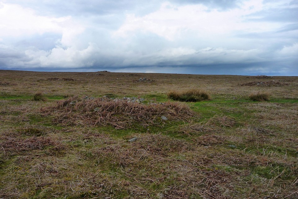
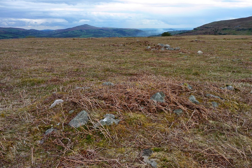
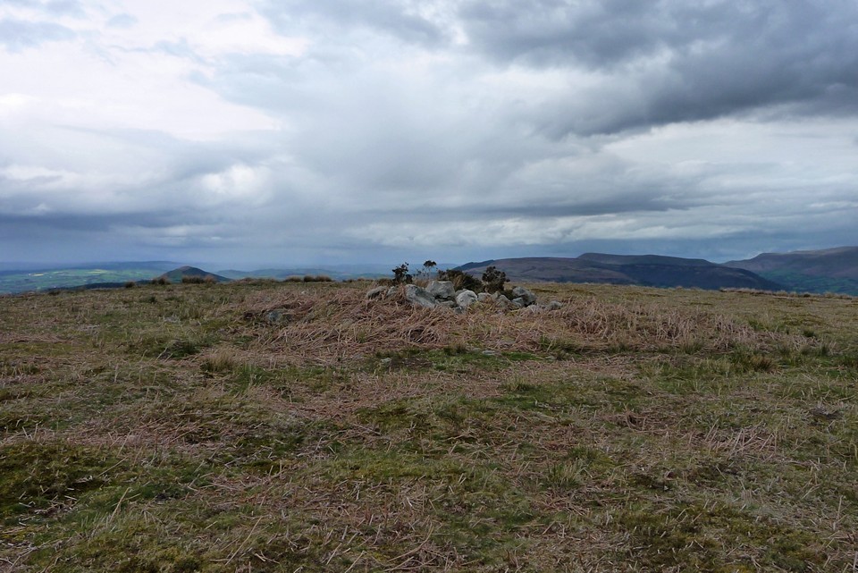
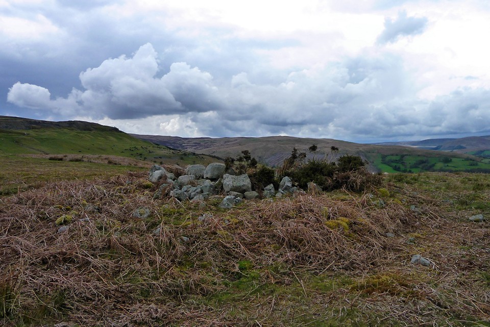
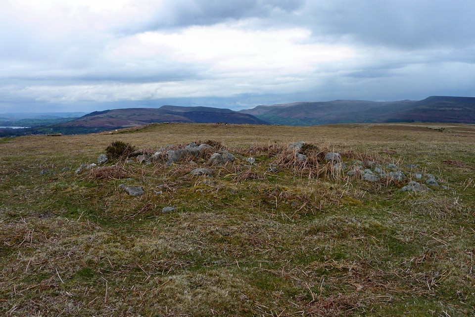
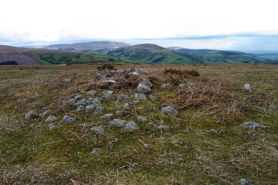
Visited 16.6.13 Directions: From the village of Llangynidr take the B4560 south until you come to a large parking area on your right; shortly after a sharp right bend. Head north east across the open moorland and you will soon spot the two large cairns showing on the O/S map. Wow, what a great place this is – far exceeding my expectations. As TSC says, just about everywhere you look there are cairns of various sizes to be seen. Beside the two main ones I spotted over another 20. Luckily the ferns had only just started to spout from the ground so spotting the cairns was easy. If I had come later in the year most of them would have been obscured by the ferns. The views are simply wonderful. The grey wispy low clouds were hugging the sides of the mountains and gave the place a tangible atmosphere. The brooding dark grey rain clouds racing across the sky added to the occasion. Given the views this large flat area of moorland is an obvious place to house a cairn cemetery. There are a lot worse places to spend eternity. On the way back to the car I noticed a small wooden cross wedged into one of the cairns. It said ‘Cliff and Sylvia – God bless’. This must have been a special place for Cliff and Sylvia as well as the ancestors. I can easily understand why. As I said, this is a wonderful location and a great place to visit – particularly when the ferns are low. I rate this site very highly and would heartily recommend a visit if possible. |
Posted by CARL 18th June 2013ce |
|
An excellent and unexpected gem of a site. Visited 1.5.2010 on a walk between Garn Caws and Carreg Waun Llech. There are two cairns shown on the OS map, which, approached from the west appear prominently on a local ridge, with the dramatic backdrop of the Black Mountains behind. The two cairns themselves are in decent condition, although the fact that the north-eastern one is a small ring cairn is obscured by the stones piled in its centre. The unexpected treat comes to the east, where the OS map shows nothing. In fact there are a huge number of small cairns (I counted over 20, but Coflein indicates that there are over 40). As I hadn't researched the site before coming, I knew nothing about these. They are small, presumably clearance cairns, but nevertheless possibly still Bronze Age and contemporary with the two larger monuments at the west. They sit on a NE facing shelf, under which sit the lovely Carreg Waun Llech standing stone. The stone is not visible from the cairn field, nor can the cairns be seen from the stone. |
 Posted by thesweetcheat
15th May 2010ce Edited 9th April 2020ce |
Miscellaneous |
|
|
Coflein description of the site (there are 28 associated monument records): "The cairnfield is located in a natural hollow. It covers an area of some 450m (NW-SE) by 200m and possibly includes also two cairns separately described (300970-1). The group comprises at least 40 stony mounds and two or three short lengths of stony bank. The mounds are of variable shape and size but average 5m in diameter and 0.4m high. The banks are short and discontinuous and appear to form no clear pattern." The two main cairns (shown on the OS map) are described as follows: Cwalca Round Cairn (SO15901734) "Situated on a local summit, the cairn measures 8m in diameter and 0.4m high. It is composed of mixed grade stones consolidataed with light vegetation. It lies on a ridge at the W edge of a larger group of smaller and more irregularly shaped cairns resulting from agricultural clearance (NPRN 300972); it could be a member of this group." Cwalca Ring Cairn (SO15911746) "Situated on a local summit in open moorland, the cairn consists of a stony ring bank measuring 2.5m wide and 0.5m high with an overall diameter of 10m. The interior is occupied with loose stones. The feature lies on a ridge at the W edge of a larger group of smaller and more irregularly shaped cairns resulting from agricultural clearance (NPRN300972); it, or at least the infill, could be a member of this group." http://www.coflein.gov.uk/en/site/300972/details/CWALCA+CAIRNFIELD/ |
Posted by thesweetcheat 14th May 2010ce |