|
|

|
|
Cwm HenwenStanding Stone / Menhir
|
||||||||||||||||||||||||
|
|
|
Images (click to view fullsize) |
|
|
Fieldnotes |
|
|
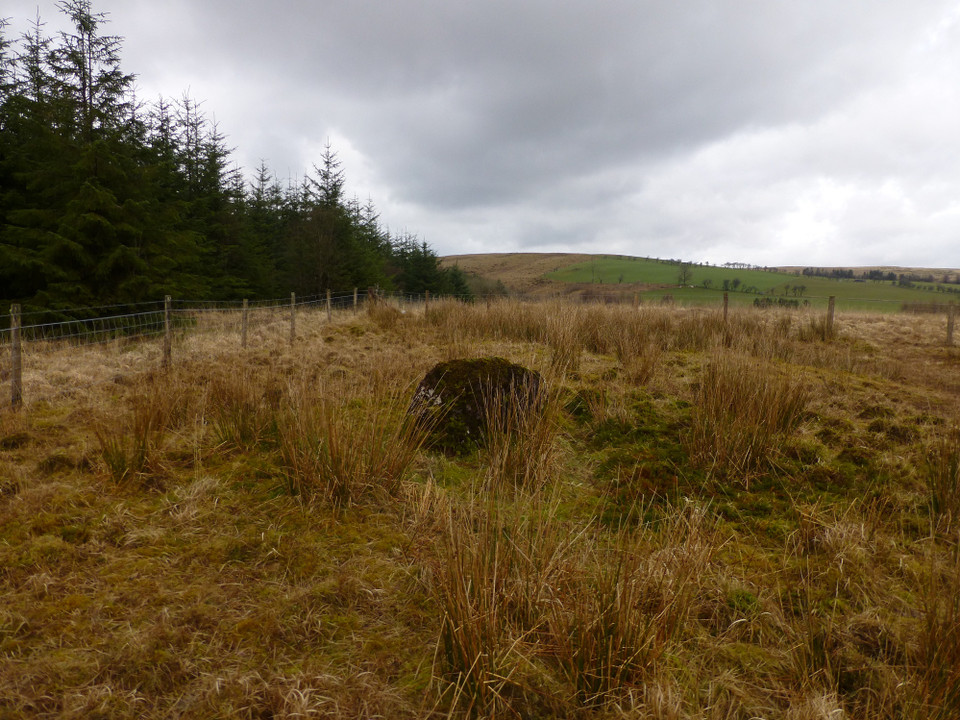
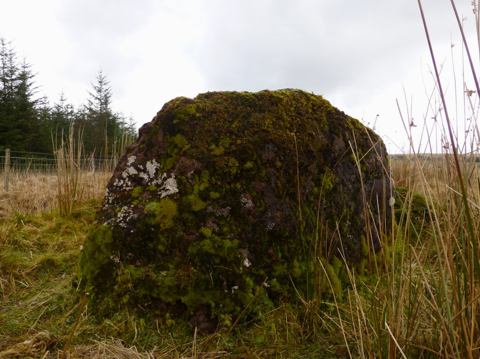
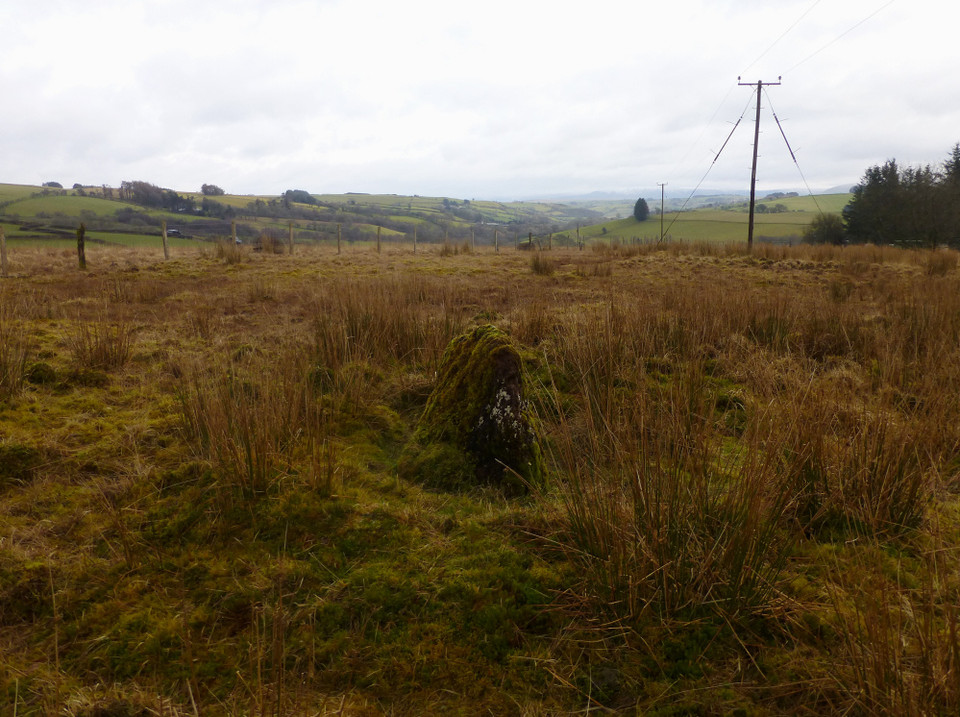
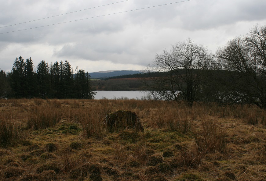
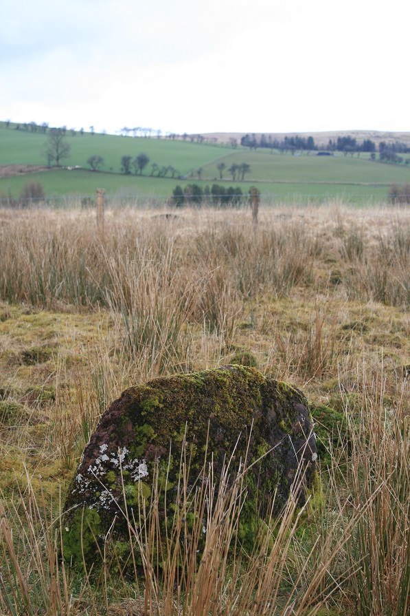
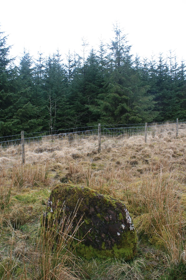
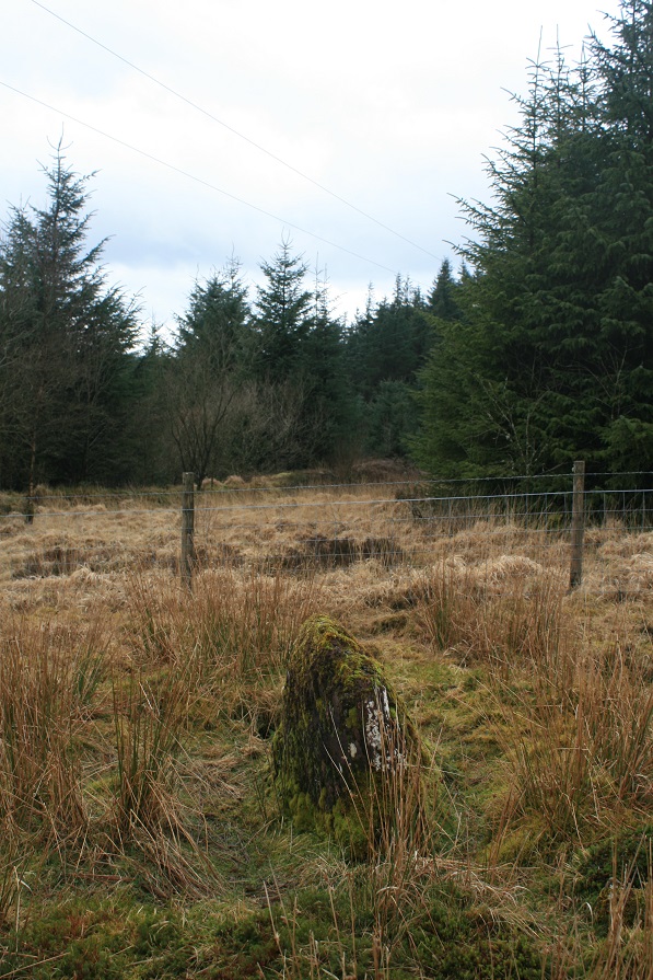
Just got time for one more site before we leave the area for pastures new, it's relatively straight forward to find, Carl's directions are spot on. Coflein gives it's dimensions as 1.4m by 0.6m by 0.9m, but does not say which one of these numbers goes with it's height. As the stone is longer than it is high my guess would be 1.4m long, 0.6m wide and 0.9m high. They wont even commit to a date or even if it is a standing stone, but rather an earthfast boulder. But with all the other antiquities around here it almost certainly is a standing stone. All be it a rather tidgy one. On the other side of the fence is a small collection of large stones, which I think Carl mistook for the nearby cairn, but that is further off into the field. So what are these stones ? Coflein says nothing about them, they seem to be the same kind of stone as the mini menhir, perhaps it was all one stone but got broken up and dragged away but that was as far they got. Probably not though. The stone enjoys good views across the Usk reservoir to the mountains of the Brecon Beacons. |
 Posted by postman
3rd March 2014ce |
|
Visited 13.1.13 Directions: From Trecastle (A40) follow the signs for the Usk Reservoir (5 miles). When you arrive at the reservoir there is a car park and picnic area. Walk across the dam to the far side of the reservoir and follow the road to the left. As you walk past the trees you will see a forestry track with a locked metal barrier. Walk up the track and after a short distance you will see a ‘path’ on your right heading through the trees. Follow this ‘path’ and you will shortly come to a metal gate. Go through the gate and the standing stone is immediately in front of you – can’t miss it! (There is a road which runs around the reservoir from the car park to the start of the forestry track if you would prefer not to walk. However, it is a very pleasant walk along the top of the dam and well worth the minimal effort required) The stone is a rich red colour (same as Mean LLia) and is largely covered in moss. COFLEIN reckon the stone is 1.4m high but I would say it is less than 1m. It is so close to the nearby Cairn that you would think the two are connected somehow? Is this the stump of a once taller stone? If it wasn’t for the trees there would be good views over the reservoir. Worth the effort to see when visiting this fairly remote but pretty part of the Brecon Beacons. |
Posted by CARL 14th January 2013ce |
Miscellaneous |
|
|
Probable standing stone, marked as such on OS 1:25000 map. Description from Coflein: "An earthfast boulder, 1.4m by 0.6m by 0.9m, set on the high point of a spur and now upon a community boundary, thought to be a standing stone." http://www.coflein.gov.uk/en/site/304784/details/CWM+HENWEN%2C+MONOLITH/ |
 Posted by thesweetcheat
28th December 2009ce |