The Modern Antiquarian
Log in
|
Register
Home
Latest Posts
Forums
Maps
Help
Browse Sites
News
Blog
Contributors
The Books
Select
-
Belgium
Denmark
Eire
France
Germany
Greece
Italy
The Netherlands
Norway
Portugal
Republic of Malta
Spain
Sweden
Switzerland
United Kingdom
County Tipperary
Knockshanbrittas (A)
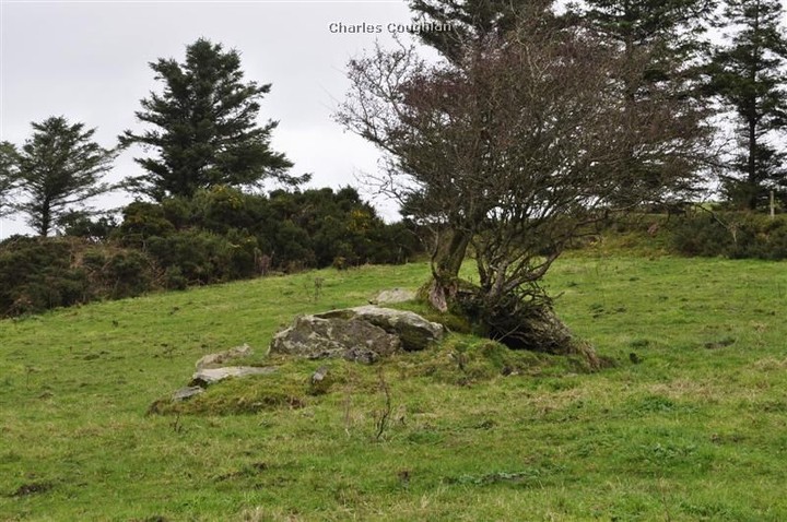
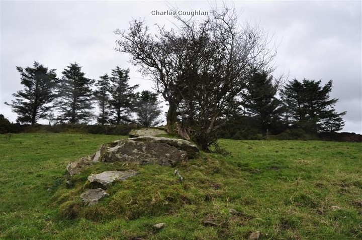
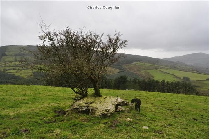
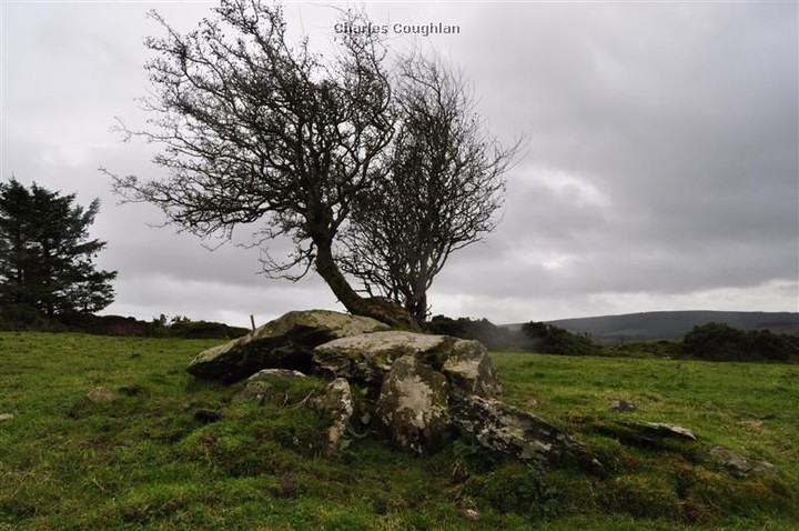
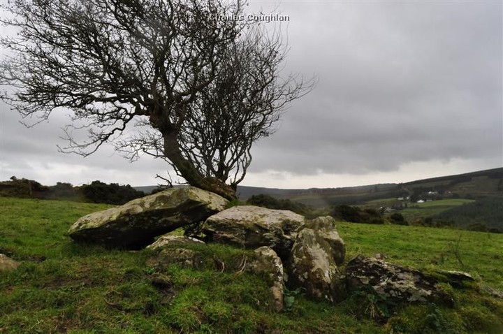
Wedge Tomb
Knockshanbrittas (A) (Wedge Tomb) on The Modern Antiquarian, the UK & Ireland's most popular megalithic community website. 6 images, plus information on many more ancient sites nearby and across the UK & Ireland.
Image © Charles Coughlan
Nearest Town:
Cappamore (12km SW)
OS Ref (IE):
R8779457509 /
Sheet: 66
Latitude:
52° 40' 7.36" N
Longitude:
8° 10' 49.58" W
Added by
bogman
Images (6)
0 discussions
Start a topic
Show |
Hide
Web searches for Knockshanbrittas (A)
Flickr
Google
Google Images
The Megalithic Portal
Bing
Stone Pages
Wikipedia
Show map
(inline Google Map)
- Sites within 20 km -
-
Aughsullish NW (0.01km SE) (1 post)
Aughsullish SW (0.14km SW) (6 posts)
Foilycleara (2.06km SSW) (3 posts)
Garracummer (2.95km ESE) (8 posts)
Goulmore (3.09km WNW) (4 posts)
Loughbrack (3.35km ENE) (11 posts)
Shanballyedmond (3.77km W) (17 posts)
Baurnadomeeny (3.96km WNW) (38 posts)
Knocknabansha (4.15km NE) (5 posts)
Baurnadomeeny (4.22km WNW) (4 posts)
Baurnadomeeny (4.23km WNW) (6 posts)
Mauherslieve (4.4km NNW) (6 posts)
Mauherslieve (4.4km NNW) (1 post)
Blackstairs (4.61km E) (3 posts)
Blackstairs (4.61km E) (4 posts)
Reardnogy More (4.88km W) (3 posts)
Reisk (5.01km NE) (1 post)
Knockmaroe (5.31km ENE) (3 posts)
Gortnageragh (5.66km SSW) (2 posts)
Lackanagoneeny (5.79km SW) (4 posts)
Knockcurraghbola Crowlands (west) (6.49km ENE) (8 posts)
Knockcurraghbola Crowlands (central) (6.59km ENE) (2 posts)
Knockcurraghbola Crowlands (east) (6.72km ENE) (2 posts)
Knockcurraghbola Crowlands (6.75km ENE) (1 post)
Knockcurraghbola Crowlands standing stone (6.97km ENE) (3 posts)
Cureeny Commons (7.28km NNW) (17 posts)
Graniera (7.49km ENE) (3 posts)
Foilaclug (7.65km SE) (3 posts)
Knockcurraghbola Commons (8.16km ENE) (22 posts)
Glencarbry (8.35km ESE) (1 post)
Kilmoylan Upper (8.81km SSW) (3 posts)
Glastrigan (9.13km NE) (13 posts)
Toorfiba (9.15km ENE) (3 posts)
Shevry (9.21km ENE) (8 posts)
Shevry (9.23km ENE) (1 post)
Cahernahallia (9.36km S) (1 post)
Cahernahallia (9.36km S) (2 posts)
Cooneen (9.77km NNE) (3 posts)
Foilnamuck (9.82km N) (5 posts)
Foilnamuck (10.32km N) (10 posts)
Cooga (10.41km ENE) (2 posts)
Cooga (10.41km ENE) (4 posts)
Cooneen (11.06km N) (8 posts)
Bauraglanna (11.49km NW) (9 posts)
Garranbane (12.85km WSW) (5 posts)
Ballinacurra (13.14km NNE) (1 post)
Scraggeen (13.17km W) (2 posts)
Tuogh (13.58km WSW) (0 posts)
Doonglara (Glenbrohane) (14.86km WSW) (1 post)
Clonalough (15.37km WNW) (2 posts)
Liseen (15.74km SW) (3 posts)
Pallas Upper (15.92km ENE) (4 posts)
Ballinahinch (16.4km WNW) (2 posts)
Garruan (16.42km WNW) (1 post)
Garraun (16.42km WNW) (3 posts)
Knocksefin (16.44km SW) (1 post)
Ballinahinch (16.53km WNW) (1 post)
Ballinahinch (16.6km WNW) (1 post)
Knocsefin (17.56km SW) (3 posts)
Garrangrena Lower (17.92km NE) (2 posts)
Cnoc Greine (17.99km SW) (3 posts)
Cappadine (18.05km WNW) (5 posts)
Rathneaveen (18.08km SSE) (2 posts)
Ballyard (18.13km W) (3 posts)
Ballynahinch (18.16km WNW) (3 posts)
Ballynahinch (18.16km WNW) (2 posts)
Ballynahinch (18.16km WNW) (1 post)
Donaskeagh (18.29km SE) (2 posts)
Rathneaveen (18.6km SSE) (2 posts)
Knockanora (18.97km NE) (4 posts)
Knockeen (19.3km WSW) (1 post)
Sarsfields Rock (19.54km SSW) (3 posts)
Longstone (19.55km SW) (2 posts)
Longstone (19.98km SSW) (1 post)
Longstone (19.98km SSW) (3 posts)
Longstone (19.98km SSW) (8 posts)
- Add -
-
Add news
Add an image
Add fieldnotes
Add folklore
Add miscellaneous
Add a link
-
Add a site
Add a nearby facility
Add an alternative name/spelling
Images
(click to view fullsize)
Add an image
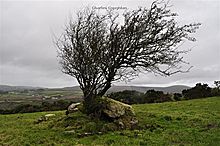 Image © Charles Coughlan