The Modern Antiquarian. Stone Circles, Ancient Sites, Neolithic Monuments, Ancient Monuments, Prehistoric Sites, Megalithic MysteriesThe Modern Antiquarian


Rathurles

Rath

<b>Rathurles</b>Posted by TheStandingStoneImage © The Standing Stone
Nearest Town:Nenagh (4km WSW)
OS Ref (IE):   R905798 / Sheet: 59
Latitude:52° 52' 8.71" N
Longitude:   8° 8' 27.92" W

Added by TheStandingStone


Discussion Topics0 discussions
Start a topic


Show map   (inline Google Map)

Images (click to view fullsize)

Add an image Add an image
<b>Rathurles</b>Posted by TheStandingStone

Fieldnotes

Add fieldnotes Add fieldnotes
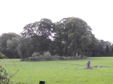
Listed as a possible ringfort in the 'Archaeological Inventory for County Tipperary' this certainly does looks like this is a rath. There is evidence of a bank but no fosse and is roughly 28m in diameter. The proximity to other ringforts in the area also suggests that this is a rath. I will let you judge for yourselves about this one. I didn't set out to see this site but passed it on the way to another rath with a church built inside which is only about half a mile away.

Located in a field off the R491 this site is in a well drained cattle field.
TheStandingStone Posted by TheStandingStone
14th December 2009ce